Andrade, California

Last updated

Andrade
California Locator Map with US.PNG
Red pog.svg
Andrade
Location in California
Usa edcp location map.svg
Red pog.svg
Andrade
Andrade (the United States)
Coordinates: 32°43′33″N114°43′33″W / 32.72583°N 114.72583°W / 32.72583; -114.72583
Country United States
State California
County Imperial County
Elevation
[1]
138 ft (42 m)

Andrade is a small locale in the southeasternmost corner of the state of California, in Imperial County. The community is located entirely within the Fort Yuma Indian Reservation. It is directly across the border from Los Algodones, the northernmost town of the municipality of Mexicali, in Baja California, and in all of Mexico. The ZIP Code is 92283. The community is inside area codes 442 and 760.

Contents

History

Andrade is named after General Guillermo Andrade, who founded the settlement with the California Development Company. GeneralGuillermoAndrade.jpg
Andrade is named after General Guillermo Andrade, who founded the settlement with the California Development Company.

Pilot Knob Station served as a stop on the San Antonio-San Diego Mail Line and Butterfield Overland Stage line and its successors until the railroad arrived in 1877. [2] The Pilot Knob Station was located at what is now Andrade, near the bank of the Colorado River at the foot of Pilot Knob, for which it was named.

Andrade Mesa wetlands AndradeMesawetlands.jpg
Andrade Mesa wetlands

Andrade is named after Mexican General Guillermo Andrade (1833-1905). The General sold the land for the settlement to the California Development Company. The town was named in 1912 with establishment of the post office. Andrade was in the Navy, a diplomat and a banker. [3] [4]

A post office operated at Andrade from 1909 to 1910 and from 1912 to 1942. [2] The name Cantu commemorated Col. Esteban Cantu, governor of the northernmost district of Baja California from 1915 to 1920. [2]

The nearby Alamo Canal was built in 1901, the All-American Canal built in 1930s. California State Route 186 was built in 1917 and number assigned was given in 1972. [5] [6] [7]

Looking across the border from Andrade into Los Algodones, Baja California LosAlgodones.JPG
Looking across the border from Andrade into Los Algodones, Baja California

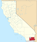
In 2000, it had a population of 59, 74.6% of whom were Hispanic or Latino. [8] In 2016, the Sleepy Hollow RV Park in Andrade was closed by its owner, the Quechan Indian Tribe, over poor water quality. [9]

Climate

This area has a large amount of sunshine year round due to its stable descending air and high pressure. According to the Köppen Climate Classification system, Andrade has a desert climate, abbreviated "BWh" on climate maps. [10]

California Historical Landmark

Charley's World of Lost Art
LocationOn dirt road about 0.5 miles Northwest of Andrade, California, by All-American Canal, Alamo Canal the Colorado River and California State Route 186.
Built1967
Reference no.939.4

California Historical Landmark number 939.4, Charley's World of Lost Art is in Andrade, California. California Historical Landmark is part of the Twentieth Century Folk Art Environments collection. Built by Charles Kasling (1901-1985). Kasling had started creating art sculptures in 1959 and they cover about two 1/2 half acres. Kasling was inspired by both his travels with the U.S. Navy and his desert travels. He also built art in Death Valley. [11] [12] [13] [14] [15]

California Historical Landmark reads:

NO. 939 Twentieth Century Folk Art Environments (Thematic) -CHARLEY'S WORLD OF LOST ART - Charles Kasling began sculpturing near Andrade in 1967, and his creations now fill a site of approximately two and a half acres. His style, best described as eclectic, was inspired partly by his world travels with the U.S. Navy and partly by the desert terrain. [16]

See also

Related Research Articles

<span class="mw-page-title-main">Hernando de Alarcón</span> Spanish explorer and navigator

Hernando de Alarcón was a Spanish explorer and navigator of the 16th century, noted for having led an early expedition to the Baja California Peninsula, during which he became one of the first Europeans to ascend the Colorado River from its mouth and perhaps the first to reach Alta California.

<span class="mw-page-title-main">Calexico, California</span> City in California, United States

Calexico is a city in southern Imperial County, California. Situated on the Mexican border, it is linked economically with the much larger city of Mexicali, the capital of the Mexican state of Baja California. It is about 122 miles (196 km) east of San Diego and 62 miles (100 km) west of Yuma, Arizona. Calexico, along with six other incorporated Imperial County cities, forms part of the larger populated area known as the Imperial Valley.

<span class="mw-page-title-main">El Centro, California</span> City in California, United States

El Centro is a city and county seat of Imperial County, California, United States. El Centro is the largest city in the Imperial Valley, the east anchor of the Southern California Border Region, and the core urban area and principal city of the El Centro metropolitan area which encompasses all of Imperial County. El Centro is also the largest U.S. city to lie entirely below sea level. The city, located in southeastern California, is 113 miles (182 km) from San Diego and less than 20 miles (32 km) from the Mexican city of Mexicali.

<span class="mw-page-title-main">Imperial, California</span> City in California, United States

Imperial is a city in Imperial County, California, 4 miles (6.4 km) north of El Centro.

<span class="mw-page-title-main">Mexicali</span> Capital city of Baja California, Mexico

Mexicali is the capital city of the Mexican state of Baja California. The city, seat of the Mexicali Municipality, has a population of 689,775, according to the 2010 census, while the Calexico–Mexicali metropolitan area is home to 1,000,000 inhabitants on both sides of the United States-Mexico border. Mexicali is a regional economic and cultural hub for the border region of The Californias.

<span class="mw-page-title-main">All-American Canal</span> Aqueduct in southern California

The All-American Canal is an 82-mile (132 km) long aqueduct, located in southeastern California. It conveys water from the Colorado River into the Yuma Project, the Imperial Valley, and to nine cities. It is the Imperial Valley's only water source, and replaced the Alamo Canal, which was located mostly in Mexico. The Imperial Dam, about 30 miles (48 km) northeast of Yuma, Arizona on the Colorado River, diverts water into the All-American Canal, which runs to just west of Calexico, California before its last branch heads mostly north into the Imperial Valley. Smaller canals branching off the All-American Canal move water into the Yuma Valley and the Imperial Valley. These canal systems irrigate up to 630,000 acres (250,000 ha) of crop land and have made possible a greatly increased crop yield in this area, originally one of the driest on earth. It is the largest irrigation canal in the world, carrying a maximum of 26,155 cubic feet per second (740.6 m3/s). Agricultural runoff from the All-American Canal drains into the Salton Sea.

<span class="mw-page-title-main">Los Algodones</span> City in Baja California, Mexico

Los Algodones is a town and borough in the municipality of Mexicali, Baja California, Mexico. Located on the United States-Mexico border to the north and east, Los Algodones is south of Andrade, California, and close to five miles west of downtown Yuma, Arizona. It reported a population of 5,474 in the 2010 Mexican census. Los Algodones is popularly referred to as "Molar City" due to hundreds of dentists that cater to Americans seeking affordable dental care outside of the United States.

<span class="mw-page-title-main">San Felipe, Baja California</span> City in Baja California, Mexico

San Felipe is a coastal city in San Felipe Municipality, Baja California, located on the Gulf of California. The population of San Felipe was reported as 17,143 inhabitants in the 2020 Mexican Census. San Felipe is historically a fishing town. Today it is also a popular tourist destination, known for its beaches, nature, and desert racing, as home to the San Felipe 250.

<span class="mw-page-title-main">Tecate</span> City in Baja California, Mexico

Tecate is a city in Tecate Municipality, Baja California. It is across the Mexico–US border from Tecate, California. As of 2019, the city had a population of 108,860 inhabitants, while the metropolitan area has a population of 132,406 inhabitants. Tecate is part of the San Diego-Tijuana metropolitan area and the largest city between Tijuana and Mexicali. Tecate is a regional economic hub and popular tourist destination, known as home to the Tecate Port of Entry and to Tecate Beer.

<span class="mw-page-title-main">Mexicali Municipality</span> Municipality in Baja California, Mexico

Mexicali Municipality is a municipality in the Mexican state of Baja California. Its municipal seat is located in the city of Mexicali. As of 2020, the municipality had a total population of 1,049,792. The municipality has an area of 13,700 km2 (5,300 sq mi). This includes many smaller outlying communities as well as the city of Mexicali. Also, the islands of Baja California located in the Gulf of California are part of the municipality, among them the mudflat islands at the mouth of the Colorado River, Isla Ángel de la Guarda and the islands of the San Lorenzo Marine Archipelago National Park. Mexicali is the northernmost municipality of Latin America.

<span class="mw-page-title-main">Cargo Muchacho Mountains</span> Landform in Imperial County, California

The Cargo Muchacho Mountains are located in the southeast Colorado Desert in the Lower Colorado River Valley, in Imperial County, California in the United States. Much of the range's geology was described by the geologist John T. Dillon.

<span class="mw-page-title-main">Algodones Dunes</span> Sand dune field in southeastern California

The Algodones Dunes is a large sand dune field, or erg, located in the southeastern portion of the U.S. state of California, near the border with Arizona and the Mexican state of Baja California. The field is approximately 45 miles (72 km) long by 6 miles (9.7 km) wide and extends along a northwest-southeast line that correlates to the prevailing northerly and westerly wind directions. The name "Algodones Dunes" refers to the entire geographic feature, while the administrative designation for that portion managed by the Bureau of Land Management is the Imperial Sand Dunes Recreation Area. In 1966, Imperial Sand Hills was designated as a National Natural Landmark by the National Park Service. The Algodones Dunes are split into many different sections. These sections include Glamis, Gordon's Well, Buttercup, Midway, and Patton's Valley. Although the Arabic-derived Spanish word algodones translates to "cotton plants", the origin of the toponym is unknown.

Pilot Knob may refer to:

<span class="mw-page-title-main">Felicity, California</span> Unincorporated community in California, United States

Felicity is an unincorporated community in Imperial County, California. The town was established in 1986 by Jacques-Andre Istel. Istel first bought the land in the 1950s and later developed it in the 1980s after selling off his parachute business. The town is "Dedicated to Remembrance" and named for Istel's wife Felicia. It is 2,600 acres and lies at an elevation of 285 feet.

<span class="mw-page-title-main">Pilot Knob (Imperial County, California)</span> Volcanic plug in Imperial County, California, United States

Pilot Knob is a peak in Imperial County, California. Pilot Knob is located 8 miles (13 km) southeast of Ogilby, It rises to an elevation of 876 feet (267 m). Pilot Knob is a rocky landform, geologically a Volcanic plug, west of Yuma, Arizona–Winterhaven, California; it is connected to the Cargo Muchacho Mountains, the central portion of the mountains being about 7 miles (11 km) north. Pilot Knob was named for its prominence as a landmark for riverboat traffic in the 19th-20th centuries on the Colorado River which borders Winterhaven–Yuma. Pilot Knob is an Area of Critical Environmental Concern administered by the Bureau of Land Management.

<span class="mw-page-title-main">Desert Training Center</span> US Army training centers during World War II

The Desert Training Center (DTC), also known as California–Arizona Maneuver Area (CAMA), was a World War II training facility established in the Mojave Desert and Sonoran Desert, largely in Southern California and Western Arizona in 1942.

The Butterfield Overland Mail route in Baja California was created as a result of an act by the United States Congress on March 3, 1857, and operated until June 30, 1861 as part of the Second Division of the route. Subsequently other stage lines operated along the route until the Southern Pacific Railroad arrived in Yuma, Arizona.

<span class="mw-page-title-main">Goat Canyon Trestle</span> Historic wooden railway bridge in southern California, United States

Goat Canyon Trestle is a wooden trestle in San Diego County, California. At a length of 597–750 feet (182–229 m), it is the world's largest all-wood trestle. Goat Canyon Trestle was built in 1933 as part of the San Diego and Arizona Eastern Railway, after one of the many tunnels through the Carrizo Gorge collapsed. The railway had been called the "impossible railroad" upon its 1919 completion. It ran through Baja California and eastern San Diego County before ending in Imperial Valley. The trestle was made of wood, rather than metal, due to temperature fluctuations in the Carrizo Gorge. By 2008, most rail traffic stopped using the trestle.

<span class="mw-page-title-main">Camp Coxcomb</span> California Historic Landmark

The Camp Coxcomb was a sub camp of the US Army Desert Training Center in Riverside County, California. The main headquarters for the Desert Training Center was Camp Young were General Patton's 3rd Armored Division was stationed. Camp Coxcomb was designated a California Historic Landmark (No.985). The site of the Camp Granite is 45 miles East of Indio, California off Interstate 10 and California State Route 177 near the Coxcomb Mountains. The train stop at Freda railroad siding delivered Troops and equipment. The camp closed in early in 1944 after about two years of operations.

<span class="mw-page-title-main">Camp Pilot Knob</span> Historical US Army sub camp in California

The Camp Pilot Knob was a sub camp of the US Army, Desert Training Center in Imperial County, California. The main headquarters for the Desert Training Center was Camp Young, this is where General Patton's 3rd Armored Division was stationed. Camp Pilot Knob was designated a California Historic Landmark (No.985). Camp Pilot Knob is near Felicity, California, in Imperial County, California. Camp Pilot Knob is 2 miles north of the US-Mexico border, just north of the now Interstate 8. The camp is five miles northwest of Yuma, Arizona and 2 miles west of the Colorado river. The camp was built just north of the Felicity train station, which was used to bring the troops and supplies to the camp. The camp is named after a hill south of the camp.

References

  1. U.S. Geological Survey Geographic Names Information System: Andrade, California
  2. 1 2 3 Durham, David L. (1998). California's Geographic Names: A Gazetteer of Historic and Modern Names of the State. Clovis, Calif.: Word Dancer Press. p. 1389. ISBN   1-884995-14-4.
  3. Gudde, Erwin; William Bright (2004). California Place Names (Fourth ed.). University of California Press. p. 13. ISBN   0-520-24217-3.
  4. General Guillermo Andrade
  5. Google (June 10, 2015). "Overview map of California State Route 186" (Map). Google Maps . Google. Retrieved June 10, 2015.
  6. California (Map). American Automobile Association. 1917. Retrieved June 21, 2014.
  7. Staff (August 2010). "State-Route 186 Transportation Concept Summary" (PDF). Caltrans. p. 1. Retrieved June 21, 2014.
  8. The entire population of Andrade is located within Block 2591, Block Group 2, Census Tract 124, Imperial County, California. Population figures are from US Census U.S. Census website .
  9. Sleepy Hollow RV park nearly cleared out
  10. Climate Summary for Andrade, California
  11. Death Valley NPS, Driftwood Charlie’s Feet
  12. Charley's World of Lost Art
  13. Driftwood Charley's World of Lost ArtCharles Kasling (1901-1985)
  14. Charley's World of Lost Art
  15. Charley's World of Lost Art
  16. californiahistoricallandmarks.com Landmark chl-939.4