Hedges, California

Last updated

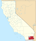
Hedges, later renamed Tumco, is a locale, a ghost town, site of a former mining town, in Imperial County, California. It lies at an elevation of 617 feet / 188 meters along the Tumco Wash in the Cargo Muchacho Mountains. [1] Nearby is the Hedges Cemetery at an elevation of 643 feet (196 meters), at 32°53′04″N114°49′52″W / 32.88444°N 114.83111°W / 32.88444; -114.83111 . [2]

Contents

History

Tumco Tumco Historic Mining Town, California (15639976842).jpg
Tumco

Gold mining had been going on in the western Cargo Muchacho Mountains by the Spanish in the early 1780s until the Yuma Revolt ended mining there until the Mexicans returned to the area after 1823. Mexican miners prospected and mined there prior to 1848, the name of the mountains date from this period. Mining was conducted mostly by Sonoran miners familiar with dry washing techniques and using arrastras to extract gold from the ore taken from small mines scattered across the mountains. Lt. Williamson's Pacific Railroad exploration party, passing the mountains in 1853 reported seeing several quartz veins from three inches to a foot or two in thickness there. Despite this report, no American miners began large scale development of the mines until the Southern Pacific Railroad passed by the location to Yuma in 1877. Ogilby a railroad stop was founded nearby in 1877 and became the rail-head and supply point for the mines and camps in the Cargo Muchacho Mountains.

Hedges began as the Gold Rock mining camp, that grew up around the Gold Rock Mine discovered by Peter Walters in 1884. He soon thereafter sold out to developers who renamed the mine the Golden Cross in 1892. In 1893, Golden Cross Mining and Milling Company began a development program bringing in a stamp mill to work the ore in the local mines. The camp grew into a town amidst the mines, named Hedges, in honor of the firm's vice president C. L. Hedges. The town was renamed Tumco in 1910, for The United Mines Company, the company that bought the Gold Cross mining company from its previous owners. The Tumco Mine operated from 1892 until 1917, and again from 1937 until 1942. The town in the late 1800s had a population of several thousand by 1942 it only had 30. [3]

Tumco Historic Mine is currently operated by the Bureau of Land Management.

California Historical Landmark

The Tumco Mines are a California Historical Landmarks and reads:

NO. 182 TUMCO MINES - Pete Walters of Ogilby discovered the first gold vein at Gold Rock on January 6, 1884. From his Little Mary Claim began a gold camp which reached its peak development between 1893 and 1899 as Hedges, with 3,200 residents. Nearly closed, 1900-10, it was reopened as Tumco, 1910-13, and worked intermittently until 1941. Tumco has long been a California ghost town. [4]

See also

Related Research Articles

<span class="mw-page-title-main">Calico, California</span> Place in California, United States

Calico is a ghost town and former mining town in San Bernardino County, California, United States. Located in the Calico Mountains of the Mojave Desert region of Southern California, it was founded in 1881 as a silver mining town, and was later converted into a county park named Calico Ghost Town. Located off Interstate 15, it lies 3 miles (4.8 km) from Barstow and 3 miles from Yermo. Giant letters spelling CALICO are visible, from the highway, on the Calico Peaks behind it. Walter Knott purchased Calico in the 1950s, and architecturally restored all but the five remaining original buildings to look as they did in the 1880s. Calico received California Historical Landmark #782, and in 2005 was proclaimed by then-Governor Arnold Schwarzenegger to be California's Silver Rush Ghost Town.

<span class="mw-page-title-main">Bodie, California</span> Ghost town in Mono County

Bodie is a ghost town in the Bodie Hills east of the Sierra Nevada mountain range in Mono County, California, United States. It is about 75 miles (121 km) southeast of Lake Tahoe, and 12 mi (19 km) east-southeast of Bridgeport, at an elevation of 8,379 feet (2554 m). Bodie became a boom town in 1876 after the discovery of a profitable line of gold; by 1879 it had a population of 7,000–10,000.

<span class="mw-page-title-main">Oatman, Arizona</span> Census-designated place in Mohave County, Arizona, United States

Oatman is a census-designated place (CDP) in the Black Mountains of Mohave County, Arizona, United States, located at an elevation of 2,710 feet (830 m). It began as a small mining camp when two prospectors struck a $10 million gold find in 1915, though the vicinity had already been settled for a number of years. Oatman's population grew to more than 3,500 in the course of a year. As of the 2020 census, its population was 102.

<span class="mw-page-title-main">Rhyolite, Nevada</span> Ghost town in Nevada, United States

Rhyolite is a ghost town in Nye County, in the U.S. state of Nevada. It is in the Bullfrog Hills, about 120 miles (190 km) northwest of Las Vegas, near the eastern boundary of Death Valley National Park. The town began in early 1905 as one of several mining camps that sprang up after a prospecting discovery in the surrounding hills. During an ensuing gold rush, thousands of gold-seekers, developers, miners and service providers flocked to the Bullfrog Mining District. Many settled in Rhyolite, which lay in a sheltered desert basin near the region's biggest producer, the Montgomery Shoshone Mine.

<span class="mw-page-title-main">Cargo Muchacho Mountains</span> Landform in Imperial County, California

The Cargo Muchacho Mountains are located in the southeast Colorado Desert in the Lower Colorado River Valley, in Imperial County, California in the United States. Much of the range's geology was described by the geologist John T. Dillon.

<span class="mw-page-title-main">Hart, California</span> Ghost town in California, United States

Hart was a short-lived gold mining town located in the Mojave desert, in San Bernardino County, California. It existed between 1908 and 1915, and was located on the northeastern edge of Lanfair Valley near the New York Mountains. The area is now in the Castle Mountains National Monument, administered by the National Park Service.

La Paz was a short-lived early gold mining town along on the western border of current-day La Paz County, Arizona. The town grew quickly after gold was discovered nearby in 1862. La Paz, Spanish for peace, was chosen as the name in recognition of the feast day for Our Lady of Peace. Originally located in the New Mexico Territory, the town became part of the Arizona Territory when President Abraham Lincoln established the new territory in 1863. In 1983 the newly-formed County of La Paz adopted the name, long after the town had become a ghost town.

<span class="mw-page-title-main">Castle Dome Mountains</span> Landform in Yuma County, Arizona, US

The Castle Dome Mountains are a mountain range in Yuma County, Arizona, within the Kofa National Wildlife Refuge. Castle Dome Peak, the high point of the range, is a prominent butte and distinctive landmark. The peak is 3,776 feet (1,151 m) high, and is located at 33°05′04″N114°08′36″W. Castle Dome was named by American soldiers at old Fort Yuma in the 1880s. Early Spanish explorers called the same peak Cabeza de Gigante, "Giant's Head."

<span class="mw-page-title-main">Castle Dome Landing, Arizona</span> Ghost town in Yuma County, Arizona

Castle Dome Landing, Arizona is a ghost town in the Castle Dome Mountains of Yuma County in the U.S. state of Arizona. It was first settled as a transport depot and mining camp around 1863 in what was then the Arizona Territory.

Potholes is a former gold camp and settlement in Imperial County, California. The settlement was located on the railroad line 4 miles (6.4 km) northeast of Bard along the Colorado River near the site of the Laguna Dam.

<span class="mw-page-title-main">Pilot Knob (Imperial County, California)</span> Volcanic plug in Imperial County, California, United States

Pilot Knob is a peak in Imperial County, California. Pilot Knob is located 8 miles (13 km) southeast of Ogilby, It rises to an elevation of 876 feet (267 m). Pilot Knob is a rocky landform, geologically a Volcanic plug, west of Yuma, Arizona–Winterhaven, California; it is connected to the Cargo Muchacho Mountains, the central portion of the mountains being about 7 miles (11 km) north. Pilot Knob was named for its prominence as a landmark for riverboat traffic in the 19th-20th centuries on the Colorado River which borders Winterhaven–Yuma. Pilot Knob is an Area of Critical Environmental Concern administered by the Bureau of Land Management.

Gila City is a ghost town in Yuma County in the U.S. state of Arizona. The town was settled in 1858 in what was then the New Mexico Territory.

The Cripple Creek Gold Rush was a period of gold production in the Cripple Creek area from the late 1800s until the early 1900s. Mining exchanges were in Cripple Creek, Colorado Springs, Pueblo and Victor. Smelting was in Gillett, Florence, and (Old) Colorado City. Mining communities sprang up quickly, but most lasted only as long as gold continued to be produced. Settlements included:

<span class="mw-page-title-main">Steamboats of the Colorado River</span> Overview of steamboats on the Colorado River

Steamboats on the Colorado River operated from the river mouth at the Colorado River Delta on the Gulf of California in Mexico, up to the Virgin River on the Lower Colorado River Valley in the Southwestern United States from 1852 until 1909, when the construction of the Laguna Dam was completed. The shallow draft paddle steamers were found to be the most economical way to ship goods between the Pacific Ocean ports and settlements and mines along the lower river, putting in at landings in Sonora state, Baja California Territory, California state, Arizona Territory, New Mexico Territory, and Nevada state. They remained the primary means of transportation of freight until the advent of the more economical railroads began cutting away at their business from 1878 when the first line entered Arizona Territory.

La Laguna was a gold mining town in New Mexico Territory, now Yuma County, Arizona. It was in existence for a short time from 1860 to 1862. The town was a steamboat landing 20 miles above Yuma, Arizona on the Colorado River. It had a few merchants and a ferry across the Colorado River that served placer miners in the vicinity. When the La Paz gold rush began, La Laguna began to decline and it was soon replaced by Castle Dome Landing, 15 miles to the north, following the discovery of gold in the Castle Dome Mountains. It remained for a time as the site of a store and a ranch, belonging to Jose Redondo, one of the first to mine gold at La Paz.

Norton's Landing or Norton's, was a steamboat landing on the Colorado River, in what was then Yuma County, Arizona Territory. Today it is in La Paz County, Arizona. Nortons Landing is 52 miles upriver from Yuma, Arizona 4 miles above Picacho, California and 18 miles below the Clip, Arizona landing. It lies on a rocky point of land next to the river at 215 feet of elevation just east of Red Cloud Wash and Black Rock Wash, where roads to the district mines in the mountains met the Colorado River.

Tumco Mine was a former gold mine in the Cargo Muchacho Mountains of Imperial County, California.

References

32°52′47″N114°49′55″W / 32.87972°N 114.83194°W / 32.87972; -114.83194