
California is a U.S. state on the western coast of North America. Covering an area of 163,696 sq mi (423,970 km2), California is among the most geographically diverse states. The Sierra Nevada, the fertile farmlands of the Central Valley, and the arid Mojave Desert of the south are some of the major geographic features of this U.S. state. It is home to some of the world's most exceptional trees: the tallest, most massive, and oldest. It is also home to both the highest and lowest points in the 48 contiguous states. The state is generally divided into Northern and Southern California, although the boundary between the two is not well defined. San Francisco is decidedly a Northern California city and Los Angeles likewise a Southern California one, but areas in between do not often share their confidence in geographic identity. The US Geological Survey defines the geographic center of the state at a point near North Fork, California.

The Chocolate Mountains of California are located in Imperial and Riverside counties in the Colorado Desert of Southern California. The mountains stretch more than 60 miles (100 km) in a northwest to southeast direction, and are located east of the Salton Sea and south and west of the Chuckwalla Mountains and the Colorado River. To the northwest lie the Orocopia Mountains.
The Chuckwalla Mountains are a mountain range in the transition zone between the Colorado Desert—Sonoran Desert and the Mojave Desert, climatically and vegetationally, in Riverside County of southern California.
The North American Cordillera, sometimes also called the Western Cordillera of North America, the Western Cordillera or the Pacific Cordillera, is the North American portion of the American Cordillera, the mountain chain system (cordillera) along the western coast of the Americas. The North American Cordillera covers an extensive area of mountain ranges, intermontane basins and plateaus in Western/Northwestern Canada, Western United States and Mexico, including much of the territory west of the Great Plains.

The New York Mountains are a small mountain range found in northeastern San Bernardino County in California, USA. The range's northeastern area lies in southeastern Nevada. The range lies just south of the small community of Ivanpah, and north of the Lanfair Valley. The mountains are part of the mountain ranges, cones, mountains, and landforms in the Mojave National Preserve. The mountains reach an elevation of 7,533 feet (2,296 m), and run in a mostly southwest-northeasterly direction between the Providence Mountains and the McCullough Range approximately five miles into Nevada and border the northwest corner of the Piute Valley of Nevada-California.

The Big Maria Mountains are located in the southeastern part of the U.S. state of California, near the Colorado River and Arizona. The range lies between Blythe and Vidal, and west of U.S. Route 95 in California and east of Midland. The mountains are home to the Eagle Nest Mine and reach an elevation of 1,030 meters, (3,379 ft). A power line that runs from Parker Dam to Yuma, Arizona runs through the range. A smaller range, the Little Maria Mountains, lie to the west of the Big Marias.

The Chemehuevi Mountains are found at the southeast border of San Bernardino County in southeastern California adjacent the Colorado River. Located south of Needles, California and northwest of the Whipple Mountains, the mountains lie in a north-south direction in general, and are approximately 15 miles in length.

The Orocopia Mountains are located in Riverside County in southern California, United States, east of the Coachella Valley, west of the Chuckwalla Mountains, and south of Interstate 10 in the Colorado Desert. The range lies in an east-west direction, and is approximately 18 miles long. The Orocopia Mountains are north of and overlooking the Salton Sea and south of Joshua Tree National Park, with the Chocolate Mountains to the southeast and the scenic Mecca Hills just northwest.
The Sacramento Mountains are a mountain range in the Eastern Mojave Desert and within Mojave Trails National Monument, in San Bernardino County, California.

The Whipple Mountains are located in eastern San Bernardino County, California. They are directly west of the Colorado River, Parker Dam, and Lake Havasu; south of Needles, California; north of Parker, Arizona and Vidal, California; and northeast of Vidal Junction, California.

The Trigo Mountains are a north-south trending mountain range in La Paz County, Arizona, bordering the Colorado River on the east in the Lower Colorado River Valley. The range lies north of the Colorado River as it turns east, north of Martinez Lake and the Imperial Reservoir. The Trigo Mountains are on a north-south stretch of the Colorado River, and form the eastern perimeter of the Imperial National Wildlife Refuge.

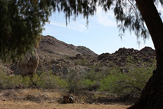
The Deserts of California have unique ecosystems and habitats, a sociocultural and historical "Old West" collection of legends, districts, and communities, and they also form a popular tourism region of dramatic natural features and recreational development. All of the deserts are located in eastern Southern California, in the Western United States.

The Coyote Mountains are a small mountain range in San Diego and Imperial Counties in southern California. The Coyotes form a narrow ESE trending 2 mi (3.2 km) wide range with a length of about 12 mi (19 km). The southeast end turns and forms a 2 mi (3.2 km) north trending "hook". The highest point is Carrizo Mountain on the northeast end with an elevation of 2,408 feet (734 m). Mine Peak at the northwest end of the range has an elevation of 1,850 ft (560 m). Coyote Wash along I-8 along the southeast margin of the range is 100 to 300 feet in elevation. Plaster City lies in the Yuha Desert about 5.5 mi (8.9 km) east of the east end of the range.
The Indian Pass Wilderness is 32,418-acre (13,119 ha) wilderness area under the administered by the Bureau of Land Management. The reserve is located in the very southeastern part of the Chocolate Mountains, in the southeastern part of California, just to the west of the Colorado River in the Lower Colorado River Valley. It adjoins the Picacho Peak Wilderness to the south, and the Imperial National Wildlife Refuge to the east.

Pilot Knob is a peak in Imperial County, California. Pilot Knob is located 8 miles (13 km) southeast of Ogilby, It rises to an elevation of 876 feet (267 m). Pilot Knob is a rocky landform, geologically a Volcanic plug, west of Yuma, Arizona–Winterhaven, California; it is connected to the Cargo Muchacho Mountains, the central portion of the mountains being about 7 miles (11 km) north. Pilot Knob was named for its prominence as a landmark for riverboat traffic in the 19th-20th centuries on the Colorado River which borders Winterhaven–Yuma. Pilot Knob is an Area of Critical Environmental Concern administered by the Bureau of Land Management.

The Buckskin Mountains is a mountain range in La Paz County, Arizona, United States. The range lies just east of the north–south Colorado River, and borders south of the east–west, west-flowing Bill Williams River.
The Rawhide Mountains are a mountain range of western Arizona, in the southwest of Mohave County. It is part of a block of mountain ranges on the north of an insular region called the Maria fold and thrust belt, containing mountain ranges, valleys, and plains. The Rawhide Mountains border the much smaller Artillery Mountains southeast, bordering on Alamo Lake State Park and the south-flowing Big Sandy River.

The Ward Valley (California) is a lengthy almost true N-S trending valley of far eastern San Bernardino County, California.
Hedges, later renamed Tumco, is a locale, a ghost town, site of a former mining town, in Imperial County, California. It lies at an elevation of 617 feet / 188 meters along the Tumco Wash in the Cargo Muchacho Mountains. Nearby is the Hedges Cemetery at an elevation of 643 feet / 196 meters, at 32°53′04″N114°49′52″W.

