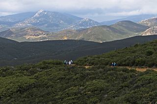
Cuyamaca is a region of eastern San Diego County. It lies east of the Capitan Grande Indian Reservation in the western Laguna Mountains, north of Descanso and south of Julian. Named for the 1845 Rancho Cuyamaca Mexican land grant, the region is now dominated by the 26,000-acre (110 km2) Cuyamaca Rancho State Park. Within the park is the prominent Cuyamaca Peak, the second-highest mountain in San Diego County at 6,512 feet (1,984.9 m).

Texas's 30th congressional district of the United States House of Representatives covers much of the city of Dallas and other parts of Dallas and Tarrant counties. The district contains the University of North Texas at Dallas, UNT Law, and Texas Women's University at Dallas. The 30th district is also home to Dallas Love Field airport and University of Texas Southwestern Medical Center. The current Representative from the 30th district is Democrat Jasmine Crockett, who has represented the district since 2023.

Pine Grove is a census-designated place in Amador County, California. It lies at an elevation of 2513 feet. The population was 2,219 at the 2010 census. It is located at 38°24′47″N120°39′32″W, along State Route 88. The community is in ZIP code 95665 and area code 209.

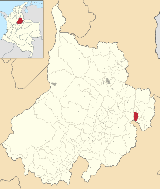
San José de Miranda is a town and municipality in the Santander Department in northeastern Colombia.

Almanza is a municipality located in the province of León, Castile and León, Spain. According to the 2009 census (INE), the municipality has a population of 609 inhabitants.

The Star Pavilion is a music and entertainment venue in Hersheypark Stadium located in Hershey, Pennsylvania, United States.

Büyük Ada is the largest island which can be seen from the town center of Karaburun town in İzmir, Turkey.
Sandringham is a town on the Eastport Peninsula in Bonavista Bay North in the Canadian province of Newfoundland and Labrador, Canada. The town had a population of 205 in the Canada 2021 Census.
Dois Irmãos das Missões is a municipality in the state of Rio Grande do Sul, Brazil. As of 2020, the estimated population was 2,008.

Biskupnica is a village in the administrative district of Gmina Człuchów, within Człuchów County, Pomeranian Voivodeship, in northern Poland. It lies approximately 10 kilometres (6 mi) west of Człuchów and 122 km (76 mi) south-west of the regional capital Gdańsk. It is located within the historic region of Pomerania.
Red Bluff Air Force Station is a closed United States Air Force General Surveillance Radar station. It is located 4.3 miles (6.9 km) west-southwest of Red Bluff, California. It was closed in 1970.
The Carrizo Creek and Carrizo Wash in California are a stream and an arroyo that the stream flows into, in San Diego County, California and Imperial County, California.

The Montgomery Women's Facility is a prison for women run by the Alabama Department of Corrections (ADOC). It is located behind Kilby Correctional Facility in Mt. Meigs, an unincorporated area in Montgomery County, Alabama. Opened in 1976, it has a capacity of 300 inmates; its warden is Adrienne Givens.
Jacumba Valley is a valley in San Diego and Imperial Counties, California. Its head is at 32°37′00″N116°10′07″W Carrizo Creek has its source in Jacumba Valley, 1.2 miles north of the California-Mexico State boundary, at 32°38′09″N116°07′05″W at an elevation of 3,210 feet, on the west side of the divide between Jacumba Valley and the valley of upper Boulder Creek. Carrizo Creek flows west then north northwest through Jacumba Valley to its mouth at the head of Carrizo Gorge. Just south of the Jacumba and In-ko-pah Mountains, the terrain consists of large, flat desert plains and hills of granite boulders. The wider region, including the Jacumba Wilderness, which sits just east of the valley, has been greatly affected by the construction of the US/Mexico border and has become a site of great numbers of migrations along migrant paths.
In-Ko-Pah Gorge is a deep narrow canyon or gorge in San Diego and Imperial counties, California. Its head is at 32°40′17″N116°06′05″W at an elevation of 2,240 feet (680 m). Myer Creek flows down the In-Ko-Pah Gorge from its source in the Jacumba Mountains at the head of the canyon to its mouth at an elevation of 846 feet (258 m), then eastward to its mouth where it settles into the sands of the Yuha Desert, east of Ocotillo. Boulder Creek enters the canyon at its confluence with Myer Creek, a little over a mile (1.6 km) below the source of Myer Creek, at an elevation of 1,775 feet (541 m).
Boulder Creek is a 5 mile long tributary stream of Myer Creek in Imperial County, California. It has its source at 32°37′39″N116°05′59″W. The mouth of Boulder Creek is at its confluence with Myer Creek at an elevation of 1,775 feet / 541 meters in In-Ko-Pah Gorge.

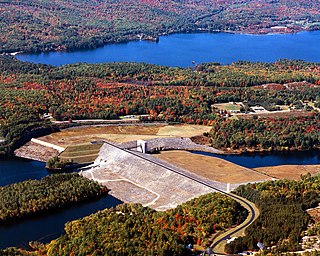
The Franklin Falls Dam is located on the Pemigewasset River in the city of Franklin, New Hampshire, in the United States. The dam was constructed between 1939 and 1943 by the Army Corps of Engineers and extends for 0.75 miles (1.21 km) across the river. During its construction, the neighboring residents of the town of Hill were forced to relocate to higher ground due to rising water levels created by the dam. The reservoir formed by the dam has a permanent pool covering 440 acres (180 ha), and the total flood storage capacity is 2,800 acres (1,100 ha). The total area of the project, including surrounding managed lands, is 3,683 acres (1,490 ha). The stretch of the Pemigewasset River potentially impounded by the dam extends 12.5 miles (20 km) north to Ayers Island Dam in the town of Bristol, and the watershed flowing to the dam extends north all the way into the White Mountains.
Fedar Creek is a stream in the U.S. state of Idaho. It is a tributary of Granite Creek.
Five Points is an unincorporated community in Goshen Township, Champaign County, Ohio, United States. It is located north of Mechanicsburg at the intersection of Ohio State Route 161, Ohio State Route 559, and Bullard-Rutan Road, at 40°06′03″N83°32′38″W.


