Clark County is a county located in the U.S. state of Nevada. The land area of Clark County is 8,061 square miles (20,880 km2), or roughly the size of New Jersey. As of the 2020 census, the population was 2,265,461. Most of the county population resides in the Las Vegas Census County Divisions, which has 2,196,623 people as of the 2020 Census. It is by far the most populous county in Nevada, and the 11th-most populous county in the United States. It covers 7% of the state's land area but holds 73% of the state's population, making Nevada the most centralized state in the United States.

Mohave County is a county in the northwestern corner of the U.S. state of Arizona. As of the 2020 census, its population was 213,267. The county seat is Kingman, and the largest city is Lake Havasu City. It is the fifth largest county in the United States.

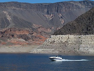
Lake Mead National Recreation Area is a U.S. national recreation area in southeastern Nevada and northwestern Arizona. Operated by the National Park Service, Lake Mead NRA follows the Colorado River corridor from the westernmost boundary of Grand Canyon National Park to just north of the cities of Laughlin, Nevada and Bullhead City, Arizona. It includes all of the eponymous Lake Mead as well as the smaller Lake Mohave – reservoirs on the river created by Hoover Dam and Davis Dam, respectively – and the surrounding desert terrain and wilderness.

A national recreation area (NRA) is a protected area in the United States established by an Act of Congress to preserve enhanced recreational opportunities in places with significant natural and scenic resources. There are 40 NRAs, which emphasize a variety of activities for visitors, including hiking, camping, boating, fishing, swimming, biking, horseback riding, and wildlife viewing, in areas that include multiple-use management for both conservation and limited utilization of natural resources. They have diverse features and contexts, being established around reservoirs, in urban areas, and within forests. Due to their size, diversity of activities, and proximity to population centers, NRAs are among the most visited units of the National Park System, with six among the thirty most visited sites.

Grand Canyon–Parashant National Monument is located on the northern edge of the Grand Canyon in northwest Arizona, on the Arizona Strip. The monument was established by Presidential Proclamation 7265 on January 11, 2000.

The Mission Mountains Wilderness is located in the U.S. state of Montana. Created by an act of Congress in 1975, the wilderness is within the Swan Lake Ranger District of the Flathead National Forest.

The Hualapai Mountains are a mountain range located in Mohave County, east of Kingman, Arizona. Rising up to 8,417 feet at its highest peak, the higher elevations of the Hualapai Mountains support Madrean Sky Island habitats, and are host to a plethora of unique flora and fauna in a wide range of microclimates, high above the surrounding Mojave Desert.
Height of the Rockies Provincial Park is a provincial park in the Canadian Rockies of south eastern British Columbia, Canada. It is located west of the Continental Divide, adjacent to Elk Lakes Provincial Park.

Carson National Forest is a national forest in northern New Mexico, United States. It encompasses 6,070 square kilometers and is administered by the United States Forest Service. The Forest Service's "mixed use" policy allows for its use for recreation, grazing, and resource extraction.

Umpqua National Forest, in southern Oregon's Cascade Range, covers an area of 983,129 acres (3,978.58 km2) in Douglas, Lane, and Jackson counties, and borders Crater Lake National Park. The four ranger districts for the forest are the Cottage Grove, Diamond Lake, North Umpqua, and Tiller ranger districts. The forest is managed by the United States Forest Service, headquartered in Roseburg.

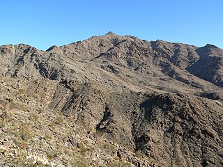
Spirit Mountain, also known as Avi Kwa Ame is a mountain within the Lake Mead National Recreation Area near Laughlin, Nevada. It is listed on the United States National Register of Historic Places as a sacred place to Native American tribes in Southern Nevada. Spirit Mountain is the highest point in the Spirit Mountain Wilderness and is the highest point in the Newberry Mountains with the summit peak at 5,639 feet (1,719 m).

The Kiavah Wilderness is a federally designated wilderness area located in the Mojave Desert, Scodie Mountains, and southern Sierra Nevada in Kern County, California, United States. California State Route 178 connects the town of Lake Isabella to State Highway 14 in the east, crossing Walker Pass at the north boundary of the wilderness.

Spirit Mountain Wilderness Area is a 33,518-acre (13,564 ha) wilderness area located in the Newberry Mountains in Clark County, Nevada, 10 miles (16 km) northwest of Laughlin. Spirit Mountain lies within the area. It is managed by the Bureau of Land Management and the National Park Service.
The Black Canyon Wilderness in the state of Nevada is a 17,220-acre (6,970 ha) wilderness area located in the Dry Lake Watershed along Dry Lake Valley at Black Canyon of the Colorado, west of the Great Basin Divide. It is part of the Lake Mead National Recreation Area. Immediately to the south is the Eldorado Wilderness, in the El Dorado Mountains. Together, the two wilderness areas protect 49,170 acres (19,900 ha).

Mount Wilson is a mountain in Mohave County, Arizona, U.S. At 5,456 feet (1,663 m), it is the second highest point of the Black Mountains after Mount Perkins.
Lime Canyon Wilderness is a unit of the National Wilderness Preservation System located in eastern Nevada, United States, within the Gold Butte National Monument. The 23,710-acre (9,600 ha) wilderness area is administered by the Bureau of Land Management, and was designated in 2002 to protect roadless, undeveloped mountains bordering Lake Mead National Recreation Area.

Muddy Mountains Wilderness Area is a 48,154-acre wilderness area, which is a part of the Muddy Mountains in Clark County, Nevada. The area is a part of the Lake Mead National Recreation Area.

Ireteba Peaks Wilderness is a 32,745 acre wilderness area spanning the area of the southern part of Eldorado Mountains to the northern parts of Lake Mohave. It is located 45 miles (72 km) south of Las Vegas and was designated as a wilderness area in 2002. Iretaba Peaks Wilderness is managed by the National Park Service and the Bureau of Land Management. The western (BLM) portion of the wilderness is part of Avi Kwa Ame National Monument, designated in 2023.
Jumbo Springs Wilderness is a 4,631 acre wilderness area located in Southern Nevada. Located 50 miles east of Las Vegas, the site connects to both the southern and eastern sides of Lake Mead. Jumbo Springs Wilderness was designated as a wilderness area in 2002 and is under the management of the Bureau of Land Management.


