
Mohave County is in the northwestern corner of the U.S. state of Arizona. As of the 2020 census, its population was 213,267. The county seat is Kingman, and the largest city is Lake Havasu City. It is the fifth largest county in the United States.
Kingman is a city in, and the county seat of, Mohave County, Arizona, United States. It is named after Lewis Kingman, an engineer for the Atlantic and Pacific Railroad. It is located 105 miles (169 km) southeast of Las Vegas, Nevada, and 180 miles (290 km) northwest of Arizona's state capital, Phoenix. The population was 32,689 at the 2020 census.

State Route 66 is a surface road in the U.S. state of Arizona in Mohave and Coconino Counties. In 1914, the road was designated "National Old Trails Highway" but in 1926 was re-designated as U.S. Route 66. In 1985, U.S. Route 66 was dropped from the highway system. Parts of the highway were either absorbed into I-40, turned over to the state, or turned over to Yavapai County.

Oatman is a census-designated place (CDP) in the Black Mountains of Mohave County, Arizona, United States, at an elevation of 2,710 feet (830 m). In 1915, it began as a small mining camp when two prospectors struck US$10 million in gold, though the vicinity had already been settled for several years. Oatman's population grew to more than 3,500 in one year. As of the 2020 United States census, its population was 102.
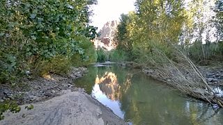
The Big Sandy River is both an intermittent and perennial stream in Mohave and La Paz counties in northwestern Arizona in the United States. It begins where Cottonwood Wash and Trout Creek converge in the Hualapai Indian Reservation east of U.S. Route 93 then flows past Wikieup south of Kingman. The Big Sandy River then passes the Signal Ghost Town Site, meanders through the Arrastra Mountain Wilderness, and joins the Santa Maria River in Southern Mohave County to form the Bill Williams River. The Bill Williams River then empties into Alamo Lake State Park. The Big Sandy River is 55.7 miles (89.6 km) long.

The Hualapai is a federally recognized Native American tribe in Arizona with about 2300 enrolled members. Approximately 1353 enrolled members reside on the Hualapai Reservation, which spans over three counties in Northern Arizona.

Erythranthe guttata, with the common names seep monkeyflower and common yellow monkeyflower, is a yellow bee-pollinated annual or perennial plant. It was formerly known as Mimulus guttatus.

U.S. Route 66 also known as the Will Rogers Highway, was a major United States Numbered Highway in the state of Arizona from November 11, 1926, to June 26, 1985. US 66 covered a total of 385.20 miles (619.92 km) through Arizona. The highway ran from west to east, starting in Needles, California, through Kingman and Seligman to the New Mexico state line. Nationally, US 66 ran from Santa Monica, California, to Chicago, Illinois. In its height of popularity, US 66 was one of the most popular highways in the state of Arizona, sometimes carrying over one million cars a year.

U.S. Route 93 (US 93) is a United States Numbered Highway in the state of Arizona that begins in Wickenburg and heads north to the Nevada state line at the Mike O'Callaghan–Pat Tillman Memorial Bridge. The total length of US 93 in Arizona is 199.38 miles. Between Wickenburg and Interstate 40 (I-40), part of US 93 is designated as the Joshua Forest Scenic Byway. While most of US 93 is a four-lane divided highway, sections of the highway between Wickenburg and I-40 are still narrow two-lane roads, gradually being upgraded to match the rest of the route. As part of a proposal by municipal leaders in Nevada and Arizona, the highway could be replaced by Interstate 11 (I-11).

Yucca is an unincorporated community and census-designated place (CDP) in Mohave County, Arizona, United States. As of the 2020 census it had a population of 96, down from 126 at the 2010 census.
Grasshopper Junction is an unincorporated community in Mohave County, Arizona, United States. Lying four miles (6 km) west of the town of Chloride, Grasshopper Junction provides access to a lone surviving mining camp along County Road 125. The area features the Grasshopper Junction restaurant as a roadside attraction.

Hackberry is an unincorporated community and census-designated place (CDP) in Mohave County, Arizona, United States. It is located on Arizona State Route 66 28 miles (45 km) northeast of Kingman. Hackberry has a post office which as of 2015 served 68 residential mailboxes with ZIP code 86411. As of the 2020 census, Hackberry had a population of 103.

Valentine is an unincorporated community and census-designated place (CDP) in Mohave County, Arizona, United States. As of the 2020 census it had a population of 39. Valentine is located on Arizona State Route 66 32 miles (51 km) northeast of Kingman. The majority of Valentine is located in a geographically isolated exclave of the Hualapai Reservation and the rest of the community is located in unincorporated Mohave County.

Erythranthe gemmipara is a rare species of flowering plant in the family Phrymaceae, known by the common name Rocky Mountain monkeyflower. It is endemic to Colorado in the United States, where there are eight known occurrences. It was formerly known as Mimulus gemmiparus.
Hualapai Valley is a valley in Mohave County, Arizona.

Antares is an unincorporated community and census designated place (CDP) in Mohave County, Arizona, United States. As of the 2020 census, it had a population of 132. It exists along part of historic U.S. Route 66.

Erythranthe, the monkey-flowers and musk-flowers, is a diverse plant genus with more than 120 members in the family Phrymaceae. Erythranthe was originally described as a separate genus, then generally regarded as a section within the genus Mimulus, and recently returned to generic rank. Mimulus sect. Diplacus was segregated from Mimulus as a separate genus at the same time. Mimulus remains as a small genus of eastern North America and the Southern Hemisphere. Molecular data show Erythranthe and Diplacus to be distinct evolutionary lines that are distinct from Mimulus as strictly defined, although this nomenclature is controversial.

Erythranthe verbenacea, also known as crimson monkeyflower, is a species of flowering plant native to western North America. This plant usually grows near desert watering places, and has been observed in the U.S. states of Utah and Arizona, and in several Mexican states including Sonora, Chihuahua, Durango, Sinaloa, and Baja California.

