WikiMili
Index of Arizona-related articles
Last updated
February 07, 2026
The location of the
state of Arizona
in the United States
Main article:
Arizona
See also:
Outline of Arizona
The following is an alphabetical list of articles related to the
U.S. state
of
Arizona
.
Contents
0–9
A
B
C
D
E
F
G
H
I
J
K
L
M
N
O
P
Q
R
S
T
U
V
W
X
Y
Z
See also
Contents
0–9
A
B
C
D
E
F
G
H
I
J
K
L
M
N
O
P
Q
R
S
T
U
V
W
X
Y
Z
See also
0–9
Map of Arizona
.az.us
–
Internet
second-level domain
for the
state of Arizona
4 Corners
4 Corners Monument
4 Peaks
7-Eleven
32nd meridian west from Washington
32nd parallel north
33rd parallel north
34th parallel north
35th parallel north
36th parallel north
37 Geminorum
37th meridian west from Washington
37th parallel north
50 State Quarters
110th meridian west
111th meridian west
112th meridian west
113th meridian west
114th meridian west
A
AMARC, "Boneyard", Tucson
An
apse
at Arcosanti
Capitol building of the Arizona Territory, built in 1901
Abert's squirrel
Acacia greggii
Aerospace Maintenance and Regeneration Center
Africanized bee
Agave deserti
All-American Canal
American Old West
Anasazi
Araucarioxylon arizonicum
Arcosanti
Area codes in Arizona
Arizona
Arizona bark scorpion
Arizona Borderlands
Arizona Cactus Botanical Garden
Arizona Canal
Arizona Cardinals
Arizona desert centipede
Arizona Conservatory for Arts and Academics
Arizona cypress
Arizona Department of Corrections, Rehabilitation & Reentry
Arizona Department of Economic Security
Arizona Department of Health Services
Arizona Department of Homeland Security
Arizona Department of Gaming
Arizona Department of Public Safety
Arizona Department of Liquor Licenses and Control
Arizona Department of Transportation
Arizona Diamondbacks
Arizona firecracker
Arizona Game and Fish Department
Arizona Health Care Cost Containment System
Arizona Highways (magazine)
Arizona League Mexico
Arizona Medical Training Institute
Arizona Native Plant Society
Arizona Rattlers
Arizona Saves
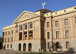
Arizona State Capitol
Arizona State Parks
Arizona State Route 66
Arizona State University
ASU School of Sustainability
Arizona Sting
Arizona Strip
Arizona Territory
Arizona Veterans Memorial Coliseum
Arizona Western College
Arizona woodpecker
Arizonasaurus
Arizona-Sonora Desert Museum
Aspen Fire
Art museums and galleries in Arizona
commons:Category:Art museums and galleries in Arizona
Astronomical observatories in Arizona
commons:Category:Astronomical observatories in Arizona
AZ
–
United States Postal Service
postal code for the
state of Arizona
B
Arizona's official state neckwear: the Bolo (or bola) tie
Barringer Crater
Battle of Apache Pass
Beaver Dam Mountains Wilderness
Black Canyon of the Colorado
Blythe Intaglios
Bola tie
Botanical gardens in Arizona
commons:Category:Botanical gardens in Arizona
Boyce Thompson Arboretum State Park
Bright Angel Trail
Buildings and structures in Arizona
commons:Category:Buildings and structures in Arizona
C
Spider Rock at Canyon de Chelly
An enlargeable map of the
15 counties
of the
state of Arizona
Cabeza Prieta National Wildlife Refuge
Camelback Mountain
Canada del Oro
Canyon de Chelly National Monument
Canyons and gorges of Arizona
commons:Category:Canyons and gorges of Arizona
Capital of the state of Arizona
Capitol of the state of Arizona
commons:Category:Arizona State Capitol
Casa Grande Ruins National Monument
Casinos in Arizona
Catalina Highway
Caves of Arizona
commons:Category:Caves of Arizona
Cemeteries in Arizona
Census statistical areas in Arizona
Central Arizona Museum Association
Central Arizona Project Aqueduct
Climate of Arizona
Climate change in Arizona
Coconino Plateau
Collared peccary
Colorado Desert
Colorado pinyon
Colorado Plateau
Colorado River
Colorado River Compact
Colorado River Delta
Communications in Arizona
commons:Category:Communications in Arizona
Confederate Territory of Arizona
, 1862–1865
Convention centers in Arizona
commons:Category:Convention centers in Arizona
Copper extraction
Copper mining in Arizona
Coronado National Memorial
Counties of the state of Arizona
commons:Category:Counties in Arizona
Cross Rail Ranch
Cuisine of Arizona
Culture of Arizona
Category:Culture of Arizona
commons:Category:Arizona culture
Cupressus arizonica
(
Arizona cypress
)
Curve-billed thrasher
D
Dasylirion wheeleri
Dasylirion wheeleri
, the desert spoon or
sotol
Davis-Monthan Air Force Base
Aerospace Maintenance and Regeneration Center
Deck Park Tunnel
Demographics of Arizona
Desert bighorn sheep
Desert iguana
Desert tortoise
Desertification
Deserts and xeric shrublands
Dendrochronology
Deserts
:
Colorado Desert
Lechuguilla Desert
North American Desert
Painted Desert, Arizona
Sonoran Desert
Tule Desert (Arizona)
Yuma Desert
Dry Lake Wind Power Project
E
Economy of Arizona
Category:Economy of Arizona
commons:Category:Economy of Arizona
Education in Arizona
Category:Education in Arizona
commons:Category:Education in Arizona
Elections in the state of Arizona
commons:Category:Arizona elections
Entrenched river
Environment of Arizona
commons:Category:Environment of Arizona
F
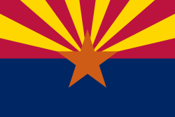
The
Flag of the State of Arizona
Festivals in Arizona
commons:Category:Festivals in Arizona
Flag of the State of Arizona
Forts of Arizona
Fort Whipple
, first capital of
Arizona territory
1864
Category:Forts in Arizona
commons:Category:Forts in Arizona
Four Corners
Four Corners Monument
Four Peaks
Frye Mesa Reservoir
G
The
Great Seal of the State of Arizona
First run of the Grand Canyon Railway, 1901
Gadsden Purchase
of 1853
Geography of Arizona
Category:Geography of Arizona
commons:Category:Geography of Arizona
Geology of Arizona
Geology of the Grand Canyon area
commons:Category:Geology of Arizona
Get Back
Ghost towns in Arizona
Category:Ghost towns in Arizona
commons:Category:Ghost towns in Arizona
Gila monster
Gila River
Gila trout
Gila woodpecker
Glen Canyon
Glen Canyon Dam
Gold cyanidation
Golf clubs and courses in Arizona
Government of the state of Arizona
website
Category:Government of Arizona
commons:Category:Government of Arizona
Governor of the State of Arizona
List of governors of Arizona
Grand Canyon
Grand Canyon Railway
Grand Canyon–Parashant National Monument
Great Seal of the State of Arizona
Great Unconformity
Gulf of California
(
Sea of Cortez
)
H
Havasu Falls
Haboob
Havasu Falls
Heritage railroads in Arizona
commons:Category:Heritage railroads in Arizona
Hiking trails in Arizona
commons:Category:Hiking trails in Arizona
History of Arizona
Historical outline of Arizona
Category:History of Arizona
commons:Category:History of Arizona
History of Phoenix, Arizona
Hoover Dam
Hoover Dam Bypass
Hot springs of Arizona
commons:Category:Hot springs of Arizona
Hotel San Carlos
Humphreys Peak
I
Images of Arizona
commons:Category:Arizona
Indigenous peoples in Arizona
Ipomopsis arizonica
(Arizona firecracker)
Islands in Arizona
J
Joshua tree in Arizona
James Reavis
, The 'Baron of Arizona'
Jojoba
Joshua tree
Jumping Cholla
K
Kaibab Plateau
Kaibab squirrel
Kitt Peak National Observatory
L
Lake Powell
Lowell Observatory, Flagstaff
Lakes in Arizona
Lake Mead
Lake Powell
Lechuguilla Desert
Lee's Ferry
Lists related to the state of Arizona
:
List of airports in Arizona
List of birds in Arizona
List of cemeteries in Arizona
List of census statistical areas in Arizona
List of cities in Arizona
List of colleges and universities in Arizona
List of Colorado River rapids and features
List of companies in Arizona
List of counties in Arizona
List of county name etymologies in Arizona
List of county seats in Arizona
List of dams and reservoirs in Arizona
List of ghost towns in Arizona
List of governors of Arizona
List of high schools in Arizona
List of highway routes in Arizona
List of hospitals in Arizona
List of hurricanes in Arizona
List of individuals executed in Arizona
List of islands in Arizona
List of lakes in Arizona
List of lava flows in Arizona
List of law enforcement agencies in Arizona
List of localities in Arizona
List of mountain ranges of Arizona
List of mountains and hills of Arizona by height
List of museums in Arizona
List of National Historic Landmarks in Arizona
List of newspapers in Arizona
List of North American deserts
List of people from Arizona
List of people from Tucson
List of places in Arizona
List of power stations in Arizona
List of private and independent schools in Arizona
List of radio stations in Arizona
List of railroads in Arizona
List of Registered Historic Places in Arizona
List of Registered Historic Places in Coconino County, Arizona
List of rivers of Arizona
List of school districts in Arizona
List of Sonoran Desert birds (Arizona)
List of state parks in Arizona
List of state prisons in Arizona
List of symbols of the State of Arizona
List of telephone area codes in Arizona
List of television stations in Arizona
List of towns in Arizona
List of Arizona's congressional delegations
List of United States congressional districts in Arizona
List of United States representatives from Arizona
List of United States senators from Arizona
List of valleys of Arizona
List of wilderness areas in Arizona
List of wilderness areas in the Lower Colorado River Valley of Arizona
Little Colorado River
London Bridge
Lost Dutchman's Gold Mine
Lowell Observatory
M
Meteor Crater
Mohave rattlesnake
Madera Canyon (Arizona)
Madrean Sky Islands
Maps of Arizona
commons:Category:Maps of Arizona
Marble Canyon
McKale Center
Meteor Crater
Mexican period of Arizona
, 1821–1848
Mike O'Callaghan – Pat Tillman Memorial Bridge
Mirrorshades Project
Mission San Xavier del Bac
Mogollon
Mogollon Monster
Mogollon Plateau
Mogollon Rim
Mojave rattlesnake
Monument Valley
Monuments and memorials in Arizona
commons:Category:Monuments and memorials in Arizona
Mormon volcanic field
Mountains of Arizona
Mount Graham
Mount Lemmon
commons:Category:Mountains of Arizona
Museums in Arizona
Category:Museums in Arizona
commons:Category:Museums in Arizona
Music of Arizona
Category:Music of Arizona
commons:Category:Music of Arizona
Category:Musical groups from Arizona
Category:Musicians from Arizona
Mystery Castle
N
Old Main at NAU
National forests of Arizona
commons:Category:National Forests of Arizona
National monuments in Arizona
commons:Category:National Monuments in Arizona
National Parks in Arizona
commons:Category:National Parks in Arizona
National Radio Astronomy Observatory
Native Americans in Arizona
Natural arches of Arizona
commons:Category:Natural arches of Arizona
Natural gas pipelines in Arizona
Natural history of Arizona
commons:Category:Natural history of Arizona
Navajo Bridge
Navajo Nation
(Native American)
North American Desert
Northern Arizona University
O
Ocotillo in bloom
Ocotillo
Old Plank Road
O'odham
P
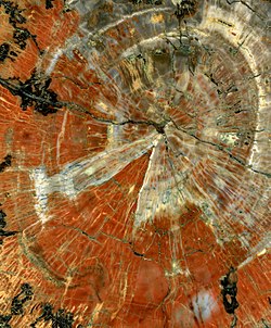
Petrified wood from Arizona
Painted lady
(butterfly)
Palo verde
, State tree
Paria Canyon-Vermilion Cliffs Wilderness
Patayan
People from Arizona
Category:People from Arizona
commons:Category:People from Arizona
Category:People from Arizona by populated place
Category:People from Arizona by county
Category:People from Arizona by occupation
Petrified wood
Phantom Ranch
Phoenix, Arizona
, territorial and state capital since 1889
Phoenix (mythology)
Phoenix Coyotes
Phoenix Eclipse
Phoenix Mercury
Phoenix Municipal Stadium
Phoenix Sky Harbor International Airport
Phoenix Suns
Phoenix Zoo
Piestewa Peak
Politics of Arizona
commons:Category:Politics of Arizona
Prescott, Arizona
, territorial capital 1864–1867 and 1877–1889
Prickly pear cactus
Protected areas of Arizona
commons:Category:Protected areas of Arizona
Q
Ben Quayle
Dan Quayle
R
Railroad museums in Arizona
commons:Category:Railroad museums in Arizona
Rattlesnake
Red Butte
Religion in Arizona
Category:Religion in Arizona
commons:Category:Religion in Arizona
Repatriation flight program
Rock formations in Arizona
commons:Category:Rock formations in Arizona
S
Restored altar and interior of Mission San Xavier del Bac
Saguaro
Saguaro National Park
Salt River Project
San Francisco Peaks
San Francisco volcanic field
San Xavier del Bac Mission
Scouting in Arizona
Sea of Cortez
(
Gulf of California
)
Settlements in Arizona
Cities in Arizona
Towns in Arizona
Census Designated Places in Arizona
Other unincorporated communities in Arizona
List of ghost towns in Arizona
List of places in Arizona
Shannon's law (Arizona)
Sierra Madre Occidental pine-oak forests
Silver mining in Arizona
Sinagua
Ski areas and resorts in Arizona
commons:Category:Ski areas and resorts in Arizona
Snaketown
Soaptree yucca
Solar power in Arizona
Sonoran Desert
Sonorasaurus
Sonorasaurus
Southwest Extreme Triangle
Southwestern United States
Spanish missions in the Sonoran Desert
Spanish missions in Arizona
Spanish period of Arizona
, 1687–1821
Sports in Arizona
commons:Category:Sports in Arizona
Sports venues in Arizona
commons:Category:Sports venues in Arizona
State of Arizona
website
Government of the state of Arizona
Category:Government of Arizona
commons:Category:Government of Arizona
Structures in Arizona
commons:Category:Buildings and structures in Arizona
Sun Devil Stadium
Birds-eye view of
Sunset Crater
Sunset Crater
Super Bowl XXVII
Superfund sites in Arizona
Symbols of the State of Arizona
Arizona state amphibian:
Arizona treefrog
(
Hyla eximia
)
Arizona state bird:
cactus wren
(
Campylorhynchus brunneicapillus
)
Arizona state butterfly:
two-tailed swallowtail
(
Papilio multicaudata
)
Arizona state colors:
federal blue
and
old gold
Arizona state fish:
Arizona trout
(
Oncorhynchus gilae apache
)
Arizona state flag:
Flag of the State of Arizona
Arizona state flower:
saguaro blossom
(
Carnegiea gigantea
)
Arizona state fossil:
petrified wood
Arizona state gemstone:
turquoise
Arizona state mammal:
ringtail
(
Bassariscus astutus
)
Arizona state motto:
Ditat Deus
(
Latin
for
God enriches
)
Arizona state neckwear:
bolo tie
Arizona state nickname and slogan:
Grand Canyon State
Arizona state reptile:
Arizona ridge-nosed rattlesnake
(
Crotalus willardi
)
Arizona state seal:
Great Seal of the State of Arizona
Arizona state songs:
Arizona March Song
and
Arizona
Arizona state tree:
blue palo verde
(
Parkinsonia florida
)
United States quarter dollar – Arizona 2008:
T
Mexican redknee tarantula
Tarantula
Telecommunications in Arizona
commons:Category:Communications in Arizona
Telephone area codes in Arizona
Territory of Arizona
, 1863–1912
Territory of Arizona (CSA)
, 1861–1865
Territory of New Mexico
, 1850–1863 & 1863–1912
Texas Canyon
Theatres in Arizona
commons:Category:Theatres in Arizona
Titan Missile Museum
Tohono O'odham
, southern Arizona Nation
Tourism in Arizona
commons:Category:Tourism in Arizona
Transportation in Arizona
Category:Transportation in Arizona
commons:Category:Transport in Arizona
Treaty of Guadalupe Hidalgo
of 1848
Tucson, Arizona
, territorial capital 1867–1877
Tucson Bird Count
Tucson Gem & Mineral Show
Tule Desert (Arizona)
Turf Paradise
U
USS
Arizona
'
s forward magazines explode during the
attack on Pearl Harbor
, 1941. 1,177 people died in the sinking of the
Arizona
.
UFO
United States of America
States of the United States of America
United States census statistical areas of Arizona
Arizona's congressional delegations
United States congressional districts in Arizona
United States Court of Appeals for the Ninth Circuit
United States District Court for the District of Arizona
United States representatives from Arizona
United States senators from Arizona
United States-Mexico border
University of Arizona
University of Arizona Mineral Museum
University of Phoenix Stadium
Uranium mining in Arizona
U.S. Route 66
US-AZ
–
ISO 3166-2:US
region code for the
state of Arizona
USS
Arizona
(BB-39)
USS
Arizona
Memorial
V
Verde Valley
W
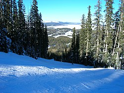
View from
Sunrise Peak
in Arizona's White Mountains
Walnut Canyon National Monument
Waterfalls in Arizona
commons:Category:Waterfalls in Arizona
Western painted lady
(butterfly)
Western United States
White Mountains (Arizona)
;Wikimedia
Wikimedia Commons:Category:Arizona
commons:Category:Maps of Arizona
n:Category:Arizona
n:Portal:Arizona
Wikipedia Category:Arizona
Wikipedia Portal:Arizona
Wikipedia:WikiProject Arizona
Category:WikiProject Arizona articles
Category:WikiProject Arizona participants
Wind power in Arizona
Windsor Hotel
Wrather Arch
X
Main gate of the old Yuma Territorial Prison
Xavier College Preparatory (Arizona)
Xeric shrublands and deserts
Xeriscaping
Y
Yaqui
Yucca
Yuma Desert
Yuma Territorial Prison
Yuman
Yuman music
Z
Zoos in Arizona
commons:Category:Zoos in Arizona
See also
Arizona portal
History portal
Mexico portal
Geography portal
North America portal
United States portal
Topic overview:
Arizona
Outline of Arizona
All pages with titles beginning with
Arizona
All pages with titles beginning with
Arizonian
All pages with titles containing
Arizona
All pages with titles containing
Arizonian
v
t
e
Indices
General reference
Culture and the arts
Geography and places
Health and fitness
History and events
Law
Mathematics and logic
Natural and physical sciences
People and self
Philosophy and thinking
Religion and belief systems
Society and social sciences
Technology and applied sciences
v
t
e
Index of United States–related articles
by political division
States
Alabama
Alaska
Arizona
Arkansas
California
Colorado
Connecticut
Delaware
Florida
Georgia
Hawaii
Idaho
Illinois
Indiana
Iowa
Kansas
Kentucky
Louisiana
Maine
Maryland
Massachusetts
Michigan
Minnesota
Mississippi
Missouri
Montana
Nebraska
Nevada
New Hampshire
New Jersey
New Mexico
New York
North Carolina
North Dakota
Ohio
Oklahoma
Oregon
Pennsylvania
Rhode Island
South Carolina
South Dakota
Tennessee
Texas
Utah
Vermont
Virginia
Washington
West Virginia
Wisconsin
Wyoming
Federal district
Washington, D.C.
Territories
American Samoa
Guam
Northern Mariana Islands
Puerto Rico
U.S. Virgin Islands
v
t
e
State
of
Arizona
Phoenix
(capital)
Topics
Agriculture
Cities
Geography
Government
constitution
governor
legislature
Index
Congressional delegations
senators
representatives
Museums
Music
Native Americans
People
Symbols
Tourist attractions
Transportation
Society
Abortion
Climate change
Culture
Crime
Demographics
Economy
Education
Elections
Gun laws
LGBTQ rights
Politics
Homelessness
Regions
Arizona Strip
Arizona Sun Corridor
Coconino Plateau
Colorado Plateau
Grand Canyon
Kaibab Plateau
Mogollon Plateau
Mogollon Rim
Mojave Desert
Monument Valley
North Central Arizona
Northeast Arizona
Northern Arizona
Oak Creek Canyon
Phoenix Metropolitan Area
Safford area
San Francisco Volcanic Field
Sonoran Desert
Southern Arizona
Traditional Arizona
Transition zone
Verde Valley
White Mountains
Counties
Apache
Cochise
Coconino
Gila
Graham
Greenlee
La Paz
Maricopa
Mohave
Navajo
Pima
Pinal
Santa Cruz
Yavapai
Yuma
History
Arizona Territory
Aztec Land & Cattle Company
Battle of Ambos Nogales
Hualapai War
Mohave War
Pah-Ute County
Sheep wars
Sitgreaves Expedition
Territorial evolution
Timeline
Mesa
Phoenix
Tucson
World War II
Women's suffrage
Portal
This page is based on this
Wikipedia article
Text is available under the
CC BY-SA 4.0
license; additional terms may apply.
Images, videos and audio are available under their respective licenses.