The System
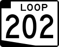
The numbering system for the state routes, with exceptions, prefers using numbers 60-99 for the routes, except when taken by an applicable US Route. Freeway state route numbers are hand-picked numbers below 60, with 24, 30, 50, and 51, being the chosen numbers. Loop freeways (Loop 101, Loop 202, Loop 303) follow a predictable (X0X) pattern, increasing both in the order of when they were constructed and distance from the city's center. Freeways near Phoenix Sky Harbor Airport were given the numbers of 143 and 153.
History and Exceptions
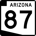
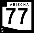
In 1927, when the system was created, the first ten state routes were added, in conjunction with the already existing US Routes. Six of these routes (73, 82, 83, 84, 87 and 88) still exist today. [7] As the system grew and expanded throughout the decades, more and more routes were added. A notable development came in 1932, when the first 3 digit spur route was added, State Route 287, a spur of Route 87. As the system continued to grow and evolve, some routes were decommissioned, and their numbers were re-used for future highways, as due to the limitations, limited numbers were available. As US routes began being decommissioned due to the rise of the Interstate Highway System, old alignments were often added to the state route system, keeping the number of the old US Highway, as a state route, all falling in the 60-99 range. As the system started to run out of numbers, more and more spur routes began being added to the system, which sometimes did not connect to their true parent, but rather, "in the vicinity" of the route. In 1974, the last 60-99 number was added to the system, State Route 98. The passage of Proposition 300 brought proper freeways to the valley, spelling the end of the state route system, since as mentioned above, state route freeways follow their own numbering rules, and State Route 143 in 1985 marked the first non-spur route to fall outside of the 60-99 system. The true end of the system occurred one year later, when State Route 238 (a non-freeway) was added, given the number seemingly at random, rather than "94" as proposed. Since 98 was added in 1974, all routes added to the system have either been freeways, spurs, small three-digit stubs, or de-commissioned US routes. Since the program's inception in 1927, all numbers between 60 and 99 were used by at least one State or US Route, aside from 94.