Illinois State Highway System

Last updated
State Highway System

I-57.svg

US 45.svg

Illinois 1.svg

Chicago Skyway logo.svg
Highway markers for Interstate 57, U.S. Route 45, Illinois Route 1 and the Chicago Skyway
Illinois-overall.png
Overall map of system: freeways in light blue, tollways in green, other highways in yellow
System information
Maintained by IDOT, ISTHA, and SCC
FormedNovember 5, 1918 (1918-11-05) [1]
Highway names
Interstates Interstate X (I-X)
US Highways U.S. Route X (US X)
State Illinois Route X (IL X)
System links

The organized State Highway System of the U.S. state of Illinois comprises all of the state routes in the state.

Contents

Illinois Highway Code

The Illinois Highway Code (605 ILCS5) states that all state highways are to be numbered and that no state highway shall go unnumbered. [2] In addition, roads in the system include state highways that connect

any State park, State forest, State wildlife or fish refuge, the grounds of any State institution or any recreational, scenic or historic place owned or operated by the State; any national cemetery; and to any tax supported airport constructed in part by State and federal funds [3]

Descriptions of each individual state highway are filed with the county clerk of the county in which the state highway resides. [4] State highways may be maintained by either the municipalities if within a municipality, or the Illinois Department of Transportation. [5] Should a highway run through a municipality, IDOT is authorized to choose a route through the municipality in order to make a route contiguous for through traffic. [6]

History

The State Highway System was created in 1918 with the first State Bond Issue (SBI) Routes, 1 through 46. Bonds were floated to pay for specific routes. SBI # 1 paid for Route 1, and so on. These initial 46 route numbers marked the major infrastructure roads desired by the state legislature in 1918. Remarkably, many of these numbers still exist on the original or nearby alignment. As the highway system grew these numbers were altered to accommodate new roads or extensions of older roads.

In 1924, additional State Bond Issues were authorized for SBI Routes 47 through 185. These route numbers were originally assigned and grouped to specific regions of the state. Thus, it is not uncommon to find groups of routes with similar numbers around each other (routes 23, 26, and 29 are found in north-central Illinois, while routes 53, 56, 58, 59, 60, 62, 64, 68 and 72 are all found in northeastern Illinois and routes 100, 101, 103, 104, 105, 107 are found in western Illinois west of the Illinois River and largely south of McDonough County line.

SBI Route numbers that were superseded by other routes, US or state routes were often reused. For example, SBI Route 61 was originally assigned to a road segment in northeastern Illinois, but was reassigned to a route in western Illinois, sometime after 1937.

Illinois Route 72 cross-sign mounted on a stoplight in Hoffman Estates ILL 72 route sign.jpg
Illinois Route 72 cross-sign mounted on a stoplight in Hoffman Estates

SBI Numbers are still used for several purposes, even when they do not match the posted number. IDOT District maps still refer to SBI numbers on the various roads it maintains, along with other non-posted designations that refer to how the route was authorized. Bridge weight plates refer to SBI numbers instead of posted route numbers as well. For example, bridge plates along old US-66 refer to the route as "SBI-4"

When the United States Numbered Highway System was started in 1926, the US numbers were just tacked onto the existing IL/SBI number unless the US Route was routed along a new route.

See also

Related Research Articles

<span class="mw-page-title-main">State highways in California</span> Highway system

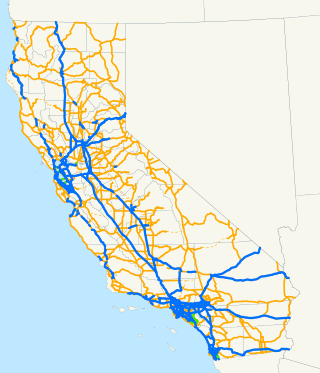
The state highway system of the U.S. state of California is a network of highways that are owned and maintained by the California Department of Transportation (Caltrans).

A routenumber, designation or abbreviation is an identifying numeric designation assigned by a highway authority to a particular stretch of roadway to distinguish it from other routes and, in many cases, also to indicate its classification, general geographical location and/or orientation. The numbers chosen may be used solely for internal administrative purposes; however, in most cases they are also displayed on roadside signage and indicated on maps.

<span class="mw-page-title-main">Illinois Tollway</span>

The Illinois State Toll Highway Authority (ISTHA) is an administrative agency of the U.S. state of Illinois charged with building, operating, and maintaining toll roads in the state. The roads, as well as the authority itself, are sometimes referred to as the Illinois Tollway. The system opened in 1958 in the Chicago area, and has subsequently expanded to include the eastern and central sections of Interstate 88 (I-88) extending into the northwestern part of the state. Beginning in 2005, the system was reconstructed to include more lanes and open road tolling, the latter of which uses I-Pass transponders to collect revenue as vehicles pass antennas at toll plazas or designated entrance or exit ramps. As of 2017, ISTHA maintains and operates 294 miles (473 km) of tollways in 12 counties in Northern Illinois.

<span class="mw-page-title-main">Illinois Route 25</span> Highway in Illinois

Illinois Route 25 is a state route in northeast Illinois. It runs north from U.S. Route 34 in Oswego to Illinois Route 62 in Algonquin. Illinois 25 is 35.04 miles (56.39 km) in length.

<span class="mw-page-title-main">Illinois Route 40</span> Highway in Illinois

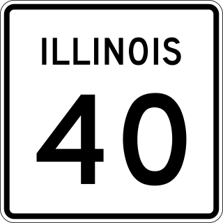
Illinois Route 40 is a 112.05-mile-long (180.33 km) north–south route in central portion of the U.S. state of Illinois. It runs from Interstate 74 (I-74) in East Peoria north to IL 78 at Mt. Carroll, just south of U.S. Route 52 and IL 64.

<span class="mw-page-title-main">Illinois Route 53</span> Highway in Illinois

Illinois Route 53 (IL 53) is an arterial north–south state highway in northeast Illinois. IL 53 runs from Main Street west of historic U.S. Route 66 (US 66) in Gardner to IL 83 in Long Grove, a distance of 82.02 miles (132.00 km). It mainly cuts through the western suburbs of Chicago, passes through Bolingbrook, Romeoville, Crest Hill and Joliet, merging into I-55 at Gardner.

<span class="mw-page-title-main">Illinois Route 171</span>

Illinois Route 171 (IL 171) is a 38.61-mile-long (62.14 km) north–south state highway in northeastern Illinois. It runs from U.S. Route 6 (US 6) in Joliet north to Illinois Route 72 at the Chicago–Park Ridge border. The section of IL 171 on Archer Avenue from Joliet to Summit is historically significant, originating as a Native American trail, and later serving for a time as part of the first numbered highway between St. Louis and Chicago.

<span class="mw-page-title-main">Illinois Route 68</span> Highway in Illinois

Illinois Route 68 (IL 68) is a 25.74-mile-long (41.42 km) east–west state highway in the northeastern part of the U.S. state of Illinois. It travels east from IL 72 in the Dundee area to the concurrency of Interstate 94 (I-94)/U.S. Route 41 (US 41) in Glencoe.

<span class="mw-page-title-main">Interstate 190 (Illinois)</span> Highway in Illinois

Interstate 190 (I-190) is an auxiliary Interstate Highway in the US state of Illinois. I-190 runs west from I-90 to O'Hare International Airport, for a distance of 3.07 miles (4.94 km). I-190 is the westernmost leg of the Kennedy Expressway.

<span class="mw-page-title-main">Interstate 41</span> Interstate Highway in eastern Wisconsin

Interstate 41 (I-41) is a 176.33-mile-long (283.78 km) north–south Interstate Highway connecting the interchange of I-94 and U.S. Route 41 (US 41), located 0.9 miles (1.4 km) south of the Wisconsin–Illinois border at the end of the Tri-State Tollway in metropolitan Chicago, to an interchange with I-43 in metropolitan Green Bay, Wisconsin. The designation travels concurrently with US 41 for its entire length, as well as portions of I-894, US 45, I-43, and sections of I-94 in Wisconsin and Illinois. The route was officially added to the Interstate Highway System on April 7, 2015, and connects Milwaukee and Green Bay with the Fox Cities.

<span class="mw-page-title-main">Illinois Route 126</span>

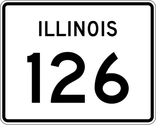
Illinois Route 126 (IL 126) is a 17.25-mile-long (27.76 km) east–west state highway in the northern part of the U.S. state of Illinois. It travels from IL 47 in Yorkville to Interstate 55 (I-55) between Plainfield and Bolingbrook.

<span class="mw-page-title-main">Illinois Route 162</span>

Illinois Route 162 (IL 162) is a 16.36-mile-long (26.33 km) east–west highway in the southwestern part of the U.S. state of Illinois. It travels from IL 203 in Granite City east to U.S. Route 40 (US 40) near Troy.

<span class="mw-page-title-main">Illinois Route 140</span>

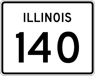
Illinois Route 140 is a 52.05-mile-long (83.77 km) east–west highway with its western terminus at Illinois Route 143 in Alton and its eastern terminus at U.S. Route 40 near Mulberry Grove. It also overlaps IL 111 in Alton and IL 127 in Greenville.

<span class="mw-page-title-main">Interstate 155 (Illinois)</span> Highway in Illinois

Interstate 155 (I-155) is a north–south spur of I-55 that provides an Interstate connection for the Illinois cities of Peoria and Lincoln. The northern terminus is just east of Peoria, at I-74 exit 101 in Morton. The southern terminus, which is northwest of Lincoln, is located on I-55 at exit 127. The highway is 32.13 miles (51.71 km) long.

The Illinois Department of Transportation (IDOT) is a state agency in charge of state-maintained public roadways of the U.S. state of Illinois. In addition, IDOT provides funding for rail, public transit and airport projects and administers fuel tax and federal funding to local jurisdictions in the state. The Secretary of Transportation reports to the Governor of Illinois. IDOT is headquartered in unincorporated Sangamon County, located near the state capital, Springfield. In addition, the IDOT Division of Highways has offices in nine locations throughout the state.

<span class="mw-page-title-main">Interstate 74 in Illinois</span> Highway in Illinois

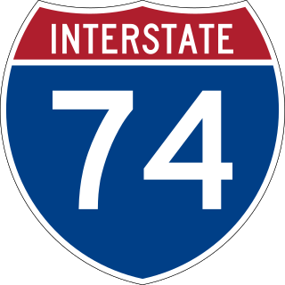
Interstate 74 (I-74) in the US state of Illinois is a major northwest–southeast Interstate Highway that runs across the central portion of the state. It runs from the Iowa state line at the Mississippi River near the city of Rock Island and runs southeast to the Indiana state line east of Danville, a distance of 220.34 miles (354.60 km). The highway runs through the major cities of Champaign, Bloomington, Peoria, and Moline.

<span class="mw-page-title-main">Interstate 66 (Kansas–Kentucky)</span> Canceled highway in the United States

Interstate 66 (I-66) is a canceled Interstate Highway designated in the Intermodal Surface Transportation Efficiency Act (ISTEA) of 1991 as the East–West TransAmerica Corridor and High Priority Corridor 3. The US Department of Transportation originally planned to extend the current I-66 from its western terminus at Middletown, Virginia, across the country to California. The route west of Kansas was not favored by any of the related state highway departments, and, as a result, I-66 west of Wichita, Kansas, through New Mexico, Arizona, Nevada and California was canceled. Among the reasons for this were lack of interest from any of the state highway departments, and the insufficient projected traffic did not justify an Interstate, especially since many segments had no preexisting highway. The National Park Service was strongly opposed to building I-66 across the Death Valley National Park. The choice for the number I-66 was a hope to capitalize on name association with the decommissioned US Route 66 (US 66). The case for westward expansion of I-66 was started by businesspeople in Wichita. Furthermore, there were no plans to build I-66 across the West Virginia–Virginia state line, leaving it as a non-contiguous highway. The I-66 concept was supported in Kentucky mainly because of the efforts of Representative Hal Rogers; however, the Kentucky Transportation Cabinet (KYTC) completed its feasibility study in 2005 and concluded that building I-66 was too costly and of little traffic benefit with high potential environmental impact and canceled the project in that state. The only remaining study of I-66 was conducted by the Federal Highway Administration (FHWA) and the Illinois Department of Transportation (IDOT) under the 66 Corridor Study, a Tier 1 environmental impact statement (EIS). This study was canceled August 6, 2015, by IDOT, and, subsequently, the FHWA announced the cancellation of the EIS in the Federal Register, ending the last I-66 project and therefore officially canceling the I-66 Trans America Highway.

<span class="mw-page-title-main">Interstate 94 in Illinois</span>

Interstate 94 (I-94) generally runs north–south through the northeastern portion of the US state of Illinois, in Lake and Cook counties. It is signed east–west in Illinois in accordance with its general alignment across the country, with west signage aligned with northbound travel and vice versa. I-94 in Illinois is 61.53 miles (99.02 km) long.

<span class="mw-page-title-main">U.S. Route 67 in Illinois</span> Section of United States Numbered Highway in Illinois, United States

U.S. Route 67 (US 67) is a component of the United States Numbered Highway System that connects Presidio, Texas, to Sabula, Iowa. In Illinois, it serves the western region of the state known as Forgottonia, named for the lack of regional transportation and infrastructure projects. The highway begins its path through the state by crossing the Clark Bridge over the Mississippi River from Missouri at Alton and heads northward through Jerseyville and Jacksonville before it crosses the Illinois River at Beardstown. The northern half of the route serves Macomb and Monmouth before it enters the Quad Cities. It leaves the state at Rock Island by crossing the Rock Island Centennial Bridge over the Mississippi River into Davenport, Iowa.

References

  1. Carlson, Miriam C. (April 2002). "Out of the Mud: Illinois' Good Roads Movement". Illinois History. Illinois Historic Preservation Agency. 55 (3): 47–9. ISSN   0019-2058 via Illinois Periodicals Online.
  2. 605 ILCS5/4-201.11
  3. 605 ILCS5/4-201.5
  4. 605 ILCS5/4-204
  5. 605 ILCS5/4-203, 605 ILCS5/4-208
  6. 605 ILCS5/4-205