North Carolina Highway System

Last updated
North Carolina Highway System

I-40.svg

US 64.svg

NC 24.svg

System information
Length79,328 mi [1]  (127,666 km)
NotesSecond largest state-maintained highway network in the United States; [2] [3] state roads maintained by the NCDOT.
Highway names
Interstates Interstate X (I-X)
US Highways U.S. Highway X (US X)
State North Carolina Highway X (NC X)
System links

The North Carolina Highway System consists of a vast network of Interstate, United States, and state highways, managed by the North Carolina Department of Transportation. North Carolina has the second largest state maintained highway network in the United States because all roads in North Carolina are maintained by either municipalities or the state. Since counties do not maintain roads, there is no such thing as a "county road" within the state. [2] [3]

Contents

Numbering

Current North Carolina highway marker design NC 67.svg
Current North Carolina highway marker design

North Carolina routes may be referred to as "North Carolina Highway x", "N.C. Highway x", "NC Route x", or just "NC x", where x is the route number. North Carolina state highways numbered under 1000 are primary state highways, [4] and numbers greater than or equal to 1000 are secondary. Nearly all secondary highways also have other names, and many primary routes are also signed with other titles.

Signage

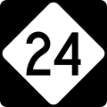
Primary highways are marked by a black square sign in which is a white equilateral diamond shape with rounded corners that contains the route number. The diamond shape does not alter to accommodate larger route numbers; the numbers are reduced in size to fit within the diamond. Michigan is the only other state, aside from North Carolina, to have a near-identical route shield, but with pointed corners and an M in Michigan's shield. Secondary highways are not signed with route markers; small green or white signs are most commonly used to designate secondary roads. On these signs, the prefix "SR" for "secondary road" sometimes precedes the road number.

Rules and exceptions

Typically, North Carolina highway route numbers do not share numbers with any U.S. Highway or Interstate Highway in the state. If a new highway is established that would have the same number as a state highway, the state highway number usually changes. North Carolina grants exceptions to this rule in limited cases. Sometimes, as in NC 540/I-540; the two routes are given the same number because they are seen as a continuous route. Other times, as in NC 295, the number is a place holder for when the highway is eventually upgraded to an Interstate route when it meets certain standards. Finally, as in NC 73, sometimes the state, for whatever reason, does not remove a former state route designation when the Interstate is signed.

Secondary roads

According to NCDOT, the secondary road (SR) system of the state "consists of those roads maintained by the Department of Transportation that do not carry 'NC' or 'US' numbers and are outside the boundary of any incorporated municipality." [5]

Unlike highways in the primary system, secondary road numbers may be repeated multiple times throughout the system, provided that they are not repeated within the same county. For example, SR 2000 may refer to the physical roadway signed as Wake Forest Road or Falls of Neuse Road in Wake County, or it may refer to the physical roadway signed as Hickory Grove Road in Gaston County. Some road numbers are quite common. In fact, the designation SR1101 is currently used, or has in the past, been used nearly 100 times by almost every county in the state.

Secondary roads that cross a county line are generally given a new number in the new county. For example, Rustic Court is a very short road, barely one tenth of a mile in length; yet, it crosses the Durham-Orange county line. The section in Durham County (0.03 miles in length) is designated SR 2397 while the section in Orange County (0.08 miles in length) is designated SR 1604. The exception to this rule applies to roads designated SR10xx, which are generally given to regionally significant roads or roads crossing one or more county lines, but which are not part of the primary system. For example, SR 1006 (Old Stage Road), is located both in Wake and Harnett counties.

The significance of secondary road numbers is almost exclusive to NCDOT operations, generally maintenance, rather than for navigational purposes by the driving public. Certainly, the secondary road numbering system is not organized to help unfamiliar motorists find their way. Rather, this is the job of the road names, which are generally established at the local level, but which often share a sign with an SR designation for convenience. In some rural areas of the state, including parts of the Mountain and Coastal Plain regions, roads may lack a road name, in which case they are known by the SR designation.

It is not uncommon for maintenance responsibility of secondary roads to transfer from NCDOT to particular municipalities as they increase in size due to annexation. When this occurs, the SR designations are eliminated. The SR road designation is also eliminated from physical roadways that are elevated into the primary system. For example, NC 157 (Guess Road) in Durham and Person counties was once a secondary road designated SR 1008. Although it ascended into the primary system years ago, some of the old signs identifying Guess Road as SR 1008 remain.

Bicycle routes

Toll roads and bridges

Other routes and highways

History

North Carolina highway marker design utilized from 1949 to 1969 NC 209 1957.svg
North Carolina highway marker design utilized from 1949 to 1969

The original highway numbering system for North Carolina was established in the 1920s. Major routes were multiples of 10, with 10, 20, and 90 running east–west, 30, 40, 50, 70, and 80 running north–south, and 60 running as a diagonal route. [6] These cross-state routes were used as a basis for numbering the two-digit roads that served as the major city-city connectors. For example, NC 90 used to run along modern US 64, which explains the multiple "90s" that branch off US 64 today (NC 9, NC 97 and NC 98).

Three-digit numbered roads were less important spurs off the two-digit roads and often served as rural connectors. These were numbered in a scheme opposite of the U.S. and Interstate auxiliary routes; the spur routes received an extra "ones" digit instead of an extra "hundreds" digit. The first spur received the number "xx1" and the second received "xx2", where xx is the parent route number. This explains the predomination of such routes as 751, 191, 561, and the relatively few "xx0" routes (which would be the 10th assigned spur route ... few parent routes would have spurs numbered this high).

In 1933-34 many roads were renumbered to eliminate conflicts with the U.S. highways now crisscrossing the state. Some numbers (50, 90), which had become effectively U.S. routes (1 and 64 respectively) were moved or eliminated while others that conflicted with established U.S. route numbers in the state were changed to non-conflicting numbers. This seems to have been done without regard to the earlier numbering system, as were all future additions to the state highway system, which is where the modern "lack of any system" system came to be.

In 1937, several routes were renumbered to be contiguous with South Carolina routes, and in 1940 the same happened with Virginia. No effort has ever been made to match up with Tennessee or Georgia routes, but most cross-border numbered roads along this area are already U.S. highways anyway.[ citation needed ]

In 1961, the routes that conflicted with Interstates were renumbered.

Highway renumbering has since been sporadic, with most being place-holders for a future Interstate route (i.e. NC 752 and NC 295). One exception being a state law passed in 2002 swapping the highway numbers of NC 136 and NC 3; the reason was in tribute to Dale Earnhardt who died in the 2001 Daytona 500, who drove the number #3 Goodwrench Chevrolet and lived in Kannapolis. [7]

See also

Related Research Articles

<span class="mw-page-title-main">Spur route</span> Short road forming a branch from a freeway, Interstate Highway, or motorway

A spur route is a short road forming a branch from a longer, more important road such as a freeway, Interstate Highway, or motorway. A bypass or beltway is not considered a spur route as it typically reconnects with another or the same major road.

<span class="mw-page-title-main">U.S. Route 311</span> Highway in the United States

U.S. Route 311 is a United States highway that runs for 62 mi (100 km) from Winston-Salem, North Carolina to near Danville, Virginia. It connects the cities of Winston-Salem, Madison, and Eden. The route runs northeast from Winston-Salem to Danville. By the numbering convention, it is an auxiliary route of US 11, however except for a brief period shortly after the route was established, it has not connected to its parent route.

A routenumber, designation or abbreviation is an identifying numeric designation assigned by a highway authority to a particular stretch of roadway to distinguish it from other routes and, in many cases, also to indicate its classification, general geographical location and/or orientation. The numbers chosen may be used solely for internal administrative purposes; however, in most cases they are also displayed on roadside signage and indicated on maps.

<span class="mw-page-title-main">Interstate 295 (North Carolina)</span> Highway in North Carolina

Interstate 295 (I-295), also known as the Fayetteville Outer Loop, is a partially completed Interstate-grade planned 34-mile-long (55 km) bypass around the western side of Fayetteville, North Carolina, United States. As of August 2020, it stretches for 22 miles (35 km) from US Highway 401 (US 401) in western Fayetteville to I-95 and US 13 near Eastover. The final section between US 401 and I-95 near Parkton is being constructed in segments and is expected to be completed around 2026. A two-mile-long (3.2 km) segment from Parkton Road northeast of Parkton to Black Bridge Road south of Hope Mills is signed as North Carolina Highway 295 (NC 295). NC 295 was also used as temporary designations for the highway before I-295 was signed.

<span class="mw-page-title-main">Interstate 540 (North Carolina)</span> State highway and Interstate Highway in North Carolina, US

Interstate 540 (I-540) and North Carolina Highway 540 (NC 540) are part of a partially completed beltway around the city of Raleigh in the US state of North Carolina, forming the Raleigh Outer Loop. When complete, the route will completely encircle the city, meeting its parent route of I-40 in two locations.

<span class="mw-page-title-main">Interstate 785</span> Highway in North Carolina

Interstate 785 (I-785) is an auxiliary Interstate Highway in the US state of North Carolina. As of 2022, it is completed through 6.81 miles (10.96 km) eastern Guilford County, through a concurrency with I-840 along the Greensboro Urban Loop. When completed, it will connect Greensboro to Danville, Virginia, a distance of about 50 miles (80 km).

The Greensboro Urban Loop is a 39.5-mile (63.6 km) Interstate Highway beltway that surrounds Greensboro, North Carolina, United States. The Urban Loop carries I-73, I-85, I-785, I-840, and US 421. It is primarily located within Greensboro city limits, though it often crisscrosses the city line. The right-of-way of the Urban Loop and its interchanges between South Elm-Eugene Street and Huffine Mill Road was annexed by the city of Greensboro in 2005. The final segment to be built, 3.7 miles (6.0 km) between North Elm Street and I-785/US 29, opened to traffic on January 23, 2023.

<span class="mw-page-title-main">Salem Parkway (North Carolina)</span>

The Salem Parkway is an 18.5-mile-long (29.8 km) freeway in the U.S. state of North Carolina, serving the city of Winston-Salem and the town of Kernersville. It is signed as U.S. Route 421 (US 421) for its entire length, though it is also concurrent with US 158 in downtown Winston-Salem and North Carolina Highway 150 (NC 150) between Winston-Salem and Kernersville. Originally known as the East–West Expressway, it was designated as part of Interstate 40 (I-40) and opened in 1958, becoming the first section of Interstate Highway in the state. I-40 was rerouted onto a new alignment bypassing Winston-Salem and Kernersville in 1992, at which time the road was designated Interstate 40 Business, nicknamed Business 40.

Joseph M. Bryan Boulevard is a controlled-access corridor connecting Interstate 73 and Interstate 840 with Benjamin Parkway in Greensboro, North Carolina. The road formerly extended westward along Interstate 73 and Cornerstone Drive to connect with North Carolina Highway 68. It also used to serve as the main entrance for Piedmont Triad International Airport until I-73 was designated, and was once named "Airport Parkway". A construction project in 2006 relocated a segment of Bryan Boulevard to make room for the airport's new FedEx hub and third runway.

<span class="mw-page-title-main">North Carolina Highway 150</span> State highway in North Carolina, US

North Carolina Highway 150 (NC 150) is a primary state highway in the U.S. state of North Carolina. It serves the Foothills and Piedmont Triad areas of the state, connecting the cities of Shelby, Mooresville, Salisbury and Winston-Salem.

<span class="mw-page-title-main">Interstate 74 in North Carolina</span> Highway in North Carolina

Interstate 74 (I-74) is a partially completed part of the Interstate Highway System that is planned to run from Davenport, Iowa, to Myrtle Beach, South Carolina. In the US state of North Carolina, I-74 currently exists in three distinct segments; from I-77 at the Virginia state line to US Highway 52 (US 52) near Mount Airy, from I-40 in Winston-Salem to US 220 near Ellerbe, and from US 74 and US 74 Business near Maxton to US 74/North Carolina Highway 41 (NC 41) near Lumberton. I-74 has an extensive concurrency with I-73 from Randleman to Ellerbe in the Piedmont. When completed, I-74 will link the cities of Mount Airy, Winston-Salem, High Point, Rockingham, Laurinburg, and Lumberton.

<span class="mw-page-title-main">Interstate 40 in North Carolina</span> Highway with its western terminus at the Tennessee state line

Interstate 40 (I-40) is a part of the Interstate Highway System that travels 2,556.61 miles (4,114.46 km) from Barstow, California, to Wilmington, North Carolina. In North Carolina, I-40 travels 420.21 miles (676.26 km) across the entirety of the state from the Tennessee state line along the Pigeon River Gorge to U.S. Highway 117 (US 117) and North Carolina Highway 132 (NC 132) in Wilmington. I-40 is the longest Interstate Highway in North Carolina and is the only Interstate to completely span the state from west to east.

<span class="mw-page-title-main">Interstate 85 in North Carolina</span> Section of Interstate Highway in North Carolina, United States

Interstate 85 (I-85) is an Interstate Highway that runs from Montgomery, Alabama, to Petersburg, Virginia. In North Carolina, I-85 travels 231.23 miles (372.13 km) from the South Carolina state line near Grover, North Carolina, to the Virginia state line near Wise. Despite being signed north–south, I-85 physically travels in a southwest–northeast direction across the state. The Interstate Highway connects the three most populous metropolitan areas of North Carolina: the Charlotte metropolitan area, Piedmont Triad, and Research Triangle, as well as nine of the 20 largest municipalities in the state. Outside of North Carolina, I-85 connects the state with Richmond, Virginia, to the north and Upstate South Carolina and Atlanta, Georgia, to the south. I-85 parallels several US Highways including US Highway 29 (US 29) between South Carolina and Greensboro, US 70 between Greensboro and Durham, US 15 between Durham and Oxford, and US 1 between Henderson and Virginia.

<span class="mw-page-title-main">U.S. Route 70 in North Carolina</span> Highway in North Carolina

U.S. Route 70 (US 70) is a part of the United States Numbered Highway System that runs from Globe, Arizona, to the Crystal Coast of the US state of North Carolina. In North Carolina, it is a major 488-mile-long (785 km) east–west highway that runs from the Tennessee border to the Atlantic Ocean. From the Tennessee state line near Paint Rock to Asheville it follows the historic Dixie Highway, running concurrently with US 25. The highway connects several major cities including Asheville, High Point, Greensboro, Durham, Raleigh, Goldsboro, and New Bern. From Beaufort on east, US 70 shares part of the Outer Banks Scenic Byway, a National Scenic Byway, before ending in the community of Atlantic, located along Core Sound.

<span class="mw-page-title-main">U.S. Route 421 in North Carolina</span> Highway in North Carolina

U.S. Route 421 (US 421) is part of the United States Numbered Highway System that runs from Fort Fisher, North Carolina to Michigan City, Indiana. In the U.S. state of North Carolina, US 421 travels 328 miles (528 km) from its southern terminus at Fort Fisher to the Tennessee state line near the community of Zionville, North Carolina. US 421 traverses the state from east to west travelling from the coastal plains to Appalachian Mountains. It provides an important connection between the cities of Wilmington, Sanford, Greensboro, Winston-Salem, and Boone. Despite being signed as north–south, much of the routing of US 421 in North Carolina runs in an east–west direction, particularly between Greensboro and the Tennessee state line. Portions of US 421 have been upgraded to freeway standards including the majority of its routing between Sanford and North Wilkesboro.

<span class="mw-page-title-main">U.S. Route 52 in North Carolina</span> Section of U.S. Highway in North Carolina, United States

U.S. Route 52 (US 52) is a north–south United States highway that runs for 150 miles (240 km) from the South Carolina state line, near McFarlan, to the Virginia state line, near Mount Airy. It serves as a strategic highway through the central North Carolina Piedmont. Because of its alignment in the state, US 52 does not follow the standard convention of an even U.S. route number going east–west.

<span class="mw-page-title-main">U.S. Route 221 in North Carolina</span> Segment of American highway

In the U.S. state of North Carolina U.S. Route 221 (US 221) is a north–south highway that travels through Western North Carolina. From Chesnee, South Carolina to Independence, Virginia, it connects the cities of Rutherfordton, Marion, Boone and Jefferson between the two out-of-state destinations. Its most memorable section, known as the Little Parkway Scenic Byway between Linville and Blowing Rock, offers area visitors a curvier alternative to the Blue Ridge Parkway and access to Grandfather Mountain.

<span class="mw-page-title-main">Interstate 87 (North Carolina)</span> Interstate Highway in Wake County, North Carolina, United States

Interstate 87 (I-87) is a partially completed Interstate Highway in the US state of North Carolina, the shortest designated primary Interstate Highway at 12.90 miles (20.76 km). The completed portion is in eastern Wake County, between Raleigh and Wendell; the majority of the completed route is known as the Knightdale Bypass, while the remaining three miles (4.8 km) follows the Raleigh Beltline (I-440). It is planned to continue northeast through Rocky Mount, Williamston, and Elizabeth City, ending in Norfolk, Virginia. It is signed as north–south, in keeping with the sign convention for most odd-numbered interstates, but the route goes primarily east–west, with the eastern direction aligning to the north designation. The entire route is concurrent with US Highway 64 (US 64), with portions also concurrent with I-440 and US 264.

<span class="mw-page-title-main">Interstate 885</span> Highway in North Carolina

Interstate 885 (I-885) and North Carolina Highway 885 (NC 885) is an 11.5-mile (18.5 km) auxiliary Interstate Highway and state highway in the U.S. state of North Carolina. It links NC 540 and I-40 to I-85 in the Durham area. The route consists of two previously preexisting segments of freeway—NC 147 to the south and US 70 to the north—connected by the East End Connector, which opened to traffic on June 30, 2022.

References

  1. State Road Maintenance Unit Road Inventory Information Section (2010). 2010 Highway and Road Mileage (PDF) (Report). North Carolina Department of Transportation. Retrieved July 15, 2012.
  2. 1 2 "State of North Carolina Highway Division". NC.gov. Retrieved August 15, 2016.
  3. 1 2 Hartgen, David T. & Karanam, Ravi K. (2007). 16th Annual Report on the Performance of State Highway Systems (PDF) (Report). Reason Foundation. p. 8. Archived from the original (PDF) on October 25, 2007. Retrieved October 20, 2007.
  4. North Carolina General Assembly (August 1, 1998). "Chapter 19A: Transportation". North Carolina Administrative Code. State of North Carolina. Retrieved December 18, 2006.
  5. http://reports.oah.state.nc.us/ncac/title%2019a%20-%20transportation/chapter%2002%20-%20division%20of%20highways/subchapter%20c/19a%20ncac%2002c%20.0101.pdf [ bare URL PDF ]
  6. "State Highway System of North Carolina". The Virginia Engraving Company. 1921. Retrieved 20 April 2013.
  7. "Session Law 2002-170 House Bill 1516" (PDF). General Assembly of North Carolina. Retrieved January 5, 2010.