
Interstate 40 (I-40) is a major east–west transcontinental Interstate Highway in the southeastern and southwestern portions of the United States. At a length of 2,556.61 miles (4,114.46 km), it is the third-longest Interstate Highway in the country, after I-90 and I-80. From west to east, it passes through California, Arizona, New Mexico, Texas, Oklahoma, Arkansas, Tennessee, and North Carolina. Its western end is at I-15 in Barstow, California, while its eastern end is at a concurrency with U.S. Route 117 (US 117) and North Carolina Highway 132 (NC 132) in Wilmington, North Carolina. Major cities served by the interstate include Flagstaff, Arizona; Albuquerque, New Mexico; Amarillo, Texas; Oklahoma City, Oklahoma; Little Rock, Arkansas; Memphis, Nashville, and Knoxville in Tennessee; and Asheville, Winston-Salem, Greensboro, Durham, Raleigh, and Wilmington in North Carolina.
Capital Boulevard is a major thoroughfare in Wake County, North Carolina. At various points along the route, it carries NC 50, U.S. Highway 70 (US 70), U.S. Route 401, and US 1. It links Downtown Raleigh with its northeastern suburbs. It is one of the busiest corridors in Raleigh, with 63 thousand average daily vehicles near its intersection with Interstate 440 (I-440).

U.S. Route 401 (US 401) is a north–south United States highway, a spur of U.S. Route 1, that travels along the Fall Line from Sumter, South Carolina to Interstate 85 near Wise, North Carolina.

U.S. Route 264 (US 264) is an east–west United States Highway located completely within the U.S. state of North Carolina, running for 215.7 miles (347.1 km). Its western terminus is located at Interstate 87 (I-87), I-440, and US 64 in Raleigh. US 264 is a freeway between Raleigh and Wilson, with segments running concurrently with I-87, I-587, I-795, and US 64. The highway is largely parallel to I-587 between Wilson and Greenville and primarily serves smaller communities such as Saratoga and Farmville. East of Greenville, US 264 is an important highway connecting communities such as Washington, Belhaven, Swan Quarter, and Engelhard. The eastern terminus of US 264 is located at US 64 in Manns Harbor.

Interstate 295 (I-295), also known as the Fayetteville Outer Loop, is a partially completed Interstate-grade planned 34-mile-long (55 km) bypass around the western side of Fayetteville, North Carolina, United States. As of August 2020, it stretches for 22 miles (35 km) from US Highway 401 (US 401) in western Fayetteville to I-95 and US 13 near Eastover. The final section between US 401 and I-95 near Parkton is being constructed in segments and is expected to be completed around 2026. A two-mile-long (3.2 km) segment from Parkton Road northeast of Parkton to Black Bridge Road south of Hope Mills is signed as North Carolina Highway 295 (NC 295). NC 295 was also used as temporary designations for the highway before I-295 was signed.

Interstate 540 (I-540) and North Carolina Highway 540 (NC 540) are part of a partially completed beltway around the city of Raleigh in the US state of North Carolina, forming the Raleigh Outer Loop. When complete, the route will completely encircle the city, meeting its parent route of I-40 in two locations.
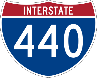
Interstate 440 (I-440), also known as the Raleigh Beltline, the Cliff Benson Beltline, or locally as The Beltline, is an Interstate Highway in the US state of North Carolina. I-440 is a 16.4-mile-long (26.4 km) partial beltway that nearly encircles central Raleigh. I-440 begins in west Raleigh at an interchange with I-40 as a continuation of U.S. Highway 64 (US 64)/US 1 and traverses a primarily residential area in west Raleigh. The freeway makes a turn toward the east, crossing US 70, Six Forks Road, and Wake Forest Road. US 1 branches north off I-440 at US 401, becoming US 401/US 1. I-440 turns toward the southeast and follows a brief concurrency with U.S. Highway 64 Business before intersecting I-87/US 64/US 264. US 64 and I-87 are concurrent with I-440 along the remainder of the road's southwesterly routing. Exit 16 is the last exit on I-440, where I-440 splits to join either I-40 eastbound or I-40 westbound.

Interstate 277 (I-277) is an auxiliary Interstate Highway in the US state of North Carolina. It serves as a 4.41-mile (7.10 km) partial loop around Uptown Charlotte.
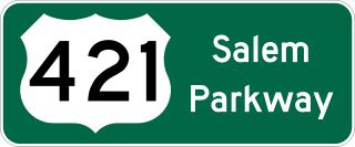
The Salem Parkway is an 18.5-mile-long (29.8 km) freeway in the U.S. state of North Carolina, serving the city of Winston-Salem and the town of Kernersville. It is signed as U.S. Route 421 (US 421) for its entire length, though it is also concurrent with US 158 in downtown Winston-Salem and North Carolina Highway 150 (NC 150) between Winston-Salem and Kernersville. Originally known as the East–West Expressway, it was designated as part of Interstate 40 (I-40) and opened in 1958, becoming the first section of Interstate Highway in the state. I-40 was rerouted onto a new alignment bypassing Winston-Salem and Kernersville in 1992, at which time the road was designated Interstate 40 Business, nicknamed Business 40.

U.S. Route 64 (US 64) is the longest numbered route in the U.S. state of North Carolina, running 604 miles (972 km) from the Tennessee state line to the Outer Banks. The route passes through the westernmost municipality in the state, Murphy, and one of the most easternmost municipalities, Manteo, making US 64 a symbolic representation of the phrase "from Murphy to Manteo" which is used to refer to the expanse of the state. The highway is a major east–west route through the central and eastern portion of the state.

Route 4 is an 18.6-mile (29.9 km) partial ring road located in Charlotte, North Carolina. Beginning and ending at Interstate 85 (I-85), it loops south around Uptown Charlotte along state-maintained secondary roads, connecting the Charlotte Douglas International Airport and several city neighborhoods including Madison Park, Myers Park, Windsor Park and Sugar Creek. The route is posted by the Charlotte Department of Transportation (CDOT), using a modified pentagonal county road shield, with a green background and the city's crown logo above the number. The loop has a radius of about 4 miles (6.4 km), hence the number.
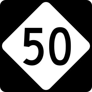
North Carolina Highway 50 (NC 50) is a primary state highway in the U.S. state of North Carolina. It goes from Topsail Beach in the south to Creedmoor in the north, connecting the cities of Warsaw, Newton Grove, Benson, and Raleigh.
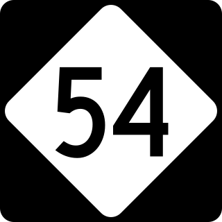
North Carolina Highway 54 (NC 54) is a 55.0-mile-long (88.5 km) primary state highway in the U.S. state of North Carolina. The highway serves the Research Triangle area, between Burlington and Raleigh, connecting the cities and towns of Chapel Hill, Durham, Morrisville and Cary. The highway also links the campuses of University of North Carolina at Chapel Hill and North Carolina State University.
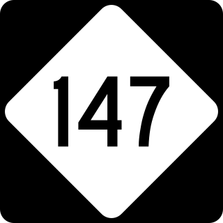
North Carolina Highway 147 (NC 147) is a primary state highway in the U.S. state of North Carolina. The highway is an 8.1-mile-long (13.0 km) freeway through Durham running roughly southeast to northwest; the entire route lies within the city limits. To the southeast, it connects the city to the Research Triangle Park. NC 147 is the northern half of the Durham Freeway, which continues south onto Interstate 885 (I-885). The route is the main arterial through Durham, running alongside its downtown. It begins at a semi-directional T interchange with I-885 southeast of downtown Durham and runs northwest-southeast before merging into I-85 northwest of downtown Durham.
Interstate 40 (I-40) is a part of the Interstate Highway System that travels 2,556.61 miles (4,114.46 km) from Barstow, California, to Wilmington, North Carolina. In North Carolina, I-40 travels 420.21 miles (676.26 km) across the entirety of the state from the Tennessee state line along the Pigeon River Gorge to U.S. Route 117 (US 117) and North Carolina Highway 132 (NC 132) in Wilmington. I-40 is the longest Interstate Highway in North Carolina and is the only Interstate to completely span the state from west to east.

U.S. Route 70 (US 70) is a part of the United States Numbered Highway System that runs from Globe, Arizona, to the Crystal Coast of the US state of North Carolina. In North Carolina, it is a major 488-mile-long (785 km) east–west highway that runs from the Tennessee border to the Atlantic Ocean. From the Tennessee state line near Paint Rock to Asheville it follows the historic Dixie Highway, running concurrently with US 25. The highway connects several major cities including Asheville, High Point, Greensboro, Durham, Raleigh, Goldsboro, and New Bern. From Beaufort on east, US 70 shares part of the Outer Banks Scenic Byway, a National Scenic Byway, before ending in the community of Atlantic, located along Core Sound.

U.S. Highway 1 (US 1) is a north–south United States Numbered Highway which runs along the East Coast of the U.S. between Key West, Florida, and the Canada–United States border near Fort Kent, Maine. In North Carolina, US 1 runs for 174.1 miles (280.2 km) across the central region of the state. The highway enters North Carolina from South Carolina, southwest of Rockingham. US 1 runs northeast, passing through or closely bypassing Southern Pines and Sanford in the Sandhills region. It next passes through Cary, the state capital of Raleigh, and Wake Forest. The highway continues north to Henderson, before leaving the state at the Virginia state line, near Wise. The route is mostly a multilane divided arterial road, with several freeway segments. It serves as a strategic highway, connecting the North Carolina Sandhills and Research Triangle regions northward to the Southside region.

U.S. Route 220 is a north–south U.S. highway which travels from Rockingham, North Carolina, to South Waverly, Pennsylvania. In the U.S. state of North Carolina, US 220 travels 123.4 miles (198.6 km) from an intersection with US 1 in Rockingham to the Virginia state line near Price, North Carolina. The highway is an important north–south route in Central North Carolina, connecting Rockingham, Asheboro, Greensboro, and Summerfield. US 220 runs concurrently with Interstate 73 from north of Rockingham to Greensboro, and from Summerfield to Stokesdale; while US 220 runs concurrently with I-74 from Rockingham to Randleman.
Several special routes of U.S. Route 70 exist. In order from west to east, these special routes are as follows.
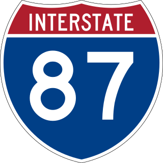
Interstate 87 (I-87) is a partially completed Interstate Highway in the US state of North Carolina, the shortest designated primary Interstate Highway at 12.9 miles (20.8 km). The completed portion is in eastern Wake County, between Raleigh and Wendell; the majority of the completed route is known as the Knightdale Bypass, while the remaining three miles (4.8 km) follows the Raleigh Beltline (I-440). It is planned to continue northeast through Rocky Mount, Williamston, and Elizabeth City, ending in Norfolk, Virginia. It is signed as north–south, in keeping with the sign convention for most odd-numbered interstates, but the route goes primarily east–west, with the eastern direction aligning to the north designation. The entire route is concurrent with US Highway 64 (US 64), with portions also concurrent with I-440 and US 264.
