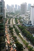
Boulevard

Last updated

Park Avenue in Midtown Manhattan, United States Park Avenue 01.jpg
Park Avenue in Midtown Manhattan, United States
The Strasse des 17. Juni in Berlin, Germany Strasse des 17. juni.brandenburger tor.night.JPG
The Straße des 17. Juni in Berlin, Germany
Mannerheimintie in Helsinki, Finland Mannerheimintie Helsinki in the night.jpg
Mannerheimintie in Helsinki, Finland

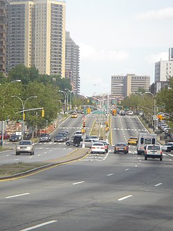
A boulevard is a type of broad avenue planted with rows of trees, or in parts of North America, any urban highway or wide road in a commercial district.

Contents

Boulevards were originally circumferential roads following the line of former city walls.

In North American usage, boulevards may be wide, multi-lane thoroughfares divided with only a central median.

Etymology

The word boulevard is borrowed from French. In French, it originally meant the flat surface of a rampart, and later a promenade taking the place of a demolished fortification. It is a borrowing from the Dutch word bolwerk 'bulwark'. [1]

Notable examples

Australia and Oceania

Australia

New Zealand

Europe

North America

Canada

Mexico

United States

South America

Argentina

Uruguay

Related Research Articles

<span class="mw-page-title-main">Paseo de la Reforma</span> Wide avenue in Mexico City

Paseo de la Reforma is a wide avenue that runs diagonally across the heart of Mexico City. It was designed at the behest of Emperor Maximilian by Ferdinand von Rosenzweig during the era of the Second Mexican Empire and modeled after the great boulevards of Europe, such as the Ringstraße in Vienna and the Champs-Élysées in Paris. The planned grand avenue was to link the National Palace with the imperial residence, Chapultepec Castle, which was then on the southwestern edge of town. The project was originally named Paseo de la Emperatriz in honor of Maximilian's consort Empress Carlota. After the fall of the Empire and Maximilian's subsequent execution, the Restored Republic renamed the Paseo in honor of the La Reforma.

<span class="mw-page-title-main">Valencia, Santa Clarita, California</span> Neighborhood of Santa Clarita in Los Angeles County, California

Valencia is a neighborhood in Santa Clarita located within Los Angeles County, California. It is one of the four unincorporated communities that merged to create the city of Santa Clarita in 1987. It is situated in the western part of Santa Clarita, stretching from Lyons Avenue to the south to north of Copper Hill Drive, and from Interstate 5 east to Bouquet Canyon and Seco Canyon Roads. Valencia was founded as a master-planned community with the first development, Old Orchard I, built on Lyons Avenue behind Old Orchard Elementary School.

<span class="mw-page-title-main">Avenue (landscape)</span> Straight path or road with a line of trees or large shrubs on both sides

In landscaping, an avenue, alameda, or allée, is traditionally a straight path or road with a line of trees or large shrubs running along each side, which is used, as its Latin source venire indicates, to emphasize the "coming to," or arrival at a landscape or architectural feature. In most cases, the trees planted in an avenue will be all of the same species or cultivar, so as to give uniform appearance along the full length of the avenue.

<span class="mw-page-title-main">Avenida de los Insurgentes</span> Street in Mexico City, Mexico

Avenida de los Insurgentes, sometimes known simply as Insurgentes, is the longest avenue in Mexico City, with a length of 28.8 km (17.9 mi) on a north-south axis across the city. Insurgentes has its origins in what was during the early 20th century known as the Via del Centenario which ran from city centre to the southern suburbs.

<span class="mw-page-title-main">Zona Río</span> Neighborhood of Tijuana in Baja California, Mexico

Zona Río is an official zone, and the main modern business district, of the city of Tijuana, Mexico.

<span class="mw-page-title-main">18 de Julio Avenue</span> Street in Montevideo, Uruguay

Avenida 18 de Julio, or 18 de Julio Avenue, is the most important avenue in Montevideo, Uruguay. It is named after the date when the country's first Constitution was sworn in, on July 18, 1830.

<span class="mw-page-title-main">The Paseo (Kansas City, Missouri)</span> Major roadway in Kansas City, Missouri

The Paseo is a major north–south parkway in Kansas City, Missouri. As the city's first major boulevard, it runs approximately 10 miles (16 km) through the center of the city: from Cliff Drive and Lexington Avenue on the bluffs above the Missouri River in the Pendleton Heights historic neighborhood, to 85th Street and Woodland Avenue. The parkway holds 223 acres (0.90 km2) of boulevard parkland dotted with several Beaux-Arts-style decorative structures and architectural details maintained by the city's Parks and Recreation department.

<span class="mw-page-title-main">Gil Puyat Avenue</span> Road in the Philippines

Senator Gil J. Puyat Avenue, also known simply as Gil Puyat Avenue and by its former official name Buendia Avenue, is a major arterial thoroughfare which travels east–west through the cities of Makati and Pasay in western Metro Manila, Philippines. It is one of the busiest avenues in Metro Manila linking the Makati Central Business District with the rest of the metropolis.

<span class="mw-page-title-main">Circuito Interior</span>

The Circuito Interior Bicentenario or more commonly, Circuito Interior or even more simply Circuito, is a 42-km-long urban freeway and at-grade boulevard, forming a loop around the central neighborhoods of Mexico City. It was built starting in 1961. The Circuito Interior received the appellation Bicentenario (Bicentennial) after a renovation that took place in 2010, Mexico's bicentennial year.

<span class="mw-page-title-main">Arnaiz Avenue</span> Collector road in Metro Manila, Philippines

Antonio Arnáiz Avenue, also known simply as Avenida Arnáiz and by its former official name Pásay Road, is a major east–west collector road that links Makati and Pasay in the Philippines. It stretches across western Metro Manila from Roxas Boulevard in Pasay to Epifanio de los Santos Avenue (EDSA) in Makati.

<span class="mw-page-title-main">Bonifacio Drive</span> Major road in Manila, Philippines

Bonifacio Drive is a road running for approximately 1 kilometer (0.62 mi) in a north-south direction between Intramuros and Port Area in Manila, Philippines. The boulevard is also designated as Radial Road 1 (R-1) of Manila's arterial road network, National Route 120 (N120) of the Philippine highway network and an auxiliary route of Asian Highway 26 (AH26).

<span class="mw-page-title-main">Monument to Cuauhtémoc</span> Sculpture in Mexico City, Mexico

The Monument to Cuauhtémoc is an 1887 monument dedicated to the last Mexica ruler (tlatoani) of Tenochtitlan Cuauhtémoc, located at the intersection of Avenida de los Insurgentes and Paseo de la Reforma in Mexico City. It is the work of Francisco Jiménez and Miguel Noreña in the "neoindigenismo", and was proposed to promote the new government of Porfirio Díaz.

<span class="mw-page-title-main">Avenida Bucareli</span> Street in Mexico City, Mexico

Avenida Bucareli, often referred to as "Bucareli Street", is a main avenue and eje vial in Mexico City. It divides the Historic center on the east from Colonia Juárez on the west. It is named after the viceroy of New Spain, Antonio María de Bucareli y Ursúa, who commissioned it. Built in the late 18th century and called Paseo Nuevo, it was once a wide boulevard lined with more than 1000 ash trees. In the 19th century the walking paths on either side were built upon and the avenue acquired its current width. It originally had three plazas, each with a fountain. Only one fountain survives, though it was moved to Plaza Loreto.

<span class="mw-page-title-main">Paseo Los Próceres</span> Monument in Caracas, Venezuela

The Paseo Los Próceres is a monument located in the Venezuelan city of Caracas, near Fort Tiuna and the Military Academy of the Bolivarian Army. On the promenade there are statues of the heroes of the War of Independence, as well as fountains, stairs, squares, roads and walls. Since 1993, the Paseo Los Próceres and the entire annex system was declared a National Historic Landmark.

<span class="mw-page-title-main">Street names in Barcelona</span>

The odonyms of Barcelona — meaning the street names in Barcelona along with the names of thoroughfares and other roads in the city — are regulated by the Ponència de Nomenclàtor dels Carrers de Barcelona, a commission under the Department of Culture of the Barcelona City Council.

Avenida Constituyentes is an avenue in Mexico City that runs from east to west. It is a principal access road to the Santa Fe, Mexico City business district. It is named in honor of the Constitution of Mexico. The avenue serves Álvaro Obregón and Miguel Hidalgo districts.

References

  1. Wiktionnaire ,
  2. "Buses to Bring Change". Cebu Daily News. 20 June 2012. Retrieved 16 September 2017.
  3. "Húsvét után jön a nagykörúti káosz". Index.hu. 17 April 2006. Retrieved 16 September 2017.
  4. "Некоммерческий проект бульвары Москвы". Bulwar.ru. Archived from the original on 18 September 2017. Retrieved 16 September 2017.

Books