
Interstate 5 (I-5) is the main north–south Interstate Highway on the West Coast of the United States, running largely parallel to the Pacific Coast of the contiguous U.S. from Mexico to Canada. It travels through the states of California, Oregon, and Washington, serving several large cities on the West Coast, including San Diego, Los Angeles, Sacramento, Portland, and Seattle. It is the only continuous Interstate highway to touch both the Mexican and Canadian borders. Upon crossing the Mexican border at its southern terminus, the highway continues to Tijuana, Baja California, as Mexican Federal Highway 1 (Fed. 1). Upon crossing the Canadian border at its northern terminus, it continues to Vancouver as British Columbia Highway 99 (BC 99).

State Route 55 (SR 55) is an 18-mile (30-km) long north–south state highway that passes through suburban Orange County in the U.S. state of California. The portion of the route built to freeway standards is known as the Costa Mesa Freeway. SR 55 runs between Via Lido south of Pacific Coast Highway in Newport Beach and the Riverside Freeway in Anaheim to the north, intersecting other major Orange County freeways such as SR 22, SR 73, and Interstate 405 (I-405).

State Route 60 (SR 60) is an east–west state highway in the U.S. state of California. It serves the cities and communities on the eastern side of the Los Angeles metropolitan area and runs along the south side of the San Gabriel Valley. It functions as a bypass route of Interstate 10 (I-10) through the area between the East Los Angeles Interchange in Los Angeles and Beaumont. SR 60 provides a route across several spurs of the Peninsular Ranges, linking the Los Angeles Basin with the Pomona Valley and San Gabriel Valley. The highway also runs concurrently with SR 57 and I-215. Portions of SR 60 are designated as either the Pomona Freeway or the Moreno Valley Freeway.
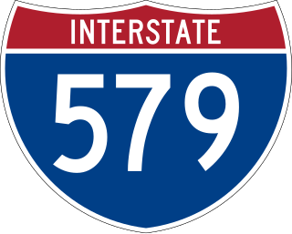
Interstate 579 (I-579) is a north–south Interstate Highway entirely within Pittsburgh, Pennsylvania. The highway is 2.73 miles (4.39 km) long. I-579 is also known as the Crosstown Boulevard since it crosses the backside of Downtown Pittsburgh.

Interstate 395 (I-395) in Virginia and Washington, D.C., is a 13.79-mile-long (22.19 km) spur route of I-95 that begins at an interchange with I-95 in Springfield and ends at an interchange with US Route 50 (US 50) in Northwest Washington, D.C. It passes underneath the National Mall near the US Capitol and ends at a junction with US 50 at New York Avenue, roughly one mile (1.6 km) north of the 3rd Street Tunnel. Despite its proximity to I-395 in Maryland, the route is unrelated and unconnected.

State Route 59 is an east–west state highway in the U.S. state of Ohio, serving the Akron metropolitan area. The western terminus of State Route 59 is in downtown Akron at a partial interchange with the Interstate 76/Interstate 77 concurrency, and the eastern terminus is at State Route 5, 0.5 miles (0.80 km) east of Ravenna. The route is approximately 23 miles (37 km) long and was certified in 1969 over what had previously been part of SR 5. It serves as a major or as the primary east–west roadway for the cities of Cuyahoga Falls, Kent, Ravenna, and Stow, the village of Silver Lake, and Franklin and Ravenna Townships.

Interstate 405 (I-405) is a north–south auxiliary Interstate Highway serving the Seattle region of Washington, United States. It bypasses Seattle east of Lake Washington, traveling through the Eastside area of King and Snohomish counties, providing an alternate route to I-5. The 30-mile (48 km) freeway serves the cities of Renton, Bellevue, Kirkland, and Bothell. I-405 terminates at I-5 in Tukwila and Lynnwood, and also intersects several major highways, including SR 167, I-90, SR 520, and SR 522.

Interstate 176 (I-176) is a spur route of eastern I-76 in Berks County, Pennsylvania. I-176, known locally as the Morgantown Expressway, travels from I-76 in Morgantown north to U.S. Route 422 (US 422) in Cumru Township in Berks County, a suburban township just outside the city of Reading; the entire length of the highway is just over 11 miles (18 km). The highway was originally known as Interstate 180 (I-180) or the "Reading Spur" when the Pennsylvania Turnpike was part of I-80S but was redesignated to its present-day number in 1964 when I-80S became I-76.

State Route 381 is a primary state highway in the US state of Virginia. Known as Commonwealth Avenue, the state highway runs 1.21 miles (1.95 km) from the Tennessee state line north to the 1.67-mile (2.69 km) Interstate 381 (I-381) within the independent city of Bristol. In conjunction with I-381, SR 381 connects I-81 with downtown Bristol. The state highway also connects the Interstate Highways with US Route 11 (US 11), US 11W, US 11E, US 19, and US 421; SR 381 runs concurrently with the latter three highways between downtown Bristol and US 11. I-381 is a spur from I-81 that provides access to Bristol. It runs for 1.67 miles (2.69 km) from the intersection of Commonwealth Avenue (SR 381) and Keys/Church streets in Bristol at exit 0 north to I-81. The I-81 interchange, the only one on I-381, is signed as exit 1A and exit 1B.

Interstate 270 (I-270) is an auxiliary interstate highway that forms a beltway loop freeway in the Columbus metropolitan area in the US state of Ohio, commonly known locally as The Outerbelt or the Jack Nicklaus Freeway. The zero-milepost is at the junction with Interstate 71 east of Grove City, intersecting with I-71 again near Worthington as well as connecting with Interstate 70 twice with the western junction near Lincoln Village and the eastern junction near Reynoldsburg. The route furthermore links to the eastern terminus of Interstate 670 near Gahanna and provides indirect access to John Glenn Columbus International Airport. The entire length of I-270 is 54.97 miles (88.47 km). It is one of four Interstate loops not to run concurrently with another Interstate freeway, the others being I-295 in Florida, I-485 in North Carolina, and I-610 in Texas.

Interstate 95 (I-95) runs 179 miles (288 km) within the commonwealth of Virginia between its borders with North Carolina and Maryland. I-95 meets the northern terminus of I-85 in Petersburg and is concurrent with I-64 for three miles (4.8 km) in Richmond. Although I-95 was originally planned as a highway through Washington, D.C., it was rerouted along the eastern portion of the Capital Beltway concurrent with I-495. From Petersburg to Richmond, I-95 utilized most of the Richmond–Petersburg Turnpike, a former toll road. In addition to Richmond, the route also runs through the medium-sized cities of Emporia, Petersburg, Colonial Heights, Fredericksburg, and Alexandria.
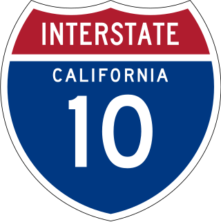
Interstate 10 (I-10) is a transcontinental Interstate Highway in the United States, stretching from Santa Monica, California, to Jacksonville, Florida. The segment of I-10 in California, also known as the Pearl Harbor Memorial Highway, runs east from Santa Monica through Los Angeles, San Bernardino, and Palm Springs before crossing into the state of Arizona. In the Greater Los Angeles area, it is known as the Santa Monica and San Bernardino freeways, linked by a short concurrency on I-5 at the East Los Angeles Interchange. I-10 also has parts designated as the Rosa Parks and Sonny Bono Memorial freeways. Some parts were also formerly designated as the Christopher Columbus Transcontinental Highway. However, the California State Legislature removed this designation following the passage of a bill on August 31, 2022. I-10 is also known colloquially as "the 10" to Southern California residents (See also California English § Freeways).
Interstate 95 (I-95) is an Interstate Highway running along the East Coast of the United States from Miami, Florida, north to the Canada–United States border at Houlton, Maine. In Maryland, the route is a major highway that runs 110.01 miles (177.04 km) diagonally from southwest to northeast, entering from the District of Columbia and Virginia at the Woodrow Wilson Bridge over the Potomac River, northeast to Maryland's border with Delaware near Elkton. It is the longest Interstate Highway within Maryland and is one of the most traveled Interstate Highways in the state, especially between Baltimore and Washington, D.C., despite alternate routes along the corridor, such as the Baltimore–Washington Parkway, U.S. Route 1 (US 1), and US 29. I-95 also has eight auxiliary routes in the state, the most of any state along the I-95 corridor. Portions of the highway, including the Fort McHenry Tunnel and the Millard E. Tydings Memorial Bridge, are tolled.

Interstate 75 (I-75) is a part of the Interstate Highway System that runs from the Hialeah–Miami Lakes border, a few miles northwest of Miami, to Sault Ste. Marie in the Upper Peninsula of Michigan. I-75 begins its national northward journey near Miami, running along the western parts of the Miami metropolitan area before traveling westward across Alligator Alley, resuming its northward direction in Naples, running along Florida's Gulf Coast, and passing the cities of Fort Myers, Punta Gorda, Venice, and Sarasota. The freeway passes through the Tampa Bay area before turning inward toward Ocala, Gainesville, and Lake City before leaving the state and entering Georgia. I-75 runs for 471 miles (758 km) in Florida, making it the longest Interstate in the state and also the longest in any state east of the Mississippi River. The Interstate's speed limit is 70 mph (110 km/h) for its entire length in Florida.

Interstate 81 (I-81) is an 855.02-mile-long (1,376.02 km) Interstate Highway. In the US state of Virginia, I-81 runs for 324.92 miles (522.91 km), making the portion in Virginia longer than any other state's portion of the route. It is also the longest Interstate Highway within the borders of Virginia. It stretches from the Tennessee state line near Bristol to the West Virginia state line near Winchester. It enters Virginia from Bristol, Tennessee, and leaves Virginia into Berkeley County, West Virginia. The route passes through the cities of Bristol, Roanoke, Lexington, Staunton, and Harrisonburg.

Interstate 5 (I-5) is a major north–south route of the Interstate Highway System in the United States, stretching from the Mexican border at the San Ysidro crossing to the Canadian border near Blaine, Washington. The segment of I-5 in California runs 796.77 miles (1,282.28 km) across the length of the state from San Ysidro to the Oregon state line south of the Medford-Ashland metropolitan area. It is the longest interstate in California, and accounts for more than half of I-5's total length. It is also the second longest stretch of Interstate Highway with a single designation within a single state after I-10 in Texas.
Interstate 75 (I-75) in the US state of Tennessee runs from Chattanooga to Jellico by way of Knoxville. I-75 enters the East Tennessee region from Georgia, following the Tennessee Valley all the way through Knoxville to near Rocky Top, then climbs into the Cumberland Mountains before crossing over into Kentucky at Jellico.

The Newhall Pass interchange is a highway interchange at Newhall Pass in Southern California, United States. It is south of the city of Santa Clarita and north of the Los Angeles neighborhoods of Granada Hills and Sylmar. It connects Interstate 5 with California State Route 14. It is officially named in the memory of Los Angeles Police officer Clarence Wayne Dean, who was killed when he was unable to stop before going over a collapsed section of the interchange immediately following the 1994 Northridge earthquake.

U.S. Route 220 is a U.S. Highway that is a spur route of US 20. It runs from Rockingham, North Carolina, north to South Waverly, Pennsylvania. In the state of Pennsylvania, the route runs 248 miles (399 km) from the Maryland border in Cumberland Valley Township, Bedford County northeast to an interchange with Interstate 86 (I-86)/New York State Route 17 in South Waverly, Bradford County a short distance south of the New York border. Through the state, US 220 passes through the cities and towns of Bedford, Altoona, State College, Lock Haven, Williamsport, and Towanda. US 220 is concurrent with the entire completed Pennsylvania segment of I-99 between I-70/I-76 in Bedford and near I-80 near Bellefonte. US 220 is also a freeway around Bedford, along the I-80 concurrency between Bellefonte and Mill Hall, between Mill Hall and Jersey Shore, from the western end of Williamsport to near Halls, and near the New York border. The remainder of US 220 in Pennsylvania is mostly a two-lane surface road.
Several special routes of U.S. Route 220 exist. In order from south to north they are as follows.
