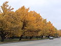
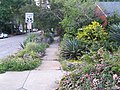
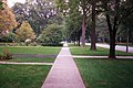
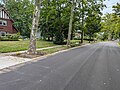
A road verge is a strip of grass or plants, and sometimes also trees, located between a roadway (carriageway) and a sidewalk (pavement). [1] Verges are known by dozens of other names, often quite regional.
The land is often public property, with maintenance usually being a municipal responsibility. Some municipal authorities, however, require that abutting property owners maintain their respective verge areas, as well as the adjunct footpaths or sidewalks. [2]
Benefits include visual aesthetics, increased safety and comfort of sidewalk users, protection from spray from passing vehicles, and a space for benches, bus shelters, street lights, and other public amenities. Verges are also often part of sustainability for water conservation or the management of urban runoff and water pollution [3] [4] [5] and can provide useful wildlife habitat. Snow that has been ploughed off the street in colder climates often is stored in the area of the verge by default.[ citation needed ]
In the British Isles, road verges serve as important habitats for a range of flora, including rare wildflowers. [6] In the UK, around 700 different species of wildflower can be found growing on verges, including 29 of the country's 52 species of orchid. [7] Verges can also support a wide range of animals and plants that may have been displaced from their usual grassland habitats, as the soil is not extensively fertilised and relatively undisturbed by human activity. Animals that reside on verges range from small insects and amphibians, to larger reptiles, mammals and birds, which rely on verges as a corridor connecting areas of undamaged habitat. As a result, verges may be managed by local areas to encourage biodiversity and conserve the ecosystems that rely on them. [7]
The main disadvantage of a road verge is that the right-of-way must be wider, increasing the cost of the road. In some localities, a wider verge offers opportunity for later road widening, should the traffic usage of a road demand this. For this reason, footpaths are usually sited a significant distance from the curb.[ citation needed ]
Certain nutrient amounts in a verge's soil can be influenced by the amount of traffic on the road it sits beside; roads with heavier traffic tend to have more nitrate in the soil due to nitrogen compounds from air pollution leaching out of the atmosphere and into the ground. [7]
In urban and suburban areas, urban runoff from private and civic properties can be guided by grading and bioswales for rainwater harvesting collection and bioretention within the "tree-lawn" – parkway zone in rain gardens. This is done for reducing runoff of rain and domestic water: for their carrying waterborne pollution off-site into storm drains and sewer systems; and for the groundwater recharge of aquifers. [3]
In some cities, such as Santa Monica, California, city code mandates specify:
Parkways, the area between the outside edge of the sidewalk and the inside edge of the curb which are a component of the Public Right of Way (PROW) – that the landscaping should require little or no irrigation and the area produce no runoff. [4]
For Santa Monica, another reason for this use of "tree-lawns" is to reduce current beach and Santa Monica Bay ocean pollution that is measurably higher at city outfalls. New construction and remodeling projects needing building permits require that landscape design submittals include garden design plans showing the means of compliance. [4]
In some cities and counties, such as Portland, Oregon, street and highway departments are regrading and planting rain gardens in road verges to reduce boulevard and highway runoff. This practice can be useful in areas with either independent Storm sewers or combined storm and sanitary sewers, reducing the frequency of pollution, treatment costs, and released overflows of untreated sewage into rivers and oceans during rainstorms. [8]
In some countries, the road verge can be a corridor of vegetation that remains after adjacent land has been cleared. Considerable effort in supporting conservation of the remnant vegetation is prevalent in Australia, where significant tracts of land are managed as part of the roadside conservation strategies by government agencies. [9] [10]
The term verge has many synonyms and dialectal differences. Some dialects and idiolects lack a specific term for this area, instead using a circumlocution. [11] [12]
Terms used include:
A sidewalk, pavement, footpath in Australia, India, New Zealand and Ireland, or footway, is a path along the side of a road. Usually constructed of concrete, pavers, brick, stone, or asphalt, it is designed for pedestrians. A sidewalk is normally higher than the roadway, and separated from it by a kerb. There may also be a planted strip between the sidewalk and the roadway and between the roadway and the adjacent land.
A street is a public thoroughfare in a built environment. It is a public parcel of land adjoining buildings in an urban context, on which people may freely assemble, interact, and move about. A street can be as simple as a level patch of dirt, but is more often paved with a hard, durable surface such as tarmac, concrete, cobblestone or brick. Portions may also be smoothed with asphalt, embedded with rails, or otherwise prepared to accommodate non-pedestrian traffic.
A lawn is an area of soil-covered land planted with grasses and other durable plants such as clover which are maintained at a short height with a lawn mower and used for aesthetic and recreational purposes—it is also commonly referred to as part of a garden. Lawns are usually composed only of grass species, subject to weed and pest control, maintained in a green color, and are regularly mowed to ensure an acceptable length. Lawns are used around houses, apartments, commercial buildings and offices. Many city parks also have large lawn areas. In recreational contexts, the specialised names turf, pitch, field or green may be used, depending on the sport and the continent.
A curb extension is a traffic calming measure which widens the sidewalk for a short distance. This reduces the crossing distance and allows pedestrians and drivers to see each other when parked vehicles would otherwise block visibility.
A boulevard is a type of broad avenue planted with rows of trees, or in parts of North America, any urban highway.
A living street is a street designed with the interests of pedestrians and cyclists in mind by providing enriching and experiential spaces. Living streets also act as social spaces, allowing children to play and encouraging social interactions on a human scale, safely and legally. Living streets consider all pedestrians granting equal access to elders and those who are disabled. These roads are still available for use by motor vehicles; however, their design aims to reduce both the speed and dominance of motorized transport. The reduction of motor vehicle dominance creates more opportunities for public transportation. Living Streets achieve these strategies by implementing the shared space approach. Reducing demarcations between vehicle traffic and pedestrians create a cohesive space without segregating different modes of transportation. Vehicle parking may also be restricted to designated bays. These street design principles first became popularized in the Netherlands during the 1970s, and the Dutch word woonerf is often used as a synonym for living street.
A driveway is a type of private road for local access to one or a small group of structures, and is owned and maintained by an individual or group.
The Millionaires' Mile, Millionaires' Row, Billionaires Row, Golden Mile or Alpha Street are the exclusive residential neighborhoods of various cities, often along one scenic strip such as a riverside or hilltop drive, or a wide city boulevard.
A Texas U-turn, or Texas turnaround, boomerang, or loop around, is a lane allowing cars traveling on one side of a one-way frontage road to U-turn onto the opposite frontage road. Typically controlled by yield signs, these allow U-turning traffic to bypass two traffic signals and avoid crossing the local traffic twice.
Bioswales are channels designed to concentrate and convey stormwater runoff while removing debris and pollution. Bioswales can also be beneficial in recharging groundwater.
Alewife Brook Reservation is a Massachusetts state park and urban wild located in Cambridge, Arlington, and Somerville. The park is managed by the state Department of Conservation and Recreation and was established in 1900. It is named for Alewife Brook, which was also historically known as Menotomy River, a tributary of the Mystic River.
Broad Street is a major arterial street in Philadelphia, Pennsylvania. The street runs for approximately 13 miles (21 km), beginning at the intersection of Cheltenham Avenue on the border of Cheltenham Township and the West/East Oak Lane neighborhoods of North Philadelphia to the Philadelphia Navy Yard in South Philadelphia. It is Pennsylvania Route 611 along its entire length with the exception of its northernmost part between Old York Road and Pennsylvania Route 309 and the southernmost part south of Interstate 95.
A curb, or kerb, is the edge where a raised sidewalk or road median/central reservation meets a street or other roadway.
Rain gardens, also called bioretention facilities, are one of a variety of practices designed to increase rain runoff reabsorption by the soil. They can also be used to treat polluted stormwater runoff. Rain gardens are designed landscape sites that reduce the flow rate, total quantity, and pollutant load of runoff from impervious urban areas like roofs, driveways, walkways, parking lots, and compacted lawn areas. Rain gardens rely on plants and natural or engineered soil medium to retain stormwater and increase the lag time of infiltration, while remediating and filtering pollutants carried by urban runoff. Rain gardens provide a method to reuse and optimize any rain that falls, reducing or avoiding the need for additional irrigation. A benefit of planting rain gardens is the consequential decrease in ambient air and water temperature, a mitigation that is especially effective in urban areas containing an abundance of impervious surfaces that absorb heat in a phenomenon known as the heat-island effect.
Nonpoint source (NPS) pollution refers to diffuse contamination of water or air that does not originate from a single discrete source. This type of pollution is often the cumulative effect of small amounts of contaminants gathered from a large area. It is in contrast to point source pollution which results from a single source. Nonpoint source pollution generally results from land runoff, precipitation, atmospheric deposition, drainage, seepage, or hydrological modification where tracing pollution back to a single source is difficult. Nonpoint source water pollution affects a water body from sources such as polluted runoff from agricultural areas draining into a river, or wind-borne debris blowing out to sea. Nonpoint source air pollution affects air quality, from sources such as smokestacks or car tailpipes. Although these pollutants have originated from a point source, the long-range transport ability and multiple sources of the pollutant make it a nonpoint source of pollution; if the discharges were to occur to a body of water or into the atmosphere at a single location, the pollution would be single-point.
Eastern Parkway is a major road that runs through a portion of the New York City borough of Brooklyn. Designed by Frederick Law Olmsted and Calvert Vaux, it was the world's first parkway, having been built between 1870 and 1874. At the time of its construction, Eastern Parkway went to the eastern edge of Brooklyn, hence its name.
Fresh Pond Parkway is a historic park and parkway on the western end of Cambridge, Massachusetts, part of the Metropolitan Park System of Greater Boston. The parkway was built in 1899 and added to the National Register of Historic Places in 2005.
Urban runoff is surface runoff of rainwater, landscape irrigation, and car washing created by urbanization. Impervious surfaces are constructed during land development. During rain, storms, and other precipitation events, these surfaces, along with rooftops, carry polluted stormwater to storm drains, instead of allowing the water to percolate through soil. This causes lowering of the water table and flooding since the amount of water that remains on the surface is greater. Most municipal storm sewer systems discharge untreated stormwater to streams, rivers, and bays. This excess water can also make its way into people's properties through basement backups and seepage through building wall and floors.
Xeriscaping is the process of landscaping, or gardening, that reduces or eliminates the need for irrigation. It is promoted in regions that do not have accessible, plentiful, or reliable supplies of fresh water and has gained acceptance in other regions as access to irrigation water has become limited, though it is not limited to such climates. Xeriscaping may be an alternative to various types of traditional gardening.
The Indianapolis Park and Boulevard System is a group of parks, parkways, and boulevards in Indianapolis, Indiana, that was designed by landscape architect George Edward Kessler in the early part of the twentieth century. Also known as the Kessler System, the district includes 3,474 acres (1,406 ha) and has shaped the city through the present day. This historic district was added to the National Register of Historic Places in 2003.
devil strip.