Highways are split into at least four different types of systems in the United States: Interstate Highways, U.S. Highways, state highways, and county highways. Highways are generally organized by a route number or letter. These designations are generally displayed along the route by means of a highway shield. Each system has its own unique shield design that will allow quick identification to which system the route belongs.
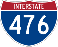
The Interstate Highway System is a federally funded and administered but state-maintained system of freeways that forms the transportation backbone of the United States, with millions of Americans relying on it for commutes, long-distance travel, and freight transport daily, among other things. Interstate highways are all constructed to precise standards, designed to maximize high-speed travel safety and efficiency. Interstate Highways also contain auxiliary routes, which are normally assigned a three-digit route number. All Interstate Highways are part of the National Highway System, a network of highways deemed essential to the defense, economy, and mobility of the country.
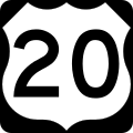
The United States Numbered Highway System is an older system consisting mostly of surface-level trunk roads, coordinated by the American Association of State Highway and Transportation Officials and maintained by state and local governments. U.S. Highways have been relegated to regional and intrastate traffic, as they have been largely supplanted by the Interstate system for long-distance travel except in areas (especially in the West) where the Interstate system is absent or underdeveloped. This has led to the decommissioning and truncation of U.S. Highways that were formerly vital long-haul routes, such as U.S. Route 21 and U.S. Route 66.
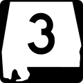
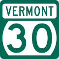
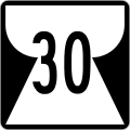
Each state also has a state highway system. State highways are of varying standards, capacity, and quality. Some state highways become so heavily traveled they may get upgraded to Interstate Highway standards. Others are more lightly traveled and have low capacity.
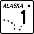
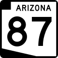
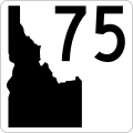
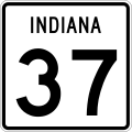
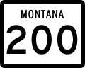
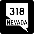
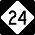
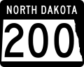
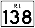
Many state highway markers are designed to suggest the geographic shape of the state or some other state symbol such as its flag. Most of the others are generically rectangular or some other neutral shape. The default design for state highway markers is the circular highway shield,[3] which is how state highways are indicated on most maps and atlases. Currently, five states—Delaware, Iowa, Kentucky, Mississippi, and New Jersey—use the circular shield for road signage on their primary state highways.
There are also numbered highways in the District of Columbia and territories. Likewise, they may also vary in standards and quality. Similarly to five of the states, the territory of the Virgin Islands opts to use the default circular shield for road signage.
Secondary highways
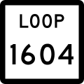
Arizona Loop
Missouri Supp.
Montana Secondary
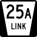
Nebraska Link
Nebraska Rec. Road
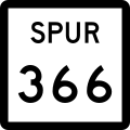
Nebraska Spur
Penn. Quadrant Route
Tennessee Secondary
Vermont Town Highway
Virginia Secondary
Texas secondary state highway markers
Beltway
FM Road
Loop
NASA Road
Park Road
PA Road
RM Road
Rec. Road
Spur
Some states may include a secondary highway system to supplement the main one, usually for a specific purpose. For example, Texas established a system of farm-to-market roads to specifically improve access to rural areas. Nebraska has Connecting Link, Spur, and Recreation Highways to provide access to small towns and state parks. The Missouri supplemental route system was designed to provide access to most farm houses, schools, churches, cemeteries, and stores within the state.
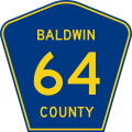
The final administrative level in some states is the county highway. As the name suggests, this type of road is maintained by a county. County roads vary widely from well-traveled multilane highways to dirt roads into remote parts of the county. In Louisiana, parish roads exist in place of county highways, as counties in that state are called parishes. Alaska also has no counties, and all roads are maintained at the national, state or municipal level. In some states, such as Massachusetts, county roads are now administered by regional entities,[4] and both Connecticut and Rhode Island have no county government and therefore no county highways. In New York and Ohio, each county has its own style of marker for its system of county roads, creating a wide variety of county road markers across those states. In some Minnesota counties, the square sign is used to denote regular county funded highways, while the standard pentagon denotes a county state aid highway, which is partially funded and maintained by the state.
Forest Highway: Highways connecting U.S. National Forests to the existing state highway systems, and thus provide improved access to recreational and logging areas.
↑Federal Highway Administration (2009). "Section 2D.11 Design of Route Signs". Manual on Uniform Traffic Control Devices (2009 2nd reviseded.). Washington, DC: Federal Highway Administration. Guidance: State Route signs...should be rectangular and should be approximately the same size as the U.S. Route sign....The shape of the white area should be circular in the absence of any determination to the contrary by the individual State concerned.
↑"County Roads". Hampshire Council of Governments. Retrieved August 16, 2017.
This page is based on this Wikipedia article Text is available under the CC BY-SA 4.0 license; additional terms may apply. Images, videos and audio are available under their respective licenses.