Bennett County is a county in the U.S. state of South Dakota. As of the 2020 census, the population was 3,381. Its county seat is Martin. The county lies completely within the exterior boundary of the Pine Ridge Indian Reservation. To the east is the Rosebud Indian Reservation, where dwell the Sicangu Oyate, also known the Upper Brulé Sioux Nation and the Rosebud Sioux Tribe (RST), a branch of the Lakota people.

The Warm Springs Indian Reservation consists of 1,019 square miles (2,640 km2) in north-central Oregon, in the United States, and is governed by the Confederated Tribes of Warm Springs.

The Little Bighorn River is a 138-mile-long (222 km) tributary of the Bighorn River in the United States in the states of Montana and Wyoming. The Battle of the Little Bighorn, also known as the Battle of the Greasy Grass, was fought on its banks on June 25–26, 1876, as well as the Battle of Crow Agency in 1887.

The Flathead Indian Reservation, located in western Montana on the Flathead River, is home to the Bitterroot Salish, Kootenai, and Pend d'Oreilles tribes – also known as the Confederated Salish and Kootenai Tribes of the Flathead Nation. The reservation was created through the July 16, 1855, Treaty of Hellgate.

The George Washington Memorial Parkway, colloquially the G.W. Parkway, is a 25-mile-long (40 km) limited-access parkway that runs along the south bank of the Potomac River from Mount Vernon, Virginia, northwest to McLean, Virginia, and is maintained by the National Park Service (NPS). It is located almost entirely in Northern Virginia, except for a short portion of the parkway northwest of the Arlington Memorial Bridge that passes over Columbia Island in Washington, D.C.

The Schaghticoke are a Native American tribe of the Eastern Woodlands who historically consisted of Mahican, Potatuck, Weantinock, Tunxis, Podunk, and their descendants, peoples indigenous to what is now New York, Connecticut, and Massachusetts. The remnant tribes amalgamated in the area near the Connecticut-New York border after many losses, including the sale of some Schaghticoke and members of neighboring tribes into slavery in the Caribbean in the 1600s.

State Route 112 is a state highway and scenic byway in the U.S. state of Washington. It runs east–west for 61 miles (98 km) along the Strait of Juan de Fuca in Clallam County, connecting the Makah Indian Reservation near Neah Bay to U.S. Route 101 (US 101) near Port Angeles.

The Ute Mountain Ute Tribe is one of three federally recognized tribes of the Ute Nation, and are mostly descendants of the historic Weeminuche Band who moved to the Southern Ute reservation in 1897. Their reservation is headquartered at Towaoc, Colorado on the Ute Mountain Ute Indian Reservation in southwestern Colorado, northwestern New Mexico and small sections of Utah.

State Road 78 is the Florida Department of Transportation designation of the highway that historically extended from Pine Island Center on the Gulf Coast of Florida to the northern tip of Lake Okeechobee. In the 1980s, two segments of the route were removed from state maintenance to county maintenance and both were redesignated County Road 78. All three sections of SR 78 are signed east–west, even though the easternmost section is actually a north–south route.

State Route 25 (SR 25), named the Coulee Reservoir Highway, is a 121.17-mile-long (195.00 km) state highway serving communities in Lincoln and Stevens counties in the U.S. state of Washington. The highway begins at an intersection with U.S. Route 2 (US 2) east of Davenport and continues northwest to cross the Spokane River. From there, SR 25 parallels the Columbia River and Franklin D. Roosevelt Lake upstream through several small communities, passing the Gifford–Inchelium Ferry, to Kettle Falls. In Kettle Falls, the roadway intersects US 395, co-signed with SR 20 and continues north to Northport, where former SR 251 is intersected and SR 25 crosses the Columbia River on the Northport Bridge. The highway travels northwest to the Canadian border, where it becomes British Columbia Highway 22 (BC 22).

The Laurel Highlands Hiking Trail is a 70.1-mile (112.8 km) hiking trail in southwestern Pennsylvania, which largely follows the Laurel Hill geologic formation. It begins at Ohiopyle State Park and travels generally to the northeast, and ends at Conemaugh Gorge near Johnstown. Construction of the trail began in 1970. It has been named as one of Pennsylvania's most popular backpacking trails and the premier trail in the southwestern region of the state.

U.S. Route 191 (US 191) is a north–south U.S. Highway in eastern Arizona. The highway runs for 516.50 miles (831.23 km), making it Arizona's longest numbered highway. The highway begins at State Route 80 near Douglas and crosses over the Utah state line near Mexican Water in the Navajo Nation. Between Douglas and Utah, US 191 shares multiple concurrencies with I-10, US 70, US 180, US 60, SR 61, I-40, SR 264, and US 160.

State Route 109 (SR 109) is a Washington state highway in Grays Harbor County. Beginning at its terminus at U.S. Route 101 (US 101) in Hoquiam, the highway travels west to intersect SR 115 near Ocean Shores and then turns north to continue along the Pacific coastline, terminating at the Quinault River Bridge in Taholah, located in the Quinault Indian Reservation. The Washington State Legislature extended the roadway north to end at US 101 south of Queets through tribal lands, although this segment has yet to be built. SR 109 was first established as Secondary State Highway 9C (SSH 9C) in 1937, which was on a more northern alignment until 1947, when it was switched to a Hoquiam to Quinault Indian Reservation route. In 1964, SSH 9C was renumbered to SR 109 and in 1983, a spur route of SR 109 that bypasses Hoquiam was added. SR 109 itself was extended by the legislature to US 101 near Queets in 1985, but the road has not been built.

U.S. Route 70 (US 70), also known as the Old West Highway, is an east–west U.S. Highway in the U.S. state of Arizona. The current route starts at US 60 in Globe and runs through the San Carlos Indian Reservation, Safford and Duncan into New Mexico near Virden. In Arizona, US 70 passes through mostly isolated hilly and mountainous terrain largely paralleling the course of the Gila River and the Arizona Eastern Railway.

U.S. Route 191 (US-191) is a major 404.168-mile (650.445 km), north–south U.S. Numbered Highway through eastern Utah, United States. The present alignment of US-191, which stretches from Mexico to Canada, was created in 1981 through Utah. Previously the route had entered northern Utah, ending at US-91 in Brigham City, but with the completion of I-15 it was truncated to Yellowstone National Park and re-extended on a completely different alignment. In addition to a large portion of US-163, this extension absorbed several state routes: SR-33, most of SR-44, and SR-260.

US Highway 2 (US 2) is a component of the United States Numbered Highway System that connects Everett, Washington, to the Upper Peninsula (UP) of the US state of Michigan, with a separate segment that runs from Rouses Point, New York, to Houlton, Maine. In Michigan, the highway runs through the UP in two segments as a part of the state trunkline highway system, entering the state at Ironwood and ending at St. Ignace; in between, US 2 briefly traverses the state of Wisconsin. As one of the major transportation arteries in the UP, US 2 is a major conduit for traffic through the state and neighboring northern Midwest states. Two sections of the roadway are included as part of the Great Lakes Circle Tours, and other segments are listed as state-designated Pure Michigan Byways. There are several memorial highway designations and historic bridges along US 2 that date to the 1910s and 1920s. The highway runs through rural sections of the UP, passing through two national and two state forests in the process.

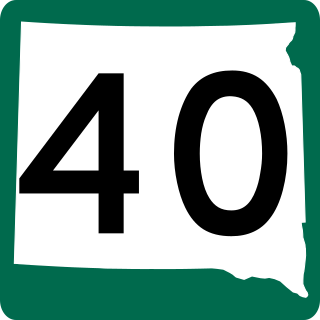
South Dakota Highway 40 (SD 40) is a state highway in southwestern part of the US state of South Dakota. The highway is just over 37 miles (60 km) long and runs from U.S. Route 16A (US 16A) in Keystone to Bureau of Indian Affairs Highway 41 (BIA 41) in Red Shirt. The highway runs near Mount Rushmore National Memorial in Keystone, and its eastern terminus is on the Pine Ridge Indian Reservation near the edge of Badlands National Park.

The Omaha Reservation of the federally recognized Omaha tribe is located mostly in Thurston County, Nebraska, with sections in neighboring Cuming and Burt counties, in addition to Monona County in Iowa. As of the 2020 federal census, the reservation population was 4,526. The tribal seat of government is in Macy. The villages of Rosalie, Pender and Walthill are located within reservation boundaries, as is the northernmost part of Bancroft. Due to land sales in the area since the reservation was established, Pender has disputed tribal jurisdiction over it, to which the Supreme Court ruled unanimously in 2016 that "the disputed land is within the reservation’s boundaries."

The Bureau of Indian Education (BIE), headquartered in the Main Interior Building in Washington, D.C., and formerly known as the Office of Indian Education Programs (OIEP), is a division of the U.S. Department of the Interior under the Assistant Secretary for Indian Affairs. It is responsible for the line direction and management of all BIE education functions, including the formation of policies and procedures, the supervision of all program activities, and the approval of the expenditure of funds appropriated for BIE education functions.

The Trail of the Ancients is a collection of National Scenic Byways located in the U.S. Four Corners states of Utah, Colorado, New Mexico, and Arizona. These byways comprise:


