This article needs additional citations for verification .(June 2014) |
A bypass is a road or highway that avoids or "bypasses" a built-up area, town, or village, to let through traffic flow without interference from local traffic, to reduce congestion in the built-up area, to improve road safety and as replacement for obsolete roads that are no longer in use as a result of devastating natural disasters (earthquakes, tsunamis, landslides, volcanic eruptions). A bypass specifically designated for trucks may be called a truck route.
If there are no strong land use controls, buildings are often built in town along a bypass, converting it into an ordinary town road, and the bypass may eventually become as congested as the local streets it was intended to avoid. Many businesses are often built there for ease of access, while homes are often avoided for noise and pollution reasons.
Bypass routes are often on new land where no road originally existed. This creates a conflict between those who support a bypass to reduce congestion in a built-up area and/or as replacement for roads that became obsolete and inactive because devastating natural disasters — those who oppose the development of (often rural) undeveloped land. A city may also oppose the project, because of the potential reduction in city core. For other reasons (e.g. natural disasters), construction of bypass routes may be started if there was a research about natural disaster green (safe) zones using space satellite-based mapping first before building them.
In Ontario, examples include the Donald Cousens Parkway (formerly named the Markham Bypass from 2004 to 2006) and the Box Grove Bypass in the city of Markham; and in Toronto a section of Highway 401 was called the Toronto Bypass in the 1950s when the highway was built as a bypass of Highway 2, Ontario Highway 2A which was built to bypass Highway 2 between Toronto and Newcastle, and the Caledonia Bypass, a section of Highway 6 in Caledonia.
In Nova Scotia, the section of Highway 104 between Thomson Station and Masstown is colloquially named the Cobequid Pass; this name is for a section of road that bypasses the Wentworth Valley by crossing the Cobequid Mountains.
The idea of bypasses predates the use of motor vehicles. The first (northern) London bypass, the present Marylebone Road between Paddington and Islington, was started in 1756.
Bypasses can take many years to gain planning approval and funding. Many towns and villages have been campaigning for bypasses for over 30 years e.g. Banwell in North Somerset. [2]
There was large-scale protest during construction of the Newbury bypass—officially known as the Winchester–Bicester Trunk Road (A34) (Newbury Bypass)—a 9-mile (14 km) stretch of dual carriageway which bypasses the town of Newbury in Berkshire, England. The protest was popularly known as the Third Battle of Newbury, a name which was also adopted by one of the main protest groups. The name was chosen in reference to the First Battle of Newbury of 1643 and the Second Battle of Newbury of 1644, both of which took place close to the town during the English Civil War.
In the United States, bypass routes are a type of special route used on an alternative routing of a highway around a town when the main route of the highway goes through the town. The original designation of these routes were "truck routes" to divert through truck traffic away from the town, but the designation was changed to "bypass" in 1959 by AASHTO.[ citation needed ] However, many "truck" routes remain where the mainline of the highway is prohibited for trucks.
In a few cases, both a bypass and a business route exist, each with auxiliary signs (e.g. U.S. Route 60 in Lexington, Kentucky). Bypass routes are less common than business routes. Many of those that existed before the era of Interstate Highways have lost their old designations. For example, in Missouri, the old bypass route of U.S. Route 71 to the east of Kansas City, Missouri was decommissioned as Interstate 435 supplanted it; the remainder that existed as suburban surface route became Missouri Route 291. Around St. Louis, Missouri, what had been U.S. Route 50 Bypass was absorbed into a diversion of U.S. Route 50 from Interstate 44 and Interstate 64.
In the Interstate Highway System in the United States, primary routes are designated with a one- or two-digit number, while bypasses and loops are generally designated with a three-digit number beginning with an even digit. However, there are many exceptions to this convention, where routes with three-digit numbers serve the main route through town while the routes with one- or two-digit numbers serve as the bypass. A few such examples can be found in the metropolitan areas of Des Moines, Iowa (Interstate 235 goes through downtown, while Interstate 35 and Interstate 80 bypass downtown), Omaha, Nebraska (Interstate 480 traverses the downtown area, while Interstate 80 is one of the bypasses), and Pittsburgh, Pennsylvania (the city is served by Interstate 279 and Interstate 376, while Interstate 70, Interstate 76, and Interstate 79 all bypass city limits).
Another meaning of the term bypass route (usually simply called a bypass) is a highway that was constructed to bypass an area that is often congested with traffic. This includes Interstate Highway beltways and U.S. Highways constructed to circumvent downtown areas. Examples of these are U.S. Route 60 bypassing Williamsburg, Virginia, Interstate 285 bypassing Downtown Atlanta, U.S. Route 20/U.S. Route 31 bypassing metro South Bend, Indiana (on the St. Joseph Valley Parkway), and Interstate 75 bypassing Tampa and St. Petersburg, Florida. These bypasses usually carry mainline routes rather than auxiliary "bypass" routes.
The first bypass route in the United States was completed in 1958 as Alabama State Route 210 (Ross Clark Circle) in Dothan, Alabama.[ citation needed ]
In the United States, the term shoofly – a borrowing from railroad jargon – is also sometimes used to refer to a short temporary roadway built to bypass a construction site or other temporary obstruction. [3] The U.S. Manual on Uniform Traffic Control Devices uses the term "diversion". [4]
In Brazil the widest and busiest bypasses are located in the state of São Paulo, and many of them intersect and merge around large cities to form ring-like systems. Most notably the Rodoanel Mário Covas, which encircles the city of São Paulo and passes through other cities in the metropolitan area, is the largest project of such type with a planned total length of 180 km upon completion. It is divided into sections and connected to major highways and while not being a toll road itself, accesses to other motorways are often placed through toll booths.
Hong Kong contains several bypasses. The first are the Island Eastern Corridor, the East Kowloon Corridor, the West Kowloon Corridor, and the Lung Cheung and Ching Cheung Roads. Later ones are named directly as bypasses, such as Kwun Tong Bypass, Hung Hom Bypass, and the Ma On Shan Bypass. Other bypasses include the Tai Po Section of the Tolo Highway, the section within the Tuen Mun New Town of the Tuen Mun Road, the Yuen Long Highway, and the West Kowloon Highway. The Central-Wan Chai Bypass, which costs HK$28.1 billion, is a series of tunnels between Central and Causeway Bay. [5]
![]() | You can help expand this article with text translated from the corresponding article in Japanese. (August 2018)Click [show] for important translation instructions.
|
Malaysia also contain several bypasses such as Rawang Bypass, Kajang Bypass, Bidor Bypass and Kuala Terengganu Bypass.
Bypass roads (or in other cases "diversion roads") in the Philippines are generally considered on national highways passing through a densely populated city or municipality. Local governments usually promote construction of bypasses where the existing highway becomes heavily congested. Bypasses are common in rural municipalities to deter through traffic from entering the poblacion or town centre. Careful planning is considered when planning a bypass through a community to ensure the original route is downgraded to local access. Control of access to properties is taken in account to avoid uncontrolled land development.
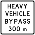
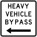
The Dwight D. Eisenhower National System of Interstate and Defense Highways, commonly known as the Interstate Highway System, or the Eisenhower Interstate System, is a network of controlled-access highways that forms part of the National Highway System in the United States. The system extends throughout the contiguous United States and has routes in Hawaii, Alaska, and Puerto Rico.
A ring road is a road or a series of connected roads encircling a town, city or country. The most common purpose of a ring road is to assist in reducing traffic volumes in the urban centre, such as by offering an alternate route around the city for drivers who do not need to stop in the city core. Ring roads can also serve to connect suburbs to each other, allowing efficient travel between them.
Interstate 68 (I-68) is a 113.15-mile (182.10 km) Interstate Highway in the U.S. states of West Virginia and Maryland, connecting I-79 in Morgantown, West Virginia, east to I-70 in Hancock, Maryland. I-68 is also Corridor E of the Appalachian Development Highway System (ADHS). From 1965 until the freeway's construction was completed in 1991, it was designated as U.S. Route 48 (US 48). In Maryland, the highway is known as the National Freeway, an homage to the historic National Road, which I-68 parallels between Keysers Ridge and Hancock. The freeway mainly spans rural areas and crosses numerous mountain ridges along its route. A road cut at Sideling Hill exposed geological features of the mountain and has become a tourist attraction.
U.S. Route 93 (US 93) is a major north–south 1,359-mile (2,187 km) U.S. Numbered Highway in the western United States, that connects U.S. Route 60 (US 60) in Wickenburg, Arizona, with British Columbia Highway 93 at the Canadian border. The highway passes through Kingman, Arizona; Las Vegas, Nevada; Twin Falls, Idaho; and Missoula, Montana.
Route 238, consisting of State Route 238 (SR 238) and Interstate 238 (I-238), is a mostly north–south state and auxiliary Interstate highway in the San Francisco Bay Area of California. The southern segment is signed as SR 238 and is a divided multilane surface highway that runs parallel to the Hayward hills between I-680 in Fremont and I-580 in Castro Valley. The northern segment is signed as I-238 and is a six-lane freeway that runs more east–west between I-580 and I-880 in San Leandro.
Interstate 376 (I-376) is a major auxiliary route of the Interstate Highway System in the US state of Pennsylvania, located within the Allegheny Plateau. It runs from I-80 near Sharon south and east to a junction with the Pennsylvania Turnpike in Monroeville, after having crossed the Pennsylvania Turnpike at an interchange in Big Beaver. The route serves Pittsburgh and its surrounding areas and is the main access road to Pittsburgh International Airport (PIT). Portions of the route are known as the Beaver Valley Expressway, Southern Expressway, and Airport Parkway. Within Allegheny County, the route runs along the majority of the Penn-Lincoln Parkway, known locally as Parkway West and Parkway East. It is currently the ninth-longest auxiliary Interstate route in the system and second only to I-476 within Pennsylvania.
A routenumber, designation or abbreviation is an identifying numeric designation assigned by a highway authority to a particular stretch of roadway to distinguish it from other routes and, in many cases, also to indicate its classification, general geographical location and/or orientation. The numbers chosen may be used solely for internal administrative purposes; however, in most cases they are also displayed on roadside signage and indicated on maps.
The road hierarchy categorizes roads according to their functions and capacities. While sources differ on the exact nomenclature, the basic hierarchy comprises freeways, arterials, collectors, and local roads. Generally, the functional hierarchy can more or less correspond to the hierarchy of roads by their owner or administrator.
A business route in the United States is a short special route that branches off a parent numbered highway at its beginning, continues through the central business district of a nearby city or town, and finally reconnects with the same parent numbered highway at the business route's end. Their designation is often intended to direct traffic to the business districts bypassed when a new highway is constructed some distance away.
A controlled-access highway is a type of highway that has been designed for high-speed vehicular traffic, with all traffic flow—ingress and egress—regulated. Common English terms are freeway, motorway, and expressway. Other similar terms include throughway or thruway and parkway. Some of these may be limited-access highways, although this term can also refer to a class of highways with somewhat less isolation from other traffic.
The Massachusetts State Highway System in the U.S. Commonwealth of Massachusetts is a system of state-numbered routes assigned and marked by the highway division of the Massachusetts Department of Transportation (MassDOT). U.S. Highways and Interstate Highways are included in the system; the only overlaps are with the end-to-end U.S. Route 3 and Route 3 and the far-apart Interstate 295, shared with Rhode Island, and Route 295, shared with New York State. A state highway in Massachusetts is a road maintained by the state, which may or may not have a number. Not all numbered routes are maintained or owned by the state.
Interstate 95 (I-95) is a part of the Interstate Highway System that runs north–south from Miami, Florida to Houlton, Maine. The highway enters Maine from the New Hampshire state line in Kittery and runs for 303 miles (488 km) to the Canada–United States border at Houlton. It is the only primary Interstate Highway in Maine. In 2004, the highway's route between Portland and Gardiner was changed so that it encompasses the entire Maine Turnpike, a toll road running from Kittery to Augusta. As an Interstate Highway, all of I-95 in Maine is included in the National Highway System, a network of roads important to the country's economy, defense, and mobility.
In the U.S. state of Arizona, Interstate 10 (I‑10), the major east–west Interstate Highway in the United States Sun Belt, runs east from California, enters Arizona near the town of Ehrenberg and continues through Phoenix and Tucson and exits at the border with New Mexico near San Simon. The highway also runs through the cities of Casa Grande, Eloy, and Marana. Segments of the highway are referred to as either the Papago Freeway, Inner Loop, or Maricopa Freeway within the Phoenix area and the Pearl Harbor Memorial Highway outside metro Phoenix.
In road transportation in the United States, a special route is a road in a numbered highway system that diverts a specific segment of related traffic away from another road. They are featured in many highway systems; most are found in the Interstate Highway System, U.S. highway system, and several state highway systems. Each type of special route possesses generally defined characteristics and has a defined relationship with its parent route. Typically, special routes share a route number with a dominant route, often referred as the "parent" or "mainline", and are given either a descriptor which may be used either before or after the route name, such as Alternate or Business, or a letter suffix that is attached to the route number. For example, an alternate route of U.S. Route 1 may be called "Alternate U.S. Route 1", "U.S. Route 1 Alternate", or "U.S. Route 1A". Occasionally, a special route will have both a descriptor and a suffix, such as U.S. Route 1A Business.
Interstate 40 (I-40) is an Interstate Highway in Oklahoma that runs 331 miles (533 km) across the state from Texas to Arkansas. West of Oklahoma City, it parallels and replaces old U.S. Highway 66 (US-66), and, east of Oklahoma City, it parallels US-62, US-266, and US-64. I-40 is the longest Interstate highway in Oklahoma.
The design of road signs in Poland is regulated by Regulation of the Ministers of Infrastructure and Interior Affairs and Administration on road signs and signals. The Annex 1 to the regulation describes conditions related to usage of the road signs – size, visibility, colors and light reflections, typeface and text, criteria of choosing the type of foil to signs faces, colorful specimens and schematics.
This article describes the highway systems available in selected countries.
Several special routes of U.S. Route 30 exist. In order from west to east they are as follows.
U.S. Route 209 (US 209) is a 211.74-mile (340.76 km) long U.S. Highway in the states of Pennsylvania and New York. Although the route is a spur of US 9, US 209 never intersects US 9, coming within five miles of the route and making the short connection via New York State Route 199 (NY 199). The southern terminus of the route is at Pennsylvania Route 147 (PA 147) in Millersburg, Pennsylvania. The northern terminus is at US 9W north of Kingston in Ulster, New York, where the road continues east as NY 199.
Terminology related to road transport—the transport of passengers or goods on paved routes between places—is diverse, with variation between dialects of English. There may also be regional differences within a single country, and some terms differ based on the side of the road traffic drives on. This glossary is an alphabetical listing of road transport terms.