Tuen Mun Road

Last updated
HK Route9.svg
Tuen Mun Road
Part of Route 9
Route information
Maintained by Highways Department
Length19.4 km (12.1 mi)
Existed1978–present
Major junctions
West end Tuen Mun (near Fu Tei)
Major intersections9;
HK Route3.svg Route 3 at Ting Kau
HK Route5.svg Route 5 at Tsuen Wan
East end Tsuen Wan (near Chai Wan Kok)
Location
Country China
Special administrative region Hong Kong
Highway system
Tuen Mun Road
Chinese 屯門公路
Cantonese Yale tyun4 mun4 gung1 lou6
Literal meaningTuen Mun public road/
Tuen Mun Highway
Tuen Mun Road Bus Interchange completed in 2012-13 Tuen Mun Road Bus Interchange 201410.jpg
Tuen Mun Road Bus Interchange completed in 2012-13
Tuen Mun Road HK Route9.svg
Westbound exitsExit numberEastbound exits
Hong Kong road sign 217.svg Lam Tei Interchange
HK Route9.svg continues as Yuen Long Highway
End Tuen Mun Road HK Route9.svg Start Tuen Mun Road HK Route9.svg
Tsing Tin Interchange
Tai Hing
Tsing Tin Road
18Tsing Tin Interchange
Tai Hing
Tsing Tin Road
San Hui
San Tak Street
19 Tuen Mun Central
Pui To Road
Tuen Mun Central
Tuen Hi Road (service road)
20 Tuen Mun Central
Tuen Fat Road (service road)
Tuen Mun Central, San Hui
Tuen Hing Road
20Ano exit
Butterfly Beach, Tuen Mun West
Wong Chu Road
21 Butterfly Beach, Tuen Mun West
Wong Chu Road
Siu Lam Interchange
Siu Lam
Castle Peak Road - Tai Lam
22Siu Lam Interchange
Siu Lam
Castle Peak Road - Tai Lam
Sham Tseng Interchange
Sham Tseng, Tsing Lung Tau
Castle Peak Road - Sham Tseng
23Sam Tseng Interchange
Sham Tseng, Ting Kau
Castle Peak Road - Sham Tseng
Ting Kau Interchange
Yuen Long, Lok Ma Chau
Tai Lam Tunnel HK Route3.svg
24Ting Kau Interchange
Lantau, Tsing Yi, Kowloon
Ting Kau Bridge HK Route3.svg
no exit24A Tsing Yi, Kowloon
Tsuen Wan Road HK Route5.svg
Start Tuen Mun Road HK Route9.svg End Tuen Mun Road HK Route9.svg
continues on as Castle Peak Road - Tsuen Wan and Cheung Pei Shan Road HK Route9.svg

History and development

Tuen Mun Road was one of Hong Kong's first high speed roads, and the first expressway. Its construction proved to be a great challenge for the engineers. The road had to be built along the winding coastline, and the steep terrain encountered required the construction of numerous viaducts, culverts and cuttings. To save construction costs, the road was built with narrow carriageways and substandard geometry, causing frequent traffic accidents and subsequent congestion for a long period, and as a result speed limits reduced to 70–80 km/h (45–50 mph). Another such measure was putting the construction work into phases.

Phase 1 of the road was built in 1977, being the present day Tsuen Wan bound carriageway. This section was officially opened on 5 May 1978 by Governor Murray MacLehose. [1] Phase 2, which consists of the Tuen Mun bound carriageway between Sham Tseng and Tsuen Wan, was opened in 1981; the remaining Tuen Mun Bound carriageway was completed in 1983.

Since the road was opened, there have been various improvements carried out to meet the increasing traffic demand, such as the addition of uphill crawler lanes (Tsuen Wan Bound) at Sam Shing Hui, So Kwun Wat, Tai Lam Chung and Ting Kau. The Highways Department has plans to carry out extensive reconstruction works on Tuen Mun Road that will include widening traffic lanes, improving horizontal curvatures and sightlines, and the installation of noise barriers. These works commenced in October 2008 and completed at the end of 2015. [2]

Tuen Mun Road remains one of the most heavily used roads in Hong Kong, as some drivers heading to Yuen Long shunpike Tai Lam Tunnel, and container trucks use it to access the River Trade Terminal in Tuen Mun.

To enhance the convenience of communicators travelling from New Territories to Kowloon or Hong Kong Island, Tuen Mun Road Bus-Bus Interchange had been under construction since 15 July 2010. The interchange on Kowloon bound side and that on Tuen Mun bound side were commissioned on 26 December 2012 and 27 July 2013 respectively. [3]

Major incidents

Bus accident near Ting Kau

Accident site Ting Kau Section of Tuen Mun Road.JPG
Accident site

In the morning of 10 July 2003, a Neoplan Centroliner bus was running on route 265M of Kowloon Motor Bus (KMB) towards Tin Shui Wai, Yuen Long. A lorry running in the middle lane lost control as the bus approached the junction with Tsing Long Highway. The two vehicles collided, knocking the bus towards the side of the viaduct. The bus broke through the parapet, and plunged into Ting Kau Village 35 metres (115 ft) below, resulting in 21 deaths (including the driver) and 20 injured.

Rescue operations were described as being the most challenging encountered by the fire services since the fire at Garley Building. This was due to the constraints at the site (a rural village sited on a steep hillside with no direct road access), and the sheer volume of severely wounded casualties.

The bus was later lifted back onto Tuen Mun Road and transported to the vehicle compound at Siu Ho Wan. It was however written off.

After the incident, then-Chief Executive Tung Chee Hwa visited the crash scene and pledged that the government would do all that it could to aid the survivors, to investigate the accident and prevent similar accidents from ever happening again. [4] [5] [6]

The lorry driver was sentenced to 18 months in jail after being found guilty of causing death by dangerous driving. At the time, it was the most serious road accident in Hong Kong history. [4] He later appealed the rulings, which were subsequently overturned. Tests have shown that the vehicle he was driving was defective (tending to veer to the side when braking), and he was then found guilty of a lesser charge, careless driving, and his sentence was shortened to five months and a two-year driving ban. [7]

Tyre burst incident near Yau Kom Tau

On 1 December 2013, a screw that protruded out of the road surface caused the tyres of about 50 heavy vehicles, of which 36 were KMB buses, to burst. The incident caused a 3-hour traffic jam and a partial closure of the road. Hundreds of passengers were affected but no one was injured in the incident. [8]

See also

Related Research Articles

<span class="mw-page-title-main">Tsing Ma Bridge</span> Suspension bridge in Hong Kong

Tsing Ma Bridge is a bridge in Hong Kong. It is the world's 16th-longest span suspension bridge, and was the second longest at time of completion. The bridge was named after the two islands it connects, namely Tsing Yi and Ma Wan. It has two decks and carries both road and rail traffic, which also makes it the largest suspension bridge of this type. The bridge has a main span of 1,377 metres (4,518 ft) and a height of 206 metres (676 ft). The span is the longest of all bridges in the world carrying rail traffic.

<span class="mw-page-title-main">Lantau Link</span> Road linking western and central Hong Kong

The Lantau Link, formerly known as the Lantau Fixed Crossing, is a roadway in Hong Kong forming part of Route 8 linking Lantau Island to Tsing Yi, from which other roads lead to the urban areas of Kowloon and the rest of the New Territories. Part of the Airport Core Programme centred on the new Hong Kong International Airport on Lantau, the link was officially opened on 27 April 1997, and it opened to traffic on 22 May the same year.

<span class="mw-page-title-main">Ting Kau Bridge</span> Bridge in New Territories, Hong Kong

Ting Kau Bridge is a 1,177-metre (3,862 ft) long cable-stayed bridge in Hong Kong that spans from the northwest of Tsing Yi Island and Tuen Mun Road. It is near the Tsing Ma Bridge which also serves as a major connector between the Hong Kong International Airport on Lantau Island and the rest of Hong Kong. It was completed on 5 May 1998. The bridge is toll-free.

<span class="mw-page-title-main">Rambler Channel</span>

Rambler Channel is a body of water in Hong Kong that separates Tsing Yi Island from Tsuen Wan and Kwai Chung in the New Territories. The channel separates the two landmasses by 900 metres at its widest point.

<span class="mw-page-title-main">Route 9 (Hong Kong)</span> Series of roads in Hong Kong

Route 9, Hong Kong is one of the strategic trunk roads, mostly in the form of a motorway, circumnavigating the New Territories. The route is also known as the New Territories Circular Road (新界環迴公路). Starting from the Shing Mun Tunnels, Route 9 links Sha Tin, Tai Po, Fanling, Sheung Shui, Yuen Long, Tuen Mun and Tsuen Wan. The section between Exit 10 in Kwu Tung and Exit 16 in Lam Tei is part of Asian Highway 1, although the Asian Highway Network is not signed in Hong Kong.

Castle Peak Road is the longest road in Hong Kong. Completed in 1920, it runs in the approximate shape of an arc of a semi-circle. It runs West from Tai Po Road in Sham Shui Po, New Kowloon, to Tuen Mun, then north to Yuen Long then east to Sheung Shui, in the very north of the New Territories. It is divided into 22 sections. It serves south, west and north New Territories, being one of the most distant roads in early Hong Kong.

<span class="mw-page-title-main">Route 3 (Hong Kong)</span> Road in Hong Kong

Route 3 is a series of expressways in Hong Kong that runs from Sai Ying Pun on Hong Kong Island to Yuen Long in the New Territories, linking West Kowloon, Kwai Chung and Tsing Yi. It was built as part of the Airport Core Programme to provide access to Hong Kong International Airport from the city, and to relieve congestion in the New Territories. The Western Harbour Crossing and Tai Lam Tunnel that form part of the route are tollways.

<span class="mw-page-title-main">Sham Tseng</span> Town in Hong Kong

Sham Tseng is a coastal area in Tsuen Wan District, Hong Kong, between Ting Kau and Tsing Lung Tau.

<span class="mw-page-title-main">Tai Lam Tunnel</span> Tunnel in New Territories, Hong Kong

Tai Lam Tunnel, running along Tsing Long Highway, is part of Route 3 Country Park Section (R3CPS) and is a transport link between the western New Territories in Ting Kau and Yuen Long.

<span class="mw-page-title-main">Tsing Long Highway</span>

Tsing Long Highway is an expressway of Route 3 from North West Tsing Yi Interchange on Tsing Yi Island to Yuen Long, in Hong Kong. Ting Kau Bridge and Tai Lam Tunnel are part of the expressway. It connects with Cheung Tsing Highway and Lantau Link at its southern end, and San Tin Highway and Yuen Long Highway at its northern end. Its speed limit at parts south of Tai Lam Tunnel and Tai Lam Tunnel is 80 km/h and parts north of Tai Lam Tunnel is 100 km/h.

<span class="mw-page-title-main">North Lantau Highway</span> Expressway in western Hong Kong

North Lantau Highway is an expressway forming part of Hong Kong's Route 8, linking Hong Kong International Airport and Lantau Island with the rest of the territory. The road has three lanes in each direction for its entire length with full-width hard shoulders for emergencies and breakdowns. The speed limit is 110 kilometres per hour (68 mph) for most of its length, the highest of any road in Hong Kong.

<span class="mw-page-title-main">Hong Kong Strategic Route and Exit Number System</span> Trunk road numbering system in Hong Kong

The Hong Kong Strategic Route and Exit Number System is a system adopted by the Transport Department of the Hong Kong Government to organise the major roads in the territory into routes 1 to 10 for the convenience of drivers. When the system was implemented in 2004, the government promoted it with a major public campaign, including the slogan "Remember the Numbers; Make Driving Easier".

<span class="mw-page-title-main">Yuen Long Highway</span>

Yuen Long Highway is a Hong Kong expressway connecting Au Tau in Yuen Long and Lam Tei in Tuen Mun of New Territories.

<span class="mw-page-title-main">Tsing Lung Tau</span>

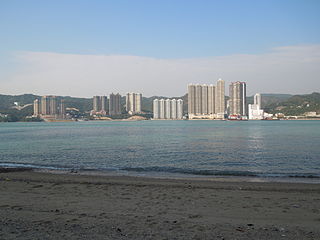
Tsing Lung Tau is a coastal residential area in the southwest coast of the New Territories in Hong Kong.

Articles related to Hong Kong include:

<span class="mw-page-title-main">New towns of Hong Kong</span> Newly developed towns in the 20th century

The Hong Kong government started developing new towns in the 1950s to accommodate Hong Kong's booming population. During the first phase of development, the newly developed towns were called "satellite towns", a concept borrowed from the United Kingdom, of which Hong Kong was a colony. Kwun Tong, located in eastern Kowloon, and Tsuen Wan, located in the south-west of the New Territories, were designated as the first satellite towns, when the urban area in Hong Kong was still relatively small, restricted to the central and western parts of Kowloon Peninsula and the northern side of Hong Kong Island. Wah Fu Estate was also built in a remote corner on the southern side of Hong Kong Island, with similar concepts but at a smaller scale.

<span class="mw-page-title-main">2003 Tuen Mun Road bus accident</span> 2003 crash of a double-decker bus in Tsuen Wan, Hong Kong

In the morning of 10 July 2003, a Kowloon Motor Bus (KMB) double-decker bus plunged off a bridge near the Ting Kau section of the Tuen Mun Road in Tsuen Wan, New Territories. The crash killed 21 people and injured 20.

References

  1. "Governor opens stage one Tuen Mun Road". South China Morning Post. 6 May 1978. p. 7.
  2. "Highways Department - Road Works: Reconstruction and Improvement of Tuen Mun Road". Highways Department of the Hong Kong Government . Retrieved 21 September 2012.
  3. "Kowloon Motor Bus Co. - Bus-bus Interchanges on Tuen Mun Road". Kowloon Motor Bus Co. Retrieved 24 July 2013.
  4. 1 2 "Bus smash kills 21 in Hong Kong". China Daily. 11 July 2003. Retrieved 21 September 2012.
  5. "At least 21 killed in HK bus accident". China Daily. 10 July 2003. Retrieved 21 September 2012.
  6. "High toll in HK bus crash - CNN". Cable News Network. 10 July 2003. Archived from the original on 21 September 2010. Retrieved 21 September 2012.
  7. "Tuen Mun bus crash victims sue truck driver".
  8. "Screw on Tuen Mun Road bursts tyres of 50 vehicles, causing 3-hour jam". South China Morning Post. 1 December 2013. Retrieved 1 December 2013.
Preceded by
Yuen Long Highway
Hong Kong Route 9
HK Route9.svg
Tuen Mun Road
Succeeded by
Cheung Pei Shan Road

22°21′40″N114°02′13″E / 22.361°N 114.037°E / 22.361; 114.037