Most of the walled villages of Hong Kong are located in the New Territories.
Hong Kong counts approximately 600 temples,shrines and monasteries. While Buddhism and Christianity are the most widely practiced religions,most religions are represented in the Special Administrative Region.

Tuen Mun Road is a major expressway in Hong Kong which connects Tuen Mun with Tsuen Wan,within the New Territories. It is part of Hong Kong's Route 9,which circumnavigates the New Territories. Opened in 1978,it was once the major trunk route linking the northwest New Territories to urban Kowloon and is known for its frequent traffic jams and road accidents owing to its early design and heavy usage. As a result,speed limits have been enforced to 70–80 km/h (45–50 mph) due to geometric constraints.

Route 9,Hong Kong is one of the strategic trunk roads,mostly in the form of a motorway,circumnavigating the New Territories. The route is also known as the New Territories Circular Road (新界環迴公路). Starting from the Shing Mun Tunnels,Route 9 links Sha Tin,Tai Po,Fanling,Sheung Shui,Yuen Long,Tuen Mun and Tsuen Wan. The section between Exit 10 in Kwu Tung and Exit 16 in Lam Tei is part of Asian Highway 1,although the Asian Highway Network is not signed in Hong Kong.

Telephone numbers in Hong Kong are mostly eight-digit. Fixed land line numbers start with 2 or 3,mobile (cellular) phone numbers with 4,5,6,7,8,or 9,pager numbers with 7 and forwarding service with 8. Since the end of 1989,there have been no area codes within Hong Kong.

Tsing Lung Tau is a coastal residential area in the southwest coast of the New Territories in Hong Kong.

Yuen Long Town is located in the district centre of Yuen Long District,New Territories,Hong Kong. It is the heart of Yuen Long and Yuen Long New Town,with a population of around 200,000.

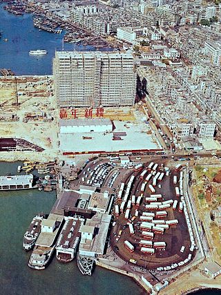
Jordan Road Ferry Pier or Ferry Point (1924–1998) is a demolished pier originally located at Jordan Road,Jordan,Hong Kong.
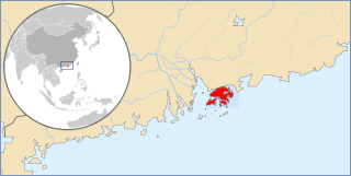
Articles related to Hong Kong include:

The Hong Kong government started developing new towns in the 1950s to accommodate Hong Kong's booming population. During the first phase of development,the newly developed towns were called "satellite towns",a concept borrowed from the United Kingdom,of which Hong Kong was a colony. Kwun Tong,located in eastern Kowloon,and Tsuen Wan,located in the south-west of the New Territories,were designated as the first satellite towns,when the urban area in Hong Kong was still relatively small,restricted to the central and western parts of Kowloon Peninsula and the northern side of Hong Kong Island. Wah Fu Estate was also built in a remote corner on the southern side of Hong Kong Island,with similar concepts but at a smaller scale.


