This article needs additional citations for verification .(February 2022) |
You can help expand this article with text translated from the corresponding article in Chinese. Click [show] for important translation instructions.
|

| Lok Ma Chau | |||||||||||
|---|---|---|---|---|---|---|---|---|---|---|---|
| Traditional Chinese | 落馬洲 | ||||||||||
| Simplified Chinese | 落马洲 | ||||||||||
| |||||||||||

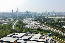
Lok Ma Chau or Lokmachau is an area in New Territories,Hong Kong. It is the site of a major pedestrian (linked directly to the Hong Kong MTR) and road border crossing point between Hong Kong and mainland China. Administratively,most of the Lok Ma Chau area is located within the Yuen Long District of Hong Kong.