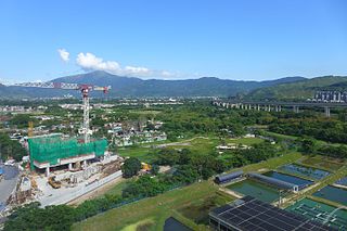
Yuen Long District is one of the districts of Hong Kong. Located in the northwest of the New Territories, it had a population of 449,070 in 2001.

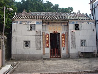
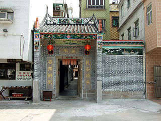
Most of the walled villages of Hong Kong are located in the New Territories.

Sheung Shui is an area in the New Territories, Hong Kong. Sheung Shui Town, a part of this area, is part of the Fanling–Sheung Shui New Town in the North District of Hong Kong. Fanling Town is to its southeast.

Sheung Shui Wai, also known as Sheung Shui Heung (上水鄉) is an area in Sheung Shui, in the northern part of the New Territories of Hong Kong. Its population is around 6,000 people.

Kam Tin, or Kam Tin Heung, is an area in the New Territories, Hong Kong. It lies on a flat alluvial plain north of Tai Mo Shan mountain and east of Yuen Long town. It was formerly known as Sham Tin (岑田). Administratively, it is part of Yuen Long District.

Yuen Long is a town in the western New Territories, Hong Kong. To its west lie Hung Shui Kiu (洪水橋), Tin Shui Wai, Lau Fau Shan and Ha Tsuen, to the south Shap Pat Heung and Tai Tong, to the east Au Tau and Kam Tin (錦田), and to the north Nam Sang Wai.

Lam Tsuen is an area in Tai Po District, Hong Kong, noted for its Lam Tsuen wishing trees. The nearby Lam Tsuen River, empties into Tai Po Hoi.
The generic forms of Hong Kong place names are mainly Cantonese, Hakka and British English, although other languages also contribute to Hong Kong place names.

Shap Pat Heung is an area in the New Territories of Hong Kong. Located south of Yuen Long and northeast of Tai Tong, the area occupied the plain north of hills of Tai Lam. The Cantonese name Shap Pat Heung means eighteen villages at its beginning. It was later expanded to thirty villages. Administratively, it is part of the Yuen Long District.
There are three plains in Hong Kong, in the northern New Territories. These plains are Yuen Long, Fanling, and Tai Po.

Yuen Long Kau Hui is an area in Yuen Long, Yuen Long District, in the western New Territories of Hong Kong.

Wang Chau is an area of Yuen Long District, located in the northwestern part of Hong Kong, west of the Shan Pui River.

Shan Pui Tsuen is a village in Shap Pat Heung, Yuen Long District, Hong Kong.

Ma Tin Tsuen is a walled village in Shap Pat Heung, Yuen Long District, Hong Kong.

Wang Toi Shan is an area of Pat Heung, in Yuen Long District, Hong Kong.
The Nine Alliances of Lek Yuen or Kau Yeuk was a regional organization of various groups in Sha Tin Valley, Hong Kong.


