
The Kwun Tong line is a rapid transit line of the MTR network in Hong Kong, coloured green on the MTR map. Starting at Whampoa in Hung Hom and ending at Tiu Keng Leng in Tseung Kwan O, Sai Kung, the route has 17 stations and takes 35 minutes to complete. The Kwun Tong line is one of the busiest railway lines on the network connecting the central and the eastern portions of Kowloon via Wong Tai Sin. The line is mostly underground, but includes a lengthy elevated section, and runs generally in an east-west direction. During the morning rush hour, the Kwun Tong line utilises 33 trains running at 29tph to achieve a route capacity of 85,000 pphpd.

Tuen Mun Road is a major expressway in Hong Kong which connects Tuen Mun with Tsuen Wan, within the New Territories. It is part of Hong Kong's Route 9, which circumnavigates the New Territories. Opened in 1978, it was once the major trunk route linking the northwest New Territories to urban Kowloon and is known for its frequent traffic jams and road accidents owing to its early design and heavy usage. As a result, speed limits have been enforced to 70–80 km/h (45–50 mph) due to geometric constraints.

Route 9, Hong Kong is one of the strategic trunk roads, mostly in the form of a motorway, circumnavigating the New Territories. The route is also known as the New Territories Circular Road (新界環迴公路). Starting from the Shing Mun Tunnels, Route 9 links Sha Tin, Tai Po, Fanling, Sheung Shui, Yuen Long, Tuen Mun and Tsuen Wan. The section between Exit 10 in Kwu Tung and Exit 16 in Lam Tei is part of Asian Highway 1, although the Asian Highway Network is not signed in Hong Kong.
Castle Peak Road is the longest road in Hong Kong. Completed in 1920, it has the approximate shape of an arc of a semi-circle. It runs west from Tai Po Road in Sham Shui Po, New Kowloon, to Tuen Mun, then north to Yuen Long and east to Sheung Shui, in the very north of the New Territories; it is divided into 22 sections.

The MacLehose Trail is a 100-kilometre hiking trail that crosses much of the New Territories, Hong Kong, starting from Pak Tam Chung, Sai Kung District in the east to Tuen Mun Town, Tuen Mun District in the west. It is the longest trail in Hong Kong and the path is marked by distance posts at 500-metre intervals. The trail is named after Murray MacLehose, Baron MacLehose of Beoch, the longest-serving governor of Hong Kong, who established the Country Parks and was himself an enthusiastic hiker. The trail passes through a variety of natural scenery including beaches and mountains.

Tsuen Wan is a town built on a bay in the western New Territories of Hong Kong, opposite Tsing Yi Island across Rambler Channel. The market town of Tsuen Wan emerged from the surrounding villages and fleets of fishing boats in the area. The modern city is centered the Tsuen Wan station of the MTR. Its coastline was further extended through land reclamation.

Pat Heung is an area in the middle of New Territories, Hong Kong. Located at the east of Kam Tin and north of Shek Kong, it is the exit to Sheung Shui and Fanling. Administratively, it belongs to Yuen Long District.

Clear Water Bay Road is a major road from Choi Hung Interchange in Ngau Chi Wan to Clear Water Bay, Sai Kung District. It also is a route to Sai Kung Town and Tseung Kwan O via Hiram's Highway and Hang Hau Road / Ying Yip Road respectively. An expressway deviation, New Clear Water Bay Road (新清水灣道), bypasses a steep, winding, 1 in 6 alignment of Clear Water Bay Road near Shun Lee and Fei Ngo Shan.
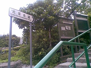
Yuen Tsuen Ancient Trail, also known as Yuen Tsuen Traditional Footpath, is a trail linking Yuen Long and Tsuen Wan in the New Territories of Hong Kong. The trail was the major trail for travelling between two major towns for villages trading their necessaries before the completion of Castle Peak Road.
Jordan Road Ferry Pier or Ferry Point (1924–1998) is a demolished pier originally located at Jordan Road, Jordan, Hong Kong.
Articles related to Hong Kong include:

Route 51 is a bus service operated by Kowloon Motor Bus (KMB) in Hong Kong's New Territories. It connects Tsuen Wan with Sheung Tsuen, a village in Pat Heung running via the steep and tortuous Route Twisk.

Cheung Pei Shan Road is a road near Cheung Pei Shan in Tsuen Wan and Sheung Kwai Chung of Hong Kong. It links the north edge of town centre of Tsuen Wan New Town to Shing Mun, from Tsuen Kam Interchange with Route Twisk, Tai Ho Road North, Wai Tsuen Road and Texaco Road North to the entrance of the Shing Mun Tunnels. The road is part of Route 9. North of the road are resited villages from the old town of Tsuen Wan and Cheung Pei Shan; to its south are public housing estates: Lei Muk Shue Estate, Cheung Shan Estate and Shek Wai Kok Estate.

Texaco Road is a road in Tsuen Wan, New Territories, Hong Kong. It connects the Tsuen Kam Interchange with Ma Tau Pa Road and Wing Shun Street, intersecting with both the Tsuen Tsing Interchange and Castle Peak Road. Texaco Road, the first internal road in Tsuen Wan, was constructed in the 1930s to facilitate the industrial development of the Texaco Fuel Company at Cape Tsing Yi Bay and was later renovated in 1959. The section of Texaco Road north of Castle Peak Road was constructed later and opened on March 31, 1981; this section is now referred to as Texaco Road North, and the Texaco Interchange, where Texaco Road intersects Castle Peak Road, was inaugurated on the same day.

The Tsuen Kam Interchange is a traffic interchange located in the Tsuen Wan District of the New Territories, Hong Kong. The Tsuen Kam Interchange is a clockwise roundabout with three lanes, measuring a total length of 450 meters. It has six exits that provide access to various areas including Sha Tin, Kwai Chung, Kowloon, Tsuen Wan, Tuen Mun, Kam Tin, and Shek Kong. The entire Tsuen Kam Interchange is designated as a route for New Territories taxis.

