Shek Kong 石崗 | |
---|---|
Shek Kong | |||||||||||||
---|---|---|---|---|---|---|---|---|---|---|---|---|---|
Traditional Chinese | 石崗 | ||||||||||||
Simplified Chinese | 石岗 | ||||||||||||
|
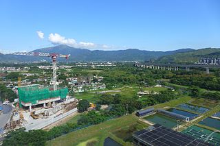
Shek Kong is an area north of Tai Mo Shan,located near Kam Tin and Pat Heung,in Yuen Long District,New Territories,Hong Kong,hosting Shek Kong San Tsuen,Shek Kong Barracks and Shek Kong Airfield.
The area named after an old walled village of Shek Kong on the south side of north tributary of Kam Tin River,predating New Territories of 1898. The village was demolished in late-1940s for the setup of Shek Kong Camp,south of Kam Tin Road. Shek Kong is Cantonese phonetic transcription of native writing 石崗that means a rocky mount. Its history was much longer as pots from Tang dynasty and Song dynasty were unearthed in Shek Kong.
The barracks and airfield occupied the largest area of Shek Kong,flattening the landscape and re-channelling of south tributary of Kam Tin River. The runway serves both military for helicopters and civilian to fly aeroplane for leisure.
There are military quarters Shek Kong Village,built in 1957,not in Shek Kong but far on the slope of and original village of Lui Kung Tin along Route Twisk. The village was originally for the married members of Shek Kong Camp/Barracks. The naming causes confusion afterwards to the location of Shek Kong and gives an illusion that Shek Kong has a vast portion of Pat Heung,including Lin Fa Tei and Sheung Tsuen,between Shek Kong Barracks/Airfield and Shek Kong Village. Some even tried to identify the rocky mount as Kwun Yam Shan which far from Shek Kong. [1]
A sizable Nepal Gurkha population is present in the area and adjacent area of Kam Tin and Pat Heung even after the withdrawal of British military and many of them are moved to various area in Yuen Long District such as Yuen Long,and even more to Kwun Chung in Kowloon. [2] [3]
The original walled village of Shek Kong,of Chau/Chow family,周in Cantonese,was in the present location of Shek Kong Barracks,just south of Kam Tin Road,predating the extension to the New Territories of Hong Kong in 1898. A map for the extension named the village Shek Kong in 1904 although earlier map of 1901 mapped it without name. [4] [5]
It was quite common conflicts between villages became a clan war in southern China. In 1935,there was a brief one between Shek Kong and Kam Tin,even villagers of both villages had lot of marriages among themselves. The shortage of water made farming difficult. A villager of Kam broke the embankment of a paddle field of Shek Kong to release water to their own paddy fields. It soon evolved into a small clan war by calling members of their own clan and was soon stopped by police force their. Some fled,some were taken to Kowloon Hospital and some were taken to Au Tau Police Station. [6] [7] This is one of early record of Shek Kong.
In 1938,an airfield,by flattening the land,was built around the village to defence against the Japanese advance to Kwangtung but soon converted to refugee camp when people fled from the Japanese aggression in Shanghai and northern China. [8] [9] Japanese war map of 1939 named it in Chinese character 錦田飛行場,namely Kam Tin Airfield. [10] The airfield rendered useless during Japanese occupation of Hong Kong between late-1941 and mid-1945 and returned to cultivation owing to food shortage.
The original village was removed when Shek Kong Camp,later known as Shek Kong Barracks,was built around 1949,guarding then British colony of Hong Kong against the advance to Sham Chun,nowadays Shenzhen,of newly established communist China. [11] A new village Shek Kong San Tsuen was at the northwest of the original village,on the opposite side of the road few years later.
The airfield became a base of Royal Air Force of the United Kingdom in 1950 and it was transferred to People's Liberation Army Air Force of China in 1997 when the sovereignty of Hong Kong was changed. In 1975 following the Fall of Saigon a refugee camp was set for Vietnamese refugee in the airfield. And again in 1980,with influx of Vietnamese boat people a detention camp was set in the airfield. [9] The operation from then was with helicopter and closing of runway was not a problem. The airfield was open to civilian use in the weekends and the Hong Kong Aviation Club was based in the airfield. [9]
British forces built some quarters for the families of garrison of the camp around 1957,on hilly slope of Lui Kung Tin,adjacent to Route Twisk,east of but far from the camp. The quarters was named as Shek Kong Families' Village and later known as Shek Kong Village. [12] This sometimes causes confusion to the location of Shek Kong.
The basin of Kam Tin and Pat Heung was long inhibited with known record of the ancestors of Kam Tin villages living in the basin as early as 973 and settled in 1105 during Song dynasty. [13] But a pottery burial jar of earlier Tang dynasty was unearthed in Shek Kong, [14] together with some of Song dynasty. [15] [16] [17] [18] [19] [20] [21]
Climate data for Shek Kong (1997–2020) | |||||||||||||
---|---|---|---|---|---|---|---|---|---|---|---|---|---|
Month | Jan | Feb | Mar | Apr | May | Jun | Jul | Aug | Sep | Oct | Nov | Dec | Year |
Record high °C (°F) | 28.4 (83.1) | 30.5 (86.9) | 30.8 (87.4) | 33.1 (91.6) | 34.4 (93.9) | 36.4 (97.5) | 37.3 (99.1) | 37.2 (99.0) | 35.9 (96.6) | 34.2 (93.6) | 32.3 (90.1) | 29.6 (85.3) | 37.3 (99.1) |
Mean daily maximum °C (°F) | 20.0 (68.0) | 21.4 (70.5) | 23.9 (75.0) | 27.1 (80.8) | 30.0 (86.0) | 31.6 (88.9) | 32.5 (90.5) | 32.6 (90.7) | 31.6 (88.9) | 29.2 (84.6) | 25.7 (78.3) | 21.5 (70.7) | 27.3 (81.1) |
Daily mean °C (°F) | 15.5 (59.9) | 17.2 (63.0) | 19.7 (67.5) | 23.2 (73.8) | 26.4 (79.5) | 28.1 (82.6) | 28.7 (83.7) | 28.5 (83.3) | 27.5 (81.5) | 25.1 (77.2) | 21.5 (70.7) | 16.9 (62.4) | 23.2 (73.8) |
Mean daily minimum °C (°F) | 12.0 (53.6) | 13.7 (56.7) | 16.5 (61.7) | 20.1 (68.2) | 23.5 (74.3) | 25.4 (77.7) | 25.7 (78.3) | 25.3 (77.5) | 24.5 (76.1) | 21.9 (71.4) | 18.0 (64.4) | 13.1 (55.6) | 20.0 (68.0) |
Record low °C (°F) | 1.9 (35.4) | 3.1 (37.6) | 6.8 (44.2) | 10.8 (51.4) | 15.9 (60.6) | 19.2 (66.6) | 21.7 (71.1) | 21.7 (71.1) | 17.6 (63.7) | 12.5 (54.5) | 5.8 (42.4) | 2.5 (36.5) | 1.9 (35.4) |
Average precipitation mm (inches) | 36.8 (1.45) | 34.2 (1.35) | 59.3 (2.33) | 137.8 (5.43) | 281.8 (11.09) | 424.8 (16.72) | 312.7 (12.31) | 342.0 (13.46) | 262.6 (10.34) | 74.7 (2.94) | 32.3 (1.27) | 32.4 (1.28) | 2,031.4 (79.97) |
Average relative humidity (%) | 72.9 | 75.6 | 77.6 | 79.3 | 81.8 | 82.8 | 82.2 | 81.8 | 78.9 | 73.4 | 72.7 | 69.9 | 77.4 |
Source:Hong Kong Observatory (precipitation 1998-2020) [22] |
Shek Kong is in Primary One Admission (POA) School Net 74. Within the school net are multiple aided schools (operated independently but funded with government money) and one government school:Yuen Long Government Primary School (元朗官立小學). [23]
Yuen Long District is one of the districts of Hong Kong. Located in the northwest of the New Territories,it had a population of 662,000 in 2021.
Most of the walled villages of Hong Kong are located in the New Territories.
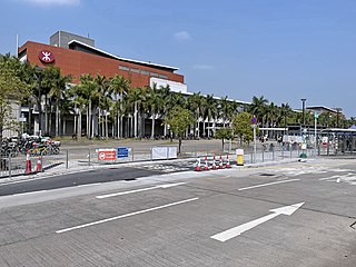
Kam Sheung Road is an MTR station on the Tuen Ma line,located between Pat Heung and Kam Tin in Hong Kong. It is situated between Tsuen Wan West and Yuen Long stations. Kam Sheung Road was the location for the KCR West Rail's opening ceremony.
Sheung Shui is an area in the New Territories,Hong Kong. Sheung Shui Town,a part of this area,is part of the Fanling–Sheung Shui New Town in the North District of Hong Kong. Fanling Town is to its southeast.
Route Twisk is a steep and tortuous dual-lane road in Hong Kong,linking Tsuen Wan and Pat Heung via Shek Kong. It joins Kam Tin Road and Lam Kam Road north in Kam Tin,and ends in the Tsuen Kam Interchange south in Tsuen Wan.
Sha Tin,also spelt Shatin,is a neighbourhood along Shing Mun River in the eastern New Territories,Hong Kong. Administratively,it is part of the Sha Tin District. Sha Tin is one of the neighbourhoods of the Sha Tin New Town project.
Kam Tin,or Kam Tin Heung,is an area in the New Territories,Hong Kong. It lies on a flat alluvial plain north of Tai Mo Shan mountain and east of Yuen Long town. It was formerly known as Sham Tin (岑田). Administratively,it is part of Yuen Long District.
Pat Heung is an area in the middle of New Territories,Hong Kong. Located at the east of Kam Tin and north of Shek Kong,it is the exit to Sheung Shui and Fanling. Administratively,it belongs to Yuen Long District.
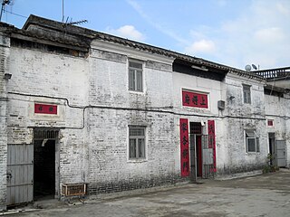
Kam Hing Wai is a walled village located in the Kam Tin area of Yuen Long District,in Hong Kong. Three other walled villages;Kat Hing Wai,Wing Lung Wai,and Tai Hong Wai) are located nearby and were built around the same time.
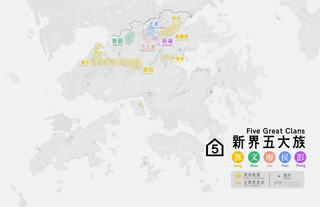
The Five Great Clans of the New Territories are the five families that settled before the seventeenth century and became sizeable in the New Territories of Hong Kong.
Kam Tsin Wai is a village located in the south of Shek Kong Airfield,in Pat Heung,Yuen Long District,Hong Kong.
Fung Kat Heung is a village in the Kam Tin area of Yuen Long District,Hong Kong.
Kam Tin Shing Mun San Tsuen or Kam Tin San Tsuen (錦田新村) is a village in the Kam Tin area of Yuen Long District,Hong Kong.
Lui Kung Tin is an area with a village of same name in Pat Heung,Yuen Long District,Hong Kong. On the western slope of Tai Mo Shan,the original Hakka village of Leung clan,in Cantonese 梁,of Lui Kung Tin was demolished around 1957 when military quarters of Shek Kong Village were built. Actually some villagers relocated themselves to Leung Uk Tsuen in Wang Toi Shan in 1940s and finally all relocated before the village demolished in 1950s. Meanwhile a new non-indigenous villages Lui Kung Tin was formed by different clans which finally became a member of Pat Heung Rural Committee in 1991.
The Tsuen Kam Interchange is a traffic interchange located in the Tsuen Wan District of the New Territories,Hong Kong. The Tsuen Kam Interchange is a clockwise roundabout with three lanes,measuring a total length of 450 meters. It has six exits that provide access to various areas including Sha Tin,Kwai Chung,Kowloon,Tsuen Wan,Tuen Mun,Kam Tin,and Shek Kong. The entire Tsuen Kam Interchange is designated as a route for New Territories taxis.