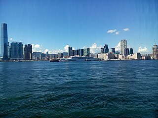
Kowloon is an urban area in Hong Kong comprising the Kowloon Peninsula and New Kowloon. It has a population of 2,019,533 and a population density of 43,033/km2 (111,450/sq mi) in 2006. It is one of the three regions of Hong Kong,along with Hong Kong Island and the New Territories,and is the smallest,second most populous and most densely populated.

Yau Tsim Mong District is one of 18 districts of Hong Kong,located on the western part of Kowloon Peninsula. It is the core urban area of Kowloon. The district has the second highest population density of all districts,at 49,115 km2 (18,963 sq mi). The 2016 By-Census recorded the total population of Yau Tsim Mong District at 342,970.

The Tsuen Wan line is one of the ten lines of the metro network in Hong Kong's MTR. It is indicated in red on the MTR map.

Yau Ma Tei is an area in the Yau Tsim Mong District in the south of the Kowloon Peninsula in Hong Kong.
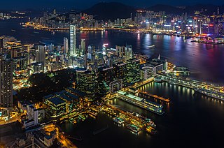
Tsim Sha Tsui,often abbreviated as TST,is an urban area in southern Kowloon,Hong Kong. The area is administratively part of the Yau Tsim Mong District. Tsim Sha Tsui East is a piece of land reclaimed from the Hung Hom Bay now east of Tsim Sha Tsui. The area is bounded north by Austin Road and in the east by Hong Chong Road and Cheong Wan Road.

Jordan is an area in Hong Kong,located on Kowloon Peninsula. It is named after a road of the same name in the district. The area is bordered by King's Park to the east,Tsim Sha Tsui to the south,Ferry Point to the west,and Yau Ma Tei to the north. Administratively,it is part of Yau Tsim Mong District.
Hong Kong counts approximately 600 temples,shrines and monasteries. While Buddhism and Christianity are the most widely practiced religions,most religions are represented in the Special Administrative Region.

Nathan Road is the main thoroughfare in Kowloon,Hong Kong,aligned south–north from Tsim Sha Tsui to Sham Shui Po. It is lined with shops and restaurants and throngs with visitors,and was known in the post–World War II years as the Golden Mile,a name that is now rarely used. It starts on the southern part of Kowloon at its junction with Salisbury Road,a few metres north of Victoria Harbour,and ends at its intersection with Boundary Street in the north. Portions of the Kwun Tong and Tsuen Wan lines run underneath Nathan Road. The total length of Nathan Road is about 3.6 km (2.2 mi).
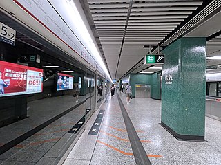
Jordan is a station on the Hong Kong MTR Tsuen Wan line. It has dark green and light green livery. It is named after Jordan Road.
This article is a list of transport means that cross Victoria Harbour in Hong Kong.
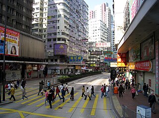
Jordan Road is a road in Jordan,Kowloon,Hong Kong. It spans from the West Kowloon Highway in West Kowloon,through Kwun Chung and Ferry Point to Gascoigne Road and is a major east–west road in southern Kowloon.

Middle Road is a street in the southern part of Tsim Sha Tsui,Kowloon,Hong Kong.
East Kowloon line was one of the original five MTR lines proposed in the late 1970s in Hong Kong,which would have connected Sheung Wan with East Kowloon.
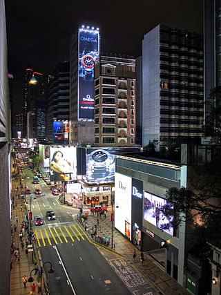
Canton Road is a major road in Hong Kong,linking the former west reclamation shore in Tsim Sha Tsui,Jordan,Yau Ma Tei,Mong Kok and Prince Edward on the Kowloon Peninsula. The road runs mostly parallel and west to Nathan Road. It starts from the junction with Salisbury Road in the south and ends in the north at the junction with Lai Chi Kok Road in the Prince Edward area. The southern section of Canton Road is home to many upscale retail shops,shopping centres and others business establishments,with busy traffic from both vehicles and pedestrians from morning till late at night.

Yau Ma Tei Theatre,once the largest theatre in Kowloon,is located at the junction of Waterloo Road and Reclamation Street,in Yau Ma Tei,Hong Kong. It is classified as "Grade II Historic Building" It is the only remaining pre-World War II theatre in Kowloon. It was recently converted into a venue for Cantonese opera. Another historical structure,Yau Ma Tei Fruit Market is adjacent to the theatre,across Reclamation Street.
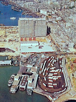
Jordan Road Ferry Pier or Ferry Point (1924–1998) is a demolished pier originally located at Jordan Road,Jordan,Hong Kong.
Articles related to Hong Kong include:


