

Ma On Kong (Chinese :馬鞍崗) is a village in Pat Heung, Yuen Long District, Hong Kong.


Ma On Kong (Chinese :馬鞍崗) is a village in Pat Heung, Yuen Long District, Hong Kong.
Ma On Kong is a recognized village under the New Territories Small House Policy. [1] It is one of the villages represented within the Pat Heung Rural Committee. For electoral purposes, Ma On Kong is part of the Pat Heung South constituency, which is currently represented by Lai Wing-tim. [2] [3]

Nai Chung is a countryside and a village in northeastern New Territories, Hong Kong. It is located at the east of Ma On Shan, partly lying within the Ma On Shan Country Park. Nai Chung lies in a larger area collectively known as Shap Sze Heung.

Choi Uk Tsuen or Tsoi Uk Tsuen is a village in Yuen Long Kau Hui, New Territories, Hong Kong.

Tai Tong is an area southwest of Shap Pat Heung, in Yuen Long District, in the northwestern part of Hong Kong.
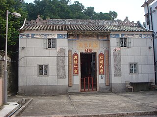
Shan Pui Tsuen is a village in Shap Pat Heung, Yuen Long District, Hong Kong.
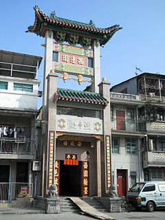
Sai Pin Wai, sometimes transliterated as Sai Bin Wai, is a walled village in the Yuen Long Kau Hui area of Yuen Long District, Hong Kong.

Tai Kiu Tsuen is a historic walled village in Shap Pat Heung, Yuen Long District, Hong Kong.

Heung Yuen Wai is a walled village in Ta Kwu Ling, North District, Hong Kong.

Tai Wai Tsuen is a walled village in the Yuen Long Kau Hui area of Yuen Long District, Hong Kong.
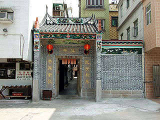
Ma Tin Tsuen is a walled village in Shap Pat Heung, Yuen Long District, Hong Kong.
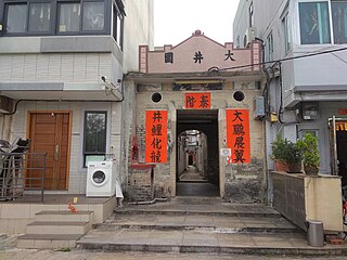
Tai Tseng Wai is a walled village in Wang Chau, Yuen Long District, Hong Kong.

Wong Uk Tsuen is a village in the Yuen Long Kau Hui area of Yuen Long District, Hong Kong.
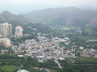
Yeung Uk Tsuen is a village in Shap Pat Heung, Yuen Long District, Hong Kong.

Ha Yau Tin Tsuen is a village in the Shap Pat Heung area of Yuen Long District, Hong Kong.
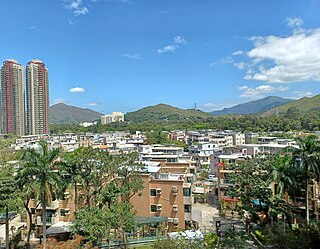
Sheung Yau Tin Tsuen is a village in the Shap Pat Heung area of Yuen Long District, Hong Kong.
Tong Tau Po Tsuen is a village in the Shap Pat Heung area of Yuen Long District, Hong Kong.

Ho Pui is a village in Pat Heung, Yuen Long District, Hong Kong.

Tai Wo Tsuen, sometimes transliterated as Tai Wor, is a village in Pat Heung, Yuen Long District, Hong Kong.

Tin Sam Tsuen is a village in Pat Heung, Yuen Long District, Hong Kong.
Yuen Leng Lei Uk is a village in Tai Po District, Hong Kong.
Yuen Leng Yip Uk is a village in Tai Po District, Hong Kong.
Coordinates: 22°24′57″N114°03′59″E / 22.415762°N 114.066359°E