Geography
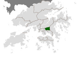
Wong Tai Sin District borders the districts of Kwun Tong to its southeast,Kowloon City to its southwest,Sai Kung to its east,and Sha Tin to its north. It covers an area of approximately 9.36 km2 (3.61 sq mi).
The district contains the areas of Diamond Hill,Wang Tau Hom,Lok Fu,Chuk Yuen,Wong Tai Sin,Tsz Wan Shan,Fung Wong [ yue ],Ngau Chi Wan,Choi Hung and Choi Wan,an area that includes several major public housing estates.
The district is largely urbanized,with high-density residential estates interspersed with parks,schools,and cultural landmarks.
Demographics
Population
As of the 2021 Hong Kong Census,Wong Tai Sin District has a total population of approximately 406,802,around 5.5% of the total Hong Kong population. [4] This is down from the 2016 Census which found the population at 425,235,indicating a slight decline in population over the five years. The district has one of the highest proportions of older residents among Hong Kong’s 18 districts and the second highest population density.
Age Structure
The age composition of Wong Tai Sin District reflects an aging population. Based on the 2021 census,the age distribution is as follows: [4]
- 0-14 years:36,271 (8.9%)
- 15-24 years:33,463 (8.2%)
- 25-34 years:50,414 (12.4%)
- 35-44 years:52,949 (13.0%)
- 45-54 years:63,093 (15.5%)
- 55-64 years:77,201(19.0%)
- 65+ years:93,411 (23.0%)
The proportion of older adults has increased over time,consistent with Hong Kong’s overall demographic trend towards an aging population.
Gender Distribution
According to the 2021 Hong Kong Census,the district population consists of approximately 187,531 males and 219,271 females. [4] This slight female predominance is common in urban Hong Kong districts.
Ethnicity and Language
Most residents of Wong Tai Sin District are ethnically Chinese,around 99.2%. This number is higher than the average for the rest of Hong Kong which is around 96.2%. [5]
Cantonese is the dominant language of this region,spoken by 94.0% of the population. Other Chinese dialects and Mandarin are used by 4.3% of the population,and English or other languages are spoken by around 1.7%,lower than the national percentage of 6.1%.
These data points show that the Wong Tai Sin District of Hong Kong is not a highly diverse area,especially when compared with Hong Kong as a whole. The district is one of the least ethnically and linguistically diverse districts in the city.
Migration
Based on the 2016 census,61.1% of Wong Tai Sin’s population was born in Hong Kong. 34.9% was born in Mainland China,Macao or Taiwan while 4.0% were born elsewhere.[2] This data shows that the population of Wong Tai Sin District is made up of a combination of long-term local residents and in-migration from other regions of China with a small portion of these people being born outside of these regions.
Population Trends
Wong Tai Sin District experienced a population decline between 2016 and 2021,reflecting Hong Kong’s overall trend of low fertility and aging population. These trends suggest a shrinking working-age population and potential challenges for social services,healthcare and urban planning.
Population Data Limitations
Detailed statistics on fertility rates,mortality rates and life expectancy for this district are not publicly available. The Hong Kong Census and Statistics Department publishes this information primarily at a territory-wide or city-wide scale rather than for individual districts. As a result,analysis of population dynamics at a district level must rely on available data. Statistics indicate that Hong Kong has experienced low fertility rates,increasing life expectancy and population aging in recent decades,trends that influence the demographic profile of Wong Tai Sin District.