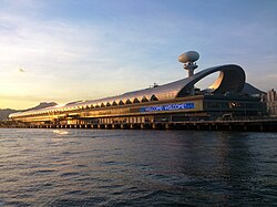
Kowloon City District

Last updated

Kowloon City
九龍城區
Kowloon City District
Hong Kong Kowloon City District.svg
Location of Kowloon City District within Hong Kong
Coordinates: 22°19′42″N114°11′30″E / 22.32820°N 114.19155°E / 22.32820; 114.19155
Country China
SAR Hong Kong
Constituencies 25
Government
  District Officer Tso Man Kwan [1]
   District Council ChairmanHo Hin-ming[ needs update ]
   District Council Vice-ChairmanNg Po-Keung
Area
  Total9.97 km2 (3.85 sq mi)
Population
 (2016 [2] )
  Total418,732
  Density42,000/km2 (110,000/sq mi)
Time zone UTC+8 (Hong Kong Time)
Largest neighbourhood by population Ma Tau Kok (53,800 – 2016 est) [3]
Website Kowloon City District Council

    Related Research Articles

    <span class="mw-page-title-main">Transport in Hong Kong</span>

    Hong Kong has a highly developed transport network, encompassing both public and private transport. Based on Hong Kong Government's Travel Characteristics Survey, over 90% of daily journeys are on public transport, the highest rate in the world. However, in 2014 the Transport Advisory Committee, which advises the Government on transportation issues, issued a report on the much-worsened congestion problem in Hong Kong and pointed at the excessive growth of private cars during the past 10–15 years.

    <span class="mw-page-title-main">Kowloon</span> Area of Hong Kong

    Kowloon is an urban area in Hong Kong comprising the Kowloon Peninsula and New Kowloon. It has a population of 2,019,533 and a population density of 43,033/km2 (111,450/sq mi) in 2006. It is one of the three areas of Hong Kong, along with Hong Kong Island and the New Territories. It is the smallest, second most populous and most densely populated of the divisions.

    <span class="mw-page-title-main">Kowloon City</span> Neighbourhood in Kowloon, Hong Kong

    Kowloon City is an area in New Kowloon, Hong Kong. It is part of Kowloon City District.

    <span class="mw-page-title-main">Wong Tai Sin District</span> District in Hong Kong, China

    Wong Tai Sin District is one of the 18 districts of Hong Kong. It is the only landlocked district in Hong Kong. It is located in Kowloon, and is the northernmost district in Kowloon. It borders the districts of Kwun Tong to its southeast, Kowloon City to its southwest, Sai Kung to its east, and Sha Tin to its north.

    <span class="mw-page-title-main">Sha Tin District</span> District in New Territories, Hong Kong

    Sha Tin District is one of the 18 districts of Hong Kong. As one of the 9 districts located in the New Territories, it covers the areas of Sha Tin, Tai Wai, Ma On Shan, Fo Tan, Siu Lek Yuen, Kwun Yam Shan and Ma Liu Shui. The district is the most populous district in Hong Kong, with a population of 659,794 as per 2016 by-census, having a larger population than many states or dependencies including Iceland, Malta, Montenegro and Brunei.

    <span class="mw-page-title-main">Kwun Tong line</span> Hong Kong MTR railway line

    The Kwun Tong line is a rapid transit line of the MTR network in Hong Kong, coloured green on the MTR map. Starting at Whampoa in Hung Hom and ending at Tiu Keng Leng in Tseung Kwan O, Sai Kung, the route has 17 stations and takes 35 minutes to complete. The Kwun Tong line is one of the busiest railway lines on the network connecting the central and the eastern portions of Kowloon via Wong Tai Sin. The line is mostly underground, but includes a lengthy elevated section, and runs generally in an east-west direction. During the morning rush hour, the Kwun Tong line utilises 33 trains running at 29tph to achieve a route capacity of 85,000 pphpd.

    <span class="mw-page-title-main">Kowloon Bay</span> Neighbourhood and body of water in New Kowloon, Hong Kong

    Kowloon Bay is a bay within Victoria Harbour and an neighbourhood within Kowloon, Hong Kong.

    <span class="mw-page-title-main">Hung Hom</span> Area of Kowloon Peninsula, Hong Kong

    Hung Hom is an area in the southeast of Kowloon Peninsula, Hong Kong. Including the areas of Whampoa, Tai Wan, Hok Yuen, Lo Lung Hang and No. 12 Hill are administratively part of the Kowloon City District, with a portion west of Hung Hom Bay in the Yau Tsim Mong District. Hung Hom serves mainly residential purposes, but it is mixed with some industrial buildings in the north.

    <span class="mw-page-title-main">Whampoa station</span> MTR station in Kowloon, Hong Kong

    Whampoa is the western terminus of the Kwun Tong line of the MTR in Hong Kong. It is located in Hung Hom, Kowloon City District within the developed area of Whampoa Garden immediately adjacent to the stern of The Whampoa, a symbol of identity for the area and its history.

    <span class="mw-page-title-main">To Kwa Wan</span> Area of Kowloon, Hong Kong

    To Kwa Wan is a bay and an area of the eastern shore of Kowloon peninsula. The area is part of urban Hong Kong, and is situated between Hok Yuen, Hung Hom, Ma Tau Chung and Ma Tau Kok. Administratively, the area belongs to the Kowloon City District of Kowloon.

    East Kowloon line was one of the original five MTR lines proposed in the late 1970s in Hong Kong, which would have connected Sheung Wan with East Kowloon.

    <span class="mw-page-title-main">Sha Tin to Central Link</span> Heavy rail expansion project

    The Sha Tin to Central Link was an expansion project of the MTR public transport network in Hong Kong. It was divided into two sections and expanded the network’s heavy rail lines.

    <span class="mw-page-title-main">East Kowloon Corridor</span> Trunk road in Kowloon, Hong Kong

    East Kowloon Corridor is a motorway in Kowloon, Hong Kong. Part of Route 5, it is a dual two-lane carriageway viaduct running from the western exit of Kai Tak Tunnel near Sung Wong Toi Road to its ramp on Chatham Road North between Lo Lung Hang Hill and the western side of Hung Hom, to the northnortheast of Fat Kwong Street Flyover.

    Articles related to Hong Kong include:

    <span class="mw-page-title-main">Sung Wong Toi station</span> MTR station in Kowloon, Hong Kong

    Sung Wong Toi is an underground MTR rapid transit station in Hong Kong on the Tuen Ma line, located in Ma Tau Chung in Kowloon City District. The station also serves Kowloon City and Ma Tau Wai via a pedestrian tunnel. The station was built as part of the Sha Tin to Central Link (SCL), and opened on 27 June 2021 along with the rest of phase 2 of the Tuen Ma line. The station was constructed by a Samsung–Hsin Chong joint venture.

    <span class="mw-page-title-main">Tuen Ma line</span> Hong Kong MTR railway line

    The Tuen Ma line is a rapid transit line that forms part of the Mass Transit Railway (MTR) system in Hong Kong. Coloured brown on the map, the Tuen Ma line is 56.2 kilometres (34.9 mi) in length, making it the longest line of the MTR network. It has a total of 27 stations, more than any other in the MTR system.

    References

    1. Welcome Message from Miss Alice CHOI, JP, District Officer (Kowloon City) Retrieved 2024-10-21
    2. "2016 Population Census: Summary Results" (in English and Chinese). Census and Statistics Department, Hong Kong Government. 2017. Retrieved 24 May 2018.
    3. District Profiles, Hong Kong Government, 8 December 2017, retrieved 15 April 2020
    4. 2016 HK Population by-Census Table A201a Population by District Council District and Year, Retrieved 2018-05-24
    5. Kowloon City district highlights extracted from Council website, Retrieved 2018-05-24
    Kowloon City District
    Traditional Chinese 九龍城區
    Simplified Chinese 九龙城区
    Jyutping Gau2lung4 sing4 keoi1
    Transcriptions
    Standard Mandarin
    Hanyu Pinyin Jiǔlóng chéng qū
    Wade–Giles Chiulung ch'eng ch'ü
    IPA [tɕjòʊlʊ̌ŋ ʈʂʰə̌ŋtɕʰý]
    Yue: Cantonese
    Yale Romanization Gáulùhng sìhng kēui
    Jyutping Gau2lung4 sing4 keoi1
    IPA [kɐ̌ulʊ̏ŋsȉːŋkʰɵ̂y]