List of state trunk highways in Wisconsin

Last updated

Wisconsin State Trunk Highways

WIS 35.svg

WIS 133.svg

Highway markers for State Trunk Highway 35 and State Trunk Highway 133
Wisconsin-overall.png
Map of the Wisconsin highway system
System information
NotesWisconsin Highways are generally state-maintained.
Highway names
Interstates Interstate X (I-X)
US Highways U.S. Highway X (US X)
State (State Trunk) Highway X (STH-X or WIS X)
System links

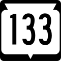
The organized system of Wisconsin State Trunk Highways (typically abbreviated as STH or WIS), the state highway system for the U.S. state of Wisconsin, was created in 1917. The legislation made Wisconsin the first state to have a standard numbering system for its highways. It was designed to connect every county seat and city with over 5000 residents. The original system numbered the roads starting at 11 and ran up to 199. The 1917 law required the creation of a distinctive state route marker, which was initially an inverted triangle. "...it soon became apparent that (the triangle) served no really useful purpose after the public had become educated to the idea of the numbering. The long vertical axis made it necessary to use a lot of space, much of which was useless." [1] Distinctive route markers were eventually redesigned to use a rounded rectangle for better space usage, but the inverted triangle remains superimposed, as a vestige. [1]

Contents

These routes were altered significantly in 1926 when United States Numbered Highways were commissioned. It was altered to include communities with at least 2,500 residents. [2] Further alteration occurred when the Interstate Highway System was commissioned in the state. [3]

I-894 west at the Zoo Interchange (I-94) Zoo Interchange from the east in Milwaukee.jpg
I-894 west at the Zoo Interchange (I-94)
WIS 13 scenery in Douglas County Douglas county WI ne hwy 13 eastwards IMG 1531.JPG
WIS 13 scenery in Douglas County

Mainline highways

NumberLength (mi)Length (km)Southern or western terminusNorthern or eastern terminusFormedRemovedNotes
WIS 10 (1919).svg WIS 10 316.51509.37 Illinois state line in Beloit Minnesota state line in Superior 01917-01-01191701926-01-011926Replaced by US 2 and US 51; number not reused because of the creation of US 10
WIS 11 (1919).svg WIS 11 WIS 32 Superior Minnesota border in La Crosse 01917-01-01191701926-01-011926Replaced by US 53, US 61 and WIS 27 (this segment became part of rerouted US 61 in 1932)
WIS 11 (1927).svg WIS 11 US 18 in Madison Minnesota border in La Crosse 01926-01-01192601933-01-011933Former WIS 41; replaced by US 14
WIS 11.svg WIS 11 157.56253.57 US 61/US 151/WIS 35 in Kieler WIS 32 in Racine 01933-01-011933currentFormer WIS 20 west of Burlington; renumbered to remove a concurrency with WIS 83
WIS 12 (1919).svg WIS 12 339.40546.21 Minnesota state line in Hudson Illinois state line in Genoa City 01917-01-01191701926-01-011926Replaced by US 12 (also why the number is not reused)
WIS 13.svg WIS 13 338.32544.47 I-90/I-94 in Wisconsin Dells US 2/US 53 in Superior 01917-01-011917currentForms a part of the Lake Superior Circle Tour
WIS 14 (1919).svg WIS 14 198.49319.44 Minnesota state line in St. Croix Falls WIS 57 in Pembine 01917-01-01191701926-01-011926Replaced by US 8
WIS 14 (1927).svg WIS 14 WIS 15 (became part of WIS 42 in 1933, and this section was swapped with WIS 32 in 1951) in Milwaukee WIS 133 in Cassville 01926-01-01192601933-01-011933Former WIS 61; split into two and renumbered as WIS 81 and WIS 15 (now I-43) because of the extension of US 14 into Wisconsin.
WIS 15 (1927).svg WIS 15 Illinois US 141 in Milwaukee 01917-01-01191701931-01-011931North of Milwaukee transferred to US 141 (short section in Milwaukee) and US 41 in 1926; replaced by WIS 42 (this section was swapped with WIS 32 in 1951)
WIS 15.svg WIS 15 WIS 32 in Milwaukee US 51 in Beloit 01933-01-01193301987-01-011987Former WIS 14; replaced by I-43
WIS 15.svg WIS 15 14.8023.82 US 45 in New London US 41 in Appleton 01996-01-011996currentNot open until 1998
WIS 16 (1919).svg WIS 16 WIS 18 (now US 10) near Manitowoc WIS 11 (now US 53) in Chippewa Falls 01917-01-01191701926-01-011926Partially replaced by US 141 and rest renumbered WIS 29 because of the creation of US 16
WIS 16.svg WIS 16 193.2310.9 US 14/US 61 in La Crosse I-94 in Waukesha 01978-01-011978currentPreviously US 16
WIS 17 (1927).svg WIS 17 85.63137.81 US 10 in Manitowoc WIS 78 in Sister Bay 01917-01-01191701932-01-011932Section from Manitowoc to Milwaukee transferred to US 141 in 1926; remainder replaced by WIS 42
WIS 17.svg WIS 17 85.63137.81 WIS 64 in Merrill FFH-16 in Phelps 01934-01-011934current
WIS 18 (1919).svg WIS 18 182.16293.16 Minnesota WIS 17 (now WIS 42) in Manitowoc 01917-01-01191701926-01-011926Replaced by US 10 and rest renumbered WIS 34 because of the creation of US 18
WIS 19.svg WIS 19 59.3795.55 US 14/WIS 78 in Mazomanie WIS 16 in Watertown 01917-01-011917currentWest of Madison replaced by US 18 in 1926; truncated to current ends in 1947 (section east of Watertown already part of US 16 (now WIS 16) and section west of Mazomanie already part with US 151)
WIS 20.svg WIS 20 42.9569.12 US 12/WIS 67 in LaGrange WIS 32 in Racine 01917-01-011917current
WIS 21.svg WIS 21 123.37198.54 WIS 16/WIS 27/WIS 71 in Sparta US 45 in Oshkosh 01917-01-011917current
WIS 22.svg WIS 22 172.18277.10 US 51/WIS 60 in Arlington US 41 in Oconto 01917-01-011917current
WIS 23.svg WIS 23 211.05339.65 WIS 11 & CTH-P in Shullsburg WIS 28/WIS 42 in Sheboygan 01917-01-011917currentOriginally went southwest via current US 151 before 1926 instead of south
WIS 24 (1927).svg WIS 24 7.8812.68 US 2 in Ashland WIS 27 in Hayward 01917-01-01191701934-01-011934Replaced by US 63
WIS 24.svg WIS 24 7.8812.68CTH-P in Hales Corners WIS 241 in Milwaukee 01947-01-011947currentOriginally ended in East Troy at WIS 20
WIS 25.svg WIS 25 85.81138.10 MN 60 in Nelson WIS 48 in Rice Lake 01917-01-011917current
WIS 26.svg WIS 26 98.15157.96 US 51 in Janesville US 41 & CTH-N in Oshkosh 01917-01-011917currentSection north of Oshkosh replaced by US 45 in 1934
WIS 27.svg WIS 27 294.08473.28 US 18/WIS 60 in Prairie du Chien US 2 in Brule 01917-01-011917currentOriginally went west on current WIS 77 to Minnesota
WIS 28 (1919).svg WIS 28 Iowa State line near Dubuque WIS 33 in Reedsburg 01917-01-01191701923-01-011923Replaced by WIS 23 (part was later US 118, now this part is a section of US 151)
WIS 28.svg WIS 28 59.7796.19 WIS 33 in Horicon WIS 23/WIS 42 in Sheboygan 01923-01-011923current
WIS 29 (1919).svg WIS 29 Minnesota State Line WIS 26 near Watertown 01917-01-01191701926-01-011926Replaced by US 16; now WIS 16
WIS 29.svg WIS 29 307.35494.63 US 10/WIS 35 in Prescott WIS 42 in Kewaunee 01926-01-011926currentFormer WIS 16, WIS 116, and WIS 146
WIS 30 (1919).svg WIS 30 WIS 11 (now US 14) in Readstown WIS 23 (now US 151) in Dickeyville 01917-01-01191701923-01-011923Replaced by WIS 11 (now US 61)
WIS 30.svg WIS 30 3.435.52 US 151 in Madison I-39/I-90/I-94 in Madison01923-01-011923currentFormerly continued east to Milwaukee via what is now I-94
WIS 31 (1927).svg WIS 31 US 10 in Manitowoc US 45 in Fond du Lac 01917-01-01191701934-01-011934Section south of Fond du Lac replaced by WIS 69 and US 151 in 1926. Rest replaced by US 151 in 1934.
WIS 31.svg WIS 31 22.8636.79 IL 131 in Pleasant Prairie WIS 32 in Caledonia 01936-01-011936current
WIS 32.svg WIS 32 325.69524.15 IL 137 in Pleasant Prairie US 45 at Land O' Lakes 01917-01-011917current32nd Division Memorial Highway; [4] swapped with WIS 42 south of Howards Grove in 1951; until 1989, followed CTH-PP, CTH-W, and CTH-67 from De Pere to Kiel
WIS 33.svg WIS 33 200.84323.22 US 14/US 61 in La Crosse WIS 32 in Port Washington 01917-01-011917current
WIS 34 (1919).svg WIS 34 Minnesota state line WIS 35 in Mondovi 01917-01-01191701923-01-011923Replaced by WIS 18 (Renumbered WIS 34 (a reference to this designation) in 1926 because of US 18, and became part of rerouted US 10 in 1934)
WIS 34 (1919).svg WIS 34 WIS 49 in Berlin WIS 95 (now US 45/old WIS 110) in Butte des Morts 01923-01-01192301926-01-011926Renumbered WIS 116
WIS 34 (1927).svg WIS 34 Minnesota state line US 12 in Fairchild 01926-01-01192601934-01-011934Former WIS 18; became part of rerouted US 10
WIS 34.svg WIS 34 22.8636.79 WIS 13/WIS 73 in Wisconsin Rapids I-39 US 51 in Knowlton 01934-01-011934currentFormer WIS 45
WIS 35.svg WIS 35 412.15663.29 IL 35 in Kieler I-535/US 53 in Superior 01917-01-011917currentSouth of Kieler replaced by US 61 in 1926.
WIS 36.svg WIS 36 35.8957.76 WIS 120 in Springfield WIS 241 in Milwaukee 01917-01-011917current
WIS 37.svg WIS 37 42.6768.67 WIS 35 in Alma US 12 in Eau Claire 01917-01-011917current
WIS 38 (1919).svg WIS 38 WIS 15 in Abrams Michigan state line north of Niagara 01917-01-01191701923-01-011923Replaced by WIS 57 (this section became part of US 141 in 1929)
WIS 38.svg WIS 38 25.3340.76 WIS 32 in Racine WIS 59 in Milwaukee 01923-01-011923current
WIS 39 (1919).svg WIS 39 43.0269.23 WIS 15 (now US 41) in Oshkosh WIS 10 (now US 51) in Woodruff 01917-01-01191701923-01-011923Replaced by WIS 26 (now US 45) and WIS 47
WIS 39.svg WIS 39 43.0269.23 US 18 in Edmund WIS 69 in New Glarus 01923-01-011923currentUntil 1999, continued east to Albany via what is now CTH-F
WIS 40.svg WIS 40 81.56131.26 US 12/WIS 29 in Elk Mound WIS 27/WIS 70 in Radisson 01917-01-011917current
WIS 41 (1919).svg WIS 41 144.00231.75 Milwaukee WIS 11 in Readstown 01917-01-01191701926-01-011926Replaced by US 18 and rest renumbered WIS 11 (now US 14) because of the creation of US 41
WIS 42 (1919).svg WIS 42 137.76221.70 WIS 19 (now US 18) in Verona Illinois state line01917-01-01191701923-01-011923Replaced by WIS 31 (this section renumbered WIS 69 in 1926)
WIS 42.svg WIS 42 137.76221.70 WIS 23/W 28 in Sheboygan Northport 01923-01-011923current
WIS 43 (1919).svg WIS 43 WIS 16 (now WIS 29) in Cadott WIS 70 in Radisson 01917-01-01191701923-01-011923Replaced by WIS 27 (which has since been realigned to the east)
WIS 43 (1970).svg WIS 43 WIS 11 in Burlington WIS 32 in Kenosha 01923-01-01192301974-01-011974Renumbered WIS 142 because of the creation of I-43
WIS 44.svg WIS 44 63.86102.77 WIS 22 in Pardeeville US 45 in Oshkosh 01917-01-011917current
WIS 45 (1919).svg WIS 45 Minnesota state line at Red Wing WIS 12 (now US 12) in Hudson 01917-01-01191701923-01-011923Replaced by WIS 35 (part now WIS 65 and US 63)
WIS 45 (1927).svg WIS 45 WIS 13/WIS 73 in Wisconsin Rapids US 51 in Knowlton 01923-01-01192301934-01-011934Renumbered WIS 34 because of the extension of US 45 into Wisconsin
WIS 46.svg WIS 46 34.1354.93 US 63/WIS 64 in Deer Park WIS 35 in Milltown 01917-01-011917currentSection south of Deer Park became part of US 63 in 1934
WIS 47.svg WIS 47 188.01302.57 WIS 114 in Menasha US 51/WIS 182 in Manitowish 01917-01-011917current
WIS 48 (1919).svg WIS 48 WIS 57 (now CTH-J) in New Holstein WIS 23/WIS 26 in Sheboygan 01917-01-01191701923-01-011923Replaced by WIS 32 (section south of Howards Grove now WIS 42)
WIS 48.svg WIS 48 98.19158.02 WIS 70/WIS 87 in Grantsburg WIS 40 in Exeland 01923-01-011923current
WIS 49.svg WIS 49 127.52205.22 US 41 & CTH-KK in Lomira WIS 29 in Elderon 01917-01-011917current
WIS 50.svg WIS 50 44.4371.50 WIS 11 in Delavan WIS 32 in Kenosha 01917-01-011917current
WIS 51 (1919).svg WIS 51 WIS 10 (now US 10) Turtle Lake WIS 11 (later US 53; now WIS 253) in Spooner 01917-01-01191701923-01-011923Replaced by WIS 24 (now US 63)
WIS 51 (1919).svg WIS 51 WIS 46 (now US 63) in Ellsworth WIS 25 in Downsville 01923-01-01192301926-01-011926Renumbered WIS 72 because of the creation of US 51
WIS 52 (1919).svg WIS 52 WIS 11 (now US 53) in Galesville WIS 12 (now US 12) in Black River Falls 01917-01-01191701923-01-011923Replaced by WIS 54
WIS 52.svg WIS 52 74.91120.56 US 51/WIS 29 in Wausau WIS 32 in Wabeno 01923-01-011923current
WIS 53 (1919).svg WIS 53 45.8073.71 WIS 35 in Fountain City WIS 73 in Neillsville 01917-01-01191701926-01-011926Renumbered WIS 95 (one part later WIS 121) because of the creation of US 53
WIS 54.svg WIS 54 243.12391.26 MN 43 in Marshland WIS 42 in Algoma 01917-01-011917current
WIS 55.svg WIS 55 175.55282.52 US 151 in Brothertown M-73 in Nelma 01917-01-011917currentOne section transferred to WIS 165 (now supplanted by realigned US 41/US 45) in 1926, sections concurrent with US 45 and US 151 in 1934; concurrency with US 45 eliminated in 1953, when the section south of the concurrency was renumbered WIS 145; concurrency with US 151 eliminated in 1965.
WIS 56 (1919).svg WIS 56 WIS 15 (now US 41/US 45) in Fond du Lac WIS 17 (now WIS 42) in Manitowoc 01917-01-01191701923-01-011923Replaced by WIS 31 (now US 151)
WIS 56.svg WIS 56 50.5681.37 WIS 35 in Genoa WIS 80 in Richland Center 01923-01-011923current
WIS 57.svg WIS 57 191.82308.70 WIS 59 in Milwaukee WIS 42 in Sister Bay 01917-01-011917currentSouth of Milwaukee replaced by US 41 in 1926 and original alignment north of Green Bay replaced by US 141 in 1929; rerouted northeast to Sister Bay.
WIS 58.svg WIS 58 53.9286.78 US 14 in Richland Center WIS 80 in Necedah 01917-01-011917current
WIS 59.svg WIS 59 116.21187.02 WIS 11/WIS 81 in Monroe WIS 32 in Milwaukee 01917-01-011917current
WIS 60.svg WIS 60 185.08297.86 US 18 in Prairie du Chien I-43/WIS 32/WS 57 in Grafton 01917-01-011917current
WIS 61 (1919).svg WIS 61 WIS 15 (became part of WIS 42 in 1933, and this section was swapped with WIS 32 in 1951) in Milwaukee WIS 133 in Cassville 01918-01-01191801926-01-011926Renumbered WIS 14 because of the creation of US 61, but split into two and renumbered as WIS 81 and WIS 15 (now I-43) because of the extension of US 14 into Wisconsin
WIS 62 (1927).svg WIS 62 US 18 in Edmund WIS 11 in Shullsburg 01917-01-01191701938-01-011938Replaced by WIS 39 and WIS 23
WIS 62.svg WIS 62 4.57.2 WIS 32 in Milwaukee WIS 32 in Milwaukee 01942-01-01194201999-01-011999Portion from Howard Avenue to Oklahoma Avenue now part of WIS 32; rest now Kinnickinnic Avenue, Plankinton Avenue, and Packard Avenue
WIS 63 (1927).svg WIS 63 WIS 64 in Merrill WIS 70 in Eagle River 01917-01-01191701934-01-011934Renumbered WIS 17 because of the extension of US 63 into Wisconsin
WIS 64.svg WIS 64 275.65443.62 MN 36 in Houlton US 41 in Marinette 01917-01-011917current
WIS 65 (1919).svg WIS 65 WIS 12 (now US 12) in Baraboo WIS 10 (now US 51) in Portage 01917-01-01191701919-01-011919Replaced by WIS 33
WIS 65 (1919).svg WIS 65 WIS 19 (now US 18) in Patch Grove WIS 20 (now WIS 11)/ WIS 42 (now later WIS 31, now WIS 69) Monroe 01919-01-01191901923-01-011923Replaced by WIS 35 and WIS 61 (later WIS 14, now WIS 81)
WIS 65.svg WIS 65 54.1287.10 US 10/US 63 in Ellsworth US 8 in St. Croix Falls 01923-01-011923current
WIS 66.svg WIS 66 18.7330.14 WIS 34 in Wisconsin Rapids WIS 49 in Rosholt 01917-01-011917currentUntil 1923, continued north to Wittenberg
WIS 67 (1919).svg WIS 67 WIS 48 (now WIS 32) in New Holstein WIS 23 in Plymouth 01917-01-01191701921-01-011921Replaced by WIS 57; now CTH-J (WIS 57 was moved off of this road in 1923) and current WIS 67
WIS 67.svg WIS 67 160.11257.67 IL 75 in Beloit US 151 in Valders 01921-01-011921current
WIS 68 (1927).svg WIS 68 9.5115.30 WIS 33 in Fox Lake WIS 17 (now WIS 32) in Port Washington 01917-01-01191701930-01-011930Replaced by WIS 33; WIS 68 reassigned to the old route of WIS 33
WIS 68.svg WIS 68 9.5115.30 WIS 33 in Fox Lake WIS 49 in Waupun 01930-01-011930current
WIS 69 (1919).svg WIS 69 Michigan state line Michigan state line01917-01-01191701926-01-011926Replaced by US 2
WIS 69.svg WIS 69 40.7865.63 IL 26 at Monroe US 18/US 151 in Verona 01926-01-011926currentFormer portion of WIS 31
WIS 70.svg WIS 70 246.49396.69 MN 70 at Grantsburg US 2/US 141 & WIS 101 in Florence 01917-01-011917current
WIS 71.svg WIS 71 53.5586.18 WIS 54/WIS 108 in Melrose WIS 80/WIS 82 in Elroy 01917-01-011917current
WIS 72 (1919).svg WIS 72 WIS 20 in Burlington WIS 50 in New Munster 01917-01-01191701923-01-011923Replaced by WIS 83
WIS 72 (1919).svg WIS 72 west of Eagle River Plum Lake 01923-01-01192301926-01-011926Renumbered WIS 155
WIS 72.svg WIS 72 29.4447.38 US 10/US 63 in Ellsworth WIS 25 in Downsville 01926-01-011926currentFormer WIS 51
WIS 73 (1919).svg WIS 73 WIS 15 (now WIS 96) in Kakauna WIS 18 (now WIS 114) in Sherwood 01917-01-01191701921-01-011921Removed from system; later became part of WIS 55
WIS 73.svg WIS 73 265.84427.83 I-39/I-90/US 51 in Edgerton US 8 in Ingram 01921-01-011921current
WIS 74.svg WIS 74 11.6818.80 WIS 190 in Pewaukee US 41/US 45/WIS 100 in Menomonee Falls 01917-01-01191702015-01-012015Replaced by extension of CTH-F and local roads; formerly ended at WIS 83 in North Lake; this section became CTH-VV in 1984, and the highway was extended south to WIS 190 in 1999.
WIS 75 (1927).svg WIS 75 WIS 36 in Franklin WIS 50 near Bristol 01917-01-01191701934-01-011934Replaced by US 45
WIS 75.svg WIS 75 12.1019.47 WIS 50/WIS 83 in Paddock Lake WIS 20 in Waterford 01934-01-011934current
WIS 76 (1919).svg WIS 76 WIS 54 in Casco WIS 17 (now WIS 42) near Rostok 01917-01-01191701923-01-011923Now CTH-E and CTH-O
WIS 76.svg WIS 76 43.4069.85 US 45 in Oshkosh US 45/WIS 22 in Bear Creek 01923-01-011923current
WIS 77 (1919).svg WIS 77 Silver Spring Drive in Milwaukee WIS 19 (now US 18) in Milwaukee 01917-01-01191701921-01-011921Replaced by WIS 57
WIS 77.svg WIS 77 139.94225.21 MN 48 at Danbury BUS US 2 at Hurley 01921-01-011921current
WIS 78 (1919).svg WIS 78 Green Bay WIS 15 (became part of US 41 in 1926; this section is now WIS 175) east of Hartford01917-01-01191701921-01-011921Replaced by WIS 29 (this section became part of WIS 60 in 1923)
WIS 78 (1927).svg WIS 78 Green Bay WIS 17 (now WIS 42) in Sister Bay 01921-01-01192101930-01-011930Replaced by WIS 57
WIS 78.svg WIS 78 92.83149.40 IL 78 in Gratiot I-39/I-90/I-94 in Portage 01931-01-011931current
WIS 79.svg WIS 79 17.6328.37 US 12 in Menomonie WIS 64 in Connorsville 01918-01-011918currentIn 1923, section from Ellsworth to Martell became part of WIS 46 (now US 63), Martell to Spring Valley became part of WIS 116 (now WIS 29), and Spring Valley to Glenwood City was given to the county (but later became WIS 128) in exchange for rerouting southeast to Menomonie; rerouted to bypass Glenwood City in 1947
WIS 80.svg WIS 80 163.23262.69 IL 84 in Hazel Green US 10 in Marshfield 01918-01-011918current
WIS 81 (1927).svg WIS 81 Illinois WIS 33 near Portage 01919-01-01191901931-01-011931Renumbered WIS 78 to match Illinois
WIS 81.svg WIS 81 123.81199.25 WIS 133 in Cassville I-39/I-90 & I-43 in Beloit 01933-01-011933current
WIS 82.svg WIS 82 116.15186.93 Iowa 9 at DeSoto I-39/US 51/WIS 23 in Oxford 01919-01-011919current
WIS 83.svg WIS 83 74.52119.93 IL 83 in Paddock Lake WIS 60 in Hartford 01919-01-011919currentFormerly ended at WIS 175 until it was truncated in 2021.
WIS 84 (1919).svg WIS 84 Osseo Brockway 01919-01-01191901923-01-011923Replaced by WIS 27 (now CTH-A and CTH-FF)
WIS 84.svg WIS 84 18.6029.93 WIS 32 in Port Washington WIS 28/WIS 144 in Boltonville 01923-01-01192301997-01-011997Now CTH-H, CTH-XX, and CTH-X
WIS 85.svg WIS 85 23.4837.79 US 10/WIS 25 in Durand WIS 37 in Eau Claire 01919-01-011919current
WIS 86 (1919).svg WIS 86 Withee Neillsville 01919-01-01191901923-01-011923Replaced by WIS 73
WIS 86.svg WIS 86 32.3252.01 WIS 13 in Ogema US 51 & CTH-D in Tomahawk 01923-01-011923current
WIS 87 (1919).svg WIS 87 Alban Waupaca 01919-01-01191901923-01-011923Replaced by WIS 49
WIS 87.svg WIS 87 25.8241.55 US 8 in St. Croix Falls WIS 48/WIS 70 in Grantsburg 01923-01-011923current
WIS 88.svg WIS 88 29.7547.88 WIS 35 in Fountain City WIS 37 in Mondovi 01919-01-011919currentUntil 1923, ran from west of Gilmanton to Elk Creek via what is now CTH-B, current route, and WIS 121
WIS 89.svg WIS 89 56.5591.01 US 14/WIS 11 in Darien WIS 73 in Columbus 01919-01-011919currentSection south of Darien became part of US 14 in 1932
WIS 90 (1949).svg WIS 90 10.4016.74 WIS 16 in Ixonia WIS 59 in Palmyra 01919-01-01191901957-01-011957Renumbered WIS 135 because of the creation of I-90, but WIS 135 was eliminated in 1990 and is now CTH-F and CTH-E
WIS 91 (1919).svg WIS 91 Ripon Oshkosh 01919-01-01191901923-01-011923Replaced by WIS 44
WIS 91 (1927).svg WIS 91 US 8 west of Bradley US 51 in Merrill 01923-01-01192301937-01-011937Section south of Tomahawk removed 1934; now CTH-CC (south of Tomahawk became part of WIS 107 in 1947)
WIS 91.svg WIS 91 US 8 near Bradley US 51 (now CTH-A) north of Tomahawk 01937-01-01193701986-01-011986Decommissioned when the US 51 Tomahawk bypass was completed; now CTH-U
WIS 91.svg WIS 91 18.8330.30 WIS 49 in Berlin US 41/WIS 44 in Oshkosh 01996-01-011996current
WIS 92 (1919).svg WIS 92 30.6849.37 Waukesha Sussex 01919-01-01191901923-01-011923Renumbered WIS 164
WIS 92.svg WIS 92 30.6849.37 US 14 in Brooklyn WIS 78 in Mount Horeb 01923-01-011923currentSection from Brooklyn to Janesville replaced by US 14 in 1932
WIS 93.svg WIS 93 68.00109.44 US 53/WIS 35 in Holmen US 53 in Eau Claire 01919-01-011919current
WIS 94 (1949).svg WIS 94 US 12 in Camp Douglas Hustler 01919-01-01191901957-01-011957Renumbered WIS 185 because of the creation of I-94, but that has since been eliminated; continued south to Union Center until 1923
WIS 95 (1919).svg WIS 95 Oshkosh Fremont 01919-01-01191901926-01-011926Replaced by US 110; now WIS 110 (which replaced US 110 in 1938), CTH-II, US 45, and CTH-S
WIS 95.svg WIS 95 73.76118.71 WIS 35 in Fountain City WIS 73 in Neillsville 01926-01-011926current
WIS 96.svg WIS 96 55.9490.03 US 10/WIS 110 in Fremont I-43 & CTH-KB in Denmark 01919-01-011919current
WIS 97.svg WIS 97 36.1158.11 WIS 13 in Marshfield WIS 64 in Goodrich 01919-01-011919current
WIS 98 (1919).svg WIS 98 Michigan state line WIS 32 in Argonne 01919-01-01191901923-01-011923Replaced by WIS 55
WIS 98.svg WIS 98 16.2026.07 WIS 73 in Greenwood WIS 13 in Spencer 01923-01-011923current
WIS 99.svg WIS 99 8.313.4 WIS 67 near Eagle WIS 83 in Mukwonago 01919-01-01191901999-01-011999Now CTH-LO
WIS 100 (1919).svg WIS 100 WIS 10/WIS 20/WIS 26 in Janesville WIS 10 in Oregon 01919-01-01191901923-01-011923Replaced by WIS 73 and WIS 106
WIS 100.svg WIS 100 39.6963.87 WIS 32 in Oak Creek I-43/WIS 32 in Bayside 01923-01-011923current
WIS 101 (1919).svg WIS 101 WIS 35 in De Soto WIS 27 in West Prairie 01919-01-01191901923-01-011923Replaced by WIS 82
WIS 101.svg WIS 101 23.5437.88 US 8 in Armstrong Creek US 2/US 141 & WIS 70 in Florence 01923-01-011923current
WIS 102 (1919).svg WIS 102 WIS 33 in Ontario WIS 21 (now CTH-A) in Ridgeville 01919-01-01191901923-01-011923Replaced by CTH-M (part later WIS 131)
WIS 102.svg WIS 102 18.2529.37 WIS 13 in Chelsea WIS 86 in Spirit 01923-01-011923current
WIS 103.svg WIS 103 WIS 49 south of Brandon US 151 near Lamartine 01919-01-01191901994-01-011994Now CTH-TC
WIS 104.svg WIS 104 15.3624.72 WIS 11 in Brodhead WIS 92 in Brooklyn 01919-01-011919current
WIS 105 (1919).svg WIS 105 Cassville WIS 65 (now WIS 35) near Beetown 01919-01-01191901923-01-011923Replaced by WIS 61 (later WIS 14, now WIS 81)
WIS 105.svg WIS 105 4.727.60 MN 39 in Oliver WIS 35 in Superior 01923-01-011923current
WIS 106.svg WIS 106 19.0830.71 WIS 16 in West Salem WIS 54/WIS 71 in Melrose 01919-01-011919current
WIS 107.svg WIS 107 Jefferson Columbus 01919-01-01191901923-01-011923Replaced by WIS 89 south of Waterloo, with the section north of Waterloo decommissioned entirely (now also part of WIS 89)
WIS 107.svg WIS 107 56.2390.49 WIS 153 in Mosinee CTH-S in Tomahawk 01923-01-011923current
WIS 108.svg WIS 108 19.0830.71 WIS 16 in West Salem WIS 54/WIS 71 in Melrose 01919-01-011919current
WIS 109.svg WIS 109 WIS 11 (now US 53) in Blair WIS 84 (later WIS 27, now CTH-A) in Hixton 01919-01-01191901923-01-011923Replaced by WIS 95
WIS 109.svg WIS 109 19.2430.96 WIS 19 in Watertown WIS 67 near Woodland 01923-01-01192301998-01-011998Now CTH-R
WIS 110 (1919).svg WIS 110 Waterloo Waterloo01919-01-01191901921-01-011921Replaced by an extended WIS 107
WIS 110 (1919).svg WIS 110 Benoit south of Barksdale 01923-01-01192301926-01-011926Replaced by an extended WIS 112 because of the creation of US 110
WIS 110.svg WIS 110 37.4460.25 US 10/WIS 96 in Fremont US 45 in Marion 01938-01-011938currentFormer US 110; extended over WIS 142 in 1960
WIS 111.svg WIS 111 10.6117.08 US 8 in Catawba WIS 13 in Phillips 01919-01-011919current
WIS 112.svg WIS 112 12.5820.25 WIS 13 in Marengo WIS 137 in Ashland 01919-01-011919currentWest end was at US 63; extended over WIS 110 to Benoit in 1926; swapped with WIS 118 south of Ashland in 1971
WIS 113 (1919).svg WIS 113 WIS 16 (later WIS 29; now CTH-X) in Thorp WIS 64 01919-01-01191901923-01-011923Replaced by an extended WIS 73
WIS 113.svg WIS 113 40.3464.92 US 151 in Madison WIS 33 in Baraboo 01923-01-011923current
WIS 114.svg WIS 114 21.0333.84 US 41 in Neenah WIS 32/WIS 57 in Hilbert 01919-01-011919current
WIS 115 (1919).svg WIS 115 US 41 in Muscoda Richland Center 01919-01-01191901923-01-011923Replaced by WIS 80
WIS 115 (1919).svg WIS 115 WIS 15 in Ackerville WIS 15 in Germantown 01923-01-01192301925-01-011925Replaced by WIS 15 (now US 41)
WIS 115.svg WIS 115 5.809.33 WIS 60 near Hustisford WIS 26 in Juneau 01926-01-01192602005-01-012005Former WIS 118; Now CTH-DJ
WIS 116 (1919).svg WIS 116 WIS 60 near Salem Illinois state line01919-01-01191901923-01-011923Replaced by WIS 83
WIS 116 (1919).svg WIS 116 Chippewa Falls Prescott 01923-01-01192301926-01-011926Replaced by WIS 29
WIS 116.svg WIS 116 14.1922.84 WIS 91 in Waukau US 45 in Butte des Morts 01926-01-011926currentFormer WIS 34
WIS 117 (1919).svg WIS 117 WIS 20 (now WIS 11) in Gratiot Illinois state line01919-01-01191901923-01-011923Replaced by WIS 81 (now WIS 78)
WIS 117.svg WIS 117 5.799.32 WIS 29/WIS 47/WIS 55 in Bonduel WIS 22 in Cecil 01923-01-011923current
WIS 118 (1919).svg WIS 118 west of Hustisford Juneau 01919-01-01191901926-01-011926Renumbered WIS 115 because of the creation of US 118
WIS 118.svg WIS 118 6.8611.04 US 63 in Benoit WIS 112 in Ashland 01939-01-011939current
WIS 119 (1919).svg WIS 119 WIS 29 (now WIS 60) in Hartford WIS 15 (later US 41, now WIS 175)01919-01-01191901923-01-011923Replaced by WIS 83
WIS 119 (1919).svg WIS 119 WIS 19 (later also US 16) in Pewaukee Milwaukee 01923-01-01192301930-01-011930Replaced by US 16; Spur on Lisbon Ave decommissioned
WIS 119 (1949).svg WIS 119 US 10 in Manitowoc WIS 42 in Manitowoc 01931-01-01193101956-01-011956Replaced by US 141 (now CTH-R)
WIS 119.svg WIS 119 US 41 in Green Bay US 141 in Green Bay01968-01-01196801969-01-011969Replaced by Business US 41 (deleted 1998)
WIS 119.svg WIS 119 1.893.04 I-94/US 41 in Milwaukee WIS 38 in Milwaukee 01978-01-011978current Milwaukee Airport Spur
WIS 120 (1919).svg WIS 120 WIS 56 (now US 151) in Brothertown WIS 114 in Sherwood 01919-01-01191901923-01-011923Replaced by WIS 55
WIS 120 (1927).svg WIS 120 WIS 20 in Burlington Racine 01923-01-01192301933-01-011933Replaced by WIS 11
WIS 120.svg WIS 120 21.3434.34 IL 47 in Genoa City I-43 in East Troy 01934-01-011934current
WIS 121 (1919).svg WIS 121 WIS 29 (now CTH-XX) in Briggsville WIS 10 (later US 51, now CTH-CX) near Endeavor 01919-01-01191901923-01-011923Replaced by WIS 23
WIS 121.svg WIS 121 45.0772.53 WIS 88 in Gilmanton WIS 95 in Alma Center 01923-01-011923current
WIS 122 (1919).svg WIS 122 WIS 18 (now US 10) near Appleton WIS 39 (later WIS 26, later US 45, now WIS 15 and WIS 76) in Greenville 01919-01-01191901923-01-011923Replaced by WIS 76
WIS 122.svg WIS 122 14.6923.64 WIS 77 in Upson CR 505 at Saxon01923-01-011923current
WIS 123.svg WIS 123 3.004.83CTH-DL at Devil's Lake State Park WIS 33/WIS 113 in Baraboo 01919-01-01191902016-01-012016Now CTH-DL
WIS 124 (1919).svg WIS 124 WIS 24 (now US 63) in Hayward WIS 11 (later US 53, now Bus. US 53) in Minong 01919-01-01191901923-01-011923Replaced by WIS 27
WIS 124.svg WIS 124 17.5928.31 US 53 in Lake Hallie WIS 64 in Eagleton 01923-01-011923current
WIS 125 (1919).svg WIS 125 US 41 in Ashland Junction WIS 10 (later US 2; now CTH-G)01920-01-01192001925-01-011925Replaced by WIS 112
WIS 125.svg WIS 125 2.624.22 US 41 in Appleton WIS 47 in Appleton01926-01-011926currentCollege Avenue; prior to 1953, followed Prospect Avenue instead
WIS 126.svg WIS 126 5.709.17 WIS 81 in Belmont US 151 & CTH-G in Belmont 01923-01-011923current
WIS 127.svg WIS 127 14.1622.79 WIS 16 near Wisconsin Dells I-39/WIS 16 in Portage 01923-01-011923current
WIS 128.svg WIS 128 27.0443.52 WIS 72 in Elmwood WIS 64 in Forest 01923-01-011923current
WIS 129 (1938).svg WIS 129 US 61/WIS 35 in Tennyson Potosi Station01920-01-01192001947-01-011947Replaced by WIS 133
WIS 129.svg WIS 129 2.694.33 US 61/WIS 35/WIS 81 in Lancaster US 61 in Lancaster01959-01-011959current
WIS 130.svg WIS 130 31.4050.53 WIS 23 in Dodgeville WIS 154 in Hill Point 01923-01-011923current
WIS 131.svg WIS 131 78.9127.0 WIS 60 in Wauzeka US 12/WIS 16 in Tomah 01923-01-011923current
WIS 132.svg WIS 132 US 18 Mount Hope 01923-01-01192301992-01-011992Now CTH-J
WIS 133.svg WIS 133 91.07146.56 US 61/WIS 35 in Potosi US 14/WIS 60/WIS 130 in Lone Rock 01923-01-011923current
WIS 134.svg WIS 134 2.854.59 US 12/US 18 in Cambridge CTH-O in London 01923-01-011923current
WIS 135 (1949).svg WIS 135 US 51 in Packwaukee WIS 13 01923-01-01192301955-01-011955Replaced by WIS 82; old route to Wisconsin Dells replaced by CTH-G and by WIS 23 in exchange for route to north of WIS 13 in 1947
WIS 135.svg WIS 135 10.4016.74 WIS 16 in Ixonia US 18 in Sullivan 01957-01-01195701990-01-011990Now CTH-F
WIS 136 (1927).svg WIS 136 US 12 in Prairie du Sac WIS 33 in North Freedom 01923-01-01192301934-01-011934Now CTH-PF; number reused on old route of WIS 33
WIS 136.svg WIS 136 19.0530.66 WIS 23/WIS 33 in Reedsburg CTH-DL and Park Road at the entrance of Devil's Lake in Baraboo01934-01-011934currentOriginal east end was at US 12 in Baraboo
WIS 137 (1927).svg WIS 137 WIS 39 near Mineral Point US 118 (now US 151) near Mineral Point 01923-01-01192301934-01-011934Now CTH-D
WIS 137 (1958).svg WIS 137 WIS 80 WIS 130 near Lone Rock 01934-01-01193401968-01-011968Replaced by WIS 133
WIS 137.svg WIS 137 6.2510.06 US 2 in Moquah WIS 13 in Ashland 01971-01-011971current
WIS 138.svg WIS 138 13.2321.29 WIS 59 in Cooksville US 14 in Oregon 01923-01-011923current
WIS 139.svg WIS 139 24.8339.96 US 8 in Cavour M-189 at Tipler 01923-01-011923current
WIS 140.svg WIS 140 11.5818.64 IL 76 in Clinton US 14/WIS 11 in Avalon 01923-01-011923current
WIS 141 (1919).svg WIS 141 WIS 29 (now WIS 16) in Fall River WIS 33 in Cambria 01923-01-01192301926-01-011926Renumbered WIS 146 because of the creation of US 141
WIS 142 (1919).svg WIS 142 US 12 in Tomah WIS 71 in Wilton 01923-01-01192301948-01-011948Replaced by WIS 131
WIS 142 (1958).svg WIS 142 US 45 in Marion US 10 in Weyauwega 01953-01-01195301960-01-011960Former WIS 145; replaced by WIS 110
WIS 142.svg WIS 142 17.6928.47 WIS 11/WIS 36/WIS 83 in Burlington I-41/I-94 & CTH-S in Kenosha 01974-01-011974currentSection from I-94 to WIS 32 was decommissioned in 1992.
WIS 143.svg WIS 143 7.512.1 US 45 in West Bend Cedarburg 01923-01-01192301997-01-011997Now county highways
WIS 144.svg WIS 144 28.6346.08 WIS 175 in Slinger WIS 57 in Random Lake
WIS 145 (1949).svg WIS 145 WIS 22 north of Weyauwega US 10 in Weyauwega 01953-01-011953Renumbered WIS 142 (now part of WIS 110)
WIS 145.svg WIS 145 24.739.8 US 18 in Milwaukee WIS 175 in Richfield 01953-01-011953currentFormer portion of WIS 55
WIS 146 (1919).svg WIS 146 Kewaunee Bellevue 01923-01-01192301926-01-011926Replaced by WIS 29
WIS 146.svg WIS 146 13.2221.28 WIS 16 in Fall River WIS 33 in Cambria 01926-01-011926currentFormer WIS 141
WIS 147.svg WIS 147 15.0924.29 WIS 42 in Two Rivers I-43 & CTH-Z in Maribel 01923-01-011923current
WIS 148.svg WIS 148 5.79.2 US 151 in Valders US 10 in Cato 01923-01-01192301985-01-011985Now CTH-J
WIS 149.svg WIS 149 40.164.5 US 151 in Peebles WIS 32/WIS 57 in Kiel 01923-01-01192302006-01-012006Now CTH-WH, CTH-G, and CTH-HH; originally continued east to Lake Michigan via what is now CTH-XX
WIS 150.svg WIS 150 6.610.6 WIS 110 west of Winchester US 45 west of Neenah 01923-01-01192302003-01-012003Decommissioned when the new US 45 freeway opened to traffic
WIS 151 (1919).svg WIS 151 Neenah Appleton 01923-01-01192301926-01-011926Renumbered WIS 125 because of the creation of US 151
WIS 152 (1949).svg WIS 152 Minnesota state line WIS 35 in Danbury 01923-01-01192301951-01-011951Replaced by WIS 77
WIS 152.svg WIS 152 7.2211.62 WIS 21/WIS 73 in Wautoma CTH-G & CTH-W in Mt. Morris 01956-01-011956current
WIS 153.svg WIS 153 61.2598.57 WIS 13 in Spencer US 45 in Tigerton 01923-01-011923current
WIS 154.svg WIS 154 22.5436.27 WIS 58 in Loyd WIS 136 in Rock Springs 01923-01-011923current
WIS 155 (1919).svg WIS 155 6.9411.17 WIS 15/WIS 55 south of Jackson WIS 55 (Fond du Lac Avenue)01923-01-01192301926-01-011926Replaced by WIS 55 (now WIS 145)
WIS 155.svg WIS 155 6.9411.17 WIS 70 in St. Germain CTH-N in Sayner 01926-01-011926current
WIS 156.svg WIS 156 28.3545.62 WIS 22 in Clintonville WIS 29/WIS 32 in Pittsfield 01923-01-011923current
WIS 157 (1919).svg WIS 157 6.9411.17 WIS 23/WIS 55 in Briggsville WIS 29 (later US 16, now WIS 16) near Briggsville01923-01-01192301924-01-011924Replaced by WIS 23 (now CTH-AA)
WIS 157 (1927).svg WIS 157 6.9411.17 WIS 32/WIS 32 near Suring US 141 01926-01-01192601934-01-011934Now CTH-M
WIS 157.svg WIS 157 2.814.52 WIS 35 in Onalaska WIS 16 in La Crosse 01938-01-011938current
WIS 158 (1938).svg WIS 158 7.3611.84 US 141 in Crivitz WIS 64 in Harmony 01923-01-01192301948-01-011948Now CTH-W
WIS 158.svg WIS 158 6.7010.78 I-41/I-94 in Kenosha WIS 32 in Kenosha01958-01-011958current
WIS 159.svg WIS 159 1.62.6 US 12 in Baraboo CTH-DL and Park Road at the entrance of Devil's Lake in Baraboo01923-01-01192302017-01-012017Now WIS 136. Until 2016 the road ended at WIS 123, but was extended east when WIS 123 was decommissioned.
WIS 160.svg WIS 160 3.445.54 WIS 29/WIS 55 in Angelica WIS 32 in Pulaski 01923-01-011923current
WIS 161.svg WIS 161 22.4236.08CTH-SS in Amherst Junction WIS 22/WIS 110 in Symco 01923-01-011923current
WIS 162.svg WIS 162 46.0374.08 WIS 35 in Stoddard WIS 71 in Four Corners 01923-01-011923current
WIS 163.svg WIS 163 23.838.3 Mishicot Luxemburg 01923-01-01192301999-01-011999Now CTH-B and CTH-AB
WIS 164.svg WIS 164 43.5470.07 WIS 36 in Waterford WIS 60 in Slinger 01924-01-011924current
WIS 165 (1949).svg WIS 165 US 41 WIS 55 in Germantown 01926-01-01192601953-01-011953Former WIS 55; decommissioned when US 41 freeway was built; now Goldendale Road and Hilltop Drive
WIS 165.svg WIS 165 7.1411.49 I-41/I-94 & CTH-Q in Pleasant Prairie WIS 32 in Pleasant Prairie 01990-01-011990currentFormerly CTH-Q
WIS 166 (1949).svg WIS 166 2.13.4 WIS 74 in Menomonee Falls WIS 55 01926-01-01192601953-01-011953Former WIS 55; decommissioned when US 41 freeway was built; now Fond du Lac Avenue
WIS 167.svg WIS 167 24.9640.17 WIS 83 in Hartford I-43/WIS 32/WIS 57 in Mequon 01926-01-011926current
WIS 168 (1958).svg WIS 168 US 16 (now WIS 16) east of Sparta Fort McCoy (now the Sparta/Fort McCoy Airport)01934-01-01193401959-01-011959Now CTH-A and 13th Avenue
WIS 168.svg WIS 168 5.939.54 Nichols Seymour 01985-01-01198502003-01-012003Now CTH-VV
WIS 169 (1938).svg WIS 169 US 16 (now WIS 16) in Sparta Fort McCoy (now the Sparta/Fort McCoy Airport)01940-01-01194001947-01-011947Now WIS 21
WIS 169.svg WIS 169 17.3627.94 WIS 13 in Mellen US 2 in Cedar 01956-01-011956current
WIS 170.svg WIS 170 23.9838.59 WIS 128 in Glenwood City WIS 40 in Colfax 01941-01-011941current
WIS 171.svg WIS 171 33.3953.74 WIS 35 in Ferryville US 14 in Boaz 01943-01-011943current
WIS 172 (1958).svg WIS 172 US 12 in Eau Claire US 53 in Eau Claire01945-01-01194501964-01-011964Replaced by Bus. US 12
WIS 172.svg WIS 172 11.6318.72 WIS 54 in Hobart I-43 in Bellevue 01975-01-011975current
WIS 173.svg WIS 173 36.8559.30 WIS 21 in Wyeville WIS 73 in Nekoosa 01947-01-011947current
WIS 174.svg WIS 174 5.909.50 WIS 31 in Pleasant Prairie WIS 50 in Kenosha 01947-01-01194701990-01-011990Now CTH-ML
WIS 175.svg WIS 175 51.4082.72 WIS 59 in Milwaukee US 151 in Fond du Lac 01953-01-011953current
WIS 176.svg WIS 176 12.720.4 WIS 78 in Wiota Illinois state line01947-01-01194701999-01-011999Now CTH-D
WIS 177.svg WIS 177 2.64.2 WIS 42 north of Two Rivers Rawley Point 01951-01-01195101985-01-011985Now CTH-V
WIS 178.svg WIS 178 23.3037.50 WIS 29 in Chippewa Falls WIS 64 in Cornell 01947-01-011947current
WIS 179.svg WIS 179 8.8014.16 WIS 27 in Eastman WIS 131 in Steuben 01947-01-011947current
WIS 180.svg WIS 180 30.4248.96 WIS 64 in Marinette US 141 in Wausaukee 01948-01-011948current
WIS 181.svg WIS 181 21.4434.50 WIS 59 in West Allis WIS 60 in Cedarburg 01947-01-011947current
WIS 182.svg WIS 182 33.4153.77 WIS 13 in Park Falls US 51/WIS 47 in Manitowish 01948-01-011948current
WIS 183.svg WIS 183 35.356.8 WIS 35 near Pepin WIS 29 near Spring Valley 01947-01-01194701989-01-011989Now CTH-CC
WIS 184.svg WIS 184 12.0419.38 WIS 11 east of Footville WIS 59 north of Fulton 01947-01-01194701999-01-011999Now CTH-H
WIS 185.svg WIS 185 3.25.1 US 12 in Camp Douglas Hustler 01959-01-01195901991-01-011991Now CTH-H
WIS 186.svg WIS 186 15.0124.16 WIS 13/WIS 73 in Vesper US 10 in Auburndale 01947-01-011947current
WIS 187.svg WIS 187 13.8722.32 WIS 54 in Shiocton WIS 156 in Navarino 01947-01-011947current
WIS 188.svg WIS 188 11.8819.12 US 12 in Sauk City WIS 113 in Harmony Grove 01947-01-011947current
WIS 189 (1958).svg WIS 189 1.42.3 WIS 83 in Rochester WIS 20 01947-01-01194701969-01-011969Now CTH-D
WIS 190.svg WIS 190 19.5831.51 WIS 16 in Pewaukee WIS 32 in Shorewood 01947-01-011947current
WIS 191.svg WIS 191 13.0420.99 WIS 23 in Dodgeville WIS 39 in Hollandale 01947-01-011947current
WIS 192.svg WIS 192 2.604.18 WIS 50 in Pleasant Prairie Former WIS 142 (now CTH-S) in Kenosha County 01947-01-01194701990-01-011990Now CTH-H
WIS 193 (1949).svg WIS 193 WIS 139 near Tipler WIS 101 near Florence 01947-01-01194701949-01-011949Became part of WIS 70
WIS 193.svg WIS 193 1.422.29 WIS 60 in Port Andrew WIS 80 in Port Andrew01949-01-011949current
WIS 194 (1949).svg WIS 194 US 14 in Janesville US 51 in Janesville01949-01-01194901952-01-011952Now part of US 14
WIS 194.svg WIS 194 11.3218.22 WIS 27 in Rusk County CTH-H in McKinley 01961-01-01196102005-01-012005Now CTH-D
WIS 199.svg WIS 199 01990-01-01199002011-01-012011Now WIS 794 SPUR (road was unsigned and still is)
WIS 213.svg WIS 213 27.2143.79 IL 2 at Beloit US 14/WIS 59 in Evansville 01961-01-011961current
WIS 241.svg WIS 241 11.2118.04 I-94/US 41 in Oak Creek WIS 24 in Milwaukee01999-01-011999currentPreviously US 41
WIS 243.svg WIS 243 0.300.48MN 243 in Osceola WIS 35 in Osceola01949-01-011949current
WIS 253.svg WIS 253 7.6112.25 US 53 in Sarona US 63 in Spooner 01988-01-011988current
WIS 310.svg WIS 310 8.7214.03 I-43/US 10 in Manitowoc WIS 42 in Two Rivers 01984-01-011984current
WIS 311.svg WIS 311 2.003.22CTH-KR in Somers WIS 11 in Sturtevant 02022-01-012022current
WIS 312.svg WIS 312 7.9012.71 I-94 in Eau Claire US 53 in Eau Claire02005-01-012005current
WIS 318.svg WIS 318 2.03.2 US 18 in Waukesha I-94 in Pewaukee 02017-01-012017currentWisconsin Highway 318 was planned to be extended south totaling 6 miles in length, forming a complete bypass and ending at Wisconsin Highway 59. However, U.S. Highway 18 used the whole bypass instead.
WIS 341.svg WIS 341 11.6 WIS 59 in West Milwaukee I-94/US 41 in Milwaukee 01999-01-01199902015-01-012015Now WIS 175
WIS 351.svg WIS 351 2.644.25 US 51 south of Janesville I-90/I-39 southeast of Janesville01988-01-01198802002-01-012002Now WIS 11
WIS 441.svg WIS 441 10.8817.51 US 10/I-41 in Menasha I-41 in Appleton 01994-01-011994current
WIS 794.svg WIS 794 4.767.66CTH-ZZ in South Milwaukee I-794 in Milwaukee 01999-01-011999currentJohn R. Plewa Memorial Lake Parkway/ “Bachelor’s Road”
  •       Former

Special routes

Except where indicated, the following highways are or were locally maintained.

NumberLength (mi)Length (km)Southern or western terminusNorthern or eastern terminusFormedRemovedNotes
Business plate.svg
WIS 11.svg Bus. WIS 11
2.604.18 WIS 11 on the west limits of Monroe WIS 11 & WIS 69 north of downtown Monroe01978-01-011978current
Business plate.svg
WIS 13.svg Bus. WIS 13
2.914.68 US 10, WIS 13 & CTH-BB south of Marshfield WIS 13 & WIS 97 in downtown Marshfield02003-01-012003currentFollows Central Avenue through Marshfield along the former route's path; state-maintained
Business plate.svg
WIS 13.svg Bus. WIS 13
WIS 13 & WIS 54 in Wisconsin Rapids WIS 13, WIS 34 & WIS 73 in Wisconsin Rapids
Business plate.svg
WIS 16.svg Bus. WIS 16
3.856.20 WIS 16 & WIS 26 on the northern edge of Watertown WIS 16 & WIS 19 on the eastern edge of Watertown01978-01-011978currentFormer route of U.S. Route 16 in Wisconsin; was Bus. US 16 1961–1978
Business plate.svg
WIS 23.svg Bus. WIS 23
2.403.86 WIS 23 southwest of downtown Green Lake WIS 23 north of downtown Green Lake01967-01-011967current
Business plate.svg
WIS 23.svg Bus. WIS 23
4.306.92 WIS 23 northwest of downtown Plymouth WIS 23 & WIS 57 northeast of Plymouth01985-01-011985current
Business plate.svg
WIS 26.svg Bus. WIS 26
5.508.85 WIS 26 southwest of Fort Atkinson WIS 26 north of Fort Atkinson01995-01-011995current
Business plate.svg
WIS 26.svg Bus. WIS 26
4.407.08 WIS 26 near Jefferson WIS 26 near Jefferson
Business plate.svg
WIS 26.svg Bus. WIS 26
5.408.69 WIS 26 near Watertown WIS 26 near Watertown
Business plate.svg
WIS 26.svg Bus. WIS 26
WIS 26 east of Fort Atkinson WIS 26 northeast of Fort Atkinson
Business plate.svg
WIS 29.svg Bus. WIS 29
8.6013.84 WIS 29 southwest of Chippewa Falls WIS 29 southeast of downtown Chippewa Falls02005-01-012005current
Business plate.svg
WIS 29.svg Bus. WIS 29
2.504.02 WIS 29 west of Abbotsford WIS 29 east of Abbotsford01999-01-011999current
Business plate.svg
WIS 29.svg Bus. WIS 29
6.7010.78 WIS 29 & CTH-MMM west of Shawano WIS 29, WIS 47/WIS 55 & CTH-K southeast of downtown Shawano01998-01-011998currentFollows part of former alignment through Shawano before joining WIS 47/WIS 55 to return to the main route
Business plate.svg
WIS 29.svg Bus. WIS 29
2.804.51 US 45, WIS 29 & CTH-M on the north side of Wittenberg US 45, WIS 29 & CTH-Q east of Wittenberg01999-01-011999currentFollows former alignment of US 45 through Wittenberg; co-signed as CTH-Q
Business plate.svg
WIS 35.svg Bus. WIS 35
4.106.60 US 53, WIS 35 & CTH-HD south of Holmen US 53/WIS 93, WIS 35 & CTH-HD northwest of Holmen
Business plate.svg
WIS 40.svg Bus. WIS 40
0.801.29 US 8 & WIS 40 in downtown Bruce WIS 40 northwest of downtown Bruce01999-01-011999current
Business plate.svg
WIS 42.svg Bus. WIS 42
4.507.24 US 151 east of I-43 along Calumet Avenue US 10/WIS 42 at Waldo Boulevard01980-01-01198002022-01-012022Followed older alignment through Manitowoc
Business plate.svg
WIS 42.svg Bus. WIS 42
01980-01-01198001993-01-011993Served Sheboygan
Business plate.svg
WIS 42.svg Bus. WIS 42
3.555.71 WIS 42/WIS 57 along Green Bay RoadWIS 42/WIS 57 along Egg Harbor Road01977-01-011977currentFollows former alignment through Sturgeon Bay, cosigned with Bus. WIS 57
Spur plate.svg
WIS 42.svg Spur WIS 42
0.080.13 WIS 42 in Gills Rock Island Clipper ferry dock in Gills RockUnsigned; state-maintained
Business plate.svg
WIS 57.svg Bus. WIS 57
3.555.71 WIS 42/WIS 57 along Green Bay RoadWIS 42/WIS 57 along Egg Harbor RoadFollows former alignment through Sturgeon Bay, cosigned with Bus. WIS 42
Business plate.svg
WIS 64.svg Bus. WIS 64
3.96.3
Business plate.svg
WIS 64.svg Bus. WIS 64
2.74.3
Spur plate.svg
WIS 794.svg Spur WIS 794
0.300.48 WIS 794 in St. Francis WIS 32 in St. FrancisUnsigned on Howard Avenue; state-maintained
  •       Former

See also

Related Research Articles

<span class="mw-page-title-main">Wisconsin Highway 100</span> State highway in Milwaukee and Waukesha counties in Wisconsin, United States

State Trunk Highway 100 is a road which encircles the outer edges of Milwaukee County, Wisconsin, United States.

<span class="mw-page-title-main">Wisconsin Highway 11</span> State highway in Wisconsin, United States

State Trunk Highway 11 is a state highway running east–west across southern Wisconsin. The highway connects Dubuque, Iowa with the cities of Janesville, Racine and Elkhorn. Most of the route is two-lane road with the exception of an expressway bypass of Monroe, a multilane bypass of Janesville, a section where it is concurrent with I-39 and I-90, a combined freeway/divided highway bypass of Burlington to the south, where it is partially concurrent with WI 36 and WI 83, and urban multilane highway in the greater Racine area.

<span class="mw-page-title-main">Wisconsin Highway 20</span> Highway in Wisconsin

State Trunk Highway 20 is a 42.95-mile (69.12 km) state highway in Walworth and Racine counties in southeastern Wisconsin, United States. The route is a short connector that bridges the city of Whitewater and points west via U.S. Highway 12 (US 12) with East Troy, Waterford and Racine. WIS 20 is a two-lane surface road with various four-lane roads within cities.

<span class="mw-page-title-main">Wisconsin Highway 23</span> State highway in Wisconsin, United States

State Trunk Highway 23 is a state highway in the U.S. state of Wisconsin. The route is signed as a north–south route from Shullsburg to Wisconsin Dells and as an east–west route from Wisconsin Dells to Sheboygan. With the exception of freeway segments between Sheboygan Falls and Sheboygan, an expressway segment between Sheboygan Falls past Greenbush to Fond du Lac, a freeway concurrency with Interstate 39 (I-39), and an expressway segment concurrent with U.S. Highway 151 (US 151), the highway is generally either two-lane surface road or urban multilane arterial. WIS 23 provides access to several important Wisconsin destinations, such as the House on the Rock, the Wisconsin Dells area and various state parks.

<span class="mw-page-title-main">Wisconsin Highway 24</span> State highway in Wisconsin

State Trunk Highway 24 is a 7.88-mile (12.68 km) state highway in southwestern Milwaukee County, Wisconsin, in the United States. The route is a multi-lane urban arterial that serves the suburbs of West Allis, Greenfield and Hales Corners, and follows Janesville Road and West Forest Home Avenue.

<span class="mw-page-title-main">Wisconsin Highway 28</span> Highway in Wisconsin

State Trunk Highway 28 is a 59.77-mile (96.19 km) state highway in Dodge, Washington, and Sheboygan counties in southeastern portion of the US state of Wisconsin that runs east–west between Horicon and Sheboygan. The route is generally two-lane road beyond portions of the road within the city of Sheboygan and the half-mile portion of the highway near Waldo which runs concurrently with Wisconsin Highway 57.

<span class="mw-page-title-main">Wisconsin Highway 48</span> State highway in Wisconsin, United States

State Trunk Highway 48 is a state highway in the U.S. state of Wisconsin. It runs east–west in northwest Wisconsin from Grantsburg to Weirgor.

<span class="mw-page-title-main">Wisconsin Highway 49</span> Highway in Wisconsin

State Trunk Highway 49 is a state highway in the U.S. state of Wisconsin. It runs north–south in central and southeast Wisconsin from Wittenberg to Lomira. The highway was initially designated in 1917, but it had not been extended to its current length until the 1950s.

<span class="mw-page-title-main">Wisconsin Highway 341</span> Former Highway in Wisconsin

State Trunk Highway 341, better known as Miller Park Way and currently Brewers Boulevard, refers to a former unsigned route designation of a segment of the oldest freeway in Milwaukee, Wisconsin, United States. It connects Interstate 94 (I-94) to WIS 59, with a single set of off-ramps to Canal Street and American Family Field's parking lots.

<span class="mw-page-title-main">Wisconsin Highway 98</span> State highway in Wisconsin, United States

State Trunk Highway 98 is a state highway in the U.S. state of Wisconsin. It runs east–west in central Wisconsin from near Greenwood to Spencer.

<span class="mw-page-title-main">Wisconsin Highway 794</span> Highway in Wisconsin

State Trunk Highway 794, officially the John R. Plewa Memorial Lake Parkway or simply the Lake Parkway, is a 4.76-mile (7.66 km) state highway in Milwaukee County, Wisconsin, United States, that goes north–south from downtown Milwaukee to its southern suburbs.

<span class="mw-page-title-main">Wisconsin Highway 115</span> Former state highway in Wisconsin

State Trunk Highway 115 was a state highway in the U.S. state of Wisconsin. It ran north–south between Hustisford and Juneau. In 2005, the road was turned over to Dodge County, which now maintains it as County Trunk Highway DJ (CTH-DJ).

<span class="mw-page-title-main">Wisconsin Highway 127</span> State highway in Wisconsin, United States

State Trunk Highway 127 is a 14.16-mile (22.79 km) state highway in the U.S. state of Wisconsin. It runs from WIS 16 near Wisconsin Dells east to Interstate 39 (I-39) and WIS 16 in Portage; the highway is located entirely within Columbia County. WIS 127 is maintained by the Wisconsin Department of Transportation (WisDOT).

<span class="mw-page-title-main">Wisconsin Highway 146</span> Highway in Wisconsin

State Trunk Highway 146 is a state highway in the U.S. state of Wisconsin. It runs north–south in central Wisconsin from Fall River to Cambria. It was designated in between 1923 and 1925.

<span class="mw-page-title-main">Wisconsin Highway 169</span> State highway in Wisconsin

State Trunk Highway 169 is a state highway in the US state of Wisconsin. It runs in north–south in northwest Wisconsin from Mellen to near Gurney. It helps accommodate traffic to the scenic Copper Falls State Park just northeast of its termination in Mellen.

<span class="mw-page-title-main">Wisconsin Highway 193</span> State highway in Wisconsin, United States

State Trunk Highway 193 is a 1.42-mile (2.29 km) state highway in the Town of Eagle in Richland County in the US state of Wisconsin that runs north–south from the south of, to the east of, the unincorporated community of Balmoral, several miles north of the village of Muscoda.

<span class="mw-page-title-main">Wisconsin Highway 194</span> Former State Highway in Wisconsin, United States

State Trunk Highway 194 was an 11.32-mile (18.22 km) state highway Rusk and Taylor counties in the US state of Wisconsin. The road was turned over to county control in 2005, and is now County Trunk Highway D (CTH-D).

<span class="mw-page-title-main">Wisconsin Highway 241</span> Highway in Wisconsin

State Trunk Highway 241 is a 12.3-mile (19.8 km) state highway in Racine and Milwaukee counties in Wisconsin, United States.

<span class="mw-page-title-main">Wisconsin Highway 253</span> State highway in Wisconsin, United States

State Trunk Highway 253 is a 7.61-mile (12.25 km) state highway in southwestern Washburn County, Wisconsin, United States, that runs north–south from north of Sarona to south of Spooner.

<span class="mw-page-title-main">Wisconsin State Trunk Highway System</span>

The Wisconsin State Trunk Highway System is the state highway system of the U.S. state of Wisconsin, including Wisconsin's segments of the Interstate Highway System and the United States Numbered Highway System, in addition to its other state trunk highways. These separate types of highways are respectively designated with an I-, US, or STH- prefix. The system also includes minor roads designated as Scenic Byways, four routes intended to promote tourism to scenic and historic areas of the state; and as Rustic Roads, lightly traveled and often unpaved local roads which the state has deemed worthy of preservation and protection. The state highway system, altogether totaling 11,753 miles (18,915 km) across all of Wisconsin's 72 counties, is maintained by the Wisconsin Department of Transportation (WisDOT).

References

  1. 1 2 Bessert, Christopher J. "In Depth: System of Numbering State Trunk Highways". Wisconsin Highways. Retrieved August 6, 2017.[ self-published source ]
  2. Plaque at Wisconsin Auto Museum[ full citation needed ]
  3. Bessert, Christopher J. (2006). "Historical Overview". Wisconsin Highways. Retrieved December 30, 2006.[ self-published source ]
  4. Bessert, Christopher J. "STH-32 Red Arrow Highway". Wisconsin Highways. Self-published. Retrieved March 17, 2014.[ self-published source ]