Two Rivers, Wisconsin

Last updated

Two Rivers, Wisconsin
City
Two Rivers Sign.jpg
Nickname: 
"The Coolest Spot in Wisconsin" [1] "The Cool City" [2] "TR" or "Trivers" "Carp Town" [3]
Motto: 
"Catch our friendly waves"
Manitowoc County Wisconsin Incorporated and Unincorporated areas Two Rivers Highlighted.svg
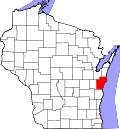
Location of Two Rivers in Manitowoc County, Wisconsin
USA Wisconsin location map.svg
Red pog.svg
Two Rivers, Wisconsin
Location in the state of Wisconsin
Coordinates: 44°9′18″N87°34′35″W / 44.15500°N 87.57639°W / 44.15500; -87.57639
CountryFlag of the United States.svg  United States
StateFlag of Wisconsin.svg  Wisconsin
County Manitowoc
Area
[4]
  Total6.49 sq mi (16.82 km2)
  Land6.04 sq mi (15.66 km2)
  Water0.45 sq mi (1.17 km2)
Population
 (2010) [5]
  Total11,712
  Estimate 
(2020) [6]
11,271
  Density1,826.77/sq mi (705.26/km2)
Time zone UTC−6 (Central (CST))
  Summer (DST) UTC−5 (CDT)
ZIP codes
54241
Area code 920
FIPS code 55-81325
Website www.two-rivers.org

Two Rivers is a city in Manitowoc County, Wisconsin, United States. The population was 11,271 at the 2020 census. It claims to be the birthplace of the ice cream sundae [7] (though other cities, such as Ithaca, New York, make the same claim [8] ). The city's advertising slogan is "Catch our friendly waves" as it is located along Lake Michigan.

Contents

History

A post office called Two Rivers has been in operation since 1848. [9] The city was named from its location at the confluence of the Mishicot and Neshota rivers, [10] now known as the East Twin and West Twin Rivers, respectively.

Geography

The East Twin and West Twin rivers meet at the Two Rivers harbor before journeying into Lake Michigan. Two Rivers Harbor.jpg
The East Twin and West Twin rivers meet at the Two Rivers harbor before journeying into Lake Michigan.

Two Rivers derives its name from the East Twin River and the West Twin River which meet in the city less than a mile from their outflows at Lake Michigan. Two Rivers is located at 44°9′17″N87°34′35″W / 44.15472°N 87.57639°W / 44.15472; -87.57639 (44.154928, −87.57642). [11]

According to the United States Census Bureau, the city has a total area of 6.49 square miles (16.81 km2), of which, 6.09 square miles (15.77 km2) is land and 0.40 square miles (1.04 km2) is water. [12]

Highways

Climate

Two Rivers, Wisconsin lies within the humid continental climate zone, modified by its close proximity to Lake Michigan. This gives the city more moderate temperatures and lesser extremes compared to its inland counterparts. The lake influence also gives Two Rivers a greater seasonal lag than places farther away from the lakeshore, with warmer Septembers and cooler Marches than the rest of the state; for instance, September, with a mean temperature of 60 °F (16 °C) is only 1 degree Fahrenheit cooler than June's 61 °F (16 °C), whereas Oshkosh, Wisconsin, a few tens of miles inland at a similar latitude, has a September that is 8 degrees Fahrenheit cooler than June.

The Köppen classification for the town is Dfb, often described as a cool summer humid continental climate, characterized by the coldest month's mean being below −3 °C (27 °F), the persistent snowpack line, and with 4 or more months above 10 °C (50 °F), but no month above 22 °C (72 °F).

Climate data for Two Rivers, Wisconsin (1991–2020 normals, extremes 1950–present)
MonthJanFebMarAprMayJunJulAugSepOctNovDecYear
Record high °F (°C)53
(12)
60
(16)
77
(25)
84
(29)
91
(33)
97
(36)
99
(37)
97
(36)
96
(36)
86
(30)
76
(24)
62
(17)
99
(37)
Mean daily maximum °F (°C)27.3
(−2.6)
29.8
(−1.2)
38.2
(3.4)
48.5
(9.2)
58.8
(14.9)
69.1
(20.6)
75.6
(24.2)
75.8
(24.3)
68.4
(20.2)
55.8
(13.2)
43.3
(6.3)
32.9
(0.5)
52.0
(11.1)
Daily mean °F (°C)19.6
(−6.9)
21.8
(−5.7)
30.7
(−0.7)
41.3
(5.2)
51.2
(10.7)
61.2
(16.2)
67.5
(19.7)
67.8
(19.9)
60.4
(15.8)
48.4
(9.1)
36.3
(2.4)
25.9
(−3.4)
44.3
(6.8)
Mean daily minimum °F (°C)12.0
(−11.1)
13.8
(−10.1)
23.2
(−4.9)
34.0
(1.1)
43.5
(6.4)
53.3
(11.8)
59.4
(15.2)
59.9
(15.5)
52.3
(11.3)
40.9
(4.9)
29.2
(−1.6)
19.0
(−7.2)
36.7
(2.6)
Record low °F (°C)−28
(−33)
−26
(−32)
−17
(−27)
9
(−13)
24
(−4)
35
(2)
39
(4)
42
(6)
29
(−2)
19
(−7)
−8
(−22)
−21
(−29)
−28
(−33)
Average precipitation inches (mm)1.78
(45)
1.45
(37)
2.04
(52)
3.40
(86)
3.43
(87)
4.15
(105)
3.34
(85)
3.23
(82)
2.52
(64)
2.77
(70)
2.12
(54)
1.80
(46)
32.03
(814)
Average snowfall inches (cm)14.8
(38)
11.3
(29)
5.7
(14)
1.9
(4.8)
0.0
(0.0)
0.0
(0.0)
0.0
(0.0)
0.0
(0.0)
0.0
(0.0)
0.2
(0.51)
2.2
(5.6)
10.0
(25)
46.1
(117)
Average precipitation days (≥ 0.01 in)9.57.98.711.011.611.110.69.69.710.79.48.5118.3
Average snowy days (≥ 0.1 in)5.94.92.40.90.00.00.00.00.00.11.24.219.6
Source: NOAA [13] [14]

Demographics

Historical population
CensusPop.Note
1860 1,337
1870 1,3652.1%
1880 2,05250.3%
1890 2,87039.9%
1900 3,78431.8%
1910 4,85028.2%
1920 7,30550.6%
1930 10,08338.0%
1940 10,3022.2%
1950 10,243−0.6%
1960 12,39321.0%
1970 13,73210.8%
1980 13,354−2.8%
1990 13,030−2.4%
2000 12,639−3.0%
2010 11,712−7.3%
2019 (est.)11,041 [6] −5.7%
U.S. Decennial Census [15]
Two Rivers Fire Department TR Fire Department.JPG
Two Rivers Fire Department

2010 census

As of the census [5] of 2010, there were 11,712 people, 5,119 households, and 3,156 families living in the city. The population density was 1,923.2 inhabitants per square mile (742.6/km2). There were 5,698 housing units at an average density of 935.6 per square mile (361.2/km2). The racial makeup of the city was 79.5% White, 8.5% African American, 3.8% Native American, 5.4% Asian, 1.7% from other races, and 7.2% from two or more races. Hispanic or Latino people of any race were 7.9% of the population.

There were 5,119 households, of which 26.9% had children under the age of 18 living with them, 48.4% were married couples living together, 9.2% had a female householder with no husband present, 4.1% had a male householder with no wife present, and 38.3% were non-families. 33.1% of all households were made up of individuals, and 15.2% had someone living alone who was 65 years of age or older. The average household size was 2.27 and the average family size was 2.86.

The median age in the city was 43.4 years. 21.6% of residents were under the age of 18; 7.4% were between the ages of 18 and 24; 23% were from 25 to 44; 29.3% were from 45 to 64; and 18.6% were 65 years of age or older. The gender makeup of the city was 48.9% male and 51.1% female.

2000 census

According to the census [16] of 2000, there were 12,639 people, 5,221 households, and 3,414 families living in the city. The population density was 2,230.1 people per square mile (860.7/km2). There were 5,547 housing units at an average density of 978.7 per square mile (377.7/km2). The racial makeup of the city was 95.74% White, 0.16% Black or African American, 0.44% Native American, 2.22% Asian, 0.06% Pacific Islander, 0.55% from other races, and 0.84% from two or more races. 1.35% of the population were Hispanic or Latino of any race.

There were 5,221 households, out of which 30.7% had children under the age of 18 living with them, 52.8% were married couples living together, 8.9% had a female householder with no husband present, and 34.6% were non-families. 29.4% of all households were made up of individuals, and 14.1% had someone living alone who was 65 years of age or older. The average household size was 2.40 and the average family size was 2.98.

In the city, the age distribution of the population shows 25.6% under the age of 18, 7.8% from 18 to 24, 27.4% from 25 to 44, 22.4% from 45 to 64, and 16.8% who were 65 years of age or older. The median age was 38 years. For every 100 females, there were 96.7 males. For every 100 females age 18 and over, there were 92.0 males.

The median income for a household in the city was $39,701, and the median income for a family was $48,241. Males had a median income of $35,378 versus $23,605 for females. The per capita income for the city was $18,908. About 4.2% of families and 6.3% of the population were below the poverty line, including 7.2% of those under age 18 and 5.9% of those age 65 or over.

Government

City hall TwoRiversWisconsinCityHall.jpg
City hall

The city has a city manager-council form of government. The city manager is Greg Buckley, who has held the position since August 1995.

Education

Two Rivers High School TwoRiversHighSchoolAugust2007WIS42.jpg
Two Rivers High School

Two Rivers has two public elementary schools, Koenig and Magee, and one parochial school: St. John's Lutheran (WELS). St. Peter the Fisherman Catholic grade school closed after the 2013–2014 school year.

The city's middle school, L. B. Clarke, serves students in fifth through eighth grade. The school was named for Charlton Heston's father-in-law, who helped fund the school; both Heston and his wife Lydia have visited the school.[ citation needed ]

Two Rivers is served by Two Rivers High School, built in 2002 to replace the now-demolished Washington High School. The school houses a photography darkroom and a television broadcast room for hands-on experience. The high school's daily announcements are broadcast by students on the city's public access television channel. The school's sports include swimming, football, track and field, baseball, soccer, and others. Some students from Two Rivers also attend Roncalli High School and Manitowoc Lutheran High School in nearby Manitowoc.

Media

Newspapers

Television and radio

Two Rivers is part of the Green Bay, Wisconsin television market, as well as the Green Bay Nielsen radio market. The city is home to WCUB-AM and WEMP-FM. Towers and studio are located elsewhere. Charter Communications provides cable service for the city.

Ice cream sundae

There is some debate between Ithaca, New York and Two Rivers over which city has the right to claim the title "birthplace of the ice cream sundae." When Ithaca mayor Carolyn K. Peterson proclaimed a day to celebrate her city as the birthplace of the sundae, she received postcards from Two Rivers' citizens reiterating that town's claim. [17] Ithaca retaliated with an ad called "Got Proof?" in the Two Rivers newspaper.

Two Rivers' claim is based on the story of George Hallauer asking Edward C. Berners, the owner of Berners' Soda Fountain, to drizzle chocolate syrup over ice cream in 1881. Berners eventually did, and wound up selling the treat for a nickel, originally only on Sundays, but later every day. According to this story, the spelling changed when a glass salesman ordered canoe-shaped dishes. When Berners died in 1939, the Chicago Tribune headlined his obituary "Man Who Made First Ice Cream Sundae Is Dead." [7] [18]

Professional football

During the 1930s and 1940s, Two Rivers was home to training camps for numerous professional football teams. The city's cool weather, athletic facilities, and general hospitality of the town's people helped lure the teams. Washington High School, The J.E. Hamilton Community House, and Walsh Field were used for practices and meetings, while teams stayed at the Hamilton Hotel. The teams included the now defunct Columbus Bullies AFL in 1940 and the Chicago Rockets AAFC in 1947. Two Rivers also hosted the National Football League's Pittsburgh Pirates, now known as the Pittsburgh Steelers, in 1939 and the Philadelphia Eagles in 1941 and 1942. [19]

Points of interest

The Historic Washington House Washington House Two Rivers.jpg
The Historic Washington House
The J.E. Hamilton Community House JE Hamilton Community House.JPG
The J.E. Hamilton Community House
Civil War Memorial Statue. City Hall and Hamilton Manufacturing in the background. Civil War Memorial Statue in Two Rivers.jpg
Civil War Memorial Statue. City Hall and Hamilton Manufacturing in the background.
Civil War Memorial Statue plaque. Civil War Memorial Statue Two Rivers Plaque.jpg
Civil War Memorial Statue plaque.

Beaches

Two Rivers two popular beaches.

Notable people

Athletes

Politicians

Images

Related Research Articles

<span class="mw-page-title-main">Sheboygan County, Wisconsin</span> County in Wisconsin, United States

Sheboygan County is a county in the U.S. state of Wisconsin. It is named after the Sheboygan River. As of the 2020 census, the population was 118,034. Its county seat is Sheboygan. The county was created in 1836 and organized in 1846. At the time, it was located in the Wisconsin Territory. Sheboygan County comprises the Sheboygan, WI Metropolitan Statistical Area. Part of the Holyland region is located in northwestern Sheboygan County.

<span class="mw-page-title-main">Racine County, Wisconsin</span> County in Wisconsin, United States

Racine County is a county in southeastern Wisconsin. As of the 2020 census, its population was 197,727, making it Wisconsin's fifth-most populous county. Its county seat is Racine. The county was founded in 1836, then a part of the Wisconsin Territory. Racine County comprises the Racine metropolitan statistical area. This area is part of the Milwaukee-Racine-Waukesha combined statistical area. According to the U.S. Census Bureau, the county has an area of 792 square miles (2,050 km2), of which 333 square miles (860 km2) is land and 460 square miles (1,200 km2) (58%) is water. The county's unemployment rate was 5.6% in June 2021.

<span class="mw-page-title-main">Milwaukee County, Wisconsin</span> County in Wisconsin, United States

Milwaukee County is a county located in the U.S. state of Wisconsin. At the 2020 census, the population was 939,489, down from 947,735 in 2010. It is both the most populous and most densely populated county in Wisconsin, and the 45th most populous county nationwide; Milwaukee, its eponymous county seat, is also the most populous city in the state. It was named after the Milwaukee River. The county was created in 1834 as part of Michigan Territory and organized the following year.

<span class="mw-page-title-main">Manitowoc County, Wisconsin</span> County in Wisconsin, United States

Manitowoc County is a county in the U.S. state of Wisconsin. As of the 2020 census, the population was 81,359. Its county seat is Manitowoc. The county was created in 1836 prior to Wisconsin's statehood and organized in 1848. Manitowoc County comprises the Manitowoc, WI Micropolitan Statistical Area.

<span class="mw-page-title-main">Calumet County, Wisconsin</span> County in Wisconsin, United States

Calumet County is a county located in the U.S. state of Wisconsin. As of the 2020 census, the population was 52,442. The county seat is Chilton. The county was created in 1836 and organized in 1850.

<span class="mw-page-title-main">Manistee County, Michigan</span> County in Michigan, United States

Manistee County is a county located in the U.S. state of Michigan. As of the 2020 census, the population was 25,032. The county seat is Manistee. The county is named for the Manistee River. Manistee County is part of Northern Michigan and has a shoreline on Lake Michigan.

<span class="mw-page-title-main">Iron River, Michigan</span> City in Michigan, United States

Iron River is a city in Iron County in the U.S. state of Michigan. As of the 2020 census, the city population was 3,007. The city is situated at the southeast corner of Iron River Township, but is administratively autonomous.

<span class="mw-page-title-main">Ludington, Michigan</span> City in Michigan, United States

Ludington is a city in the U.S. state of Michigan. It is the county seat and the largest city in Mason County. The population was 7,655 at the 2020 census.

<span class="mw-page-title-main">Ahnapee, Wisconsin</span> Town in Wisconsin, United States

Ahnapee is a town in Kewaunee County, Wisconsin, United States, on the Ahnapee River. The population was 940 as of the 2010 census. The Ahnapee State Trail passes through the town of Ahnapee.

<span class="mw-page-title-main">Algoma, Wisconsin</span> City in Wisconsin, United States

Algoma is a city in Kewaunee County in the U.S. state of Wisconsin. The population was 3,243 at the 2020 census. Algoma is part of the Green Bay Metropolitan Statistical Area.

<span class="mw-page-title-main">Cato, Wisconsin</span> Town in Wisconsin, United States

Cato is a town in Manitowoc County, Wisconsin, United States. The population was 1,616 at the 2000 census. A Manitowoc County park is located in the town; it is called "Cato Falls" for a waterfall on the Manitowoc River.

<span class="mw-page-title-main">Maribel, Wisconsin</span> Village in Wisconsin, United States

Maribel is a village in Manitowoc County, Wisconsin, United States. The population was 336 at the 2020 census.

<span class="mw-page-title-main">Meeme, Wisconsin</span> Town in Wisconsin, United States

Meeme is a town in Manitowoc County, Wisconsin, United States. The population was 1,538 at the 2000 census. Its Menominee name is Omīnīw which means "pigeon". The Menominee sold this land to the United States in the 1831 Treaty of Washington.

<span class="mw-page-title-main">Two Creeks, Wisconsin</span> Town in Wisconsin, United States

Two Creeks is a town in Manitowoc County, Wisconsin, United States. The population was 551 at the 2000 census.

<span class="mw-page-title-main">Valders, Wisconsin</span> Village in Wisconsin, United States

Valders is a village in Manitowoc County, Wisconsin, United States. The population was 962 at the 2010 census.

<span class="mw-page-title-main">Green Lake, Wisconsin</span> City in Wisconsin, United States

Green Lake is a city in and county seat of Green Lake County, Wisconsin, United States. The city had a population of 1,001 in the 2020 census. It is located on the north side of Green Lake. The Town of Green Lake is located on the south side of Big Green Lake, opposite the city.

<span class="mw-page-title-main">Princeton, Wisconsin</span> City in Wisconsin, United States

Princeton is a city in western part of Green Lake County, Wisconsin, United States. The population was 1,214 at the 2010 census. The city is located within the Town of Princeton. The Fox River flows through the city, dividing the city into an east half and west half.

<span class="mw-page-title-main">Manitowoc, Wisconsin</span> City in Wisconsin, United States

Manitowoc is a city in and the county seat of Manitowoc County, Wisconsin, United States. The city is located on Lake Michigan at the mouth of the Manitowoc River. According to the 2020 census, Manitowoc had a population of 34,626.

<span class="mw-page-title-main">Mishicot, Wisconsin</span> Village in Wisconsin, United States

Mishicot is a village in Manitowoc County, Wisconsin, United States. The population was 1,442 at the 2010 census. The village is adjacent to the Town of Mishicot.

<span class="mw-page-title-main">Sundae</span> Ice cream dessert

A sundae is an ice cream frozen dessert of American origin that typically consists of one or more scoops of ice cream topped with sauce or syrup and other toppings such as sprinkles, whipped cream, marshmallows, peanuts, maraschino cherries, or other fruits.

References

  1. Pawlitzke, Mary (1978). The Two Rivers Story. Denmark, Wisconsin: Brown County Publishing Co. p. 2.
  2. Pawlitzke, Mary (1978). The Two Rivers Story. Denmark, Wisconsin: Brown County Publishing Co. p. 10.
  3. Hodgson, Cindy (May 21, 2010). "Fishing contest will include new Carp Fest set for June 5, 6". Herald Times Reporter. Archived from the original on April 13, 2013. Retrieved February 26, 2013.
  4. "2019 U.S. Gazetteer Files". United States Census Bureau. Retrieved August 7, 2020.
  5. 1 2 "U.S. Census website". United States Census Bureau . Retrieved November 18, 2012.
  6. 1 2 "Population and Housing Unit Estimates". United States Census Bureau. May 24, 2020. Retrieved May 27, 2020.
  7. 1 2 "Two Rivers – The REAL Birthplace of the Ice Cream Sundae". Two Rivers Economic Development. Retrieved June 26, 2007.
  8. Michael Turback (2004). "Ithaca's Gift to the World" . Retrieved June 26, 2007.
  9. "Manitowoc County". Jim Forte Postal History. Retrieved March 30, 2015.
  10. Chicago and North Western Railway Company (1908). A History of the Origin of the Place Names Connected with the Chicago & North Western and Chicago, St. Paul, Minneapolis & Omaha Railways. p. 132.
  11. "US Gazetteer files: 2010, 2000, and 1990". United States Census Bureau. February 12, 2011. Retrieved April 23, 2011.
  12. "US Gazetteer files 2010". United States Census Bureau. Archived from the original on July 2, 2012. Retrieved November 18, 2012.
  13. "NowData - NOAA Online Weather Data". National Oceanic and Atmospheric Administration. Retrieved June 14, 2021.
  14. "Station: Two Rivers, WI". U.S. Climate Normals 2020: U.S. Monthly Climate Normals (1991-2020). National Oceanic and Atmospheric Administration. Retrieved June 14, 2021.
  15. "Census of Population and Housing". Census.gov. Retrieved June 4, 2015.
  16. "U.S. Census website". United States Census Bureau . Retrieved January 31, 2008.
  17. Laura Zaichkin, "Sundae wars continue between Ithaca and Two Rivers", Ithaca Journal, June 30, 2006
  18. "Man Who Made First Ice Cream Sundae Is Dead". Chicago Daily Tribune. July 2, 1939. p. 1.
  19. "JS Online: Years ago, Wisconsin was truly the 'Big Cheese'". Archived from the original on September 10, 2012. Retrieved November 24, 2010.
  20. "Wisconsin Shipwreck Coast National Marine Sanctuary Designation; Final Regulations". NOAA via Federal Register. June 23, 2021. Retrieved June 29, 2021.
  21. National Marine Sanctuaries media document: Wisconsin Shipwreck Coast National Marine Sanctuary Accessed 29 June 2021
  22. NOAA News "NOAA designates new national marine sanctuary in Wisconsin’s Lake Michigan," June 22, 2021 Accessed 29 June 2021
  23. "2019 Kites over Lake Michigan".