Collins | |
|---|---|
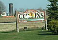
 Collins post office | |
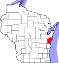
 Collins Location within the state of Wisconsin | |
| Coordinates: 44°05′08″N87°58′58″W / 44.08556°N 87.98278°W | |
| Country | United States |
| State | Wisconsin |
| County | Manitowoc |
| Area | |
• Total | 0.496 sq mi (1.28 km2) |
| • Land | 0.496 sq mi (1.28 km2) |
| • Water | 0 sq mi (0 km2) |
| Elevation | 814 ft (248 m) |
| Population | |
• Total | 203 |
| • Density | 410/sq mi (160/km2) |
| Time zone | UTC-6 (Central (CST)) |
| • Summer (DST) | UTC-5 (CDT) |
| ZIP code | 54207 |
| Area code | 920 |
| GNIS feature ID | 1563267 [3] |
Collins is an unincorporated census-designated place in the town of Rockland, Manitowoc County, Wisconsin, United States, in the east central part of the state. Its zip code is 54207, although its post office is being studied for closure. [4] As of the 2020 census, its population was 203, down from 164 at the 2010 census. [5]
Contents
The Collins Marsh Wildlife Area is located east of the community. [6]
Wisconsin Highway 32 ran through the community; the route later became Wisconsin Highway 67 before it became County Highway W. County Highway JJ and the Wisconsin Central Ltd. railroad runs east–west through the community.
Collins has an area of 0.496 square miles (1.28 km2), all of it land.
The community was named for Sumner J. Collins, who was the general superintendent of the Wisconsin Central Railroad in the 1890s. [7]