Manitowoc County is a county in the U.S. state of Wisconsin. As of the 2020 census, the population was 81,359. Its county seat is Manitowoc. The county was created in 1836 prior to Wisconsin's statehood and organized in 1848. Manitowoc County comprises the Manitowoc, WI Micropolitan Statistical Area.

Calumet County is a county located in the U.S. state of Wisconsin. As of the 2020 census, the population was 52,442. The county seat is Chilton. The county was created in 1836 and organized in 1850.

Franklin is a town in Manitowoc County, Wisconsin, United States. The population was 1,293 at the 2000 census.
Two Creeks is a town in Manitowoc County, Wisconsin, United States. The population was 551 at the 2000 census.

Manitowoc is a city in and the county seat of Manitowoc County, Wisconsin, United States. The city is located on Lake Michigan at the mouth of the Manitowoc River. According to the 2020 census, Manitowoc had a population of 34,626.

The Killsnake River is a 19.7-mile-long (31.7 km) river in eastern Wisconsin in the United States. It is a tributary of the South Branch of the Manitowoc River, which flows to Lake Michigan.
Wisconsin's 6th congressional district is a congressional district of the United States House of Representatives in eastern Wisconsin. It is based in the rural, suburban and exurban communities between Madison, Milwaukee, and Green Bay. It also includes the village of River Hills in far northern Milwaukee County. The district is currently represented by Glenn Grothman (R-Glenbeaulah) who took office in January 2015.
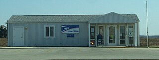
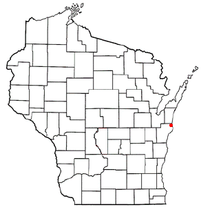
Collins is an unincorporated census-designated place in the town of Rockland, Manitowoc County, Wisconsin, United States, in the east central part of the state. Its zip code is 54207, although its post office is being studied for closure. As of the 2010 census, its population is 164.
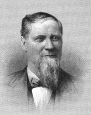
Joseph Rankin was an American businessman and Democratic politician. He was elected to two terms as U.S. Representative for Wisconsin's 5th congressional district, but died during his second term. Earlier in his career, he served 11 years in the Wisconsin Legislature, representing Manitowoc County, and was chairman of the Democratic Party of Wisconsin.

School Hill is an unincorporated community in the town of Meeme located in Manitowoc County, Wisconsin, United States. School Hill is located in southern Manitowoc County along County "X" at its intersections with Marken Road and County "M".

Tisch Mills is an unincorporated community in Kewaunee and Manitowoc counties, Wisconsin, United States. Tisch Mills is located in the towns of Carlton in Kewaunee County and Mishicot in Manitowoc County, 5 miles (8 km) north of the village of Mishicot. It is at an elevation of 636 feet (194 m) above sea level.
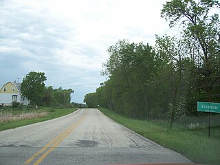
Steinthal is an unincorporated community in the Town of Eaton, Manitowoc County, Wisconsin, United States. The community had a post office and general store.

Hayton is an unincorporated community in the town of Charlestown, Calumet County, Wisconsin, United States. It is located a few miles (kilometers) east of Chilton at the intersection of U.S. Route 151 and County T.

Zander is an unincorporated community located in the town of Gibson, Manitowoc County, Wisconsin.

Rockwood is an unincorporated community located in the town of Kossuth, Manitowoc County, Wisconsin, United States. Rockwood is located on County Highway R approximately 6 miles (9.7 km) north-northwest of downtown Manitowoc. U.S. Route 141 passed through the community before it was decommissioned in 1981 after being replaced by Interstate 43 as the major route between Green Bay and Milwaukee. US 141 was renamed as County R.
Newtonburg is an unincorporated community located in the town of Newton, Manitowoc County, Wisconsin, United States. It is a community to the west of the intersection of WIS 42 and English Lake Road. St. John's Lutheran Church, founded 1851 and built in 1922, is the focal point of the community.

Meeme is an unincorporated community located in the town of Meeme, Manitowoc County, Wisconsin, United States. It is located at both the intersections of WIS-42 and CTH-XX
Grimms is an unincorporated community located in the town of Cato, Manitowoc County, Wisconsin, United States.

Wells is an unincorporated community in the town of Rantoul, Calumet County and the town of Rockland, Manitowoc County, Wisconsin, United States.

Northeim is an unincorporated community located in the town of Newton, Manitowoc County, Wisconsin, United States. Northeim is located on Pine Creek at the junction of County Highways U and LS, 6.8 miles (10.9 km) south-southwest of Manitowoc.


