Cato, Wisconsin

Last updated

Cato, Wisconsin
CatoWisconsinTownHall.jpg
Town Hall in Clarks Mills
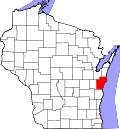
WIMap-doton-Cato.png
Location of Cato, Wisconsin
Coordinates: 44°6′12″N87°51′28″W / 44.10333°N 87.85778°W / 44.10333; -87.85778
Country Flag of the United States.svg  United States
State Flag of Wisconsin.svg  Wisconsin
County Manitowoc
Area
  Total35.3 sq mi (91.6 km2)
  Land35.1 sq mi (91.0 km2)
  Water0.2 sq mi (0.6 km2)
Elevation
[1]
833 ft (254 m)
Population
 (2000)
  Total1,616
  Density46.0/sq mi (17.8/km2)
Time zone UTC-6 (Central (CST))
  Summer (DST) UTC-5 (CDT)
Area code 920
FIPS code 55-13237 [2]
GNIS feature ID1582933 [1]
Website www.townofcato.com

Cato is a town in Manitowoc County, Wisconsin, United States. The population was 1,616 at the 2000 census. A Manitowoc County park is located in the town which is called "Cato Falls" for a waterfall on the Manitowoc River.

Contents

Communities

History

A post office called Cato was established in 1870, and remained in operation until it was discontinued in 1998. [3] The town was named after Cato, New York, the former hometown of an early settler. [4]

Geography

According to the United States Census Bureau, the town has a total area of 35.3 square miles (91.6 km2), of which, 35.1 square miles (91.0 km2) of it is land and 0.2 square miles (0.6 km2) of it (0.62%) is water.

Demographics

As of the census [2] of 2000, there were 1,616 people, 548 households, and 458 families residing in the town. The population density was 46.0 people per square mile (17.8/km2). There were 571 housing units at an average density of 16.3 per square mile (6.3/km2). The racial makeup of the town was 97.59% White, 0.50% Native American, 0.68% Asian, 0.62% from other races, and 0.62% from two or more races. Hispanic or Latino of any race were 1.67% of the population.

There were 548 households, out of which 36.1% had children under the age of 18 living with them, 73.4% were married couples living together, 5.7% had a female householder with no husband present, and 16.4% were non-families. 13.7% of all households were made up of individuals, and 5.7% had someone living alone who was 65 years of age or older. The average household size was 2.95 and the average family size was 3.24.

In the town, the population was spread out, with 28.1% under the age of 18, 8.5% from 18 to 24, 30.6% from 25 to 44, 22.6% from 45 to 64, and 10.2% who were 65 years of age or older. The median age was 36 years. For every 100 females, there were 106.1 males. For every 100 females age 18 and over, there were 108.6 males.

The median income for a household in the town was $53,462, and the median income for a family was $59,145. Males had a median income of $36,384 versus $23,750 for females. The per capita income for the town was $21,434. About 3.3% of families and 4.9% of the population were below the poverty line, including 5.7% of those under age 18 and 6.8% of those age 65 or over.

Infrastructure and transport

Cato is bisected north to south by U.S. Route 10, the main road in and out of the town. The Manitowoc River runs its course about two and a half miles south of Cato. The nearest Interstate highway is Interstate 43, where an exit near Manitowoc Rapids links with US 10. Though Manitowoc County Airport is the nearest airport, it has no regularly scheduled commercial service, and airports serving Green Bay and Appleton such as Green Bay–Austin Straubel International Airport and Appleton International Airport provide the closest commercial service to Cato. [5] [6]

Notable people

Related Research Articles

<span class="mw-page-title-main">Glenmore, Wisconsin</span> Town in Wisconsin, United States

Glenmore is a town in Brown County in the U.S. state of Wisconsin. The population was 1,045 at the 2020 census.

<span class="mw-page-title-main">Morrison, Wisconsin</span> Town in Wisconsin, United States

Morrison is a town in Brown County in the U.S. state of Wisconsin. The population was 1,599 at the 2010 census.

<span class="mw-page-title-main">Pittsfield, Wisconsin</span> Town in Wisconsin, United States

Pittsfield is a town in Brown County in the U.S. state of Wisconsin. The population was 2,608 at the 2010 census.

<span class="mw-page-title-main">Scott, Brown County, Wisconsin</span> Town in Wisconsin, United States

Scott is a town in Brown County in the U.S. state of Wisconsin. As of the 2020 census, the population was 3,636.

<span class="mw-page-title-main">Lamartine, Wisconsin</span> Town in Wisconsin, United States

Lamartine is a town in Fond du Lac County, Wisconsin, United States. The population was 1,616 at the 2000 census. The unincorporated communities of Lamartine, Rogersville, and Woodhull are located in the town.

<span class="mw-page-title-main">Ahnapee, Wisconsin</span> Town in Wisconsin, United States

Ahnapee is a town in Kewaunee County, Wisconsin, United States, on the Ahnapee River. The population was 940 as of the 2010 census. The Ahnapee State Trail passes through the town of Ahnapee.

<span class="mw-page-title-main">Carlton, Wisconsin</span> Town in Wisconsin, United States

Carlton is a town in Kewaunee County, Wisconsin, United States. The population was 1,014 at the 2010 census. Carlton is probably named for James Carlton, an early settler in the area.

<span class="mw-page-title-main">Franklin, Kewaunee County, Wisconsin</span> Town in Wisconsin, United States

Franklin is a town in Kewaunee County, Wisconsin, United States. The population was 993 at the 2010 census.

<span class="mw-page-title-main">Montpelier, Wisconsin</span> Town in Wisconsin, United States

Montpelier is a town in Kewaunee County, Wisconsin, United States. The population was 1,306 at the 2010 census.

<span class="mw-page-title-main">Cooperstown, Wisconsin</span> Town in Wisconsin, United States

Cooperstown is a town in Manitowoc County, Wisconsin, in the United States. As of the 2000 census, the town population was 1,403.

<span class="mw-page-title-main">Franklin, Manitowoc County, Wisconsin</span> Town in Wisconsin, United States

Franklin is a town in Manitowoc County, Wisconsin, United States. The population was 1,293 at the 2000 census.

<span class="mw-page-title-main">Gibson, Wisconsin</span> Town in Wisconsin, United States

Gibson is a town in Manitowoc County, Wisconsin, United States. The population was 1,352 at the 2000 census.

<span class="mw-page-title-main">Liberty, Manitowoc County, Wisconsin</span> Town in Wisconsin, United States

Liberty is a town in Manitowoc County, Wisconsin, United States. The population was 1,287 at the 2000 census.

<span class="mw-page-title-main">Meeme, Wisconsin</span> Town in Wisconsin, United States

Meeme is a town in Manitowoc County, Wisconsin, United States. The population was 1,538 at the 2000 census. Its Menominee name is Omīnīw which means "pigeon". The Menominee sold this land to the United States in the 1831 Treaty of Washington.

<span class="mw-page-title-main">Newton, Manitowoc County, Wisconsin</span> Town in Wisconsin, United States

Newton is a town in Manitowoc County, Wisconsin, United States. The population was 2,241 at the 2000 census.

<span class="mw-page-title-main">Schleswig, Wisconsin</span> Town in Wisconsin, United States

Schleswig is a town in Manitowoc County, Wisconsin, United States. The population was 1,900 at the 2000 census.

<span class="mw-page-title-main">Two Creeks, Wisconsin</span> Town in Wisconsin, United States

Two Creeks is a town in Manitowoc County, Wisconsin, United States. The population was 551 at the 2000 census.

<span class="mw-page-title-main">Maple Valley, Wisconsin</span> Town in Wisconsin, United States

Maple Valley is a town in Oconto County, Wisconsin, United States. The population was 670 at the 2000 census.

<span class="mw-page-title-main">Stiles, Wisconsin</span> Town in Wisconsin, United States

Stiles is a town in Oconto County, Wisconsin, United States. The population was 1,465 at the 2000 census. The unincorporated communities of Stiles and Stiles Junction are located in the town. Situated within ancestral Menominee territory that was ceded to the United States in the 1836 Treaty of the Cedars, its Menominee name is Pæhkuahkiw which means "pointed hillock".

<span class="mw-page-title-main">Herman, Sheboygan County, Wisconsin</span> Town in Wisconsin, United States

Herman is a town in Sheboygan County, Wisconsin, United States. The population was 2,044 at the 2000 census. It is included in the Sheboygan, Wisconsin Metropolitan Statistical Area. The town is home to Lakeland University.

References

  1. 1 2 "US Board on Geographic Names". United States Geological Survey. October 25, 2007. Retrieved January 31, 2008.
  2. 1 2 "U.S. Census website". United States Census Bureau . Retrieved January 31, 2008.
  3. "Manitowoc County". Jim Forte Postal History. Retrieved February 28, 2015.
  4. Chicago and North Western Railway Company (1908). A History of the Origin of the Place Names Connected with the Chicago & North Western and Chicago, St. Paul, Minneapolis & Omaha Railways. p. 53.
  5. "Airports Near Me - Cato, Wisconsin | Travelmath". www.travelmath.com. Retrieved August 10, 2023.
  6. "Dropped Pin". maps.apple.com. Retrieved August 10, 2023.
  7. 'Farmer Well Known In Two Counties Dies,' Manitowoc Herald Times, August 8, 1924, pg. 1
  8. 'Wisconsin Blue Book 1915,' Biographical Sketch of Peter J. Murphy, pg. 518
  9. Dorfman, Joseph (1934). Thorstein Veblen and His America. Harvard University Press. ISBN   0-678-00007-7.

44°08′34″N87°51′40″W / 44.14278°N 87.86111°W / 44.14278; -87.86111