
Manitowoc is a city in and the county seat of Manitowoc County, Wisconsin, United States. The city is located on Lake Michigan at the mouth of the Manitowoc River. According to the 2010 census, Manitowoc had a population of 33,736, with over 50,000 residents in the surrounding communities. The city's sister city is Kamogawa, Japan.
US Highway 141 (US 141) is a north–south United States Numbered Highway in the states of Wisconsin and Michigan. The highway runs north-northwesterly from an interchange with Interstate 43 (I-43) in Bellevue, Wisconsin, near Green Bay, to a junction with US 41/M-28 near Covington, Michigan. In between, it follows city streets in Green Bay and has a concurrent section with US 41 in Wisconsin. North of Green Bay, US 141 is either a freeway or an expressway into rural northern Wisconsin before downgrading to an undivided highway. In Michigan, US 141 is an undivided highway that runs through rural woodlands. The highway has two segments in each state; after running through Wisconsin for about 103 miles (166 km), it crosses into Michigan for approximately another 8 miles (13 km). After that, it crosses back into Wisconsin for about 14 1⁄2 miles (23 km) before crossing the state line one last time. The northernmost Michigan section is about 43 1⁄2 miles (70 km), making the overall length about 169 miles (272 km).
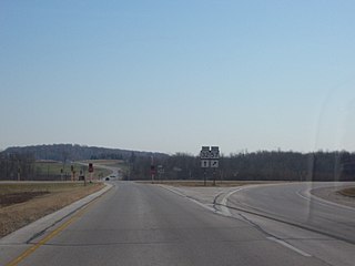
State Trunk Highway 310 is a state highway in the U.S. state of Wisconsin. It runs east–west in east central Wisconsin from near Manitowoc to Two Rivers. The nearly nine-mile-long (14 km) road passes through mainly rural areas and intersects multiple County Highways along the way. The route came about in 1984 when US 10 was rerouted southbound with I-43 and County Highway D fell into state control.

Collins is an unincorporated census-designated place in the town of Rockland, Manitowoc County, Wisconsin, United States, in the east central part of the state. Its zip code is 54207, although its post office is being studied for closure. As of the 2010 census, its population is 164. The Collins Marsh Wildlife Area is located east of the community. Wisconsin Highway 32 ran through the community; the route later became Wisconsin Highway 67 before it became County Highway W. County Highway JJ and the Wisconsin Central Ltd. railroad runs east–west through the community. Collins has an area of 0.496 square miles (1.28 km2), all of it land. The community was named for Sumner J. Collins, who was the general superintendent of the Wisconsin Central Railroad in the 1890s.

School Hill is an unincorporated community in the town of Meeme located in Manitowoc County, Wisconsin, United States. School Hill is located in southern Manitowoc County along County "X" at its intersections with Marken Road and County "M".
Millhome is an unincorporated community in the town of Schleswig, Manitowoc County, Wisconsin, United States. The nearest city to Millhome is Kiel. The community is located just west of the intersection of Wisconsin Highway 32 and Wisconsin Highway 57 and is along the border between Manitowoc and Sheboygan Counties. The Sheboygan River passes through the community.

Branch is an unincorporated community located, in the Town of Manitowoc Rapids, in Manitowoc County, Wisconsin, United States. Branch is located on U.S. Route 10 east of Whitelaw.

The Devil's River State Trail is a 14.24-mile (22.94 km) state-designated rail trail in Manitowoc County, Wisconsin. Parts of the trail are under construction as of early 2010. The trail nearly parallels Interstate 43 for much of its route. The trail starts in the village park of Denmark, continuing through the village parks of both Maribel and Francis Creek, ending just north of Rockwood. The trail is scheduled to be expanded southwards to the city of Manitowoc.
Cato is an unincorporated community located in the town of Cato, Manitowoc County, Wisconsin, United States. Cato is located on U.S. Route 10 2 miles (3.2 km) west of Whitelaw.

Newton is an unincorporated community located in the town of Newton, Manitowoc County, Wisconsin, United States. Newton is located along Interstate 43 near Exit 144, 5.5 miles (8.9 km) east-northeast of Cleveland. Newton has a post office with ZIP code 53063.

Hayton is an unincorporated community in the town of Charlestown, Calumet County, Wisconsin, United States. It is located a few miles (kilometers) east of Chilton at the intersection of U.S. Route 151 and County T.

Cooperstown is an unincorporated community located in the town of Cooperstown, Manitowoc County, Wisconsin, United States. Cooperstown is located on County Highway R 3 miles (4.8 km) north-northeast of Maribel.
Taus is an unincorporated community located in the town of Franklin, Manitowoc County, Wisconsin, United States.
Kellners Corners is an unincorporated community located in the town of Manitowoc Rapids, Manitowoc County, Wisconsin, United States.
Reifs Mills is an unincorporated community located in the town of Franklin, Manitowoc County, Wisconsin. United States.
Two Creeks is an unincorporated community located in the town of Two Creeks, Manitowoc County, Wisconsin, United States. Two Creeks is located on Wisconsin Highway 42 10.2 miles (16.4 km) north of Two Rivers.
Maple Grove is an unincorporated community located in the towns of Franklin and Maple Grove, Manitowoc County, Wisconsin, United States. Maple Grove is located on County Highway G 3 miles (4.8 km) northeast of Reedsville.
Madsen is an unincorporated community located in the town of Cato, Manitowoc County, Wisconsin, United States. Madsen is located on County Highway S and the Canadian National Railway near U.S. Route 151, 8.2 miles (13.2 km) west of Manitowoc.
Northeim is an unincorporated community located in the town of Newton, Manitowoc County, Wisconsin, United States. Northeim is located on Pine Creek at the junction of County Highways U and LS, 6.8 miles (10.9 km) south-southwest of Manitowoc.


