Rockland, Manitowoc County, Wisconsin

Last updated
Rockland, Wisconsin
RocklandWisconsinTownHall.jpg
Town hall in Collins
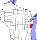
WIMap-doton-Rockland c.png
Location of Rockland, Wisconsin
Coordinates: 44°6′5″N87°58′56″W / 44.10139°N 87.98222°W / 44.10139; -87.98222 Coordinates: 44°6′5″N87°58′56″W / 44.10139°N 87.98222°W / 44.10139; -87.98222
Country Flag of the United States.svg  United States
State Flag of Wisconsin.svg  Wisconsin
County Manitowoc
Area
  Total35.5 sq mi (92.0 km2)
  Land34.5 sq mi (89.4 km2)
  Water1.0 sq mi (2.6 km2)
Elevation
[1]
807 ft (246 m)
Population
 (2000)
  Total896
  Density26.0/sq mi (10.0/km2)
Time zone UTC-6 (Central (CST))
  Summer (DST) UTC-5 (CDT)
Area code(s) 920
FIPS code 55-68925 [2]
GNIS feature ID1584057 [1]

Rockland is a town in Manitowoc County, Wisconsin, United States. The population was 896 at the 2000 census. The unincorporated community of Collins is located in the town. The unincorporated community of Wells is also partially located in the town.

Contents

Geography

According to the United States Census Bureau, the town has a total area of 35.5 square miles (92.0 km2), of which, 34.5 square miles (89.4 km2) of it is land and 1.0 square miles (2.6 km2) of it (2.84%) is water.

Demographics

As of the census [2] of 2000, there were 896 people, 308 households, and 255 families residing in the town. The population density was 26.0 people per square mile (10.0/km2). There were 336 housing units at an average density of 9.7 per square mile (3.8/km2). The racial makeup of the town was 98.21% White, 0.45% Native American, 1.00% from other races, and 0.33% from two or more races. Hispanic or Latino of any race were 1.79% of the population.

There were 308 households, out of which 38.6% had children under the age of 18 living with them, 75.0% were married couples living together, 4.2% had a female householder with no husband present, and 17.2% were non-families. 13.6% of all households were made up of individuals, and 5.8% had someone living alone who was 65 years of age or older. The average household size was 2.91 and the average family size was 3.23.

In the town, the population was spread out, with 26.5% under the age of 18, 7.1% from 18 to 24, 31.1% from 25 to 44, 25.8% from 45 to 64, and 9.5% who were 65 years of age or older. The median age was 36 years. For every 100 females, there were 109.3 males. For every 100 females age 18 and over, there were 109.2 males.

The median income for a household in the town was $53,500, and the median income for a family was $56,635. Males had a median income of $34,219 versus $22,625 for females. The per capita income for the town was $19,798. About 6.4% of families and 7.9% of the population were below the poverty line, including 13.4% of those under age 18 and 10.8% of those age 65 or over.

Notable people

Related Research Articles

Whitewater Township, Michigan Civil township in Michigan, United States

Whitewater Township is a civil township of Grand Traverse County in the U.S. state of Michigan. The population was 2,688 at the 2020 census, an increase from 2,597 at the 2010 census.

Richfield Township, Roscommon County, Michigan Civil township in Michigan, United States

Richfield Township is a civil township of Roscommon County in the U.S. state of Michigan. As of the 2010 census, the township had a total population of 3,731.

Penn Township, Butler County, Pennsylvania Township in Pennsylvania, United States

Penn Township is a township in Butler County, Pennsylvania, United States. The population was 5,071 at the 2010 census.

Gordon, Ashland County, Wisconsin Town in Wisconsin, United States

Gordon is a town in Ashland County in the U.S. state of Wisconsin. The population was 283 at the 2010 census. The unincorporated communities of Clam Lake and Morse are located in the town.

Russell, Bayfield County, Wisconsin Town in Wisconsin, United States

Russell is a town in Bayfield County, Wisconsin, United States. The population was 1,279 at the 2010 census. The unincorporated communities of Red Cliff and Sand Bay are located in Russell. Red Cliff is the administrative center of the Red Cliff Band of Lake Superior Chippewa. York Island and Raspberry Island are part of the town.

Oakland, Burnett County, Wisconsin Town in Wisconsin, United States

Oakland is a town in Burnett County in the U.S. state of Wisconsin. The population was 827 at the 2010 census. It is along Wisconsin Highway 35. The unincorporated communities of Oakland and Yellow Lake are located in the town.

Fremont, Clark County, Wisconsin Town in Wisconsin, United States

Fremont is a town in Clark County in the U.S. state of Wisconsin. The population was 1,265 at the 2010 census. The unincorporated community of Chili is located in the community.

Pleasant Springs, Wisconsin Town in Wisconsin, United States

Pleasant Springs is a town in Dane County, Wisconsin, United States. The population was 3,053 at the 2000 census. The unincorporated community of Kegonsa is located in the town. The unincorporated community of Hoffman Corners is also located partially in the town.

Ashippun, Wisconsin Town in Wisconsin, United States

Ashippun is a town in Dodge County, Wisconsin, United States. The census-designated place of Ashippun and unincorporated communities of Alderley and Old Ashippun are located in the town. The population was 2,308 at the 2000 census.

Spring Grove, Wisconsin Town in Wisconsin, United States

Spring Grove is a town in Green County, Wisconsin, United States. The population was 861 at the 2000 census. The unincorporated community of Oakley is located in the town. The ghost towns of Clarence and Tyrone are also located in the town.

Maple Grove, Manitowoc County, Wisconsin Town in Wisconsin, United States

Maple Grove is a town in Manitowoc County, Wisconsin, United States. The population was 852 at the 2000 census. The unincorporated community of Maple Grove is located partially in the town.

Stockton, Wisconsin Town in Wisconsin, United States

Stockton is a town in Portage County, Wisconsin, United States. The population was 2,896 at the 2000 census. The unincorporated communities of Arnott, Custer, Fancher, Esker, and Stockton are located in Stockton.

Magnolia, Wisconsin Town in Wisconsin, United States

Magnolia is a town in Rock County, Wisconsin, United States. The population was 854 at the 2000 census. The unincorporated communities of Cainville and Magnolia are located in the town.

Mitchell, Wisconsin Town in Wisconsin, United States

Mitchell is a town in Sheboygan County, Wisconsin, United States. The population was 1,132 at the 2000 census. It is included in the Sheboygan, Wisconsin Metropolitan Statistical Area. The unincorporated community of Parnell is located in the town.

Richmond, St. Croix County, Wisconsin Town in Wisconsin, United States

Richmond is a town in St. Croix County, Wisconsin, United States. The population was 1,556 at the 2000 census. The unincorporated community of Boardman is located in the town.

Stanton, St. Croix County, Wisconsin Town in Wisconsin, United States

Stanton is a town in St. Croix County, Wisconsin, United States. The population was 1,003 at the 2000 census. The unincorporated community of Stanton is located in the town. The Stanton Town Hall is located at 2245 County Road T Deer Park.

Christiana, Vernon County, Wisconsin Town in Wisconsin, United States

Christiana is a town in Vernon County, Wisconsin, United States. The population was 871 at the 2000 census. The unincorporated community of Newry is located within the town.

Harmony, Vernon County, Wisconsin Town in Wisconsin, United States

Harmony is a town in Vernon County, Wisconsin, United States. The population was 739 at the 2000 census. The unincorporated community of Newton is located in the town.

Clinton (town), Rock County, Wisconsin Town in Wisconsin, United States

Clinton is a town in Rock County in the U.S. state of Wisconsin. The population was 2,190 at the 2000 census. The Village of Clinton and the unincorporated community of Bergen are located in the town.

Arcadia is a town in Trempealeau County, Wisconsin, United States. The population was 1,555 at the 2000 census. The unincorporated communities of Dewey Corners, North Creek, and Tamarack are located in the town. The ghost towns of Cortland and Williamsburg were also located in the town.

References

  1. 1 2 "US Board on Geographic Names". United States Geological Survey. 2007-10-25. Retrieved 2008-01-31.
  2. 1 2 "U.S. Census website". United States Census Bureau . Retrieved 2008-01-31.
  3. 'Wisconsin Blue Book 1917,' Biographical Sketch of Martin Rappel, pg. 535