Rustic Road (Wisconsin)

Last updated
Rustic Roads
Rustic road.svg
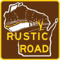
Standard Rustic Road marker
Highway names
Interstates Interstate X (I-X)
US Highways U.S. Highway X (US X)
State (State Trunk) Highway X (STH-X or WIS X)
County Highway:(County Trunk) Highway X (CTH-X)
Rustic Road:Rustic Road X (RX)
System links

The Rustic Road system is a system of Wisconsin scenic roads. They differ from the main trunkline highway system in that they are not meant to be major through routes, but lightly traveled local access, [1] and are to meet minimum standards for natural features. Rustic roads have lower speed limits than those on other highway systems. [2] Each route is marked by brown and yellow signs, with the route number on a small placard below the sign. [3] The letter "R" prefix is followed by the number designation. Wisconsin is the only state to have a system of rustic roads. [4] Wisconsin has a separate system of scenic byways following the development of a national system in the 1990s. [5]

Contents

System description

Rustic Road 26 in autumn RusticRoadR26FallSceneryWisconsin.jpg
Rustic Road 26 in autumn
Rustic Road 1, north of Medford Rustic Road Number 1.jpg
Rustic Road 1, north of Medford

The Rustic Road concept was conceived in 1973. [1] The Wisconsin State Legislature established the program to help preserve lightly traveled scenic rural roads. There are a few requirements that a road must have in order to be designated as a rustic road, such as having outstanding natural features or areas that set the road apart from other roads, be a lightly traveled road, not be scheduled for a major improvement which would change its rustic characteristics, and preferably be at least two miles (3.2 km) with a loop, completed closure, or connection to a major highway at both ends of the route. [6] The maximum speed limit established by law is 45 miles per hour (72 km/h), but can be set lower by a local government if desired. [6] Rustic roads may be dirt, gravel, or paved. [6] They can be one- or two-way and can have accommodations for bicycles and hiking adjacent to or incorporated into the road or surrounding area. [2] The designation process is initiated by application for designation by a local government. [1]

History

The effort to identify rustic roads began in order to help local government and citizens preserve Wisconsin's scenic routes. The Rustic Roads system was established by the 1973 Wisconsin State Legislature. [3] The law created the Wisconsin Rustic Roads Board. [7] The first road was designated in 1975 in Taylor County in the Town of Rib Lake. [1] The application requires the reasons why a road should be designated, photographs, and a resolution of support from the local government. [1] A 10-member volunteer board develops the rules and standards for the roads, and enacts the final approval for each designation. [3] Before approving, two members of the board separately drive and personally assess the proposed route. [1] As of 2014, the system has 115 Rustic Roads for a total length of 665 miles (1,070 km) in 59 of the state's 72 counties. [1] At that time, the roads varied in length from 2 to 37 miles (3.2 to 59.5 km). [1]

List

NumberLength (mi)Length (km)Southern or western terminusNorthern or eastern terminusCountiesFormedRemovedNotes
Rustic road.svgR15.08.0CTH-D in Rib Lake WIS 102 in Rib Lake Taylor 01975-01-011975currentGravel, first Rustic Road in Wisconsin
Rustic road.svgR27.912.7Center and Grove Streets in Burlington WIS 83 in Waterford Racine Paved; three segments with 0.9 mi (1.4 km) of connecting highway
Rustic road.svgR33.65.8CTH-E in Springfield WIS 128 in Glenwood Saint Croix Paved
Rustic road.svgR44.06.4CTH-W in Springfield WIS 128 in Glenwood Saint Croix Gravel; gas a spur segment included in R4 Spur for a total mileages of 4.6 mi (7.4 km)
Rustic road.svgR4 Spur0.60.97R4 in Springfield CTH-W in Springfield Saint Croix Gravel; it is included in R4 mileage and description by WisDOT
Rustic road.svgR53.15.0 WIS 164 in Waterford WIS 36 in Wind Lake Racine Paved
Rustic road.svgR613.621.9 WIS 64 in Cleveland CTH-D in Washington Chippewa, Rusk Paved; WisDOT lists the route stopping 0.3 mi (0.48 km) short at the Rusk County line, but it is signed to CTH–D; route is concurrent with CTH-E
Rustic road.svgR73.55.6CTH-AB in FranklinMontpelier WIS 29 in Montpelier Kewaunee Paved
Rustic road.svgR83.04.8Loop including CTH-IR, Sunrise Road, Pine Lane, and Westview Road in Suamico Brown Paved; loop route
Rustic road.svgR96.710.8CTH-T and Brauer Road in SevastopolSturgeon Bay CTH-T and Whitefish Bay Road in Sevastopol Door Paved; route is concurrent with CTH-T
Rustic road.svgR102.54.0Main Street in Summit CTH-P in Summit Waukesha Paved; part of route is concurrent with CTH-B
Rustic road.svgR118.914.3 WIS 50 in Lyons R11 / S Road in Lyons Walworth Paved; loop route that has two spur segments included in R11 Spur A and R11 Spur B for a total mileage as 10.3 mi (16.6 km)
Rustic road.svgR11 Spur A0.20.32R12 in Lyons R11 in Lyons Walworth Paved; it is included in R11 mileage and description by WisDOT
Rustic road.svgR11 Spur B0.30.48R11 in Lyons Walburg Road in Lyons Walworth Paved; it is included in R11 mileage and description by WisDOT
Rustic road.svgR125.79.2 WIS 50 in Lyons WIS 36 in Lyons Walworth Paved
Rustic road.svgR133.04.8Baer Drive in Hudson River Road in Saint Joseph Saint Croix Paved
Rustic road.svgR142.03.2CTH-A in Easton CTH-B in New Chester–Easton Adams Gravel
Rustic road.svgR155.48.7Fish Lake Road in Grantsburg Hickerson Road in Grantsburg Burnett WisDOT lists portions of the route as gravel, but it appears to be fully paved
Rustic road.svgR166.09.7CTH-O at city limits of Two Rivers CTH-V in Two Rivers Manitowoc Paved; WisDOT lists the route starting 0.8 mi (1.3 km) late at the city limits of Two Rivers, but it is signed from a point parallel with 25th Street; route is concurrent with CTH-O
Rustic road.svgR172.74.3CTH-T in Lanark US 10 in Lanark Portage Paved
Rustic road.svgR186.810.9Loop including 23rd Street, 23-24 1/2 Street, 16 1/4 Avenue, 25th Street, and 17 1/4 Avenue in Stanley and Sumner Barron Paved; two segments with CTH-M as a connecting highway
Rustic road.svgR192.33.7CTH-B in Dunn Goodland Park Road in Dunn Dane Paved
Rustic road.svgR202.94.7Dreyson Road in StoughtonSchneider Road in McFarland Dane Paved
Rustic road.svgR225.58.9White River Road in NeshkoroWhite River Road in Neshkoro Green Lake Gravel and paved portions
Rustic road.svgR233.65.8Rural Road in Hartman Creek State ParkRural Road in Rural Waupaca Paved
Rustic road.svgR242.74.3Emmons Creek Road near WaupacaEmmons Creek Road near Rural Waupaca Paved and gravel portions
Rustic road.svgR412.33.770th Street north of CTH-GEastern end of Clara Lake Drive at CTH-E Polk Paved and gravel sections; the road turns from north–south to east–west just north of the Hunky Dory resort and just south of the Straight River and the south end of Big Round Lake.
Rustic road.svgR613.35.3CTH-M in Hortonville Wisconsin Highway 76 near Stepehnsville Outagamie Paved
Rustic road.svgR812.94.7 WIS 39 near New Glarus CTH-H near New Glarus Green Paved, known to locals as Marty Road
Rustic road.svgR1162.23.5CTH-A in Boardman 120th St St. Croix Travels along 140th Avenue
Rustic road.svgR1171.82.9CTH-A near Saxeville CTH-W and 26th rd near Saxeville Waushara Connects with R-48

See also

Related Research Articles

Great River Road Highway designation

The Great River Road is a collection of state and local roads that follow the course of the Mississippi River through ten states of the United States. They are Minnesota, Wisconsin, Iowa, Illinois, Missouri, Kentucky, Tennessee, Arkansas, Mississippi and Louisiana. It formerly extended north into Canada, serving the provinces of Ontario and Manitoba. The road is designated as both a National Scenic Byway and an All-American Road in several states along the route.

Interstate 39 (I-39) is a highway in the Midwestern United States. I-39 runs from Normal, Illinois, at I-55 to State Trunk Highway 29 (WIS 29) in the town of Rib Mountain, Wisconsin, which is approximately six miles (9.7 km) south of Wausau. I-39 was designed to replace U.S. Route 51 (US 51), which, in the early 1980s, was one of the busiest two-lane highways in the United States. I-39 was built in the 1980s and 1990s.

Interstate 43 (I-43) is a 191.55-mile-long (308.27 km) Interstate Highway located entirely within the US state of Wisconsin, connecting I-39/I-90 in Beloit with Milwaukee and I-41, U.S. Highway 41 (US 41) and US 141 in Green Bay. State Trunk Highway 32 (WIS 32) runs concurrently with I-43 in two sections and I-94, I-894, US 10, US 41, US 45, WIS 57, and WIS 42 overlap I-43 once each. There are no auxiliary or business routes connected to I-43, though an alternate route to direct traffic during road closures is signed along local and state highways from Milwaukee County north into Brown County.

A Pure Michigan Byway is the designation for a segment of the State Trunkline Highway System in the US state of Michigan that is a "scenic, recreational, or historic route that is representative of Michigan's natural and cultural heritage." The designation was created with the name Michigan Heritage Route by the state legislature on June 22, 1993, and since then six historic, seven recreational and seven scenic byways have been designated by the Michigan Department of Transportation (MDOT), and another two have been proposed. These byways have been designated in both the Upper and Lower peninsulas of the state. The current name was adopted on December 30, 2014, and it references the Pure Michigan tourism marketing campaign.

National Scenic Byway United States category of road

A National Scenic Byway is a road recognized by the United States Department of Transportation for one or more of six "intrinsic qualities": archeological, cultural, historic, natural, recreational, and scenic. The program was established by Congress in 1991 to preserve and protect the nation's scenic but often less-traveled roads and promote tourism and economic development. The National Scenic Byways Program (NSBP) is administered by the Federal Highway Administration (FHWA).

U.S. Highway 8 (US 8) is a United States Numbered Highway that runs primarily east–west for 280 miles (451 km), mostly within the state of Wisconsin. It connects Interstate 35 (I-35) in Forest Lake, Minnesota, to US 2 at Norway in the Upper Peninsula of Michigan near the border with Wisconsin. Except for the short freeway segment near Forest Lake, and sections near the St. Croix River bridge and Rhinelander, Wisconsin, it is mostly undivided surface road. As a state highway in the three states, US 8 is maintained by the Minnesota, Wisconsin and Michigan departments of transportation.

State Route 12 or Scenic Byway 12 (SR-12), also known as "Highway 12 — A Journey Through Time Scenic Byway", is a 122.863-mile-long (197.729 km) state highway designated an All-American Road located in Garfield County and Wayne County, Utah, United States.

Interstate 41 (I-41) is a 176.33-mile-long (283.78 km) north–south Interstate Highway connecting the interchange of I-94 and U.S. Route 41 (US 41), located 0.9 miles (1.4 km) south of the Wisconsin–Illinois border at the end of the Tri-State Tollway in metropolitan Chicago, to an interchange with I-43 in metropolitan Green Bay, Wisconsin. The designation travels concurrently with US 41, I-894, US 45, I-43, and sections of I-94 in Wisconsin and Illinois. The route was officially added to the Interstate Highway System on April 7, 2015, and connects Milwaukee and Green Bay with the Fox Cities.

Route 169 (Connecticut–Massachusetts)

Route 169 is a 47.36-mile-long (76.22 km) state highway in the U.S. states of Connecticut and Massachusetts. It begins in the city of Norwich, Connecticut, and runs 38 miles (61 km) through Northeastern Connecticut, continuing across the state line into Southbridge, Massachusetts. The route ends in Charlton after another nine miles (14 km). A portion of the route in the town center of Pomfret is on the National Register of Historic Places as Pomfret Street Historic District, and 32.10 miles (51.66 km) of the road is designated as the Connecticut State Route 169 National Scenic Byway.

State Trunk Highway 42 is a state highway in the U.S. state of Wisconsin. It runs for about 138 miles (222 km) north–south in northeast Wisconsin from Sheboygan to the ferry dock in Northport. Much of the highway is part of the Lake Michigan Circle Tour from the eastern junction with U.S. Highway 10 (US 10) in Manitowoc to its junction with WIS 57 in Sister Bay. WIS 42 parallels I-43 from Sheboygan to Manitowoc, and parallels WIS 57 throughout much of the route, particularly from Manitowoc to Sturgeon Bay, meeting the northern terminus of WIS 57 in Sister Bay.

Wisconsin Highway 57 is a 191.82-mile-long (308.70 km) state highway in Wisconsin, United States. It runs from its southern terminus at Wisconsin Highway 59 in Milwaukee to its northern terminus at Wisconsin Highway 42 in Sister Bay. Much of WIS 57 parallels Interstate 43 (I-43) and WIS 42, particularly from Saukville to its northern terminus in Sister Bay. The highway is concurrent with I-43 for 12 miles (19 km) in Ozaukee County. Like most Wisconsin state highways, WIS 57 is maintained by the Wisconsin Department of Transportation (WisDOT).

U.S. Highway 12 in the U.S. state of Wisconsin runs east–west across the western to southeast portions of the state. It enters from Minnesota running concurrently with Interstate 94 (I-94) at Hudson, parallels the Interstate to Wisconsin Dells, and provides local access to cities such as Menomonie, Eau Claire, Black River Falls, Tomah and Mauston. It then provides an alternative route for traffic between northwestern Wisconsin and Madison and is the anchor route for the Beltline Highway around Madison. Finally, it serves southeastern Wisconsin, connecting Madison with Fort Atkinson, Whitewater, Elkhorn and Lake Geneva. The West Beltline Highway and the segment between Elkhorn and Genoa City are freeways, and the segment between Sauk City and Middleton is an expressway. The remainder of the road is a two-lane surface road or an urban multi-lane arterial. Between Hudson and west of Warrens, the road closely parallels the former main line of the Omaha Road, now operated by Union Pacific Railroad.

U.S. Highway 41 (US 41) is a north–south highway United States Numbered Highway in eastern Wisconsin. It runs from Pleasant Prairie on the Illinois border north to Marinette on the Michigan border. Most of the route is concurrent with Interstate 41 in the state, with the exception of the portion between Howard, a suburb of Green Bay, and Marinette.

The Dinosaur Diamond is a 486-mile (782 km) scenic and historic byway loop through the dinosaur fossil laden Uinta Basin of the U.S. states of Utah and Colorado. The byway comprises the following two National Scenic Byways:

Wisconsin State Trunk Highway System

The Wisconsin State Trunk Highway System is the state highway system of the U.S. state of Wisconsin, including Wisconsin's segments of the Interstate Highway System and the United States Numbered Highway System, in addition to its other state trunk highways. These separate types of highways are respectively designated with an I-, US, or STH- prefix. The system also includes minor roads designated as Scenic Byways, four routes intended to promote tourism to scenic and historic areas of the state; and as Rustic Roads, lightly-traveled and often unpaved local roads which the state has deemed worthy of preservation and protection. The state highway system, altogether totaling 11,753 miles (18,915 km) across all of Wisconsin's 72 counties, is maintained by the Wisconsin Department of Transportation (WisDOT).

References

  1. 1 2 3 4 5 6 7 8 Woldt, Jennifer K. (October 23, 2014). "Waushara County Road Seeking Rustic Designation". The Post Crescent . Appleton, WI. p. A11.
  2. 1 2 Rustic Roads Board (June 1, 1981). "Chapter Trans-RR 1" (PDF). State of Wisconsin. Archived from the original (PDF) on June 24, 2008. Retrieved January 1, 2008.
  3. 1 2 3 Logan, Ben; Vukelich, George; Feraca, Jean; Blei, Norbert; Stokes, Bill (1995). Wisconsin's Rustic Roads: A Road Less Travelled. Boulder Junction, WI: Lost River Press. pp. 101+. ISBN   978-1-883755-02-7.
  4. "Wisconsin Rustic Roads". PBS Wisconsin Documentaries. Green Bay, WI. January 15, 2010. Wisconsin Public Television. WPNE-TV.
  5. "Designated byways". Wisconsin Department of Transportation. Archived from the original on February 1, 2014. Retrieved November 16, 2014.
  6. 1 2 3 Logan et al. (1995) , p. 103
  7. Logan et al. (1995) , p. 105