Waterville, Wisconsin

Last updated

Waterville, Wisconsin
WIMap-doton-Waterville.png
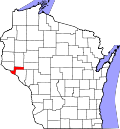
Location of Waterville, Wisconsin
Coordinates: 44°38′37″N92°3′23″W / 44.64361°N 92.05639°W / 44.64361; -92.05639
Country Flag of the United States.svg  United States
State Flag of Wisconsin.svg  Wisconsin
County Pepin
Area
  Total36.2 sq mi (93.7 km2)
  Land35.7 sq mi (92.5 km2)
  Water0.5 sq mi (1.2 km2)
Elevation
[1]
817 ft (249 m)
Population
 (2020)
  Total829
  Density24.0/sq mi (9.3/km2)
Time zone UTC-6 (Central (CST))
  Summer (DST) UTC-5 (CDT)
Area code(s) 715 & 534
FIPS code 55-84025 [2]
GNIS feature ID1584367 [1]

Waterville is a town in Pepin County, Wisconsin, United States. The population was 829 at the 2020 census. The unincorporated community of Arkansaw is located within the eastern portion of the town.

Contents

Geography

According to the United States Census Bureau, the town has a total area of 36.2 square miles (93.7 km2), of which, 35.7 square miles (92.5 km2) of it is land and 0.5 square miles (1.2 km2) of it (1.30%) is water.

Demographics

As of the census [2] of 2000, there were 859 people, 331 households, and 229 families residing in the town. The population density was 24.0 people per square mile (9.3/km2). There were 351 housing units at an average density of 9.8 per square mile (3.8/km2). The racial makeup of the town was 98.95% White, 0.12% Asian, 0.23% from other races, and 0.70% from two or more races. Hispanic or Latino of any race were 1.05% of the population.

Waterville had the highest percentage of people reporting Austrian ancestry in 2000 with 12.1% of its population. [3]

There were 331 households, out of which 31.4% had children under the age of 18 living with them, 58.9% were married couples living together, 6.0% had a female householder with no husband present, and 30.8% were non-families. 25.7% of all households were made up of individuals, and 12.7% had someone living alone who was 65 years of age or older. The average household size was 2.60 and the average family size was 3.17.

In the town, the population was spread out, with 26.0% under the age of 18, 7.6% from 18 to 24, 30.8% from 25 to 44, 20.3% from 45 to 64, and 15.4% who were 65 years of age or older. The median age was 38 years. For every 100 females, there were 118.0 males. For every 100 females age 18 and over, there were 117.8 males.

The median income for a household in the town was $37,292, and the median income for a family was $41,250. Males had a median income of $27,163 versus $19,861 for females. The per capita income for the town was $15,482. About 7.9% of families and 10.0% of the population were below the poverty line, including 10.2% of those under age 18 and 17.0% of those age 65 or over.

Related Research Articles

<span class="mw-page-title-main">Linden, California</span> Census-designated place in California, United States

Linden is a census-designated place (CDP) in San Joaquin County, California, United States. The population was 1,784 at the 2010 census, up from 1,103 at the 2000 census. The city is host of the Linden Cherry Festival each spring.

<span class="mw-page-title-main">Waterville, Iowa</span> City in Iowa, United States

Waterville is a city in Paint Creek Township, Allamakee County, Iowa, United States. The population was 109 at the time of the 2020 census.

<span class="mw-page-title-main">Waterville, Kansas</span> City in Marshall County, Kansas

Waterville is a city in Marshall County, Kansas, United States. As of the 2020 census, the population of the city was 658.

Moscow is a town in Somerset County, Maine, United States. The population was 475 at the 2020 census.

<span class="mw-page-title-main">Randolph, Minnesota</span> City in Minnesota, United States

Randolph is a city in Dakota County, Minnesota, United States. The population was 436 at the 2010 census.

<span class="mw-page-title-main">Waterville, Minnesota</span> City in Minnesota, United States

Waterville is a town in Le Sueur County, Minnesota, United States. The population was 1,868 at the 2010 census. It is close to Sakatah Lake State Park on the Cannon River.

<span class="mw-page-title-main">Vergas, Minnesota</span> City in Minnesota, United States

Vergas is a city in northern Otter Tail County, Minnesota, United States. The population was 348 at the 2020 census.

<span class="mw-page-title-main">Kenockee Township, Michigan</span> Civil township in Michigan, United States

Kenockee Township is a civil township of St. Clair County in the U.S. state of Michigan. The population was 2,405 at the 2020 Census.

<span class="mw-page-title-main">Waterville Valley, New Hampshire</span> Town in New Hampshire, United States

Waterville Valley is a New England town in Grafton County, New Hampshire, United States. The population was 508 at the 2020 census, up from 247 at the 2010 census.

<span class="mw-page-title-main">Quinby, South Carolina</span> Town in South Carolina, United States

Quinby is a town in Florence County, South Carolina, United States. The population was 932 at the 2010 census, up from 842 in 2000. It is part of the Florence Metropolitan Statistical Area.

<span class="mw-page-title-main">Waterville, Vermont</span> Town in Vermont, United States

Waterville is a town in Lamoille County, Vermont, United States. The population was 686 at the 2020 census.

<span class="mw-page-title-main">Waterville, Washington</span> Town in Washington, United States

Waterville is a town in and the county seat of Douglas County, Washington, United States which is known for its wheat industry. As a part of Douglas County, it is part of the Wenatchee-East Wenatchee metropolitan area. The population was 1,134 at the 2020 census.

<span class="mw-page-title-main">Oak Grove, Dodge County, Wisconsin</span> Town in Wisconsin, United States

Oak Grove is a town in Dodge County, Wisconsin, United States. The population was 1,126 at the 2000 census. The unincorporated community of Minnesota Junction is located in the town. The unincorporated community of Rolling Prairie is also located partially in the town.

Friendship is a town in Fond du Lac County, Wisconsin, United States. The population was 2,406 at the 2000 census. The unincorporated communities of Dexter and Van Dyne are located within the town.

<span class="mw-page-title-main">Hustisford (town), Wisconsin</span> Town in Wisconsin, United States

Hustisford is a town in Dodge County, Wisconsin, United States. The population was 1,379 at the 2000 census. Most of the town residents live in the village of Hustisford, within the town.

Lomira is a town in Dodge County, Wisconsin, United States. The population was 1,228 at the 2000 census. The Village of Lomira is located within the town. The unincorporated communities of Knowles and Nasbro are located in the town.

Lowell is a town in Dodge County, Wisconsin, United States. The population was 1,169 at the 2000 census. The Village of Lowell and the unincorporated community of North Lowell are located in the town.

Rosendale is a town in Fond du Lac County, Wisconsin, United States. The population was 783 at the 2000 census. The village of Rosendale is located partially within the town. The unincorporated communities of Rosendale Center and West Rosendale are also located in the town.

Wittenberg is a town in Shawano County, Wisconsin, United States. As of the 2000 census, the town had a total population of 894. The Village of Wittenberg is located within the town. The unincorporated community of Whitcomb is also located within the town.

<span class="mw-page-title-main">Oakland, Maine</span> Town in the state of Maine, United States

Oakland is a town in Kennebec County in the U.S. state of Maine. The population was 6,230 at the 2020 census. Oakland is 4 miles (6 km) west of Waterville and approximately 18 miles (29 km) north of Augusta, the state capital. Waterville and Augusta are service centers for Oakland, and many Oakland residents commute to jobs in those areas.

References

  1. 1 2 "US Board on Geographic Names". United States Geological Survey. October 25, 2007. Retrieved January 31, 2008.
  2. 1 2 "U.S. Census website". United States Census Bureau . Retrieved January 31, 2008.
  3. Austrian ancestry by city – ePodunk

43°01′12″N88°26′17″W / 43.02000°N 88.43806°W / 43.02000; -88.43806