Hewett, Wisconsin

Last updated

Hewett, Wisconsin
WIMap-doton-Hewett.png
Location of Hewett, Wisconsin
Coordinates: 44°33′44″N90°43′32″W / 44.56222°N 90.72556°W / 44.56222; -90.72556
Country Flag of the United States.svg  United States
State Flag of Wisconsin.svg  Wisconsin
County Clark
Area
  Total35.8 sq mi (92.7 km2)
  Land35.8 sq mi (92.6 km2)
  Water0.0 sq mi (0.1 km2)
Elevation
[1]
1,004 ft (306 m)
Population
 (2000)
  Total314
  Density8.8/sq mi (3.4/km2)
Time zone UTC-6 (Central (CST))
  Summer (DST) UTC-5 (CDT)
Area code(s) 715 & 534
FIPS code 55-34200 [2]
GNIS feature ID1583382 [1]

Hewett is a town in Clark County in the U.S. state of Wisconsin. The population was 314 at the 2000 census. The unincorporated community of Columbia is located in the town.

Contents

Geography

According to the United States Census Bureau, the town has a total area of 35.8 square miles (92.7 km2), of which, 35.8 square miles (92.6 km2) of it is land and 0.04 square miles (0.1 km2) of it (0.08%) is water.

Demographics

As of the census [2] of 2000, there were 314 people, 125 households, and 96 families residing in the town. The population density was 8.8 people per square mile (3.4/km2). There were 200 housing units at an average density of 5.6 per square mile (2.2/km2). The racial makeup of the town was 100.00% White. Hispanic or Latino of any race were 0.32% of the population.

There were 125 households, out of which 31.2% had children under the age of 18 living with them, 70.4% were married couples living together, 4.8% had a female householder with no husband present, and 22.4% were non-families. 15.2% of all households were made up of individuals, and 8.0% had someone living alone who was 65 years of age or older. The average household size was 2.51 and the average family size was 2.84.

In the town, the population was spread out, with 22.3% under the age of 18, 5.1% from 18 to 24, 32.2% from 25 to 44, 25.8% from 45 to 64, and 14.6% who were 65 years of age or older. The median age was 40 years. For every 100 females, there were 102.6 males. For every 100 females age 18 and over, there were 105.0 males.

The median income for a household in the town was $46,111, and the median income for a family was $47,500. Males had a median income of $31,750 versus $23,594 for females. The per capita income for the town was $18,039. About 2.0% of families and 1.2% of the population were below the poverty line, including none of those under the age of eighteen or sixty-five or over.

Related Research Articles

<span class="mw-page-title-main">Bargersville, Indiana</span> Town in Indiana, United States

Bargersville is a town in White River and Union townships, Johnson County, Indiana, United States. The population was 9,560 at the 2020 census.

<span class="mw-page-title-main">Sidney, Indiana</span> Town in Indiana, United States

Sidney is a town in Jackson Township, Kosciusko County, in the U.S. state of Indiana. The population was 83 at the 2010 census.

<span class="mw-page-title-main">Sorrento, Maine</span> Town in Maine, United States

Sorrento is a town in Hancock County, Maine, United States. The population was 279 at the 2020 census.

Woodville is a town in Penobscot County, Maine, United States. The population was 201 at the 2020 census.

<span class="mw-page-title-main">Smithfield, Maine</span> Town in the state of Maine, United States

Smithfield is a town in Somerset County, Maine, United States. The population was 925 at the 2020 census. The town was incorporated on February 29, 1840, making it the only town in Maine incorporated on Leap Day. The town was named after the Rev. Henry Smith, an early settler.

<span class="mw-page-title-main">Steuben, Maine</span> Town in the state of Maine, United States

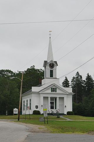
Steuben is a town in Washington County, Maine, United States. Incorporated in 1795, it was named after Baron Friedrich Wilhelm von Steuben, the Inspector General of the U.S. Army during the Revolutionary War. The population was 1,129 at the 2020 census.

<span class="mw-page-title-main">Hanover, Ohio</span> Village in Ohio, United States

Hanover is a village in Licking County, Ohio, United States. The population was 1,270 at the 2020 census. The village lies along Ohio State Route 16.

<span class="mw-page-title-main">South Prairie, Washington</span> Town in Washington, United States

South Prairie is a town in Pierce County, Washington, United States. The population was 373 at the 2020 census.

<span class="mw-page-title-main">Matoaka, West Virginia</span> Census-designated place in West Virginia, United States

Matoaka is a census-designated place in Mercer County, West Virginia, United States. The population was 173 at the 2020 census. It is part of the Bluefield, WV-VA micropolitan area which has a population of 100,093. This town is named for Chief Powhatan's daughter Matoaka who was better known by her nickname "Pocahontas". Matoaka became an unincorporated town when it voted to dissolve its charter in May 2018.

<span class="mw-page-title-main">Clinton, Barron County, Wisconsin</span> Town in Wisconsin, United States

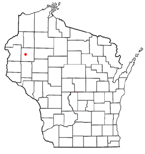
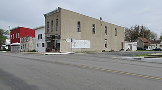
Clinton is a town in Barron County, in the U.S. state of Wisconsin. The population was 879 at the 2010 census. The unincorporated community of Poskin is located in Clinton, along U.S. Route 8.

<span class="mw-page-title-main">Levis, Wisconsin</span> Town in Wisconsin, United States

Levis is a town in Clark County in the U.S. state of Wisconsin. The population was 504 at the 2000 census.

<span class="mw-page-title-main">Castle Rock, Wisconsin</span> Town in Wisconsin, United States

Castle Rock is a town in Grant County, Wisconsin, United States. The population was 314 at the 2000 census. The unincorporated community of Castle Rock is located in the town.

<span class="mw-page-title-main">Guenther, Wisconsin</span> Town in Wisconsin, United States

Guenther is a town in Marathon County, Wisconsin, United States. It is part of the Wausau, Wisconsin Metropolitan Statistical Area. The population was 341 at the 2010 census. The unincorporated communities of Ashley and Rocky Corners are located partially in the town.

<span class="mw-page-title-main">Beaver, Marinette County, Wisconsin</span> Town in Wisconsin, United States

Beaver is a town in Marinette County, Wisconsin, United States. The population was 1,123 at the 2000 census. The unincorporated community of Beaver is located in the town.

<span class="mw-page-title-main">Little Rice, Wisconsin</span> Town in Wisconsin, United States

Little Rice is a town in Oneida County, Wisconsin, United States. The population was 314 at the 2000 census. The unincorporated community of McCord is located in the town.

<span class="mw-page-title-main">Emery, Wisconsin</span> Town in Wisconsin, United States

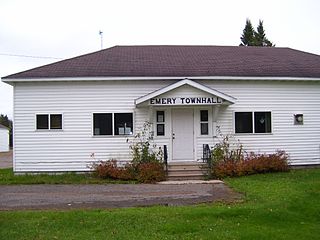
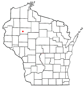
Emery is a town in Price County, Wisconsin, United States. The population was 325 at the 2000 census. The unincorporated community of Dover is located in the town.

<span class="mw-page-title-main">Stubbs, Wisconsin</span> Town in Wisconsin, United States

Stubbs is a town in Rusk County, Wisconsin, United States. The population was 587 at the 2000 census. The unincorporated community of Apollonia is located in the town.

<span class="mw-page-title-main">Ridgeway, Ohio</span> Village in Ohio, United States

Ridgeway is a village in Hardin and Logan counties in the U.S. state of Ohio. The population was 314 at the 2020 census.

Hammond is a town in St. Croix County, Wisconsin, United States. The population was 947 at the 2000 census. The Village of Hammond is located within the town.

<span class="mw-page-title-main">Viroqua (town), Wisconsin</span> Town in Wisconsin, United States

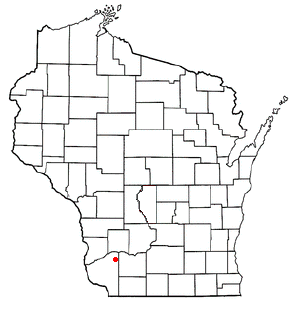
Viroqua is a town in Vernon County, Wisconsin, United States. The population was 1,560 at the 2000 census. The City of Viroqua is located within the town.

References

  1. 1 2 "US Board on Geographic Names". United States Geological Survey. October 25, 2007. Retrieved January 31, 2008.
  2. 1 2 "U.S. Census website". United States Census Bureau . Retrieved January 31, 2008.