Hendren, Wisconsin

Last updated

Hendren, Wisconsin
Farmland in Hendren Clark County Wisconsin.jpg
Rolling farmland between the mounds on the north end of Hendren
WIMap-doton-Hendren.png
Location of Hendren, Wisconsin
Coordinates: 44°43′52″N90°43′49″W / 44.73111°N 90.73028°W / 44.73111; -90.73028
Country Flag of the United States.svg  United States
State Flag of Wisconsin.svg  Wisconsin
County Clark
Area
  Total35.9 sq mi (93.0 km2)
  Land35.8 sq mi (92.7 km2)
  Water0.1 sq mi (0.3 km2)
Elevation
[1]
1,142 ft (348 m)
Population
 (2010)
  Total499
  Density14/sq mi (5.4/km2)
Time zone UTC-6 (Central (CST))
  Summer (DST) UTC-5 (CDT)
Area code(s) 715 & 534
FIPS code 55-33900 [2]
GNIS feature ID1583377 [1]

Hendren is a town in Clark County in the U.S. state of Wisconsin. The population was 499 at the 2010 census. [3] The unincorporated communities of Tioga and Willard are located in the town.

Contents

History

Hendren was named for William T. Hendren, a member of the clergy who helped organize churches in the area. [4]

Geography

The Town of Hendren is located in west-central Clark County. According to the United States Census Bureau, the town has a total area of 35.9 square miles (93.0 km2), of which 35.8 square miles (92.7 km2) is land and 0.1 square miles (0.3 km2), or 0.33%, is water. [3]

Demographics

Hendren's town shed, on the north side of Willard Hendren Wisconsin Town Shed.jpg
Hendren's town shed, on the north side of Willard

As of the census [2] of 2000, there were 513 people, 197 households, and 131 families residing in the town. The population density was 14.3 people per square mile (5.5/km2). There were 247 housing units at an average density of 6.9 per square mile (2.7/km2). The racial makeup of the town was 98.64% White, 0.39% Pacific Islander, 0.97% from other races. Hispanic or Latino of any race were 1.56% of the population.

There were 197 households, out of which 29.9% had children under the age of 18 living with them, 58.4% were married couples living together, 4.6% had a female householder with no husband present, and 33.0% were non-families. 28.4% of all households were made up of individuals, and 13.7% had someone living alone who was 65 years of age or older. The average household size was 2.60 and the average family size was 3.26.

In the town, the population was spread out, with 28.3% under the age of 18, 4.7% from 18 to 24, 25.0% from 25 to 44, 23.8% from 45 to 64, and 18.3% who were 65 years of age or older. The median age was 41 years. For every 100 females, there were 112.0 males. For every 100 females age 18 and over, there were 105.6 males.

The median income for a household in the town was $27,353, and the median income for a family was $37,917. Males had a median income of $28,333 versus $20,357 for females. The per capita income for the town was $13,318. About 15.6% of families and 18.6% of the population were below the poverty line, including 28.2% of those under age 18 and 11.3% of those age 65 or over.

Related Research Articles

<span class="mw-page-title-main">Bayview, Wisconsin</span> Town in Wisconsin, United States

Bayview is a town in Bayfield County, Wisconsin, United States. The population was 487 at the 2010 census. The unincorporated community of Sioux is located in the town.

<span class="mw-page-title-main">Beaver, Clark County, Wisconsin</span> Town in Wisconsin, United States

Beaver is a town in Clark County in the U.S. state of Wisconsin. The population was 885 at the 2010 census.

<span class="mw-page-title-main">Butler, Clark County, Wisconsin</span> Town in Wisconsin, United States

Butler is a town in Clark County in the U.S. state of Wisconsin. The population was 96 at the 2010 census.

<span class="mw-page-title-main">Eaton, Clark County, Wisconsin</span> Town in Wisconsin, United States

Eaton is a town in Clark County in the U.S. state of Wisconsin. The population was 712 at the 2010 census.

Foster is a town in Clark County in the U.S. state of Wisconsin. The population was 95 at the 2010 census, unchanged from the 2000 census.

<span class="mw-page-title-main">Fremont, Clark County, Wisconsin</span> Town in Wisconsin, United States

Fremont is a town in Clark County in the U.S. state of Wisconsin. The population was 1,265 at the 2010 census. The unincorporated community of Chili is located in the community.

<span class="mw-page-title-main">Grant, Clark County, Wisconsin</span> Town in Wisconsin, United States

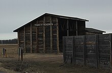
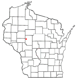
Grant is a town in Clark County in the U.S. state of Wisconsin. The population was 916 at the 2010 census. The ghost towns of Kurth and Maple Works were located in the town.

<span class="mw-page-title-main">Green Grove, Wisconsin</span> Town in Wisconsin, United States

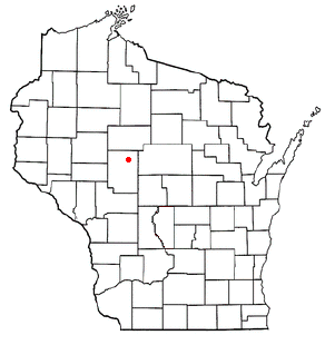
Green Grove is a town in Clark County in the U.S. state of Wisconsin. The population was 756 at the 2010 census, down from 902 at the 2000 census. The unincorporated communities of Atwood and Bright are located in the town.

<span class="mw-page-title-main">Mayville, Clark County, Wisconsin</span> Town in Wisconsin, United States

Mayville is a town in Clark County in the U.S. state of Wisconsin. The population was 919 at the 2000 census.

<span class="mw-page-title-main">Pine Valley, Wisconsin</span> Town in Wisconsin, United States

Pine Valley is a town in Clark County in the U.S. state of Wisconsin. The population was 1,121 at the 2000 census. The unincorporated community of Sidney is located in the town.

<span class="mw-page-title-main">Weston, Clark County, Wisconsin</span> Town in Wisconsin, United States

Weston is a town in Clark County in the U.S. state of Wisconsin. The population was 638 at the 2000 census. The unincorporated communities of Christie and Globe are located in the town.

<span class="mw-page-title-main">Springvale, Columbia County, Wisconsin</span> Town in Wisconsin, United States

Springvale is a town in Columbia County, Wisconsin, United States. The population was 550 at the 2000 census.

<span class="mw-page-title-main">Marietta, Wisconsin</span> Town in Wisconsin, United States

Marietta is a town in Crawford County, Wisconsin, United States. The population was 510 at the 2000 census. The unincorporated community of Easter Rock is located in the town. The unincorporated community of Boydtown is located partially in the town.

<span class="mw-page-title-main">Perry, Wisconsin</span> Town in Wisconsin, United States

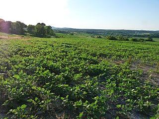
Perry is a town in Dane County, Wisconsin, United States. The population was 670 at the 2000 census. The unincorporated communities of Daleyville and Forward are located in the town.

<span class="mw-page-title-main">Brighton, Marathon County, Wisconsin</span> Town in Wisconsin, United States

Brighton is a town in Marathon County, Wisconsin, United States. It is part of the Wausau, Wisconsin Metropolitan Statistical Area. The population was 620 at the 2020 census.

<span class="mw-page-title-main">Burnside, Wisconsin</span> Town in Wisconsin, United States

Burnside is a town in Trempealeau County, Wisconsin, in the United States. As of the 2000 census, the population was 529. The ghost town of New City was located in the town. The town was named after civil war general Ambrose Burnside.

<span class="mw-page-title-main">Sugar Creek, Wisconsin</span> Town in Wisconsin, United States

Sugar Creek is a town in Walworth County, Wisconsin, United States. The population was 3,902 at the 2020 census. The unincorporated communities of Millard and Tibbets are located in the town. The unincorporated community of Abells Corners is also located partially in the town.

Colby is a town in Clark County in the U.S. state of Wisconsin. The population was 874 at the 2010 census.

<span class="mw-page-title-main">Unity, Wisconsin</span> Village in Wisconsin, United States

Unity is a village in Clark and Marathon counties in the U.S. state of Wisconsin. It is part of the Wausau, Wisconsin Metropolitan Statistical Area. The population was 343 at the 2010 census. Of this, 204 were in Marathon County, and 139 were in Clark County. The village is located in northeastern town of Unity in Clark County and northwestern town of Brighton in Marathon County.

Almond is a town in Portage County, Wisconsin, United States. The population was 679 at the 2000 census. The unincorporated community of West Almond is located in the town.

References

  1. 1 2 "US Board on Geographic Names". United States Geological Survey. October 25, 2007. Retrieved January 31, 2008.
  2. 1 2 "U.S. Census website". United States Census Bureau . Retrieved January 31, 2008.
  3. 1 2 "Geographic Identifiers: 2010 Demographic Profile Data (G001): Hendren town, Clark County, Wisconsin". U.S. Census Bureau, American Factfinder. Retrieved September 29, 2015.[ dead link ]
  4. Callary, Edward. Place Names of Wisconsin. Madison, WI: University of Wisconsin Press. p. 118. ISBN   978-0-299-30964-0.