Green Grove, Wisconsin

Last updated
Green Grove, Wisconsin
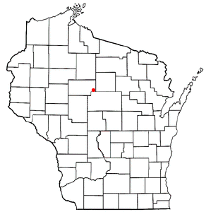
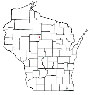
WIMap-doton-Green Grove.png
Location of Green Grove, Wisconsin
Coordinates: 44°54′7″N90°29′27″W / 44.90194°N 90.49083°W / 44.90194; -90.49083 Coordinates: 44°54′7″N90°29′27″W / 44.90194°N 90.49083°W / 44.90194; -90.49083
Country Flag of the United States.svg  United States
State Flag of Wisconsin.svg  Wisconsin
County Clark
Area
  Total36.2 sq mi (93.8 km2)
  Land36.0 sq mi (93.2 km2)
  Water0.2 sq mi (0.5 km2)
Elevation
[1]
1,276 ft (389 m)
Population
 (2010)
  Total756
  Density21/sq mi (8.1/km2)
Time zone UTC-6 (Central (CST))
  Summer (DST) UTC-5 (CDT)
Area code(s) 715 & 534
FIPS code 55-31275 [2]
GNIS feature ID1583317 [1]

Green Grove is a town in Clark County in the U.S. state of Wisconsin. The population was 756 at the 2010 census, [3] down from 902 at the 2000 census. The unincorporated communities of Atwood and Bright are located in the town.

Contents

Geography

The town of Green Grove is in northeastern Clark County. It is bordered to the northwest by the city of Owen and at its northeast corner by the village of Curtiss. According to the United States Census Bureau, the town has a total area of 36.2 square miles (93.8 km2), of which 36.0 square miles (93.2 km2) is land and 0.2 square miles (0.5 km2), or 0.58%, is water. [3]

Demographics

As of the census [2] of 2000, there were 902 people, 225 households, and 177 families residing in the town. The population density was 24.7 people per square mile (9.5/km2). There were 236 housing units at an average density of 6.5 per square mile (2.5/km2). The racial makeup of the town was 98.89% White, 0.22% Native American, 0.22% Asian, and 0.67% from two or more races. Hispanic or Latino of any race were 0.44% of the population.

There were 225 households, out of which 39.1% had children under the age of 18 living with them, 68.9% were married couples living together, 5.8% had a female householder with no husband present, and 20.9% were non-families. 16.0% of all households were made up of individuals, and 8.9% had someone living alone who was 65 years of age or older. The average household size was 3.11 and the average family size was 3.57.

In the town, the population was spread out, with 27.4% under the age of 18, 6.2% from 18 to 24, 21.7% from 25 to 44, 18.7% from 45 to 64, and 25.9% who were 65 years of age or older. The median age was 41 years. For every 100 females, there were 96.1 males. For every 100 females age 18 and over, there were 96.7 males.

The median income for a household in the town was $37,667, and the median income for a family was $41,023. Males had a median income of $32,120 versus $19,063 for females. The per capita income for the town was $14,067. About 10.4% of families and 13.1% of the population were below the poverty line, including 18.7% of those under age 18 and 14.8% of those age 65 or over.

Related Research Articles

<span class="mw-page-title-main">West Gardiner, Maine</span> Town in the state of Maine, United States

West Gardiner is a town in Kennebec County, Maine, United States. The population was 3,671 at the 2020 census. West Gardiner is included in the Augusta, Maine micropolitan New England City and Town Area.

<span class="mw-page-title-main">Clarks Grove, Minnesota</span> City in Minnesota, United States

Clarks Grove is a city in Freeborn County, Minnesota, United States. The population was 706 at the 2010 census.

<span class="mw-page-title-main">Diamond, Missouri</span> City in Missouri, United States

Diamond is a city in north central Newton County, Missouri, United States, located southeast of Joplin. The population was 902 at the 2010 census. It is part of the Joplin, Missouri, Metropolitan Statistical Area. Diamond is primarily renowned as the birthplace of George Washington Carver.

<span class="mw-page-title-main">Clarks Summit, Pennsylvania</span> Borough in Pennsylvania, United States

Clarks Summit is a borough in Lackawanna County, northwest of Scranton in Northeastern Pennsylvania. The population was 5,108 at the 2020 census. It is also the northern terminus of the Pennsylvania Turnpike Northeast Extension, I-476.

<span class="mw-page-title-main">Cedar Grove, West Virginia</span> Town in West Virginia, United States

Cedar Grove is a town in Kanawha County, West Virginia, United States. The population was 714 at the 2020 census. Cedar Grove was incorporated in 1902. Its name is derived from the time the town was established, when a large juniper forest, misidentified as cedars by early settlers, was growing at that location. Cedar Grove is the site of Fort Kelley and the oldest settlement in the Kanawha Valley, dating from 1773. Landmarks located here include the Tompkins Home (1844) and the Old Brick Church (1853). The current mayor is James Hudnall.

<span class="mw-page-title-main">Pine Grove, West Virginia</span> Town in West Virginia, United States

Pine Grove is a town in Wetzel County, West Virginia, United States. The population was 363 at the 2020 census. The community was named for a grove of pine trees near the original town site.

<span class="mw-page-title-main">Butler, Clark County, Wisconsin</span> Town in Wisconsin, United States

Butler is a town in Clark County in the U.S. state of Wisconsin. The population was 96 at the 2010 census.

Foster is a town in Clark County in the U.S. state of Wisconsin. The population was 95 at the 2010 census, unchanged from the 2000 census.

<span class="mw-page-title-main">Hendren, Wisconsin</span> Town in Wisconsin, United States

Hendren is a town in Clark County in the U.S. state of Wisconsin. The population was 499 at the 2010 census. The unincorporated communities of Tioga and Willard are located in the town.

<span class="mw-page-title-main">Reseburg, Wisconsin</span> Town in Wisconsin, United States

Reseburg is a town in Clark County in the U.S. state of Wisconsin. The population was 740 at the 2000 census. the unincorporated community of Reseburg is located in the town.

<span class="mw-page-title-main">Jefferson, Green County, Wisconsin</span> Town in Wisconsin, United States

Jefferson is a town in Green County, Wisconsin, United States. The population was 1,212 at the 2000 census. The census-designated place of Juda is located in the town. The unincorporated community of Twin Grove is also located in the town.

<span class="mw-page-title-main">Spring Grove, Wisconsin</span> Town in Wisconsin, United States

Spring Grove is a town in Green County, Wisconsin, United States. The population was 861 at the 2000 census. The unincorporated community of Oakley is located in the town. The ghost towns of Clarence and Tyrone are also located in the town.

<span class="mw-page-title-main">Elk Grove, Wisconsin</span> Town in Wisconsin, United States

Elk Grove is a town in Lafayette County, Wisconsin, United States. The population was 551 at the 2010 census, up from 463 at the 2000 census. The unincorporated communities of Elk Grove, Ipswich, and Meekers Grove are located in the town.

<span class="mw-page-title-main">Emmet, Marathon County, Wisconsin</span> Town in Wisconsin, United States

The Town of Emmet is located in Marathon County, Wisconsin, United States. It is part of the Wausau, Wisconsin Metropolitan Statistical Area. The population was 931 at the 2010 census. The unincorporated community of Halder is located in the town.

<span class="mw-page-title-main">Grover, Marinette County, Wisconsin</span> Town in Wisconsin, United States

Grover is a town in Marinette County, Wisconsin, United States. The population was 1,768 at the 2010 census. The unincorporated communities of Harmony, May Corner, and Wilcox are located in the town. The unincorporated community of County Line is also located partially in the town.

<span class="mw-page-title-main">Pelican, Wisconsin</span> Town in Wisconsin, United States

Pelican is a town in Oneida County, Wisconsin, United States. The population was 2,902 at the 2000 census. The unincorporated community of Malvern is located in the town. The town took its name from Pelican Lake.

<span class="mw-page-title-main">Sugar Creek, Wisconsin</span> Town in Wisconsin, United States

Sugar Creek is a town in Walworth County, Wisconsin, United States. The population was 3,902 at the 2020 census. The unincorporated communities of Millard and Tibbets are located in the town. The unincorporated community of Abells Corners is also located partially in the town.

Colby is a town in Clark County in the U.S. state of Wisconsin. The population was 874 at the 2010 census.

The Town of Patch Grove is located in Grant County, Wisconsin, United States. The population was 390 at the 2000 census. The Village of Patch Grove is located within the town.

<span class="mw-page-title-main">Green Lake (town), Wisconsin</span> Town in Wisconsin, United States

Green Lake is a town in Green Lake County, Wisconsin, United States. The population was 1,258 at the 2000 census. The town is located on the south side of Green Lake, with the city of Green Lake on the north side. The unincorporated communities of Forest Glen Beach, Greenwyck, Indian Hills, Sandstone Bluff, Spring Grove, Tuleta Hills, and Utley are located in the town.

References

  1. 1 2 "US Board on Geographic Names". United States Geological Survey. 2007-10-25. Retrieved 2008-01-31.
  2. 1 2 "U.S. Census website". United States Census Bureau . Retrieved 2008-01-31.
  3. 1 2 "Geographic Identifiers: 2010 Demographic Profile Data (G001): Green Grove town, Clark County, Wisconsin". U.S. Census Bureau, American Factfinder. Retrieved September 29, 2015.[ dead link ]