Chili, Wisconsin | |
|---|---|
Census-designated place | |
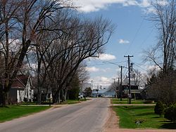
 County Y runs through town | |
 Chili | |
| Coordinates: 44°37′37″N90°21′23″W / 44.62694°N 90.35639°W | |
| Country | United States |
| State | Wisconsin |
| County | Clark |
| Town | Fremont |
| Area | |
• Total | 1.301 sq mi (3.37 km2) |
| • Land | 1.287 sq mi (3.33 km2) |
| • Water | 0.014 sq mi (0.04 km2) |
| Elevation | 1,234 ft (376 m) |
| Population (2010) | |
• Total | 226 |
| • Density | 170/sq mi (67/km2) |
| Time zone | UTC-6 (Central (CST)) |
| • Summer (DST) | UTC-5 (CDT) |
| ZIP code | 54420 |
| Area codes | 715 & 534 |
| GNIS feature ID | 1563021 [1] |
Chili is an unincorporated census-designated place in the Town of Fremont in Clark County, Wisconsin, United States. Chili is west-southwest of Marshfield. Chili has a post office with ZIP code 54420. [2] As of the 2010 census, its population was 226. [3]