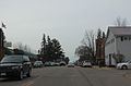
Greenwood, Wisconsin

Last updated

Greenwood, Wisconsin
Greenwood Wisconsin Downtown Looking South WIS73.jpg
Looking south in downtown Greenwood on WIS73
Clark County Wisconsin Incorporated and Unincorporated areas Greenwood Highlighted.svg
Location of Greenwood in Clark County, Wisconsin.
Coordinates: 44°46′4″N90°35′56″W / 44.76778°N 90.59889°W / 44.76778; -90.59889
Country Flag of the United States.svg  United States
State Flag of Wisconsin.svg  Wisconsin
County Clark
Area
[1]
  Total2.76 sq mi (7.15 km2)
  Land2.68 sq mi (6.93 km2)
  Water0.08 sq mi (0.22 km2)
Elevation
[2]
1,181 ft (360 m)
Population
 (2010) [3]
  Total1,026
  Estimate 
(2019) [4]
998
  Density372.94/sq mi (143.97/km2)
Time zone UTC-6 (Central (CST))
  Summer (DST) UTC-5 (CDT)
Area code(s) 715 & 534
FIPS code 55-31575 [5]
GNIS feature ID1565856 [2]
Website greenwoodwi.com

Greenwood is a city in Clark County in the U.S. state of Wisconsin. The population was 1,026 at the 2010 census.

Contents

Geography

Greenwood is located at 44°46′4″N90°35′56″W / 44.76778°N 90.59889°W / 44.76778; -90.59889 (44.767826, -90.598959). [6]

According to the United States Census Bureau, the city has a total area of 2.86 square miles (7.41 km2), of which, 2.78 square miles (7.20 km2) is land and 0.08 square miles (0.21 km2) is water. [7]

The town has a peace memorial, created by Ernest Durig from an artificial stone made using concrete and fine white sand. [8] Unveiled in 1937, it was restored in 1982, [9] and sits adjacent to the 1934 City Hall, on the corner of Main Street and Division Street. [10]

Demographics

Historical population
CensusPop.Note
1900 708
1910 665−6.1%
1920 76114.4%
1930 651−14.5%
1940 77619.2%
1950 95623.2%
1960 1,0418.9%
1970 1,036−0.5%
1980 1,1248.5%
1990 969−13.8%
2000 1,07911.4%
2010 1,026−4.9%
2019 (est.)998 [4] −2.7%
U.S. Decennial Census [11]

2010 census

As of the census [3] of 2010, there were 1,026 people, 464 households, and 259 families living in the city. The population density was 369.1 inhabitants per square mile (142.5/km2). There were 520 housing units at an average density of 187.1 per square mile (72.2/km2). The racial makeup of the city was 97.5% White, 0.9% African American, 0.4% Native American, 0.1% Asian, 0.7% from other races, and 0.5% from two or more races. Hispanic or Latino of any race were 1.5% of the population.

There were 464 households, of which 24.4% had children under the age of 18 living with them, 43.8% were married couples living together, 7.5% had a female householder with no husband present, 4.5% had a male householder with no wife present, and 44.2% were non-families. 36.6% of all households were made up of individuals, and 16.2% had someone living alone who was 65 years of age or older. The average household size was 2.18 and the average family size was 2.87.

The median age in the city was 44.1 years. 22.5% of residents were under the age of 18; 7.6% were between the ages of 18 and 24; 21.2% were from 25 to 44; 27.1% were from 45 to 64; and 21.7% were 65 years of age or older. The gender makeup of the city was 48.1% male and 51.9% female.

2000 census

As of the census [5] of 2000, there were 1,079 people, 468 households, and 287 families living in the city. The population density was 381.9 people per square mile (147.2/km2). There were 502 housing units at an average density of 177.7 per square mile (68.5/km2). The racial makeup of the city was 99.17% White, 0.19% Native American, 0.09% Asian, 0.09% from other races, and 0.46% from two or more races. Hispanic or Latino of any race were 1.11% of the population.

There were 468 households, out of which 27.8% had children under the age of 18 living with them, 50.9% were married couples living together, 6.4% had a female householder with no husband present, and 38.5% were non-families. 34.2% of all households were made up of individuals, and 19.2% had someone living alone who was 65 years of age or older. The average household size was 2.27 and the average family size was 2.93.

In the city, the population was spread out, with 23.6% under the age of 18, 7.5% from 18 to 24, 28.5% from 25 to 44, 18.6% from 45 to 64, and 21.8% who were 65 years of age or older. The median age was 38 years. For every 100 females, there were 93.7 males. For every 100 females age 18 and over, there were 93.9 males.

The median income for a household in the city was $32,917, and the median income for a family was $43,438. Males had a median income of $33,750 versus $22,132 for females. The per capita income for the city was $18,841. About 5.7% of families and 9.3% of the population were below the poverty line, including 13.1% of those under age 18 and 11.1% of those age 65 or over.

Notable people

Images

Related Research Articles

<span class="mw-page-title-main">Westville, Florida</span> Town in the state of Florida, United States

Westville is a town in Holmes County, Florida, United States. The Town of Westville is part of the Florida Panhandle in North Florida. As of the 2020 census, the town had a population of 261, down from 289 at the 2010 census. From 2010 to 2020, Westville's population growth percentage was -9.7%.

<span class="mw-page-title-main">Mingo, Iowa</span> City in Iowa, United States

Mingo is a city in Jasper County, Iowa, United States. The population was 302 at the time of the 2020 census.

<span class="mw-page-title-main">Avon, Montana</span> CDP in Montana, United States

Avon is a census-designated place (CDP) in Powell County, Montana, United States. The population was 124 at the 2000 census. The town sits along the Little Blackfoot River, and serves as a gateway to the Beaverhead-Deerlodge National Forest.

<span class="mw-page-title-main">Owen, Wisconsin</span> City in Wisconsin, United States

Owen is a city in Clark County in the U.S. state of Wisconsin. The population was 940 at the 2010 census. Owen is located directly east of the village of Withee, which is about half the size of Owen.

<span class="mw-page-title-main">Schofield, Wisconsin</span> City in Wisconsin, United States

Schofield is a city in Marathon County, Wisconsin, United States. It is part of the Wausau, Wisconsin Metropolitan Statistical Area. The population was 2,157 at the 2020 census. The city was named for William Scholfield, who came to the area in the 1851 to open a sawmill. The city has since dropped the "L" from its name.

<span class="mw-page-title-main">Park Falls, Wisconsin</span> City in Wisconsin, United States

Park Falls is a city in Price County, Wisconsin, United States. The population was 2,462 at the 2010 census. Located in the woods of north central Wisconsin, primarily the Chequamegon National Forest, Park Falls is a small community divided by the North Fork of the Flambeau River, a popular destination for fishing, canoeing and whitewater rafting.

<span class="mw-page-title-main">Phillips, Wisconsin</span> City in Wisconsin, United States

Phillips is a city and the county seat of Price County, Wisconsin, United States. The population was 1,478 at the 2010 census.

<span class="mw-page-title-main">Lublin, Wisconsin</span> Village in Wisconsin, United States

Lublin is a village in Taylor County, Wisconsin, United States. The population was 118 at the 2010 census.

<span class="mw-page-title-main">Pittsville, Wisconsin</span> City in Wisconsin, United States

Pittsville is a city in Wood County, Wisconsin, United States. The population was 874 at the 2010 census.

Loyal is a town in Clark County in the U.S. state of Wisconsin. The population was 787 at the 2000 census. The City of Loyal is located within the town. The unincorporated community of Spokeville is also located partially in the town.

<span class="mw-page-title-main">Mason, Wisconsin</span> Village in Wisconsin, United States

Mason is a village in Bayfield County, Wisconsin, United States. The population was 93 at the 2010 census. The village is located within the Town of Mason.

<span class="mw-page-title-main">Loyal, Wisconsin</span> City in Wisconsin, United States

Loyal is a city in Clark County in the U.S. state of Wisconsin. The population was 1,261 at the 2010 census. The city is located within the Town of Loyal, though it is politically independent.

<span class="mw-page-title-main">Unity, Wisconsin</span> Village in Wisconsin, United States

Unity is a village in Clark and Marathon counties in the U.S. state of Wisconsin. It is part of the Wausau, Wisconsin Metropolitan Statistical Area. The population was 343 at the 2010 census. Of this, 204 were in Marathon County, and 139 were in Clark County. The village is located in northeastern town of Unity in Clark County and northwestern town of Brighton in Marathon County.

<span class="mw-page-title-main">Withee, Wisconsin</span> Village in Wisconsin, United States

Withee is a village in Clark County in the U.S. state of Wisconsin. The population was 487 at the 2010 census. The village is located mostly within the Town of Hixon, with a small portion extending south into the Town of Longwood.

<span class="mw-page-title-main">Fairchild, Wisconsin</span> Village in Wisconsin, United States

Fairchild is a village in Eau Claire County, Wisconsin, United States. The population was 550 at the 2010 census. The village is located within the Town of Fairchild.

<span class="mw-page-title-main">Mount Hope, Wisconsin</span> Village in Wisconsin, United States

Mount Hope is a village in Grant County, Wisconsin, United States. The population was 225 at the 2010 census. The village is located within the Town of Mount Hope.

<span class="mw-page-title-main">Melrose, Wisconsin</span> Village in Wisconsin, United States

Melrose is a village in Jackson County, Wisconsin, United States. The population was 503 at the 2010 census. The village is located within the Town of Melrose.

<span class="mw-page-title-main">Necedah, Wisconsin</span> Village in Wisconsin, United States

Necedah is a village in Juneau County, Wisconsin, United States. The population was 916 at the 2020 census. The village is located within the Town of Necedah.

<span class="mw-page-title-main">Hillsboro, Wisconsin</span> City in Wisconsin, United States

Hillsboro is a city in Vernon County, Wisconsin, United States. The population was 1,397 at the 2020 Census. The city is located within the Town of Hillsboro. Hillsboro is known as the Czech Capital of Wisconsin.

<span class="mw-page-title-main">Fort Fairfield (CDP), Maine</span> Census-designated place in Maine, United States

Fort Fairfield is a census-designated place (CDP) comprising the main village within the town of Fort Fairfield in Aroostook County, Maine, United States. The population of the CDP was 1,825 at the 2010 census, out of a population of 3,496 for the entire town.

References

  1. "2019 U.S. Gazetteer Files". United States Census Bureau. Retrieved August 7, 2020.
  2. 1 2 "US Board on Geographic Names". United States Geological Survey. October 25, 2007. Retrieved January 31, 2008.
  3. 1 2 "U.S. Census website". United States Census Bureau . Retrieved November 18, 2012.
  4. 1 2 "Population and Housing Unit Estimates". United States Census Bureau. May 24, 2020. Retrieved May 27, 2020.
  5. 1 2 "U.S. Census website". United States Census Bureau . Retrieved January 31, 2008.
  6. "US Gazetteer files: 2010, 2000, and 1990". United States Census Bureau. February 12, 2011. Retrieved April 23, 2011.
  7. "US Gazetteer files 2010". United States Census Bureau. Archived from the original on January 25, 2012. Retrieved November 18, 2012.
  8. "Greenwood, Wisconsin's Peace Memorial" . Retrieved July 31, 2016.
  9. Garbush, Florence (August 4, 1982). "Peace monument part of Greenwood's history". Eau Claire Leader Telegram. p. 28.
  10. 44°46′02″N90°35′53″W / 44.767143°N 90.597952°W
  11. "Census of Population and Housing". Census.gov. Retrieved June 4, 2015.