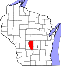
Easton, Adams County, Wisconsin

Last updated
Easton, Wisconsin
Adams County Wisconsin incorporated and unincorporated areas Easton highlighted.svg
Location in Adams County and the state of Wisconsin.
USA Wisconsin location map.svg
Red pog.svg
Easton
Usa edcp location map.svg
Red pog.svg
Easton
Coordinates: 43°50′41″N89°47′33″W / 43.84472°N 89.79250°W / 43.84472; -89.79250
Country Flag of the United States.svg  United States
State Flag of Wisconsin.svg  Wisconsin
County Adams
Area
  Total36.1 sq mi (93.6 km2)
  Land36.1 sq mi (93.4 km2)
  Water0.08 sq mi (0.2 km2)
Elevation
[1]
961 ft (293 m)
Population
 (2010)
  Total1,130
  Density31/sq mi (12.1/km2)
Time zone UTC-6 (Central (CST))
  Summer (DST) UTC-5 (CDT)
Area code 608
FIPS code 55-22000 [2]
GNIS feature ID1583117 [1]

Easton is a town in Adams County in the U.S. state of Wisconsin. The population was 1,130 at the 2010 census. [3] The unincorporated communities of Brookside and White Creek are located in the town.

Contents

Geography

According to the United States Census Bureau, the town has a total area of 36.1 square miles (93.6 km2), of which 36.1 square miles (93.4 km2) is land and 0.077 square miles (0.2 km2), or 0.26%, is water. [3]

Demographics

As of the census [2] of 2000, there were 1,194 people, 486 households, and 325 families residing in the town. The population density was 33.1 people per square mile (12.8/km2). There were 821 housing units at an average density of 22.7 per square mile (8.8/km2). The racial makeup of the town was 97.57% White, 0.84% African American, 0.17% Native American, 0.17% Asian, 0.25% from other races, and 1.01% from two or more races. Hispanic or Latino of any race were 1.59% of the population. No Pacific Islanders live in Easton.

There were 486 households, out of which 28.0% had children under the age of 18 living with them, 53.5% were married couples living together, 7.4% had a female householder with no husband present, and 33.1% were non-families. 27.4% of all households were made up of individuals, and 11.9% had someone living alone who was 65 years of age or older. The average household size was 2.46 and the average family size was three people.

In the town, the population was spread out, with 26.6% under the age of 18, 5.9% from 18 to 24, 25.0% from 25 to 44, 26.3% from 45 to 64, and 16.1% who were 65 years of age or older. The median age was 39 years. For every 100 females, there were 103.8 males. For every 100 females age 18 and over, there were 100.9 males.

The median income for a household in the town was $30,469, and the median income for a family was $35,043. Males had a median income of $32,778 versus $21,667 for females. The per capita income for the town was $15,011. 11.2% of the population and 7.7% of families were below the poverty line. 14% of those under the age of 18 and 8.9% of those 65 and older were living below the poverty line.

Related Research Articles

<span class="mw-page-title-main">Taylorsville, California</span> Census-designated place in California, United States

Taylorsville is a census-designated place (CDP) in Plumas County, California, United States. The population was 150 at the 2010 census, down from 154 at the 2000 census. The annual Stone Ranch Reunion is held in Taylorsville.

<span class="mw-page-title-main">East Oakdale, California</span> Census-designated place in California, United States

East Oakdale is an unincorporated census-designated place (CDP) on the Stanislaus River, located east of the city of Oakdale in Stanislaus County, California.

<span class="mw-page-title-main">Easton, Illinois</span> Village in Illinois, United States

Easton is a village in Mason County, Illinois, United States. As of the 2020 census, the village population was 312.

<span class="mw-page-title-main">Preston, Iowa</span> City in Iowa, United States

Preston is a city in Jackson County, Iowa, United States. The population was 949 at the time of the 2020 census.

<span class="mw-page-title-main">Easton, Maine</span> Town in the state of Maine, United States

Easton is a town in Aroostook County, Maine, United States. The population was 1,320 at the 2020 census.

<span class="mw-page-title-main">Easton, Minnesota</span> City in Minnesota, United States

Easton is a city in Faribault County, Minnesota, United States. The population was 199 at the 2010 census.

<span class="mw-page-title-main">Rushford Village, Minnesota</span> City in Minnesota, United States

Rushford Village is a city in Fillmore County, Minnesota, United States. The population was 807 at the 2010 census. It surrounds the city of Rushford.

<span class="mw-page-title-main">Big Falls, Minnesota</span> City in Minnesota, United States

Big Falls is a city in Koochiching County, Minnesota, United States. The population was 175 at the 2020 census.

<span class="mw-page-title-main">Darfur, Minnesota</span> City in Minnesota, United States

Darfur is a city in Watonwan County, Minnesota, United States. The population was 108 at the 2010 census.

<span class="mw-page-title-main">Circle, Montana</span> Town in Montana, United States

Circle is a town in and the county seat of McCone County, Montana, United States. The population was 591 at the 2020 census.

<span class="mw-page-title-main">Ong, Nebraska</span> Village in Nebraska, United States

Ong is a village in Clay County, Nebraska, United States. The population was 49 at the 2020 census. It is part of the Hastings, Nebraska Micropolitan Statistical Area.

<span class="mw-page-title-main">Easton, New Hampshire</span> Town in New Hampshire, United States

Easton is a town in Grafton County, New Hampshire, United States. The population was 292 at the 2020 census.

<span class="mw-page-title-main">Lincolnville, Pennsylvania</span> Census-designated place in Pennsylvania, United States

Lincolnville is a census-designated place in Crawford County, Pennsylvania, United States. The population was 96 at the 2010 census.

<span class="mw-page-title-main">Bruni, Texas</span> CDP in Texas, United States

Bruni is a census-designated place (CDP) in Webb County, Texas, United States. The population was 379 at the 2010 census.

<span class="mw-page-title-main">Fairfield, Vermont</span> Town in Vermont, United States

Fairfield is a town in Franklin County, Vermont, United States, chartered in 1763. The population was 2,044 at the 2020 census. President Chester A. Arthur was born in Fairfield in 1829, and lived there for the first three years of his life. A replica of his home, the Chester Alan Arthur State Historic Site, is open seasonally.

<span class="mw-page-title-main">Oakland, Jefferson County, Wisconsin</span> Town in Wisconsin, United States

Oakland is a town in Jefferson County, Wisconsin, United States. The population was 3,100 at the 2010 census. The unincorporated communities of Breezy Knoll, Oakland, and Sylvan Mounds, as well as the census-designated place of Lake Ripley, are located in the town.

<span class="mw-page-title-main">Easton, Marathon County, Wisconsin</span> Town in Wisconsin, United States

The Town of Easton is located in northeast Marathon County, Wisconsin, United States. It is part of the Wausau, Wisconsin Metropolitan Statistical Area. The population was 1,111 at the 2010 census. The unincorporated communities of Johnson and Kalinke are located in the town. The unincorporated community of Sunset is also located partially in the town.

<span class="mw-page-title-main">Sarona, Wisconsin</span> Town in Wisconsin, United States

Sarona is a town in Washburn County, Wisconsin, United States. The population was 382 at the 2000 census. The unincorporated community of Sarona is located in the town.

<span class="mw-page-title-main">Deerfield (town), Dane County, Wisconsin</span> Town in Wisconsin, USA

Deerfield is a town in Dane County, Wisconsin, United States. The population was 1,470 at the 2000 census. The Village of Deerfield is located within the town. The unincorporated communities of London and Old Deerfield are located in the town.

Neshkoro is a town in Marquette County, Wisconsin, United States. The population was 595 at the 2000 census. The Village of Neshkoro is located within the town.

References

  1. 1 2 "US Board on Geographic Names". United States Geological Survey. 2007-10-25. Retrieved 2008-01-31.
  2. 1 2 "U.S. Census website". United States Census Bureau . Retrieved 2008-01-31.
  3. 1 2 "Geographic Identifiers: 2010 Demographic Profile Data (G001): Easton town, Adams County, Wisconsin". U.S. Census Bureau, American Factfinder. Archived from the original on February 12, 2020. Retrieved August 30, 2013.

Coordinates: 43°50′17″N89°48′24″W / 43.83806°N 89.80667°W / 43.83806; -89.80667