Springville, Wisconsin | |
---|---|
Coordinates: 43°46′41″N89°48′45″W / 43.77806°N 89.81250°W | |
Country | United States |
State | Wisconsin |
County | Adams |
Area | |
• Total | 44.7 sq mi (115.8 km2) |
• Land | 43.7 sq mi (113.1 km2) |
• Water | 1.0 sq mi (2.7 km2) |
Elevation | 981 ft (299 m) |
Population | |
• Total | 1,283 |
• Density | 29/sq mi (11/km2) |
Time zone | UTC-6 (Central (CST)) |
• Summer (DST) | UTC-5 (CDT) |
Area code | 608 |
FIPS code | 55-76350 [3] |
GNIS feature ID | 1584205 [1] |
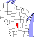
Springville is a town in Adams County in the U.S. state of Wisconsin. The population was 1,283 at the 2020 census, down from 1,318 at the 2010 census. [4]
Springville is located at 43°46′40″N89°47′14″W / 43.77778°N 89.78722°W (43.778050, −89.787360). [5]
According to the United States Census Bureau, the town has a total area of 44.7 square miles (115.8 km2), of which 43.7 square miles (113.1 km2) is land and 1.0 square mile (2.7 km2), or 2.33%, is water. [4]
As of the census [3] of 2000, there were 1,167 people, 487 households, and 349 families residing in the town. The population density was 26.6 people per square mile (10.3 people/km2). There were 864 housing units at an average density of 19.7 units per square mile (7.6 units/km2). The racial makeup of the town was 98.20% White, 0.17% African American, 0.17% Native American, 0.17% Asian, 0.09% Pacific Islander, 0.17% from other races, and 1.03% from two or more races. Hispanic or Latino of any race were 1.29% of the population.
There were 487 households, out of which 24.6% had children under the age of 18 living with them, 61.2% were married couples living together, 6.0% had a female householder with no husband present, and 28.3% were non-families. 23.0% of all households were made up of individuals, and 8.0% had someone living alone who was 65 years of age or older. The average household size was 2.40 and the average family size was 2.78.
In the town, the population was spread out, with 21.2% under the age of 18, 5.7% from 18 to 24, 26.4% from 25 to 44, 28.5% from 45 to 64, and 18.3% who were 65 years of age or older. The median age was 43 years. For every 100 females, there were 107.7 males. For every 100 females age 18 and over, there were 103.1 males.
The median income for a household in the town was $34,531, and the median income for a family was $38,000. Males had a median income of $30,529 versus $22,760 for females. The per capita income for the town was $16,146. About 9.8% of families and 12.3% of the population were below the poverty line, including 20.4% of those under age 18 and 11.0% of those age 65 or over.
It is in the service area of the School District of Wisconsin Dells, [6] which operates Spring Hill Middle School and Wisconsin Dells High School.
Adams County is a county in the U.S. state of Wisconsin. As of the 2020 census, the population was 20,654. Its county seat is Friendship. The county was created in 1848 and organized in 1853. Sources differ as to whether its name is in honor of the second President of the United States, John Adams, or his son, the sixth President, John Quincy Adams.
Springville is a census-designated place (CDP) in Tulare County, California, United States. The population was 967 at the 2020 census, up from 934 at the 2010 census. The original name of the town was “Daunt”, after William Daunt, a settler who opened the first store in the town in 1860. The name was changed to “Springville” in January, 1911, in reference to the soda springs found in the area.
Goldsboro is a town in Caroline County, Maryland, United States. William James Yeager is the current mayor. The population was 246 at the 2010 United States Census. The zip code is 21636. First known as Oldtown, it was renamed in 1870 for the prominent Goldsborough family who owned land in the area. Castle Hall was listed on the National Register of Historic Places in 1975.
Dell Prairie is a town in Adams County in the U.S. state of Wisconsin. The population was 1,631 at the 2020 census, up from 1,590 at the 2010 census. The unincorporated community of Plainville is located in the town.
Easton is a town in Adams County in the U.S. state of Wisconsin. The population was 1,062 at the 2020 census, down from 1,130 at the 2010 census. The unincorporated communities of Brookside and White Creek are located in the town.
Friendship is a village in Adams County in the U.S. state of Wisconsin. It is the county seat of Adams County. The population was 648 at the 2020 census.
Jackson is a town in Adams County in the U.S. state of Wisconsin. The population was 1,141 at the 2020 census, up from 1,003 at the 2010 census.
New Haven is a town in Adams County in the U.S. state of Wisconsin. The population was 680 at the 2020 census, up from 655 at the 2010 census. The unincorporated community of Big Spring is located in the town.
Preston is a town in Adams County in the U.S. state of Wisconsin. The population was 1,377 at the 2020 census, slightly down from 1,393 at the 2010 census. The unincorporated community of Cottonville is located in the town. The ghost towns of Fordham and Roche a Cri were also located in the town.
Quincy is a town in Adams County in the U.S. state of Wisconsin. The population was 1,159 at the 2020 census, slightly down from 1,163 at the 2010 census. The ghost town of Quincy was located in the town.
The Town of Rome is located in Adams County in the U.S. state of Wisconsin. The population was 3,025 at the 2020 census, up from 2,720 at the 2010 census. The census-designated places of Lake Arrowhead, Lake Camelot, and Lake Sherwood are located in the town. The unincorporated communities of New Rome and Rome are also located in the town.
The Town of Newport is located in Columbia County, Wisconsin, United States. The population was 681 at the 2000 census. The ghost town of Moe Settlement was located in the town.
Angelo is a town in Monroe County, Wisconsin, United States. The population was 1,268 at the 2000 census. The unincorporated community of Farmers Valley is also located partially in the town.
Lake Delton is a village located on the Wisconsin River in Sauk County, Wisconsin, United States. The population was 3,501 at the 2020 census. Lake Delton, along with the nearby Wisconsin Dells, is a resort area and a center for tourism in the upper Midwest. Lake Delton is included in the Baraboo Micropolitan Area which comprises part of the larger Madison Combined Statistical Area.
Jefferson is a town in Vernon County, Wisconsin, United States. The population was 974 at the 2000 census. The unincorporated communities of Bud, Esofea, and Springville are located with the town.
Adams is a town in Adams County in the U.S. state of Wisconsin. The population was 1,378 at the 2020 census. The city of Adams is located within the town. The ghost town of Adams Center was also located in the town.
Adams is a city in Adams County in the U.S. state of Wisconsin. The population was 1,761 at the 2020 census. The city is located within the Town of Adams.
The Town of Black Earth is located in Dane County, Wisconsin, United States. The population was 510 at the 2020 census.
Cross Plains is a town in Dane County, Wisconsin, United States. The population was 1,419 at the 2000 census. The Village of Cross Plains is located partially within the town. The unincorporated community of Pine Bluff is located in the town.
Dane is a town in Dane County, Wisconsin, United States. The population was 968 at the 2000 census. The unincorporated community of Lutheran Hill is located partially in the town.