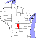
Leola, Wisconsin

Last updated
Leola, Wisconsin
Adams County Wisconsin incorporated and unincorporated areas Leola highlighted.svg
Location in Adams County and the state of Wisconsin.
USA Wisconsin location map.svg
Red pog.svg
Leola
Location in Adams County and the state of Wisconsin.
Usa edcp location map.svg
Red pog.svg
Leola
Leola (the United States)
Coordinates: 44°12′11″N89°38′52″W / 44.20306°N 89.64778°W / 44.20306; -89.64778 Coordinates: 44°12′11″N89°38′52″W / 44.20306°N 89.64778°W / 44.20306; -89.64778
Country Flag of the United States.svg  United States
State Flag of Wisconsin.svg  Wisconsin
County Adams
Area
  Total37.31 sq mi (96.62 km2)
  Land37.28 sq mi (96.55 km2)
  Water0.03 sq mi (0.07 km2)
Elevation
[1]
1,033 ft (315 m)
Population
 (2010)
  Total308
  Density8/sq mi (3.2/km2)
Time zone UTC-6 (Central (CST))
  Summer (DST) UTC-5 (CDT)
Area code(s) 608
FIPS code 55-43425 [2]
GNIS feature ID1583543 [1]
Website www.tn.leola.wi.gov

Leola is a town in Adams County in the U.S. state of Wisconsin. The population was 308 at the 2010 census. [3]

Contents

Geography

According to the United States Census Bureau, the town has a total area of 37.3 square miles (96.6 km2), of which 0.027 square miles (0.07 km2), or 0.08%, is water. [3]

Demographics

At the 2000 census, [2] there were 265 people, 107 households and 80 families residing in the town. The population density was 7.1 per square mile (2.7/km2). There were 177 housing units at an average density of 4.8 per square mile (1.8/km2). The racial makeup was 96.98% White, 0.38% African American, 1.51% Native American, 0.38% Asian, 0.75% from other races. Hispanic or Latino of any race were 0.75% of the population.

There were 107 households, of which 27.1% had children under the age of 18 living with them, 69.2% were married couples living together, 3.7% had a female householder with no husband present, and 24.3% were non-families. 19.6% of all households were made up of individuals, and 7.5% had someone living alone who was 65 years of age or older. The average household size was 2.48 and the average family size was 2.84.

19.6% of the population were under the age of 18, 5.3% from 18 to 24, 24.2% from 25 to 44, 32.5% from 45 to 64, and 18.5% who were 65 years of age or older. The median age was 45 years. For every 100 females, there were 103.8 males. For every 100 females age 18 and over, there were 99.1 males.

The median household income was $36,607 and the median family income was $38,611. Males had a median income of $29,028 and females $21,607. The per capita income was $15,699. About 7.7% of families and 10.5% of the population were below the poverty line, including 26.1% of those under the age of eighteen and none of those 65 or over.

Related Research Articles

Woodlawn Heights, Indiana Town in Indiana, United States

Woodlawn Heights is a neighborhood in Anderson Township, Madison County, Indiana, United States. It is part of the Anderson, Indiana Metropolitan Statistical Area. The population was 79 at the 2010 census.

Dyer Brook, Maine Town in Maine, United States

Dyer Brook is a town in Aroostook County, Maine, United States. The population was 213 at the 2010 census. Dyer Brook is also host to the local school, Southern Aroostook Community School.

Sidney, Maine Town in Maine, United States

Sidney is a town in Kennebec County, Maine, United States. The population was 4,208 at the 2010 census. Sidney was incorporated as a town on January 30, 1792. The town was named for Sir Philip Sidney, an English author. Sidney is included in the Augusta, Maine micropolitan New England City and Town Area. Since 1937, the town is the home of the New England Music Camp.

Galestown, Maryland Town in Maryland, United States

Galestown is a town in Dorchester County, Maryland, United States. The population was 138 at the 2010 census.

Huston Township, Clearfield County, Pennsylvania Township in Pennsylvania, United States

Huston Township is a township in Clearfield County, Pennsylvania, United States. The population was 1,433 at the 2010 census.

Alpena, South Dakota Town in South Dakota, United States

Alpena is a town in northeastern corner of Jerauld County, South Dakota, United States. The population was 286 at the 2010 census.

Leola, South Dakota City in South Dakota, United States

Leola is a small city in, and the county seat of, McPherson County, South Dakota, United States. It was founded on May 1, 1884, and named for Leola Haynes, daughter of one of the town's founders. The population was 457 as of the 2010 census.

Plymouth, Utah Town in Utah, United States

Plymouth is a town in Box Elder County, Utah, United States. The population was 414 at the 2010 census.

Gauley Bridge, West Virginia Town in West Virginia, United States

Gauley Bridge is a town in Fayette County, West Virginia, United States. The population was 614 at the 2010 census. The Kanawha River is formed at Gauley Bridge by the confluence of the New and Gauley Rivers. Two miles to the southeast of Gauley Bridge, in Glen Ferris, West Virginia, is Kanawha Falls, a popular stopping point on Midland Trail Scenic Highway.

Henderson, West Virginia Town in West Virginia, United States

Henderson is a town in Mason County, West Virginia, United States, at the confluence of the Ohio and Kanawha Rivers. The population was 271 at the 2010 census. It is part of the Point Pleasant, WV–OH Micropolitan Statistical Area. The town was incorporated in 1893 and named for Samuel Bruce Henderson, who owned the townsite at the time.

Mill Creek, West Virginia Town in West Virginia, United States

Mill Creek is a town in Randolph County, West Virginia, United States, along the Tygart Valley River. The population was 724 at the 2010 census.

Womelsdorf (Coalton), West Virginia Town in West Virginia, United States

Womelsdorf (Coalton) is a town in Randolph County, West Virginia, United States. The population was 250 at the 2010 census.

Gibraltar, Wisconsin Town in Wisconsin, United States

Gibraltar is a town in Door County, Wisconsin, United States. The population was 1,021 at the 2010 census. The unincorporated communities of Fish Creek and Juddville are located in the town.

Grant, Dunn County, Wisconsin Town in Wisconsin, United States

Grant is a town in Dunn County, Wisconsin, United States. The population was 426 at the 2000 census.

Knapp is a town in Jackson County, Wisconsin, in the United States. As of the 2000 census, the town population was 275. The unincorporated community of Lapham Junction is located in the town.

Gilman is a town in Pierce County, Wisconsin, United States. The population was 772 at the 2000 census. The unincorporated communities of Olivet and Viking are partially located in the town.

Stinnett, Wisconsin Town in Wisconsin, United States

Stinnett is a town in Washburn County, Wisconsin, United States. The population was 263 at the 2000 census. The unincorporated community of Stanberry is located in the town. The ghost town of Harmon was located in the town.

Royalton, Wisconsin Town in Wisconsin, United States

Royalton is a town in Waupaca County, Wisconsin, United States. The population was 1523 at the 2000 census. The unincorporated communities of Baldwins Mill and Royalton are located in the town.

Leon, Waushara County, Wisconsin Town in Wisconsin, United States

Leon is a town in Waushara County, Wisconsin, United States. The population was 1,281 at the 2000 census. The census-designated place of Pine River is located in the town. The village of Redgranite is located adjacent to the town.

Black Earth, Wisconsin Village in Wisconsin, United States

Black Earth is a village in Dane County, Wisconsin, United States. The population was 1,338 at the 2010 census. The village is located within the Town of Black Earth. It is part of the Madison Metropolitan Statistical Area.

References

  1. 1 2 "US Board on Geographic Names". United States Geological Survey. October 25, 2007. Retrieved January 31, 2008.
  2. 1 2 "U.S. Census website". United States Census Bureau . Retrieved January 31, 2008.
  3. 1 2 "Geographic Identifiers: 2010 Demographic Profile Data (G001): Leola town, Adams County, Wisconsin". U.S. Census Bureau, American Factfinder. Archived from the original on February 12, 2020. Retrieved August 30, 2013.