Grand Marsh, Wisconsin

Last updated
Grand Marsh, Wisconsin
Adams County Wisconsin incorporated and unincorporated areas Grand Marsh highlighted.svg
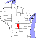
Location in Adams County and the state of Wisconsin.
Coordinates: 43°53′13″N89°42′22″W / 43.88694°N 89.70611°W / 43.88694; -89.70611 Coordinates: 43°53′13″N89°42′22″W / 43.88694°N 89.70611°W / 43.88694; -89.70611
Country United States
State Wisconsin
County Adams
Town New Chester
Area
  Total1.209 sq mi (3.13 km2)
  Land1.209 sq mi (3.13 km2)
  Water0 sq mi (0 km2)
Elevation
1,010 ft (310 m)
Population
  Total127
  Density110/sq mi (41/km2)
Time zone UTC-6 (Central (CST))
  Summer (DST) UTC-5 (CDT)
ZIP code
53936
Area code(s) 608
GNIS feature ID1565712 [1]

Grand Marsh is an unincorporated census-designated place located in Adams County, Wisconsin, United States. The community is southeast of Adams, in the town of New Chester. Grand Marsh has a post office with ZIP code 53936, which opened in 1850. [2] [3] As of the 2010 census, its population is 127. [4]

The community took its name from the surrounding wetlands. [3]

Related Research Articles

Strasburg, Colorado Census Designated Place in Colorado, United States

Strasburg is an unincorporated town, a post office, and a census-designated place (CDP) located in and governed by Adams and Arapahoe counties, Colorado, United States. The CDP is a part of the Denver–Aurora–Lakewood, CO Metropolitan Statistical Area. The Strasburg post office has the ZIP Code 80136. At the United States Census 2010, the population of the Strasburg CDP was 2,447, while the population of the 80136 ZIP Code Tabulation Area was 4834 including adjacent communities.

Watkins, Colorado Census Designated Place in Colorado, United States

Watkins is an unincorporated town and a census-designated place (CDP) located in and governed by Arapahoe and Adams counties, Colorado, United States. The CDP is a part of the Denver–Aurora–Lakewood, CO Metropolitan Statistical Area. The town is surrounded by Aurora and its post office, which lies within the Aurora city limits, has the ZIP Code 80137. At the United States Census 2010, the population of the Watkins CDP was 653, while the population of the 80137 ZIP Code Tabulation Area was 1,323 including adjacent communities.

Collins, Wisconsin Census-designated place in Wisconsin, United States

Collins is an unincorporated census-designated place in the town of Rockland, Manitowoc County, Wisconsin, United States, in the east central part of the state. Its zip code is 54207, although its post office is being studied for closure. As of the 2010 census, its population is 164. The Collins Marsh Wildlife Area is located east of the community. Wisconsin Highway 32 ran through the community; the route later became Wisconsin Highway 67 before it became County Highway W. County Highway JJ and the Wisconsin Central Ltd. railroad runs east–west through the community. Collins has an area of 0.496 square miles (1.28 km2), all of it land. The community was named for Sumner J. Collins, who was the general superintendent of the Wisconsin Central Railroad in the 1890s.

Forest Junction, Wisconsin Census-designated place in Wisconsin, United States

Forest Junction is an unincorporated census-designated place in the town of Brillion, Calumet County, Wisconsin, United States. As of the 2010 census, its population was 616.

Woodford, Wisconsin Census-designated place in Wisconsin, United States

Woodford is an unincorporated community and census-designated place (CDP) in Lafayette County, Wisconsin, United States. Woodford is south of Argyle, in the town of Wiota. Woodford has a post office with ZIP code 53599. As of the 2010 census, its population is 69.

Babcock, Wisconsin Census-designated place in Wisconsin, United States

Babcock is an census-designated place located in Wood County, Wisconsin, United States. Babcock is southwest of Wisconsin Rapids, in the town of Remington. Babcock has a post office with ZIP code 54413. As of the 2010 census, its population is 126. Its motto is "Birds, Bogs, and Bucks." The community was named for Joseph W. Babcock, a sawmill operator who purchased the site and built a hotel and a depot.

Summit Lake, Wisconsin Census-designated place in Wisconsin, United States

Summit Lake is an unincorporated census-designated place located in Langlade County, Wisconsin, United States. Summit Lake is located along U.S. Route 45 17 miles (27 km) north of Antigo, in the town of Upham. Summit Lake has a post office with ZIP code 54485. As of the 2010 census, its population is 144.

Grand View, Wisconsin Census-designated place in Wisconsin, United States

Grand View is an unincorporated, census-designated place located in the town of Grandview, Bayfield County, Wisconsin, United States.

Iron River (CDP), Wisconsin Census-designated place in Wisconsin, United States

Iron River is an unincorporated, census-designated place located in the town of Iron River, Bayfield County, Wisconsin, United States.

Cable (CDP), Wisconsin Census-designated place in Wisconsin, United States

Cable is an unincorporated, census-designated place located in the town of Cable, Bayfield County, Wisconsin, United States.

Long Lake (CDP), Wisconsin Census-designated place in Wisconsin, United States

Long Lake is an unincorporated census-designated place in the town of Long Lake, Florence County, Wisconsin, United States. Long Lake is located on the eastern shore of Long Lake along Wisconsin Highway 139, 21 miles (34 km) west-southwest of Florence. As of the 2010 census, its population was 50. The community became a census-designated place in 2010. The community has the 54542 ZIP code.

Gilmanton (community), Wisconsin Census-designated place in Wisconsin, United States

Gilmanton is a census-designated place located in the town of Gilmanton, in Buffalo County, Wisconsin, United States. Gilmanton is located at the junction of Wisconsin Highway 88 and Wisconsin Highway 121 7 miles (11 km) south of Mondovi. Gilmanton has a post office with ZIP code 54743. Its population was 131 in 2017.

Elcho (CDP), Wisconsin Unincorporated community in Wisconsin, United States

Elcho is a census-designated place located in the town of Elcho, Langlade County, Wisconsin, United States. Elcho is located on U.S. Route 45 and Wisconsin Highway 47 16.5 miles (26.6 km) southwest of Crandon. Elcho has a post office with ZIP code 54428. As of the 2010 census, its population was 339.

Minocqua (CDP), Wisconsin Census-designated place in Wisconsin, United States

Minocqua is a census-designated place located in the town of Minocqua, Oneida County, Wisconsin, United States. Minocqua is located on a peninsula on Minocqua Lake, 21.5 miles (34.6 km) northwest of Rhinelander. The community is served by U.S. Route 51. Minocqua has a post office with ZIP code 54548. As of the 2010 census, its population is 451.

Three Lakes (CDP), Wisconsin Census-designated place in Wisconsin, United States

Three Lakes is an unincorporated census-designated place located in the town of Three Lakes, Oneida County, Wisconsin, United States. Three Lakes is located at the junction of U.S. Route 45 and Wisconsin Highway 32 9 miles (14 km) south-southeast of Eagle River. Three Lakes has a post office with ZIP code 54562. As of the 2010 census, its population is 605.

Argonne (CDP), Wisconsin Census-designated place in Wisconsin, United States

Argonne is an unincorporated census-designated place in the town of Argonne, Forest County, Wisconsin, United States. Argonne is located at the junction of Wisconsin Highway 32 and Wisconsin Highway 55 6 miles (9.7 km) north of Crandon. Argonne has a post office with ZIP code 54511. The community was established in 1888. As of the 2010 census, its population was 160.

Abrams (CDP), Wisconsin Census-designated place in Wisconsin, United States

Abrams is an unincorporated community census-designated place located in the town of Abrams, Oconto County, Wisconsin, United States. Abrams is located near U.S. Route 41 and U.S. Route 141 8 miles (13 km) south-southeast of Oconto Falls. Abrams has a post office with ZIP code 54101. As of the 2010 census, its population was 340.

Brule (CDP), Wisconsin Census-designated place in Wisconsin, United States

Brule is an unincorporated, census-designated place; located in the town of Brule, Douglas County, Wisconsin, United States.

Gordon (CDP), Wisconsin Census-designated place in Wisconsin, United States

Gordon is an unincorporated, census-designated place; located in the town of Gordon, Douglas County, Wisconsin, United States.

Springbrook (community), Wisconsin Census-designated place in Wisconsin, United States

Springbrook is an unincorporated community and census-designated place located in the town of Springbrook, Washburn County, Wisconsin, United States. Springbrook is located on U.S. Route 63 13 miles (21 km) northeast of Spooner. Springbrook has a post office with ZIP code 54875. Its population was 76 in 2017.

References

  1. U.S. Geological Survey Geographic Names Information System: Grand Marsh, Wisconsin
  2. "ZIP Code™ Lookup". USPS.com. United States Postal Service . Retrieved December 27, 2020.
  3. 1 2 Callary, Edward (2016). Place Names of Wisconsin. Madison, Wisconsin: University of Wisconsin Press. p. 107. ISBN   9780299309640.
  4. "U.S. Census website". U.S. Census Bureau . Retrieved 4 April 2011.