Richfield, Adams County, Wisconsin

Last updated
Richfield, Wisconsin
Adams County Wisconsin incorporated and unincorporated areas Richfield highlighted.svg
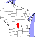
Location in Adams County and the state of Wisconsin.
Coordinates: 44°0′59″N89°38′54″W / 44.01639°N 89.64833°W / 44.01639; -89.64833 Coordinates: 44°0′59″N89°38′54″W / 44.01639°N 89.64833°W / 44.01639; -89.64833
Country Flag of the United States.svg  United States
State Flag of Wisconsin.svg  Wisconsin
County Adams
Area
  Total35.5 sq mi (92.0 km2)
  Land35.5 sq mi (92.0 km2)
  Water0.0 sq mi (0.0 km2)
Elevation
[1]
1,020 ft (311 m)
Population
 (2010)
  Total158
  Density4/sq mi (1.7/km2)
Time zone UTC-6 (Central (CST))
  Summer (DST) UTC-5 (CDT)
Area code 608
FIPS code 55-67425 [2]
GNIS feature ID1584021 [1]

Richfield is a town in Adams County in the U.S. state of Wisconsin. The population was 158 at the 2010 census. [3] The ghost town of Pilot Knob was located in the town.

Contents

Geography

Richfield is located at 44°1′45″N89°39′36″W / 44.02917°N 89.66000°W / 44.02917; -89.66000 (44.029410, −89.660180). [4]

According to the United States Census Bureau, the town has a total area of 35.5 square miles (92.0 km2), all of it land. [3]

Demographics

As of the census [2] of 2000, there were 144 people, 62 households, and 44 families residing in the town. The population density was 4.1 people per square mile (1.6/km2). There were 103 housing units at an average density of 2.9 per square mile (1.1/km2). The racial makeup of the town was 99.31% White, and 0.69% from two or more races.

There were 62 households, out of which 16.1% had children under the age of 18 living with them, 64.5% were married couples living together, 3.2% had a female householder with no husband present, and 29.0% were non-families. 21.0% of all households were made up of individuals, and 12.9% had someone living alone who was 65 years of age or older. The average household size was 2.32 and the average family size was 2.64.

In the town, the population was spread out, with 18.8% under the age of 18, 5.6% from 18 to 24, 20.1% from 25 to 44, 34.0% from 45 to 64, and 21.5% who were 65 years of age or older. The median age was 48 years. For every 100 females, there were 132.3 males. For every 100 females age 18 and over, there were 120.8 males.

The median income for a household in the town was $34,792, and the median income for a family was $34,792. Males had a median income of $26,250 versus $19,375 for females. The per capita income for the town was $23,333. There were 14.0% of families and 17.1% of the population living below the poverty line, including 35.0% of under eighteens and 14.3% of those over 64.

Related Research Articles

<span class="mw-page-title-main">Meadow Vista, California</span> Census-designated place in California, United States

Meadow Vista is a census-designated place (CDP) in Placer County, California, United States. It is part of the Sacramento–Arden-Arcade–Roseville Metropolitan Statistical Area. The population was 3,217 at the 2010 census, up from 3,096 at the 2000 census.

<span class="mw-page-title-main">Richfield, Idaho</span> City in Idaho, United States

Richfield is a city in Lincoln County, Idaho, in the United States. The population was 482 at the 2010 census.

<span class="mw-page-title-main">Spaulding, Illinois</span> Village in Illinois, United States

Spaulding is a village in Sangamon County, Illinois, United States. The population was 873 at the 2010 census. It is part of the Springfield, Illinois Metropolitan Statistical Area. Spaulding is in the Riverton School District #14.

<span class="mw-page-title-main">Toulon, Illinois</span> City in Illinois, United States

Toulon is a city in Stark County, Illinois, United States. The population was 1,292 at the 2010 census. It is the county seat of Stark County. Toulon is part of the Peoria, Illinois Metropolitan Statistical Area, and is the northwestern terminus of the Rock Island Trail State Park.

<span class="mw-page-title-main">Glenwood, Indiana</span> Town in Indiana, United States

Glenwood is a town in Fairview and Orange townships, Fayette County and Union Township, Rush County in the U.S. state of Indiana. The population was 250 at the 2010 census.

<span class="mw-page-title-main">Richfield, Kansas</span> City in Morton County, Kansas

Richfield is a city in Morton County, Kansas, United States. As of the 2020 census, the population of the city was 30.

<span class="mw-page-title-main">Benton, Maine</span> Town in the state of Maine, United States

Benton is a town in Kennebec County, Maine, United States. It was formed in 1842, as a subdivision of the town of Clinton. The population was 2,715 at the 2020 census. The town was named for Missouri Senator Thomas Hart Benton.

<span class="mw-page-title-main">Huron Township, Michigan</span> Civil township in Michigan, United States

Huron Township is a civil township of Huron County in the U.S. state of Michigan. The population was 423 at the 2000 census.

<span class="mw-page-title-main">Missouri City, Missouri</span> City in Missouri, United States

Missouri City is a city in Clay County, Missouri, United States. The population was 217 at the 2020 census. It is part of the Kansas City metropolitan area.

<span class="mw-page-title-main">Clarksburg, Missouri</span> City in Missouri, United States

Clarksburg is a city in Moniteau County, Missouri, United States. The population was 334 at the 2010 census. It is part of the Jefferson City, Missouri Metropolitan Statistical Area.

<span class="mw-page-title-main">Richfield, North Carolina</span> Town in North Carolina, United States

Richfield is a town in Stanly County, North Carolina, United States. The town was originally called "Ritchie's Field," for the prominent Ritchie family who established the post office, sawmill, and streets of the settlement.

<span class="mw-page-title-main">Richfield, Ohio</span> Village in Ohio, United States

Richfield is a village in Summit County, Ohio, United States. The population was 3,648 at the 2010 census. The village and the adjacent Richfield Township are approximately equidistant between the downtown areas of Akron and Cleveland. It is part of the Akron metropolitan area. Richfield is the sister city of Wolfach, Germany.

<span class="mw-page-title-main">Dacoma, Oklahoma</span> Town in Oklahoma, United States

Dacoma is a town in Woods County, Oklahoma, United States. The population was 107 at the 2010 census, down from 148 in 2000. Dacoma shares a school district with the nearby town of Carmen.

<span class="mw-page-title-main">Gibson, Tennessee</span> Town in Tennessee, United States

Gibson is a town in Gibson County, Tennessee, United States. The population was 396 at the 2010 census.

<span class="mw-page-title-main">Matoaka, West Virginia</span> Census-designated place in West Virginia, United States

Matoaka is a census-designated place in Mercer County, West Virginia, United States. The population was 227 at the 2010 census. It is part of the Bluefield, WV-VA micropolitan area which has a population of 107,578. This town is named for Chief Powhatan's daughter Matoaka who was better known by her nickname "Pocahontas". Matoaka became an unincorporated town when it voted to dissolve its charter in May 2018.

<span class="mw-page-title-main">Canton, Wisconsin</span> Town in Wisconsin, United States

Canton is a town in Buffalo County in the U.S. state of Wisconsin. The population was 305 at the 2010 census. The ghost town of Springdale was located in the town.

<span class="mw-page-title-main">Rose, Wisconsin</span> Town in Wisconsin, United States

Rose is a town in Waushara County, Wisconsin, United States. The population was 595 at the 2000 census. The unincorporated community of Heffron is located partially in the town.

<span class="mw-page-title-main">Richfield, Wood County, Wisconsin</span> Town in Wisconsin, United States

Richfield is a town in Wood County, Wisconsin, United States. The population was 1,523 at the 2000 census. The unincorporated community of Bethel is located within the town.

Mondovi is a town in Buffalo County in the U.S. state of Wisconsin. The population was 469 at the 2010 census. The city of Mondovi is located mostly within the town.

<span class="mw-page-title-main">Wyocena (town), Wisconsin</span>

Wyocena is a town in Columbia County, Wisconsin, United States. The population was 619 at the 2000 Census. The Village of Wyocena is located within the town.

References

  1. 1 2 "US Board on Geographic Names". United States Geological Survey. 2007-10-25. Retrieved 2008-01-31.
  2. 1 2 "U.S. Census website". United States Census Bureau . Retrieved 2008-01-31.
  3. 1 2 "Geographic Identifiers: 2010 Demographic Profile Data (G001): Richfield town, Adams County, Wisconsin". U.S. Census Bureau, American Factfinder. Archived from the original on February 12, 2020. Retrieved September 6, 2013.
  4. "US Gazetteer files: 2010, 2000, and 1990". United States Census Bureau. 2011-02-12. Retrieved 2011-04-23.