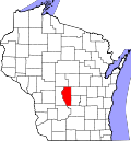
Big Flats, Wisconsin

Last updated

Big Flats, Wisconsin
Adams County Wisconsin incorporated and unincorporated areas Big Flats highlighted.svg
Location in Adams County and the state of Wisconsin.
USA Wisconsin location map.svg
Red pog.svg
Big Flats
Usa edcp location map.svg
Red pog.svg
Big Flats
Coordinates: 44°6′26″N89°47′57″W / 44.10722°N 89.79917°W / 44.10722; -89.79917
Country Flag of the United States.svg  United States
State Flag of Wisconsin.svg  Wisconsin
County Adams
Government
  TypeTown Board [1]
Area
[2]
  Total48.1 sq mi (124.5 km2)
  Land47.9 sq mi (124.1 km2)
  Water0.2 sq mi (0.4 km2)
Elevation
[3]
1,001 ft (305 m)
Population
 (2020) [4]
  Total948
  Density19.8/sq mi (7.6/km2)
Time zone UTC-6 (Central (CST))
  Summer (DST) UTC-5 (CDT)
ZIP Code
54613
Area code 608
FIPS code 55-07300 [5]
GNIS feature ID1582809 [3]
Website bigflatswi.com

Big Flats is a town in Adams County in the U.S. state of Wisconsin. The population was 948 at the 2020 census. [4]

Contents

The unincorporated community of Big Flats is located in the town. Big Flats is located at the junction of Wisconsin Highway 13 and County Highway C 10 miles (16 km) north of Friendship. [6]

History

The town of Big Flats was created on November 15, 1861, and the name was changed from Brownsville. [7] The community of Big Flats once had a post office, which opened in August 1862; John W. Potter was the first postmaster. The community most likely takes its name from Big Flats, New York. [8]

Big Flats tornado

On August 27, 1994, the town of Big Flats was hit by an F3 tornado. It touched down at 8:41 P.M. CDT and was on the ground for 16 minutes. The tornado's path was 10.5 miles (16.9 km) long and 850 yards (780 m) wide. [9] The tornado killed two people and injured 22. It destroyed 24 homes, caused major damage to 8, and light to moderate damage to 160. It destroyed the Big Flats Fire Department, the Town Hall, and a thrift store. Seventy cows were crushed when a barn roof and an upper floor containing 16,000 bales of hay collapsed. The tornado caused $1 million in damage. [9]

Cottonville Forest Fire

Big Flats was the site of a devastating wildfire, the Cottonville Forest Fire, on May 5, 2005. [10] It started when a man lit a fire within a fire ring constructed of concrete blocks, attempting to burn off dead grass. The fire jumped out of the ring and began burning the grass in the surrounding area. [11] Smoke from the fire was spotted by the fire tower in Rome's Dyracuse Park. [12]

The fire spread in a north-northeast direction, [11] along Roche A Cri Creek. [13] Smoke from the fire was visible from 60 miles (97 km) away. [13] About 177 firefighters from 20 fire departments responded. Wisconsin Department of Natural Resources (DNR) firefighters came from as far away as Hayward. Two DNR planes used to drop foam flew in from Minnesota. [14] By the time it was contained 11 hours later, the flames had spread northward about 10 miles (16 km). [15] It burned approximately 3,410 acres (13.8 km2), destroying 30 residences. Approximately 60 other out-buildings were also destroyed. [11]

It was the biggest forest fire in Wisconsin since the Ekdall Church and Oak Lake Fires burned more than 16,000 acres (65 km2) in Washburn and Burnett counties April 21–22, 1980. [13] [16]

Thomas Barnhart was charged with setting a fire which became a forest fire, a misdemeanor. [11] He pleaded no contest and was sentenced to a local jail term of 90 days, which was stayed, with two years of probation, 100 hours of community service, and $150 per month of restitution which is applied to uninsured expenses of the victims. [17] On November 13, 2006, the total amount of restitution owed was set at $1,436,504. [18]

Geography

According to the United States Census Bureau, the town has a total area of 48.1 square miles (124.5 km2), of which 47.9 square miles (124.1 km2) is land and 0.15 square miles (0.4 km2), or 0.34%, is water. [2]

Demographics

As of the census [5] of 2000, there were 946 people, 402 households, and 270 families residing in the town. The population density was 19.7 people per square mile (7.6/km2). There were 797 housing units at an average density of 16.6 per square mile (6.4/km2). The racial makeup of the town was 97.36% White, 0.53% African American, 0.63% Native American, 0.53% from other races, and 0.95% from two or more races. Hispanic or Latino of any race were 2.11% of the population.

There were 402 households, out of which 20.6% had children under the age of 18 living with them, 56.5% were married couples living together, 6.0% had a female householder with no husband present, and 32.6% were non-families. 25.4% of all households were made up of individuals, and 11.4% had someone living alone who was 65 years of age or older. The average household size was 2.35 and the average family size was 2.77.

In the town, the population was spread out, with 21.5% under the age of 18, 5.3% from 18 to 24, 23.2% from 25 to 44, 29.7% from 45 to 64, and 20.4% who were 65 years of age or older. The median age was 45 years. For every 100 females, there were 109.3 males. For every 100 females age 18 and over, there were 111.1 males.

The median income for a household in the town was $27,800, and the median income for a family was $36,250. Males had a median income of $31,583 versus $21,806 for females. The per capita income for the town was $14,629. About 6.9% of families and 13.1% of the population were below the poverty line, including 16.6% of those under age 18 and 5.5% of those age 65 or over.

Related Research Articles

<span class="mw-page-title-main">Wood County, Wisconsin</span> County in Wisconsin, United States

Wood County is a county located in the U.S. state of Wisconsin. As of the 2020 census, the population was 74,207. Its county seat is Wisconsin Rapids. The county is named after Joseph Wood, a member of the Wisconsin State Assembly. Wood County comprises the Wisconsin Rapids-Marshfield, WI Micropolitan Statistical Area and is included in the Wausau-Stevens Point-Wisconsin Rapids, WI Combined Statistical Area.

<span class="mw-page-title-main">Onalaska, Texas</span> City in the United States

Onalaska is a city in Polk County, Texas, United States. Situated on a peninsula between the main channel and one arm of Lake Livingston, the population was 3,020 at the 2020 census.

<span class="mw-page-title-main">Dell Prairie, Wisconsin</span> Town in Wisconsin, United States

Dell Prairie is a town in Adams County in the U.S. state of Wisconsin. The population was 1,590 at the 2010 census. The unincorporated community of Plainville is located in the town.

<span class="mw-page-title-main">New Haven, Adams County, Wisconsin</span> Town in Wisconsin, United States

New Haven is a town in Adams County in the U.S. state of Wisconsin. The population was 655 at the 2010 census. The unincorporated community of Big Spring is located in the town.

<span class="mw-page-title-main">Preston, Adams County, Wisconsin</span> Town in Wisconsin, United States

Preston is a town in Adams County in the U.S. state of Wisconsin. The population was 1,393 at the 2010 census. The unincorporated community of Cottonville is located in the town. The ghost towns of Fordham and Roche a Cri were also located in the town.

<span class="mw-page-title-main">Rome, Adams County, Wisconsin</span> Town in Wisconsin, United States

The Town of Rome is located in Adams County in the U.S. state of Wisconsin. The population was 2,720 at the 2010 census. The census-designated places of Lake Arrowhead, Lake Camelot, and Lake Sherwood are located in the town. The unincorporated communities of New Rome and Rome are also located in the town.

<span class="mw-page-title-main">Cadott, Wisconsin</span> Village in Wisconsin, United States

Cadott is a village in Chippewa County in the U.S. state of Wisconsin. The population was 1,437 at the 2010 census.

<span class="mw-page-title-main">Wheatland, Kenosha County, Wisconsin</span> Town in Wisconsin, United States

Wheatland is a town in Kenosha County, Wisconsin, United States. The population was 3,391 at the 2020 census. The census-designated place of Powers Lake is located partially in the town. The unincorporated communities of Lily Lake, New Munster, and Slades Corners are also located in the town.

<span class="mw-page-title-main">Hazelhurst, Wisconsin</span> Town in Wisconsin, United States

Hazelhurst is a town in Oneida County, Wisconsin, United States. The population was 1,258 at the 2018 census. The unincorporated community of Hazelhurst is located in the town.

<span class="mw-page-title-main">Ladysmith, Wisconsin</span> City in Wisconsin, United States

Ladysmith is a city and the county seat of Rusk County, Wisconsin, United States. The population was 3,216 at the 2020 census.

<span class="mw-page-title-main">New Richmond, Wisconsin</span> City in Wisconsin, United States

New Richmond is a city in St. Croix County, Wisconsin, United States. Its population was 10,079 as of the 2020 census.

<span class="mw-page-title-main">Grand Rapids, Wisconsin</span> Town in Wisconsin, United States

The Town of Grand Rapids is located in Wood County, Wisconsin, United States. The population was 7,801 at the 2000 census. The census-designated place of Lake Wazeecha is located in the town. The unincorporated community of Kellner is located also partially in the town.

<span class="mw-page-title-main">Wisconsin Rapids, Wisconsin</span> City in Wisconsin, United States

Wisconsin Rapids is a city in and the county seat of Wood County, Wisconsin, United States. The population was 18,877 at the 2020 census. The city also forms one of the core areas of the United States Census Bureau's Marshfield-Wisconsin Rapids Micropolitan Statistical Area, which includes all of Wood County and had a 2020 population of 74,207.

<span class="mw-page-title-main">Marshfield, Wisconsin</span> City in Wisconsin, United States

Marshfield is in Wood and Marathon counties in the state of Wisconsin. It is located at the intersection of U.S. Highway 10, Highway 13 and Highway 97. The largest city in Wood County, its population was 18,929 at the 2020 census. Of this, 18,119 were in Wood County, and 810 were in Marathon County. The city is part of the United States Census Bureau's Marshfield-Wisconsin Rapids Micropolitan Statistical Area, which includes all of Wood County. The portion of the city in Marathon County is part of the Wausau Metropolitan Statistical Area.

<span class="mw-page-title-main">Fritch, Texas</span> City in Texas, United States

Fritch is a city in Hutchinson and Moore Counties in the U.S. state of Texas. The population was 2,117 at the 2010 census.

<span class="mw-page-title-main">Black Earth, Wisconsin</span> Village in Wisconsin, United States

Black Earth is a village in Dane County, Wisconsin, United States. The population was 1,338 at the 2010 census. The village is located within the Town of Black Earth. It is part of the Madison Metropolitan Statistical Area.

<span class="mw-page-title-main">Verona, Wisconsin</span> City in Wisconsin, United States

Verona is a city in Dane County, Wisconsin, United States. The population was 14,030 at the 2020 census. The city is located ten miles southwest of downtown Madison within the Town of Verona. It is part of the Madison metropolitan area.

<span class="mw-page-title-main">Jefferson, Wisconsin</span> City in Wisconsin, United States

Jefferson is a city in Jefferson County, Wisconsin, United States, and is its county seat. It is at the confluence of the Rock and Crawfish rivers. The population was 7,793 at the 2020 census. The city is partially bordered by the Town of Jefferson.

<span class="mw-page-title-main">Wausaukee, Wisconsin</span> Village in Wisconsin, United States

Wausaukee is a village in Marinette County, Wisconsin, in the United States. The population was 596 at the 2020 census. The village is part of the Marinette, WI–MI Micropolitan Statistical Area.

<span class="mw-page-title-main">Eagle (town), Wisconsin</span> Town in Wisconsin, United States

Eagle is a town in Waukesha County, Wisconsin, United States. The population was 3,478 at the 2020 census. The Village of Eagle is located within the town. The unincorporated community of Eagleville is also located in the town.

References

  1. "Town of Big Flats". Adams County. Archived from the original on August 18, 2007. Retrieved November 30, 2007.
  2. 1 2 "2020 U.S. Gazetteer Files". United States Census Bureau. Retrieved March 22, 2024.
  3. 1 2 "US Board on Geographic Names". United States Geological Survey. October 25, 2007. Retrieved January 31, 2008.
  4. 1 2 "Profile of General Population and Housing Characteristics: 2020 Demographic Profile Data (DP-1): Big Flats town, Adams County, Wisconsin". United States Census Bureau . Retrieved March 22, 2024.
  5. 1 2 "U.S. Census website". United States Census Bureau . Retrieved January 31, 2008.
  6. Adams County (PDF) (Map). Wisconsin Department of Transportation. Archived from the original (pdf) on 16 May 2011. Retrieved 22 May 2011.
  7. Wisconsin Historical Society-Big Flats, Wisconsin
  8. Callary, Edward (2016). Place Names of Wisconsin. Madison, Wisconsin: University of Wisconsin Press. p. 29. ISBN   9780299309640.
  9. 1 2 Boyne, Jeff (January 22, 2006). "Adams County (WI) Tornadoes 1850-2006". NOAA's National Weather Service Weather Forecast Office. Retrieved November 29, 2007.
  10. "Cottonville fire anniversary sign unveiling at Big Flats" (Press release). Wisconsin Department of Natural Resources. April 20, 2006. Archived from the original on February 11, 2007. Retrieved November 28, 2007.
  11. 1 2 3 4 "Text of wildfire criminal complaint". Wisconsin Rapids Daily Tribune. May 26, 2005. Archived from the original on August 13, 2007. Retrieved November 28, 2007.
  12. Madden, Karen (May 26, 2005). "Towers first line of wildfire defense". Wisconsin Rapids Daily Tribune. Retrieved November 28, 2007.[ dead link ]
  13. 1 2 3 Johnson, Annysa; Bergquist, Lee; Benson, Dan (May 7, 2005). "Man using fire to clear land ignited Cottonville blaze". Milwaukee Journal Sentinel. Archived from the original on September 22, 2008. Retrieved November 29, 2007.
  14. Madden, Karen (May 11, 2005). "Fire chief describes 'the big one'". Wisconsin Rapids Daily Tribune. Retrieved November 28, 2007.[ dead link ]
  15. "15 homes destroyed, fire source ID'd". Wisconsin Rapids Daily Tribune. May 6, 2005. Retrieved November 28, 2007.[ dead link ]
  16. "Ekdall Church-Oak Lake Fires". Wisconsin Department of Natural Resources. 30 July 2007. Archived from the original on 12 November 2007. Retrieved 29 November 2007.
  17. "State of Wisconsin vs. Thomas J. Barnhart Charge(s)/Sentence(s)". Wisconsin Court System. January 6, 2006. Retrieved November 28, 2007.
  18. "State of Wisconsin vs. Thomas J. Barnhart Court Record Events". Wisconsin Court System. November 13, 2006. Archived from the original on July 18, 2011. Retrieved November 28, 2007.

44°06′43″N89°48′28″W / 44.11194°N 89.80778°W / 44.11194; -89.80778