Preston, Adams County, Wisconsin

Last updated
Preston, Wisconsin
Adams County Wisconsin incorporated and unincorporated areas Preston highlighted.svg
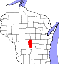
Location in Adams County and the state of Wisconsin.
Coordinates: 44°1′13″N89°47′19″W / 44.02028°N 89.78861°W / 44.02028; -89.78861 Coordinates: 44°1′13″N89°47′19″W / 44.02028°N 89.78861°W / 44.02028; -89.78861
Country Flag of the United States.svg  United States
State Flag of Wisconsin.svg  Wisconsin
County Adams
Area
  Total35.8 sq mi (92.8 km2)
  Land35.4 sq mi (91.6 km2)
  Water0.5 sq mi (1.3 km2)
Elevation
[1]
968 ft (295 m)
Population
 (2010)
  Total1,393
  Density39/sq mi (15.2/km2)
Time zone UTC-6 (Central (CST))
  Summer (DST) UTC-5 (CDT)
Area code 608
FIPS code 55-65450 [2]
GNIS feature ID1583982 [1]
Website https://www.townofprestontremplo.com/

Preston is a town in Adams County in the U.S. state of Wisconsin. The population was 1,393 at the 2010 census. [3] The unincorporated community of Cottonville is located in the town. The ghost towns of Fordham and Roche a Cri were also located in the town.

Contents

Geography

Preston is located at 44°1′20″N89°46′30″W / 44.02222°N 89.77500°W / 44.02222; -89.77500 (44.022410, −89.775110). [4]

According to the United States Census Bureau, the town has a total area of 35.8 square miles (92.8 km2), of which 35.4 square miles (91.6 km2) is land and 0.50 square miles (1.3 km2), or 1.36%, is water. [3]

Demographics

As of the census [2] of 2000, there were 1,360 people, 561 households, and 411 families residing in the town. The population density was 38.4 people per square mile (14.8/km2). There were 960 housing units at an average density of 27.1 per square mile (10.5/km2). The racial makeup of the town was 97.72% White, 0.29% African American, 0.59% Native American, 0.37% Asian, 0.07% Pacific Islander, 0.29% from other races, and 0.66% from two or more races. Hispanic or Latino of any race were 1.99% of the population.

There were 561 households, out of which 26.4% had children under the age of 18 living with them, 64.7% were married couples living together, 5.5% had a female householder with no husband present, and 26.7% were non-families. 20.7% of all households were made up of individuals, and 10.5% had someone living alone who was 65 years of age or older. The average household size was 2.42 and the average family size was 2.78.

In the town, the population was spread out, with 22.9% under the age of 18, 4.2% from 18 to 24, 24.1% from 25 to 44, 28.8% from 45 to 64, and 20.1% who were 65 years of age or older. The median age was 44 years. For every 100 females, there were 109.2 males. For every 100 females age 18 and over, there were 104.5 males.

The median income for a household in the town was $33,491, and the median income for a family was $36,458. Males had a median income of $32,794 versus $21,413 for females. The per capita income for the town was $19,117. About 6.9% of families and 9.6% of the population were below the poverty line, including 11.9% of those under age 18 and 3.6% of those age 65 or over.

Related Research Articles

<span class="mw-page-title-main">Sylvania, Alabama</span> Town in Alabama, United States

Sylvania is a town in DeKalb County, Alabama, United States. It incorporated in October 1967. At the 2010 census the population was 1,837, up from 1,186 in 2000. Sylvania is located atop Sand Mountain.

<span class="mw-page-title-main">Sale City, Georgia</span> Town in Georgia, United States

Sale City is a town in Mitchell County, Georgia, United States. The population was 354 at the 2020 census.

<span class="mw-page-title-main">Preston, Iowa</span> City in Iowa, United States

Preston is a city in Jackson County, Iowa, United States. The population was 949 at the time of the 2020 census.

<span class="mw-page-title-main">Earling, Iowa</span> City in Iowa, United States

Earling is a city in Shelby County, Iowa, United States. The population was 397 at the time of the 2020 census.

<span class="mw-page-title-main">Preston, Maryland</span> Town in Maryland

Preston is a town in Caroline County, Maryland, United States. The population was 719 at the 2010 census.

Preston Township is a township in Fillmore County, Minnesota, United States. The population was 374 at the 2000 census.

<span class="mw-page-title-main">Hardwick, Minnesota</span> City in Minnesota, United States

Hardwick is a city in Rock County, Minnesota, United States. Hardwick was platted in 1892, and named after J. L. Hardwick, a railroad official. The city is known throughout the region for its immense stray cat population. As of 2018, stray cats outnumbered human residents of the city. A post office has been in operation at Hardwick since 1891. Hardwick was incorporated in 1898.

<span class="mw-page-title-main">Zena, New York</span> CDP in New York, United States

Zena is a hamlet in Ulster County, New York, United States. As of the 2020 census the population was 1,038.

<span class="mw-page-title-main">Shreve, Ohio</span> Village in Ohio, United States

Shreve is a village in Clinton Township, Wayne County, Ohio, United States. The population was 1,514 at the 2010 census. Shreve is served by a branch of the Wayne County Public Library.

<span class="mw-page-title-main">Speers, Pennsylvania</span> Borough in Pennsylvania, United States

Speers is a borough in Washington County, Pennsylvania, United States. The population was 1,087 at the 2020 census.

<span class="mw-page-title-main">Grantsville, West Virginia</span> Town in West Virginia, United States

Grantsville is a town in Calhoun County, West Virginia, United States. The population was 482 at the 2020 census. It is the county seat of Calhoun County. The town was established along the Little Kanawha River in 1865 and named for Ulysses S. Grant. Grantsville is home to Wayne Underwood Park, which includes a .25-mile-long (0.40 km) walking trail, and to the annual West Virginia Wood Festival.

<span class="mw-page-title-main">Brandonville, West Virginia</span> Town in West Virginia, United States

Brandonville is a town in northern Preston County, West Virginia, United States. The population was 136 at the 2020 census. It is part of the Morgantown metropolitan area.

<span class="mw-page-title-main">Bruceton Mills, West Virginia</span> Town in West Virginia, United States

Bruceton Mills is a town in northern Preston County, West Virginia, United States, along Big Sandy Creek. The population was 64 at the 2020 census. It is part of the Morgantown metropolitan area.

<span class="mw-page-title-main">Reedsville, West Virginia</span> Town in West Virginia, United States

Reedsville is a town in western Preston County, West Virginia, United States. The population was 530 at the 2020 census. It is part of the Morgantown metropolitan area.

<span class="mw-page-title-main">Ringle, Wisconsin</span> Town in Wisconsin, United States

Ringle is a town in Marathon County, Wisconsin, United States. It is part of the Wausau (WI) Metropolitan Statistical Area. The population was 1,711 at the 2010 census. The unincorporated community of Ringle is located in the town.

<span class="mw-page-title-main">Rushford, Wisconsin</span> Town in Wisconsin, United States

Rushford is a town in Winnebago County, Wisconsin, United States. The population was 1,561 at the 2010 census. The unincorporated communities of Eureka, Island Park, and Waukau are located in the town. The ghost town of Delhi was located in the town.

<span class="mw-page-title-main">Weddington, North Carolina</span> Town in North Carolina, United States

Weddington is a suburban town in Union County, North Carolina, United States. A small portion of the town extends into Mecklenburg County. The population was 9,459 at the 2010 census. It is a suburb in the Charlotte metropolitan area. The current mayor of Weddington is Craig Horn.

<span class="mw-page-title-main">Gratiot, Wisconsin</span> Village in Wisconsin, United States

Gratiot is a village in Lafayette County, Wisconsin, United States. The population was 236 at the 2010 census. The village is surrounded by the Town of Gratiot.

The Town of Elderon is located in Marathon County, Wisconsin, United States. It is part of the Wausau, Wisconsin Metropolitan Statistical Area. The population was 606 at the 2010 census. The unincorporated community of Ingersoll is located in the town.

<span class="mw-page-title-main">Star Prairie, Wisconsin</span> Village in Wisconsin, United States

Star Prairie is a village in St. Croix County in the U.S. state of Wisconsin. The population was 561 at the 2010 census. The village is located along the Apple River on the boundary between the Town of Star Prairie and the Town of Stanton.

References

  1. 1 2 "US Board on Geographic Names". United States Geological Survey. 2007-10-25. Retrieved 2008-01-31.
  2. 1 2 "U.S. Census website". United States Census Bureau . Retrieved 2008-01-31.
  3. 1 2 "Geographic Identifiers: 2010 Demographic Profile Data (G001): Preston town, Adams County, Wisconsin". U.S. Census Bureau, American Factfinder. Archived from the original on February 12, 2020. Retrieved September 6, 2013.
  4. "US Gazetteer files: 2010, 2000, and 1990". United States Census Bureau. 2011-02-12. Retrieved 2011-04-23.