Lake Sherwood, Wisconsin

Last updated
Lake Sherwood, Wisconsin
Adams County Wisconsin incorporated and unincorporated areas Lake Sherwood highlighted.svg
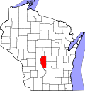
Location in Adams County and the state of Wisconsin.
Coordinates: 44°12′23″N89°47′17″W / 44.20639°N 89.78806°W / 44.20639; -89.78806 Coordinates: 44°12′23″N89°47′17″W / 44.20639°N 89.78806°W / 44.20639; -89.78806
Country United States
State Wisconsin
County Adams
Town Rome
Area
  Total1.404 sq mi (3.64 km2)
  Land1.054 sq mi (2.73 km2)
  Water0.350 sq mi (0.91 km2)
Elevation
1,014 ft (309 m)
Population
 (2010) [1]
  Total372
  Density260/sq mi (100/km2)
Time zone UTC-6 (Central (CST))
  Summer (DST) UTC-5 (CDT)
Area code(s) 608
GNIS feature ID2586519 [2]

Lake Sherwood is a census-designated place in the town of Rome, Adams County, Wisconsin, United States. Its population was 372 as of the 2010 census. [1]

Related Research Articles

Adams County, Wisconsin U.S. county in Wisconsin

Adams County is a county in the U.S. state of Wisconsin. As of the 2010 census, the population was 20,875. Its county seat is Friendship. The county was created in 1848 and organized in 1853. Sources differ as to whether its name is in honor of the second President of the United States, John Adams, or his son, the sixth President, John Quincy Adams.

Washburn County, Wisconsin U.S. county in Wisconsin

Washburn County is a county in the U.S. state of Wisconsin. It is named after Governor Cadwallader C. Washburn. As of the 2010 census, the population was 15,911. Its county seat is Shell Lake. The county was created in 1883.

Walworth County, Wisconsin U.S. county in Wisconsin

Walworth County is a county located in the U.S. state of Wisconsin. As of the 2010 census, the population was 102,228. Its county seat is Elkhorn. The county was created in 1836 from Wisconsin Territory and organized in 1839. It is named for Reuben H. Walworth.

Sawyer County, Wisconsin U.S. county in Wisconsin

Sawyer County is a county in the U.S. state of Wisconsin. As of the 2010 census, the population was 16,557. Its county seat is Hayward.

Oneida County, Wisconsin U.S. county in Wisconsin

Oneida County is a county in the state of Wisconsin, United States. At the 2010 census, the population was 35,998. Its county seat is Rhinelander.

Marquette County, Wisconsin U.S. county in Wisconsin

Marquette County is a county located in the U.S. state of Wisconsin. As of the 2010 census, the population was 15,404. Its county seat is Montello. The county was created in 1836 from the Wisconsin Territory and organized in 1848.

Marinette County, Wisconsin U.S. county in Wisconsin

Marinette County is a county in the U.S. state of Wisconsin. As of the 2010 census, the population was 41,749. Its county seat is Marinette, which now includes the former independent village of Menekaunee as a neighborhood.

Kenosha County, Wisconsin U.S. county in Wisconsin

Kenosha County is a county in the southeastern corner of the U.S. state of Wisconsin. Its population in 2018 was estimated to be 169,290, making it the eighth most populous county in Wisconsin. The county is named after the county seat, Kenosha, the fourth largest city in Wisconsin.

Green Lake County, Wisconsin U.S. county in Wisconsin

Green Lake County is a county located in the U.S. state of Wisconsin. As of the 2010 census, the population was 19,051. Its county seat is Green Lake.

Dodge County, Wisconsin U.S. county in Wisconsin

Dodge County is a county located in the U.S. state of Wisconsin. As of the 2010 census, the population was 88,759. Its county seat is Juneau. The county was created from the Wisconsin Territory in 1836 and organized in 1844.

Clark County, Wisconsin U.S. county in Wisconsin

Clark County is a county in the U.S. state of Wisconsin. As of the 2010 census, the population was 34,690. Its county seat is Neillsville.

Calumet County, Wisconsin U.S. county in Wisconsin

Calumet County is a county located in the U.S. state of Wisconsin. As of the 2010 census, the population was 48,971. The county seat is Chilton. The county was created in 1836 and organized in 1850.

Burnett County, Wisconsin U.S. county in Wisconsin

Burnett County is a county located in the U.S. state of Wisconsin. As of the 2010 census, the population was 15,457. Its county seat is Siren, with the majority of county governmental services located at the Burnett County Government Center. The county was created in 1856 and organized in 1865.

Barron County, Wisconsin U.S. county in Wisconsin

Barron County is a county located in the U.S. state of Wisconsin. As of the 2010 census, the population was 45,870. Its county seat is Barron. The county was created in 1859 and later organized in 1874.

Rome, Adams County, Wisconsin Town in Wisconsin, United States

Rome is a town in Adams County in the U.S. state of Wisconsin. The population was 2,720 at the 2010 census. The census-designated places of Lake Arrowhead, Lake Camelot, and Lake Sherwood are located in the town. The unincorporated communities of New Rome and Rome are also located in the town.

Sherwood may refer to:

Green Lake, Wisconsin City in Wisconsin, United States

Green Lake is a city in Green Lake County, Wisconsin, United States. The population was 960 at the 2010 census. The city is located on the north side of Green Lake. The city of Green Lake is the county seat for the county of Green Lake. The Town of Green Lake is located on the south side of Big Green Lake, opposite the city.

The Fox Cities of Northeastern Wisconsin are the cities, towns and villages along the Fox River as it flows from Lake Winnebago northward into Green Bay.

Lake Sherwood, California Place in California, United States

Lake Sherwood is an unincorporated community in the Santa Monica Mountains, in Ventura County, California overlooking Lake Sherwood reservoir. It is a body contact lake, swimming, fishing, SUP and boating allowed, located south of the Conejo Valley and city of Thousand Oaks, and west of Westlake Village. The lake is naturally fed by thousand of acres of open-space, watershed mountains and natural springs.

State Trunk Highway 55 is a state highway in the U.S. state of Wisconsin. It travels south-to-north in the northeastern part of Wisconsin from an intersection with U.S. Route 151 (US 151) approximately 1.5 miles (2.4 km) north of Brothertown, near the eastern shore of Lake Winnebago in Calumet County, to the Michigan state line at the Brule River approximately one mile (1.6 km) northeast of Nelma in Forest County, where it connects to M-73.

References

  1. 1 2 "U.S. Census website". U.S. Census Bureau . Retrieved 12 April 2011.
  2. U.S. Geological Survey Geographic Names Information System: Lake Sherwood, Wisconsin