Columbia County, Wisconsin

Last updated

Columbia County
Columbia County WI courthouse.jpg
Columbia County courthouse in December 2014
Map of Wisconsin highlighting Columbia County.svg
Location within the U.S. state of Wisconsin
Wisconsin in United States.svg
Wisconsin's location within the U.S.
Coordinates: 43°28′N89°20′W / 43.47°N 89.33°W / 43.47; -89.33
CountryFlag of the United States.svg United States
StateFlag of Wisconsin.svg  Wisconsin
Founded1846
Named for Christopher Columbus
Seat Portage
Largest cityPortage
Area
  Total796 sq mi (2,060 km2)
  Land766 sq mi (1,980 km2)
  Water30 sq mi (80 km2)  3.8%
Population
 (2020) [1]
  Total58,490
  Density76.4/sq mi (29.5/km2)
Time zone UTC−6 (Central)
  Summer (DST) UTC−5 (CDT)
Congressional district 6th
Website www.co.columbia.wi.us

Columbia County is a county located in the U.S. state of Wisconsin. As of the 2020 census, the population was 58,490. [2] Its county seat and largest city is Portage. [3] The county was created in 1846 [4] as part of Wisconsin Territory.

Contents

Columbia County is part of the Madison, WI Metropolitan Statistical Area as well as the Madison-Janesville-Beloit, WI Combined Statistical Area.

Geography

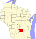
According to the U.S. Census Bureau, the county has a total area of 796 square miles (2,060 km2), of which 766 square miles (1,980 km2) is land and 30 square miles (78 km2) (3.8%) is water. [5] The county's highest point is in the Baraboo Range, near Durward's Glen at 1,480 feet above sea level. [6]

Major highways

Railroads

Buses

Airports

Adjacent counties

Demographics

Historical population
CensusPop.Note
1850 9,565
1860 24,441155.5%
1870 28,80217.8%
1880 28,065−2.6%
1890 28,3501.0%
1900 31,1219.8%
1910 31,1290.0%
1920 30,468−2.1%
1930 30,5030.1%
1940 32,5176.6%
1950 34,0234.6%
1960 36,7087.9%
1970 40,1509.4%
1980 43,2227.7%
1990 45,0884.3%
2000 52,46816.4%
2010 56,8338.3%
2020 58,4902.9%
U.S. Decennial Census [7]
1790–1960 [8] 1900–1990 [9]
1990–2000 [10] 2010–2020 [2]

2020 census

As of the census of 2020, [1] the population was 58,490. The population density was 76.4 people per square mile (29.5 people/km2). There were 26,565 housing units at an average density of 34.7 units per square mile (13.4 units/km2). The racial makeup of the county was 91.9% White, 1.5% Black or African American, 0.7% Asian, 0.5% Native American, 1.3% from other races, and 4.1% from two or more races. Ethnically, the population was 3.7% Hispanic or Latino of any race.

2000 census

2000 Census Age Pyramid for Columbia County USA Columbia County, Wisconsin age pyramid.svg
2000 Census Age Pyramid for Columbia County
Columbia County Law Enforcement Center ColumbiaCountyLawEnforcementCenterWIS33.jpg
Columbia County Law Enforcement Center
Columbus, Wisconsin Columbus Wisconsin 11.jpg
Columbus, Wisconsin
Doylestown Wisconsin Municipal Building Doylestown Wisconsin Municipal Building.jpg
Doylestown Wisconsin Municipal Building

As of the census [11] of 2000, there were 52,468 people, 20,439 households, and 14,164 families residing in the county. The population density was 68 people per square mile (26 people/km2). There were 22,685 housing units at an average density of 29 units per square mile (11 units/km2). The racial makeup of the county was 97.18% White, 0.88% Black or African American, 0.35% Native American, 0.33% Asian, 0.02% Pacific Islander, 0.44% from other races, and 0.79% from two or more races. 1.58% of the population were Hispanic or Latino of any race. 46.4% were of German, 10.2% Norwegian, 7.8% Irish, 6.4% English and 5.0% United States or American ancestry.

There were 20,439 households, out of which 32.20% had children under the age of 18 living with them, 58.10% were married couples living together, 7.40% had a female householder with no husband present, and 30.70% were non-families. 25.50% of all households were made up of individuals, and 11.00% had someone living alone who was 65 years of age or older. The average household size was 2.49 and the average family size was 2.99.

In the county, the population was spread out, with 25.20% under the age of 18, 7.10% from 18 to 24, 29.90% from 25 to 44, 23.40% from 45 to 64, and 14.40% who were 65 years of age or older. The median age was 38 years. For every 100 females, there were 101.60 males. For every 100 females age 18 and over, there were 100.40 males.

In 2017, there were 602 births, giving a general fertility rate of 63.9 births per 1000 women aged 15–44, the 35th highest out of all 72 Wisconsin Counties. [12] Additionally, there were 63 reported induced abortions performed on women of Columbia County residence, with a rate of 6.7 abortions per 1000 women aged 15–44, which is above the Wisconsin average rate of 5.2. [13]

Communities

Cities

Villages

Towns

Census-designated places

Unincorporated communities

Ghost town/neighborhood

Politics

For most of its history, Columbia County voters have backed the Republican Party candidate in national elections. Prior to 1992, the only times Republicans failed to win the county in the preceding 100 years of presidential elections were in the midst of a divided party vote in 1912, in 1924 when Wisconsinite Robert La Follette was on the ballot, and in the national Democratic Party landslides of 1932, 1936, & 1964. From 1992 onward, the county has been a Democratic-leaning swing county, voting for the statewide winner in all presidential elections since then except in 2004 and 2020, and voting for the national winner in all except 2000 and 2020. Republican Donald Trump won narrow pluralities in the county in 2016 and 2020, although a majority of county residents supported Democrat Tammy Baldwin's re-election to the United States Senate in 2018.

United States presidential election results for Columbia County, Wisconsin [14]
Year Republican Democratic Third party
No.%No.%No.%
2020 16,92749.98%16,41048.45%5321.57%
2016 14,16347.69%13,52845.55%2,0076.76%
2012 13,02642.64%17,17556.23%3451.13%
2008 12,19341.65%16,66156.92%4181.43%
2004 14,95650.60%14,30048.38%2991.01%
2000 11,98746.85%12,63649.38%9643.77%
1996 8,37738.92%10,33648.03%2,80813.05%
1992 9,09937.94%9,34838.98%5,53723.09%
1988 10,47553.09%9,13246.28%1230.62%
1984 11,66258.52%8,12540.77%1400.70%
1980 10,47849.90%8,71541.51%1,8038.59%
1976 10,07550.63%9,45747.52%3681.85%
1972 10,12258.02%7,08340.60%2421.39%
1968 8,63352.60%6,69840.81%1,0836.60%
1964 6,25338.20%10,09361.66%240.15%
1960 10,28260.94%6,57638.97%150.09%
1956 10,12066.01%5,15833.65%520.34%
1952 11,13367.78%5,27232.10%200.12%
1948 6,40652.64%5,61546.14%1481.22%
1944 7,86756.50%5,99743.07%600.43%
1940 8,26053.68%7,02145.63%1060.69%
1936 5,60737.25%8,93659.36%5113.39%
1932 4,97036.43%8,45561.98%2161.58%
1928 7,61560.70%4,81938.41%1110.88%
1924 4,72440.41%9077.76%6,05951.83%
1920 7,39483.25%1,20113.52%2873.23%
1916 3,39557.52%2,29938.95%2083.52%
1912 2,46342.55%2,47342.73%85214.72%
1908 4,07260.12%2,36334.89%3384.99%
1904 4,73067.53%1,90727.23%3675.24%
1900 4,76365.71%2,18130.09%3054.21%
1896 4,84563.57%2,38031.23%3975.21%
1892 3,31449.26%2,95743.95%4576.79%

See also

Related Research Articles

<span class="mw-page-title-main">Adams County, Wisconsin</span> County in Wisconsin, United States

Adams County is a county in the U.S. state of Wisconsin. As of the 2020 census, the population was 20,654. Its county seat is Friendship. The county was created in 1848 and organized in 1853. Sources differ as to whether its name is in honor of the second President of the United States, John Adams, or his son, the sixth President, John Quincy Adams.

<span class="mw-page-title-main">Wood County, Wisconsin</span> County in Wisconsin, United States

Wood County is a county located in the U.S. state of Wisconsin. As of the 2020 census, the population was 74,207. Its county seat is Wisconsin Rapids. The county is named after Joseph Wood, a member of the Wisconsin State Assembly. Wood County comprises the Wisconsin Rapids-Marshfield, WI Micropolitan Statistical Area and is included in the Wausau-Stevens Point-Wisconsin Rapids, WI Combined Statistical Area.

<span class="mw-page-title-main">Waushara County, Wisconsin</span> County in Wisconsin, United States

Waushara County is a county located in the U.S. state of Wisconsin. As of the 2020 census, the population was 24,520. Its county seat is Wautoma.

<span class="mw-page-title-main">Vernon County, Wisconsin</span> County in Wisconsin, United States

Vernon County is a county in the U.S. state of Wisconsin. As of the 2020 census, the population was 30,714. Its county seat is Viroqua.

<span class="mw-page-title-main">Sauk County, Wisconsin</span> County in Wisconsin, United States

Sauk County is a county in Wisconsin. It is named after a large village of the Sauk people. As of the 2020 census, the population was 65,763. Its county seat and largest city is Baraboo. The county was created in 1840 from Wisconsin Territory and organized in 1844. Sauk County comprises the Baraboo, WI Micropolitan Statistical Area and is included in the Madison metropolitan area.

<span class="mw-page-title-main">Rusk County, Wisconsin</span> County in Wisconsin, United States

Rusk County is a county in the U.S. state of Wisconsin. As of the 2020 census, the population was 14,188. Its county seat is Ladysmith.

<span class="mw-page-title-main">Richland County, Wisconsin</span> County in Wisconsin, United States

Richland County is a county in the U.S. state of Wisconsin. As of the 2020 census, the population was 17,304. Its county seat is Richland Center. The county was created from the Wisconsin Territory in 1842 and organized in 1850. It is named for the high quality of its soil.

<span class="mw-page-title-main">Price County, Wisconsin</span> County in Wisconsin, United States

Price County is a county in the U.S. state of Wisconsin. As of the 2020 census, the population was 14,054. Its county seat is Phillips.

<span class="mw-page-title-main">Portage County, Wisconsin</span> County in Wisconsin, United States

Portage County is a county in the U.S. state of Wisconsin. As of the 2020 census, the population was 70,377. Its county seat is Stevens Point.

<span class="mw-page-title-main">Pepin County, Wisconsin</span> County in Wisconsin, United States

Pepin County is a county in the U.S. state of Wisconsin. As of the 2020 census, the population was 7,318, making it the fourth-least populous county in Wisconsin; it is also the smallest county in Wisconsin by area. Its county seat is Durand.

<span class="mw-page-title-main">Oconto County, Wisconsin</span> County in Wisconsin, United States

Oconto County is a county in the U.S. state of Wisconsin. As of the 2020 census, the population was 38,965. Its county seat is Oconto. The county was established in 1851.

<span class="mw-page-title-main">Monroe County, Wisconsin</span> County in Wisconsin, United States

Monroe County is a county in the U.S. state of Wisconsin. As of the 2020 census, the population was 46,274. Its county seat is Sparta.

<span class="mw-page-title-main">Marathon County, Wisconsin</span> County in Wisconsin, United States

Marathon County is a county located in the U.S. state of Wisconsin. As of the 2020 census, the population was 138,013. Marathon County's seat is Wausau. It was founded in 1850, created from a portion of Portage County. At that time the county stretched to the northern border with the upper Michigan peninsula. It is named after the battlefield at Marathon, Greece.

<span class="mw-page-title-main">Langlade County, Wisconsin</span> County in Wisconsin, United States

Langlade County is a county located in the U.S. state of Wisconsin. As of the 2020 census, the population was 19,491. Its county seat is Antigo.

<span class="mw-page-title-main">Iowa County, Wisconsin</span> County in Wisconsin, United States

Iowa County is a county in the U.S. state of Wisconsin. As of the 2020 census, the population was 23,709. Its county seat and largest city is Dodgeville. When created, it was part of the Michigan Territory. Iowa County is part of the Madison, Wisconsin, Metropolitan Statistical Area.

<span class="mw-page-title-main">Green County, Wisconsin</span> County in Wisconsin, United States

Green County is a county located in the U.S. state of Wisconsin. As of the 2020 census, the population was 37,093. Its county seat is Monroe. Green County is included in the Madison, WI Metropolitan Statistical Area.

<span class="mw-page-title-main">Dodge County, Wisconsin</span> County in Wisconsin, United States

Dodge County is a county located in the U.S. state of Wisconsin. As of the 2020 census, the population was 89,396. Its county seat is Juneau. The county was created from the Wisconsin Territory in 1836 and organized in 1844.

<span class="mw-page-title-main">Sauk City, Wisconsin</span> Village in Wisconsin, United States

Sauk City is a village in Sauk County, Wisconsin, United States. The population was 3,518 as of the 2020 census. The first incorporated village in the state, the community was founded by Agoston Haraszthy and his business partner, Robert Bryant.

<span class="mw-page-title-main">Wyocena, Wisconsin</span> Village in Wisconsin, United States

Wyocena is a village in Columbia County, Wisconsin, United States. The population was 768 at the 2010 census. The village is located within the Town of Wyocena. It is part of the Madison Metropolitan Statistical Area.

<span class="mw-page-title-main">Madison metropolitan area, Wisconsin</span> Metropolitan statistical area of the United States

The Madison, Wisconsin, metropolitan area, also known as Greater Madison, is the metropolitan area surrounding the city of Madison, Wisconsin. Madison is the state capital of Wisconsin and is Wisconsin's second largest city, and the metropolitan area is also the state's second largest which the Madison MSA borders to its east.

References

  1. 1 2 "2020 Decennial Census: Columbia County, Wisconsin". data.census.gov. U.S. Census Bureau. Retrieved July 1, 2022.
  2. 1 2 "State & County QuickFacts". United States Census Bureau. Archived from the original on June 6, 2011. Retrieved January 18, 2014.
  3. "Find a County". National Association of Counties. Archived from the original on May 31, 2011. Retrieved June 7, 2011.
  4. "Wisconsin: Individual County Chronologies". Wisconsin Atlas of Historical County Boundaries. The Newberry Library. 2007. Archived from the original on April 14, 2017. Retrieved August 13, 2015.
  5. "2010 Census Gazetteer Files". United States Census Bureau. August 22, 2012. Retrieved August 2, 2015.
  6. Wisconsin High Points. Wisconsin State Cartographer's Office.
  7. "U.S. Decennial Census". United States Census Bureau. Retrieved August 2, 2015.
  8. "Historical Census Browser". University of Virginia Library. Archived from the original on August 11, 2012. Retrieved August 2, 2015.
  9. Forstall, Richard L., ed. (March 27, 1995). "Population of Counties by Decennial Census: 1900 to 1990". United States Census Bureau. Retrieved August 2, 2015.
  10. "Census 2000 PHC-T-4. Ranking Tables for Counties: 1990 and 2000" (PDF). United States Census Bureau. April 2, 2001. Archived (PDF) from the original on October 9, 2022. Retrieved August 2, 2015.
  11. "U.S. Census website". United States Census Bureau . Retrieved May 14, 2011.
  12. "Annual Wisconsin Birth and Infant Mortality Report, 2017 P-01161-19 (June 2019): Detailed Tables". Archived from the original on June 19, 2019. Retrieved June 19, 2019.
  13. Reported Induced Abortions in Wisconsin, Office of Health Informatics, Division of Public Health, Wisconsin Department of Health Services. Section: Trend Information, 2013-2017, Table 18, pages 17-18
  14. Leip, David. "Dave Leip's Atlas of U.S. Presidential Elections". uselectionatlas.org. Retrieved November 11, 2020.

Further reading

43°28′N89°20′W / 43.47°N 89.33°W / 43.47; -89.33